Tysons, also known as Tysons Corner, is a census-designated place (CDP) in Fairfax County, Virginia, United States, developed from the corner of Chain Bridge Road (SR 123) and the Leesburg Pike (SR 7). Located in Northern Virginia between the community of McLean and the town of Vienna along the Capital Beltway (I-495), it is in the Washington metropolitan area. Tysons is home to two super-regional shopping malls—Tysons Corner Center and Tysons Galleria—and the corporate and administrative headquarters of numerous companies, such as Intelsat, Alarm.com, Booz Allen Hamilton, Capital One, DXC Technology, Freddie Mac, Gannett, Hilton Worldwide, ID.me and Tegna. As an unincorporated community, Tysons is Fairfax County’s central business district and a regional commercial center. It has been called a quintessential example of an edge city. The population was 26,374 as of the 2020 census.
| Name: | Tysons CDP |
|---|---|
| LSAD Code: | 57 |
| LSAD Description: | CDP (suffix) |
| State: | Virginia |
| County: | Fairfax County |
| Elevation: | 486 ft (148 m) |
| Total Area: | 4.27 sq mi (11.1 km²) |
| Land Area: | 4.26 sq mi (11.0 km²) |
| Water Area: | 0.01 sq mi (0.026 km²) |
| Total Population: | 26,374 |
| Population Density: | 6,177/sq mi (2,385/km²) |
| FIPS code: | 5179950 |
| GNISfeature ID: | 1496341 |
Online Interactive Map
Click on ![]() to view map in "full screen" mode.
to view map in "full screen" mode.
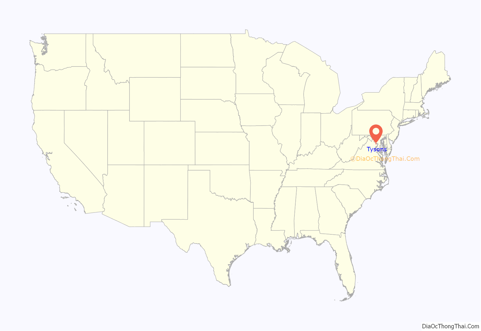
Tysons location map. Where is Tysons CDP?

History
Known originally as Peach Grove, the area received the designation “Tysons Crossroads” after the Civil War. William Tyson, a Maryland native from Cecil County, purchased a tract of land from A. Lawrence Foster. Tyson served as postmaster of the now discontinued Peach Grove Post Office from 1854 to 1866. The Peach Grove Post Office was established on April 22, 1851.
As recently as the 1950s, Tysons was a quiet rural intersection flanked by a few small stores and a fruit stand operated by the Tyson descendants, who sold apples and apple cider from the corner of their property. Big changes came in 1963 when the Tysons area moved from a country crossroads to a giant commercial urban area with the awarding of contracts at the interchange of Route 7 and Route 123.
In 1962, the Fairfax County Board of Supervisors approved the Tysons Corner Shopping Center (now Tysons Corner Center), which was planned to be 88.13 acres (356,600 m) within a 150 acres (0.61 km) triangle bordered by Chain Bridge Road, Leesburg Pike, and the Capital Beltway. Developers proclaimed it the largest enclosed mall in the world when it opened on July 25, 1968.
In recent years, the influx of technology companies into Northern Virginia has brought many new office buildings and hotels to the landscape. The rapid growth of Tysons (in comparison to other locations near the Capital Beltway) has been the topic of numerous studies. One factor was the aggressive promotion of Tysons by Earle Williams, for many years the CEO of the defense contracting firm Braddock Dunn & McDonald. Tysons serves as a “downtown” of Fairfax County, with one quarter of all office space and one eighth of all retail in the county, despite occupying just 1% of the county. It is an auto-oriented edge city with severe traffic congestion, and faces competition from the urban areas of Arlington and newer suburban edge cities such as Dulles.
In 2008, the Fairfax County Board of Supervisors unanimously voted to begin a 40-year plan to urbanize Tysons around the coming four stops of Washington Metro’s Silver Line in the vein of neighboring Arlington County‘s Rosslyn-Ballston corridor. A preliminary estimate from the Fairfax County Department of Transportation suggested that $7.83 billion in transportation infrastructure projects would be necessary to transform Tysons Corner into a high-density urban center from 2010 to 2050, most of which would be allocated to both construction phases of the Silver Line. Existing plans call for construction of a grid layout for streets around the rail stations, projected to cost $742 million. An additional $1 billion will be spent on further transit and street grid projects from 2030 to 2050.
In November 2012, the county approved Arbor Row, a 2,500,000 ft (762,000 m) mixed-used development of office and residential high-rises, ground-floor retail, and underground parking near the Tysons Corner Station. In April 2013, the county approved Scotts Run Station South, a 6,700,000 ft (2,042,160 m) development containing 17 buildings, including six office and residential buildings, one hotel, and ground-floor retail near the McLean Station. This development alone will be larger than Reston Town Center.
Ahead of the Washington Metro Silver Line opening in mid-2014, the Fairfax County Board of Supervisors and the Tysons Partnership, a nonprofit association that represents the area’s stakeholders, began rebranding the area as simply “Tysons”, dropping “Corner” from the name. The change started as a matter of convenience, but later took hold to market the change in the area’s character, according to members of the board. The change was unofficial at the time, and either “Tysons” or “Tysons Corner” could be used in addresses. But in November 2015, the U.S. Census Bureau announced the CDP’s name would officially be changed to Tysons as of the next summer.
Current developments
Tysons is seen as a modern prototype of an edge city. In its 40-year history, it has been given substantial redevelopment offers for the next 20 to 30 years. The area has seen growing interest as plans to make it an urban center were begun in 2010. Private-sector development in the United States in combination with political groups have begun the planning process behind the redevelopment of Tysons. Two forces are at work in the creation of an edge city, as it can be beneficial to both parties. With the redevelopment process taking place there has been an aggressive push to bring in businesses to Tysons. Edge cities such as Tysons have specific regional accessibility that has been enhanced by major projects funded by federal and state governments. One of the bigger enhancements to transportation specifically to Tysons was the construction “of the Washington Dulles International Airport and an associated access road and the Capital Beltway but also expansions to state roads”.
The plan remains to see Tysons become Fairfax County’s downtown core. So far, “eight districts have been delimited, with four centered on new metro stations being transit-oriented development districts”. Future plans for transportation around the area continue to be made. “The aims of the plan are for 75% of development to be within half a mile of metro stations, an urban center of 200,000 jobs and 100,000 residents, a jobs balance of 4.0 per household”.
Tysons Road Map

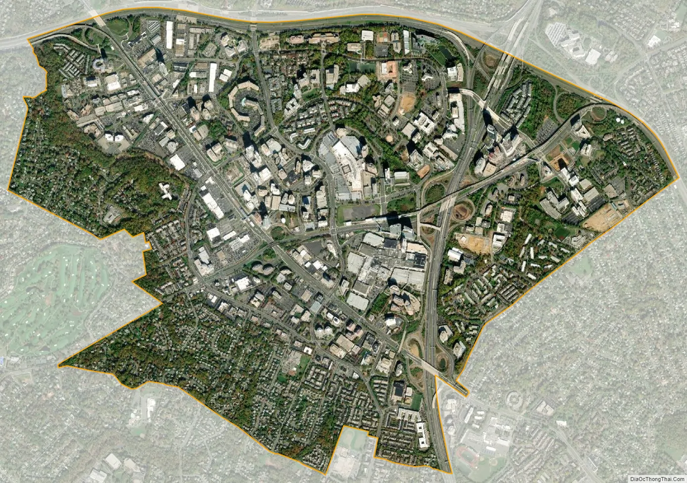
Tysons city Satellite Map
Geography
Tysons is located at 38°55′7″N 77°13′47″W / 38.91861°N 77.22972°W / 38.91861; -77.22972 (38.918485, −77.229833) at an elevation of 486 feet (148 m). Located in Northern Virginia at the intersection of Virginia State Route 123 and State Route 7, Tysons is 11 miles (18 km) west of downtown Washington, D.C., and 6 miles (9.7 km) northeast of Fairfax, the county seat.
The community lies in the Piedmont upland, about 3.7 miles (6.0 km) south-southwest of the Potomac River. The highest natural point in Fairfax County, at 520 feet (160 m) above sea level, is in Tysons. Wolftrap Creek, a tributary of nearby Difficult Run, forms the community’s northwestern border. Two of the creek’s tributaries, Moomac Creek and the Old Courthouse Spring Branch, flow north through northwest Tysons. Scott Run, a tributary of the Potomac, flows north through eastern Tysons.
According to the United States Census Bureau, the community has an area of 4.27 square miles (11.1 km), of which 4.26 square miles (11.0 km) is land and 0.01 square miles (0.026 km) is water.
As a suburb of Washington, D.C., Tysons is a part of both the Washington metropolitan area and the larger Baltimore–Washington metropolitan area. It is bordered on all sides by other Washington suburbs, including McLean to the north, Pimmit Hills to the east, Idylwood to the southeast, Dunn Loring to the south, Vienna to the southwest, and Wolf Trap to the west.
Climate
Tysons’s climate is characterized by hot, humid summers and generally mild to cool winters. According to the Köppen Climate Classification system, Tysons has a humid subtropical climate, abbreviated “Cfa” on climate maps.
See also
Map of Virginia State and its subdivision:- Accomack
- Albemarle
- Alexandria
- Alleghany
- Amelia
- Amherst
- Appomattox
- Arlington
- Augusta
- Bath
- Bedford
- Bedford City
- Bland
- Botetourt
- Bristol
- Brunswick
- Buchanan
- Buckingham
- Buena Vista
- Campbell
- Caroline
- Carroll
- Charles City
- Charlotte
- Charlottesville
- Chesapeake
- Chesterfield
- Clarke
- Clifton Forge City
- Colonial Heights
- Covington
- Craig
- Culpeper
- Cumberland
- Danville
- Dickenson
- Dinwiddie
- Emporia
- Essex
- Fairfax
- Fairfax City
- Falls Church
- Fauquier
- Floyd
- Fluvanna
- Franklin
- Frederick
- Fredericksburg
- Galax
- Giles
- Gloucester
- Goochland
- Grayson
- Greene
- Greensville
- Halifax
- Hampton
- Hanover
- Harrisonburg
- Henrico
- Henry
- Highland
- Hopewell
- Isle of Wight
- James City
- King and Queen
- King George
- King William
- Lancaster
- Lee
- Lexington
- Loudoun
- Louisa
- Lunenburg
- Lynchburg
- Madison
- Manassas
- Manassas Park
- Martinsville
- Mathews
- Mecklenburg
- Middlesex
- Montgomery
- Nelson
- New Kent
- Newport News
- Norfolk
- Northampton
- Northumberland
- Norton
- Nottoway
- Orange
- Page
- Patrick
- Petersburg
- Pittsylvania
- Poquoson
- Portsmouth
- Powhatan
- Prince Edward
- Prince George
- Prince William
- Pulaski
- Radford
- Rappahannock
- Richmond
- Roanoke
- Roanoke City
- Rockbridge
- Rockingham
- Russell
- Salem
- Scott
- Shenandoah
- Smyth
- Southampton
- Spotsylvania
- Stafford
- Staunton
- Suffolk
- Surry
- Sussex
- Tazewell
- Virginia Beach
- Warren
- Washington
- Waynesboro
- Westmoreland
- Williamsburg
- Winchester
- Wise
- Wythe
- York
- Alabama
- Alaska
- Arizona
- Arkansas
- California
- Colorado
- Connecticut
- Delaware
- District of Columbia
- Florida
- Georgia
- Hawaii
- Idaho
- Illinois
- Indiana
- Iowa
- Kansas
- Kentucky
- Louisiana
- Maine
- Maryland
- Massachusetts
- Michigan
- Minnesota
- Mississippi
- Missouri
- Montana
- Nebraska
- Nevada
- New Hampshire
- New Jersey
- New Mexico
- New York
- North Carolina
- North Dakota
- Ohio
- Oklahoma
- Oregon
- Pennsylvania
- Rhode Island
- South Carolina
- South Dakota
- Tennessee
- Texas
- Utah
- Vermont
- Virginia
- Washington
- West Virginia
- Wisconsin
- Wyoming


