Goshen is a town in Rockbridge County, Virginia, United States. The population was 361 in the 2010 census.
The town is known for hosting Goshen Scout Reservation, one of the largest Boy Scout camps in America.
| Name: | Goshen town |
|---|---|
| LSAD Code: | 43 |
| LSAD Description: | town (suffix) |
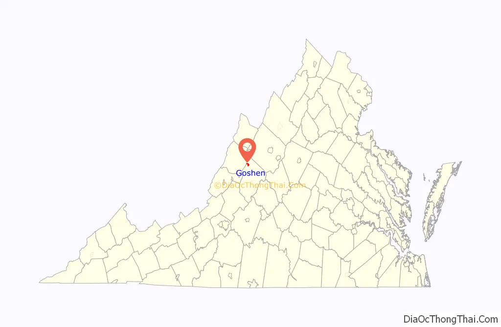
| State: | Virginia |
| County: | Rockbridge County |
| Elevation: | 1,404 ft (428 m) |
| Total Area: | 1.79 sq mi (4.63 km²) |
| Land Area: | 1.73 sq mi (4.48 km²) |
| Water Area: | 0.06 sq mi (0.15 km²) |
| Total Population: | 361 |
| Population Density: | 212.96/sq mi (82.22/km²) |
| ZIP code: | 24439 |
| Area code: | 540 |
| FIPS code: | 5131968 |
| GNISfeature ID: | 1494961 |
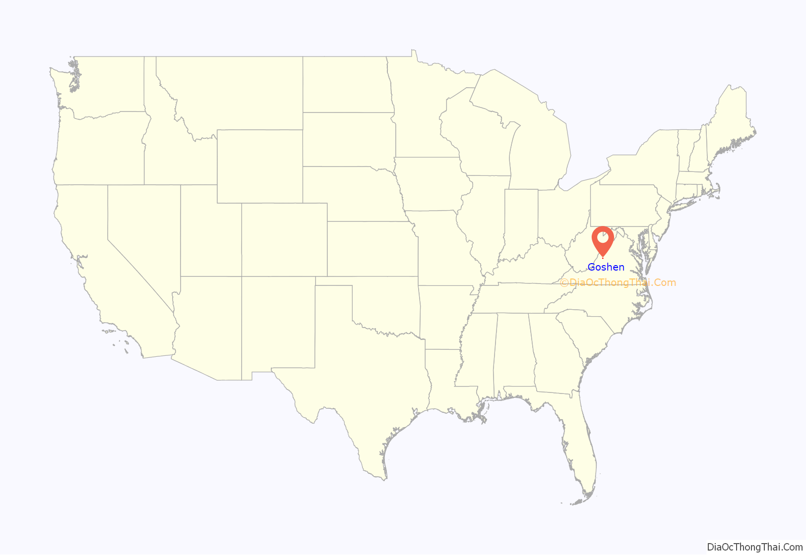
Online Interactive Map
Click on ![]() to view map in "full screen" mode.
to view map in "full screen" mode.
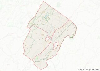
Goshen location map. Where is Goshen town?
History
Goshen was once inhabited by Indian tribes such as the Cherokee and Shawnee. In the 18th century, European settler, Alexander Dunlop and his wife Anna MacFarlane moved to the Calfpasture. A few of the first settlers include Bratton, Lockridge, Graham, Carter, and Davis. The first Goshen council was headed in 1744 by James Patton and John Lewis.
Goshen was based on farms, much like today, raising mainly corn. While Goshen was mainly farmland, in the 1800s, Goshen Pass and Panther’s Gap was a bustling community with a school, a hotel, a post office, and foundries.
The Alleghany Hotel was built by the Goshen Improvement company, the company which in the boom period of 1890 selected Goshen station as a site for laying of and the founding of a new city. The hotel was known as the “house of entertainment,” but a few years before the fire, it was renamed the Alleghany Sanitarium, housing tuberculosis patients. On Thanksgiving Day, 1922, the Alleghany Hotel smoldered in flames and ash for 2+1⁄2 hours before the building was completely destroyed. During this time, Goshen was without a fire department to combat the flames.
The Goshen Land Company Bridge was listed on the National Register of Historic Places in 1978.
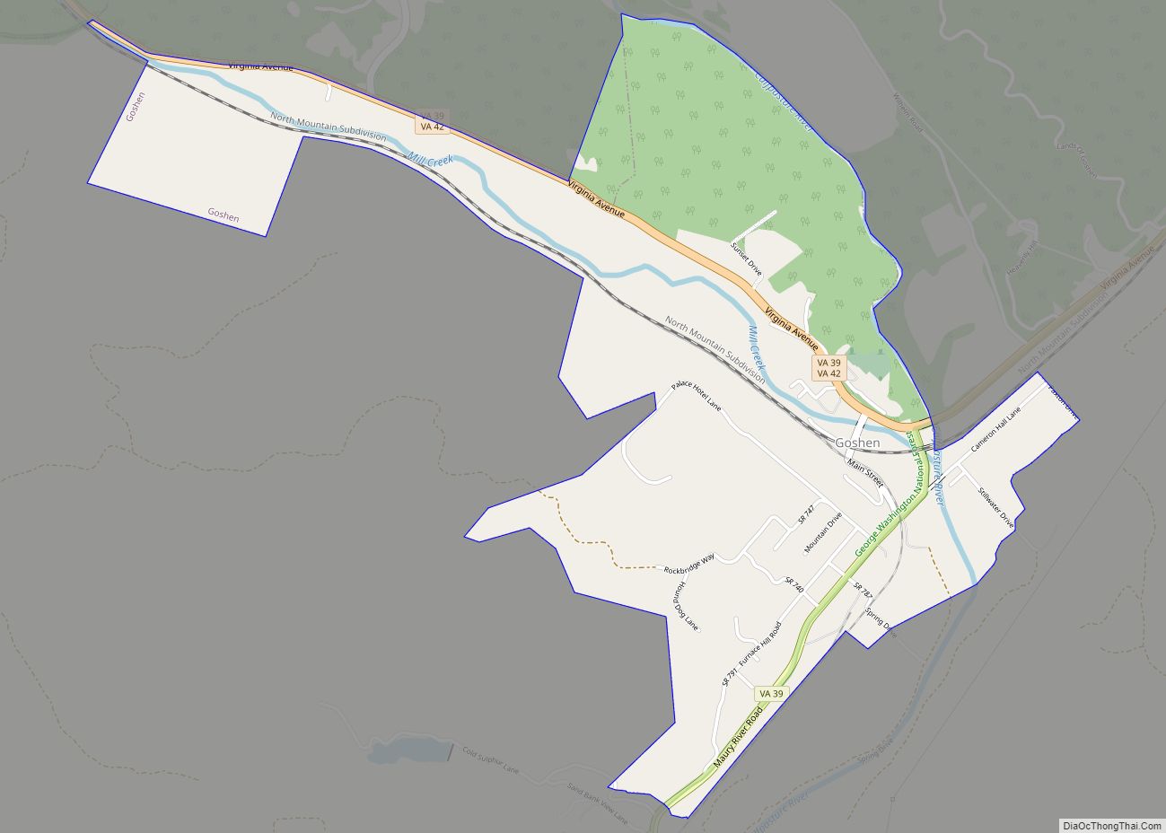
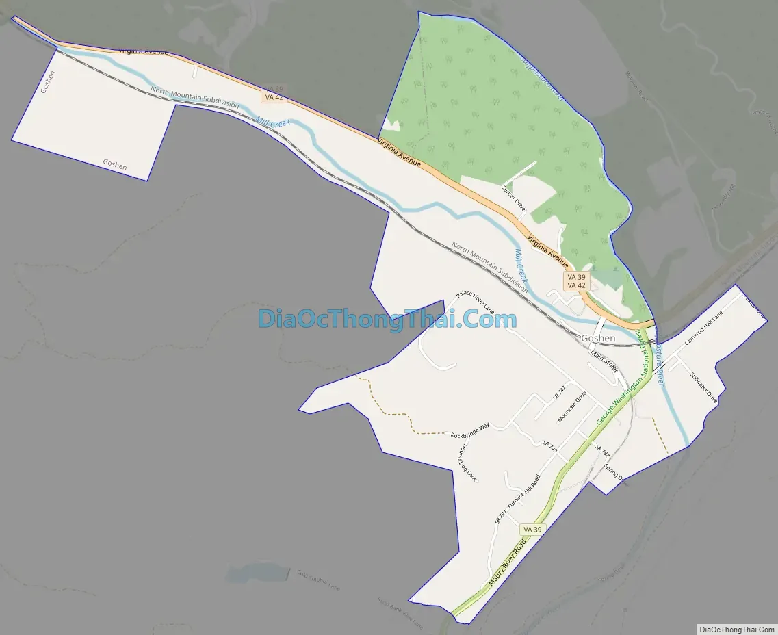
Goshen Road Map
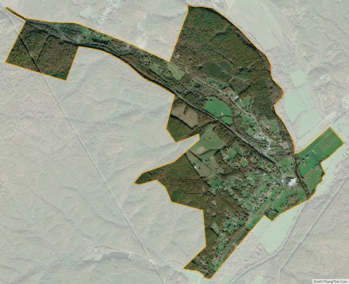
Goshen city Satellite Map
Geography
Goshen is located at 37°59′21″N 79°29′55″W / 37.989100°N 79.498603°W / 37.989100; -79.498603 (37.989100, −79.498603).
According to the United States Census Bureau, the town has a total area of 1.7 square miles (4.5 km), all of it land.
The Calfpasture River flows through Goshen, just before joining the Little Calfpasture River to form the Maury River.
See also
Map of Virginia State and its subdivision:- Accomack
- Albemarle
- Alexandria
- Alleghany
- Amelia
- Amherst
- Appomattox
- Arlington
- Augusta
- Bath
- Bedford
- Bedford City
- Bland
- Botetourt
- Bristol
- Brunswick
- Buchanan
- Buckingham
- Buena Vista
- Campbell
- Caroline
- Carroll
- Charles City
- Charlotte
- Charlottesville
- Chesapeake
- Chesterfield
- Clarke
- Clifton Forge City
- Colonial Heights
- Covington
- Craig
- Culpeper
- Cumberland
- Danville
- Dickenson
- Dinwiddie
- Emporia
- Essex
- Fairfax
- Fairfax City
- Falls Church
- Fauquier
- Floyd
- Fluvanna
- Franklin
- Frederick
- Fredericksburg
- Galax
- Giles
- Gloucester
- Goochland
- Grayson
- Greene
- Greensville
- Halifax
- Hampton
- Hanover
- Harrisonburg
- Henrico
- Henry
- Highland
- Hopewell
- Isle of Wight
- James City
- King and Queen
- King George
- King William
- Lancaster
- Lee
- Lexington
- Loudoun
- Louisa
- Lunenburg
- Lynchburg
- Madison
- Manassas
- Manassas Park
- Martinsville
- Mathews
- Mecklenburg
- Middlesex
- Montgomery
- Nelson
- New Kent
- Newport News
- Norfolk
- Northampton
- Northumberland
- Norton
- Nottoway
- Orange
- Page
- Patrick
- Petersburg
- Pittsylvania
- Poquoson
- Portsmouth
- Powhatan
- Prince Edward
- Prince George
- Prince William
- Pulaski
- Radford
- Rappahannock
- Richmond
- Roanoke
- Roanoke City
- Rockbridge
- Rockingham
- Russell
- Salem
- Scott
- Shenandoah
- Smyth
- Southampton
- Spotsylvania
- Stafford
- Staunton
- Suffolk
- Surry
- Sussex
- Tazewell
- Virginia Beach
- Warren
- Washington
- Waynesboro
- Westmoreland
- Williamsburg
- Winchester
- Wise
- Wythe
- York
- Alabama
- Alaska
- Arizona
- Arkansas
- California
- Colorado
- Connecticut
- Delaware
- District of Columbia
- Florida
- Georgia
- Hawaii
- Idaho
- Illinois
- Indiana
- Iowa
- Kansas
- Kentucky
- Louisiana
- Maine
- Maryland
- Massachusetts
- Michigan
- Minnesota
- Mississippi
- Missouri
- Montana
- Nebraska
- Nevada
- New Hampshire
- New Jersey
- New Mexico
- New York
- North Carolina
- North Dakota
- Ohio
- Oklahoma
- Oregon
- Pennsylvania
- Rhode Island
- South Carolina
- South Dakota
- Tennessee
- Texas
- Utah
- Vermont
- Virginia
- Washington
- West Virginia
- Wisconsin
- Wyoming