Huntington is a census-designated place (CDP) in Fairfax County, Virginia, United States. The population was 11,267 at the 2010 census. It is located next to the southern border of the city of Alexandria and is part of the Washington metropolitan area. Its main component is the namesake Huntington subdivision, a late-1940s neighborhood of mainly duplex homes.
In June 2006, the lower-lying northern section was ravaged by floods due to a torrential rainstorm that sent adjoining Cameron Run over its banks. Nevertheless, it remains popular with first-time home buyers due largely to its proximity to the Huntington Metro station, the southern terminus of Metrorail’s Yellow Line. There are also several high-rise apartment and condominium complexes on and near U.S. Route 1 where much of the CDP’s population resides. The area is included in ZIP code 22303 and has an Alexandria mailing address, although it is outside the city limits.
| Name: | Huntington CDP |
|---|---|
| LSAD Code: | 57 |
| LSAD Description: | CDP (suffix) |
| State: | Virginia |
| County: | Fairfax County |
| Elevation: | 66 ft (20 m) |
| Total Area: | 1.1 sq mi (2.9 km²) |
| Land Area: | 1.1 sq mi (2.8 km²) |
| Water Area: | 0.04 sq mi (0.1 km²) |
| Total Population: | 11,267 |
| Population Density: | 10,368/sq mi (4,003.3/km²) |
| FIPS code: | 5139064 |
| GNISfeature ID: | 1493118 |
Online Interactive Map
Click on ![]() to view map in "full screen" mode.
to view map in "full screen" mode.
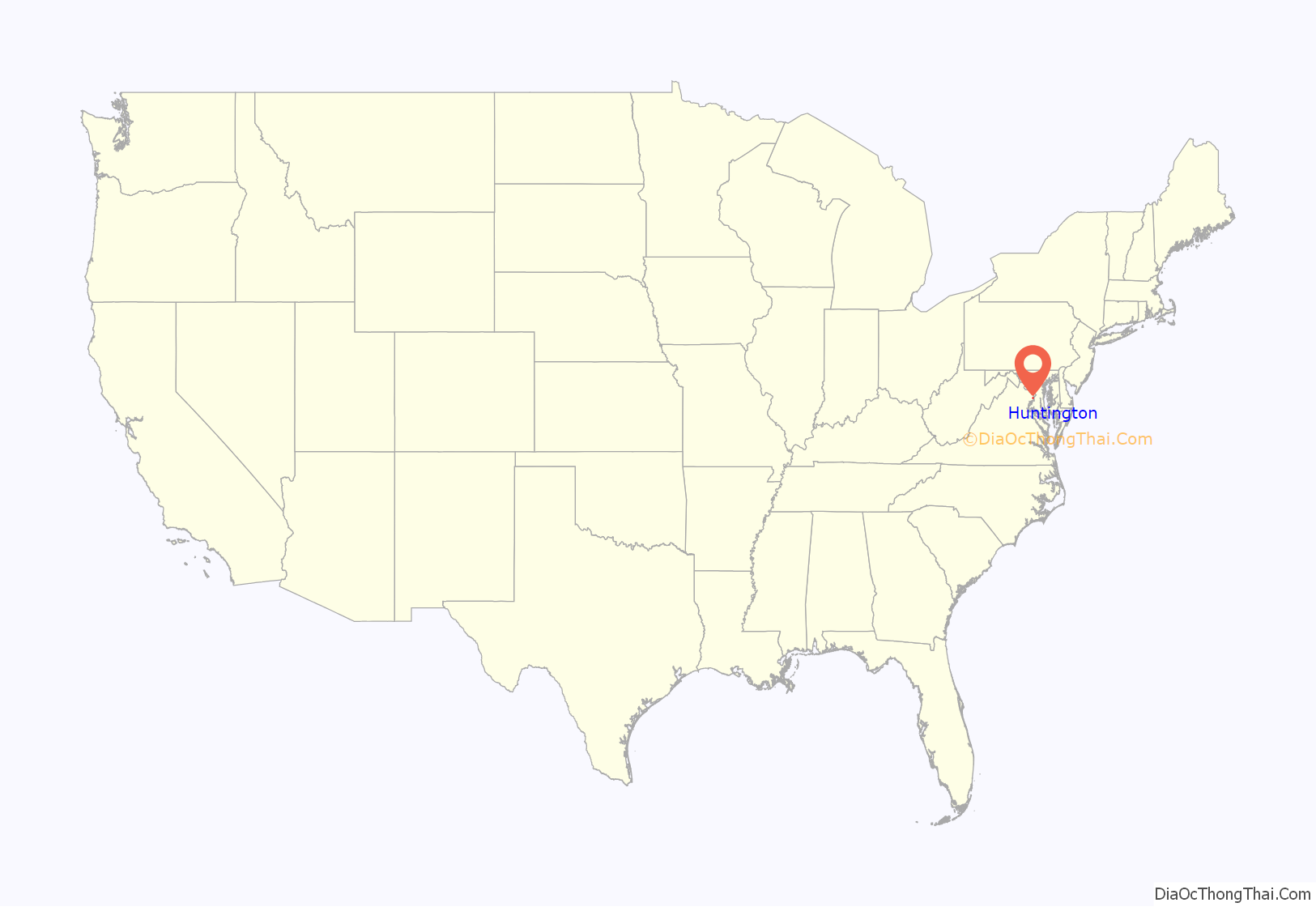
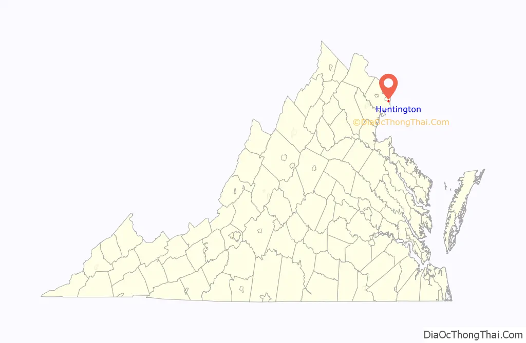
Huntington location map. Where is Huntington CDP?
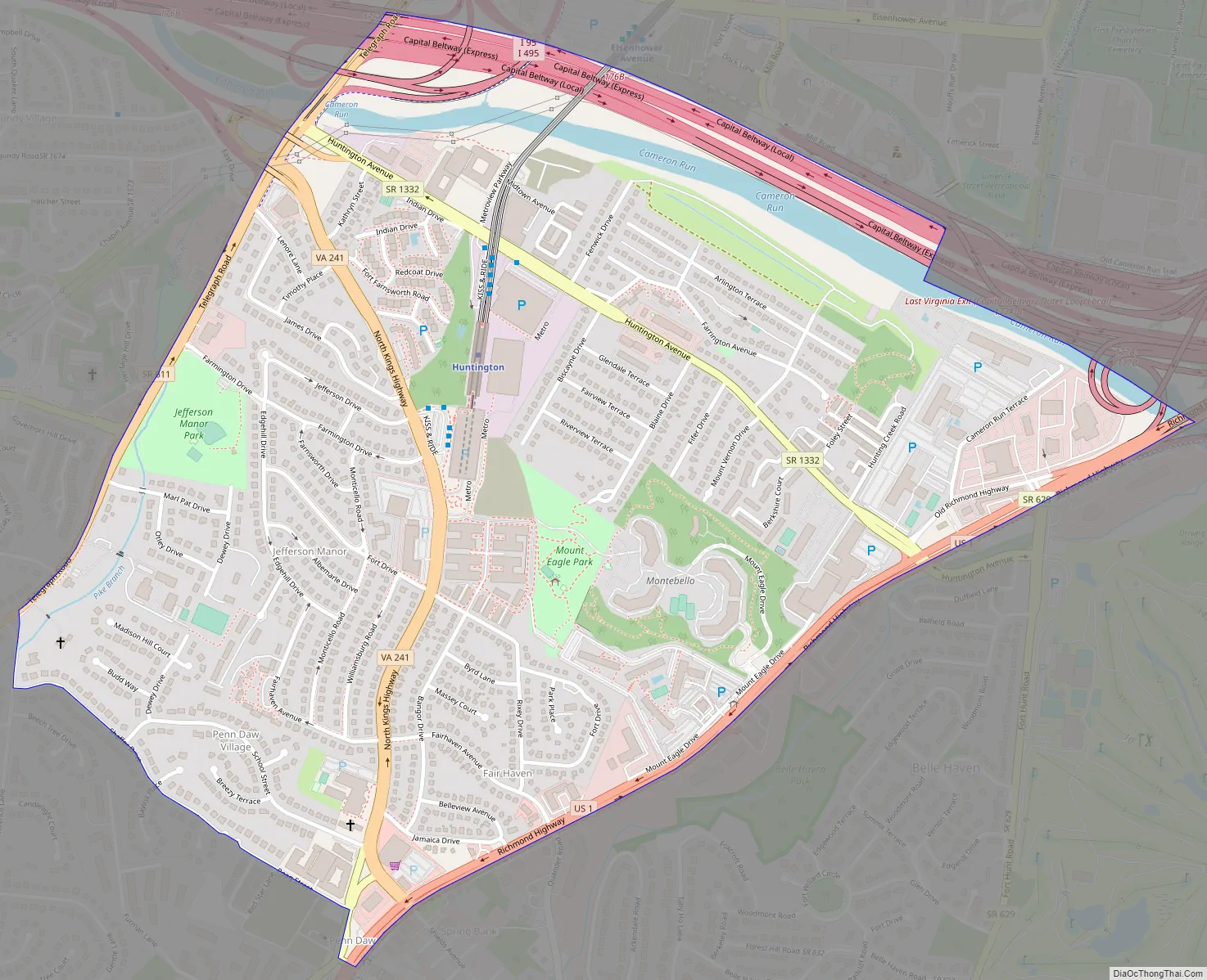
Huntington Road Map
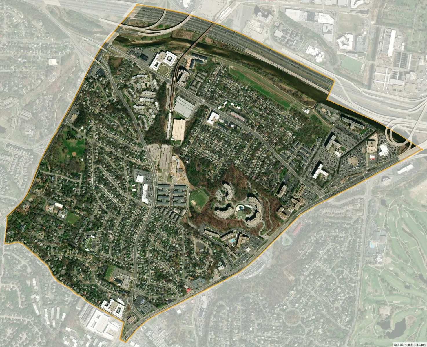
Huntington city Satellite Map
Geography
Huntington is located in southeastern Fairfax County at 38°47′33″N 77°4′20″W / 38.79250°N 77.07222°W / 38.79250; -77.07222 (38.792563, −77.072120). It is bordered to the north by the city of Alexandria, to the southeast by Belle Haven, and to the west by Rose Hill. U.S. Route 1 forms the border between Huntington and Belle Haven, and the boundary with Rose Hill is drawn to follow Poag Street, Shaffer Drive, Florence Lane, and Telegraph Road. Downtown Alexandria (Old Town) is 2 miles (3 km) to the northeast, and downtown Washington, D.C. is 10 miles (16 km) to the north.
According to the United States Census Bureau, the Huntington CDP has a total area of 1.1 square miles (2.9 km), of which 1.1 square miles (2.8 km) is land and 0.04 square miles (0.1 km), or 3.47%, is water.
See also
Map of Virginia State and its subdivision:- Accomack
- Albemarle
- Alexandria
- Alleghany
- Amelia
- Amherst
- Appomattox
- Arlington
- Augusta
- Bath
- Bedford
- Bedford City
- Bland
- Botetourt
- Bristol
- Brunswick
- Buchanan
- Buckingham
- Buena Vista
- Campbell
- Caroline
- Carroll
- Charles City
- Charlotte
- Charlottesville
- Chesapeake
- Chesterfield
- Clarke
- Clifton Forge City
- Colonial Heights
- Covington
- Craig
- Culpeper
- Cumberland
- Danville
- Dickenson
- Dinwiddie
- Emporia
- Essex
- Fairfax
- Fairfax City
- Falls Church
- Fauquier
- Floyd
- Fluvanna
- Franklin
- Frederick
- Fredericksburg
- Galax
- Giles
- Gloucester
- Goochland
- Grayson
- Greene
- Greensville
- Halifax
- Hampton
- Hanover
- Harrisonburg
- Henrico
- Henry
- Highland
- Hopewell
- Isle of Wight
- James City
- King and Queen
- King George
- King William
- Lancaster
- Lee
- Lexington
- Loudoun
- Louisa
- Lunenburg
- Lynchburg
- Madison
- Manassas
- Manassas Park
- Martinsville
- Mathews
- Mecklenburg
- Middlesex
- Montgomery
- Nelson
- New Kent
- Newport News
- Norfolk
- Northampton
- Northumberland
- Norton
- Nottoway
- Orange
- Page
- Patrick
- Petersburg
- Pittsylvania
- Poquoson
- Portsmouth
- Powhatan
- Prince Edward
- Prince George
- Prince William
- Pulaski
- Radford
- Rappahannock
- Richmond
- Roanoke
- Roanoke City
- Rockbridge
- Rockingham
- Russell
- Salem
- Scott
- Shenandoah
- Smyth
- Southampton
- Spotsylvania
- Stafford
- Staunton
- Suffolk
- Surry
- Sussex
- Tazewell
- Virginia Beach
- Warren
- Washington
- Waynesboro
- Westmoreland
- Williamsburg
- Winchester
- Wise
- Wythe
- York
- Alabama
- Alaska
- Arizona
- Arkansas
- California
- Colorado
- Connecticut
- Delaware
- District of Columbia
- Florida
- Georgia
- Hawaii
- Idaho
- Illinois
- Indiana
- Iowa
- Kansas
- Kentucky
- Louisiana
- Maine
- Maryland
- Massachusetts
- Michigan
- Minnesota
- Mississippi
- Missouri
- Montana
- Nebraska
- Nevada
- New Hampshire
- New Jersey
- New Mexico
- New York
- North Carolina
- North Dakota
- Ohio
- Oklahoma
- Oregon
- Pennsylvania
- Rhode Island
- South Carolina
- South Dakota
- Tennessee
- Texas
- Utah
- Vermont
- Virginia
- Washington
- West Virginia
- Wisconsin
- Wyoming


