Laurel Hill is a census-designated place in Fairfax County, Virginia, United States. The population as of the 2010 census was 6,855. Formerly part of the Lorton CDP, it comprises most of what was formerly the Lorton Reformatory grounds, which were purchased by Fairfax County in 2002 following the prison’s closing and redeveloped as a new suburban community. The name “Laurel Hill” was adopted from Laurel Hill House, an 18th-century structure which had served as the residence of the Superintendent of the Reformatory, and originally was the home of Revolutionary War patriot William Lindsay.
| Name: | Laurel Hill CDP |
|---|---|
| LSAD Code: | 57 |
| LSAD Description: | CDP (suffix) |
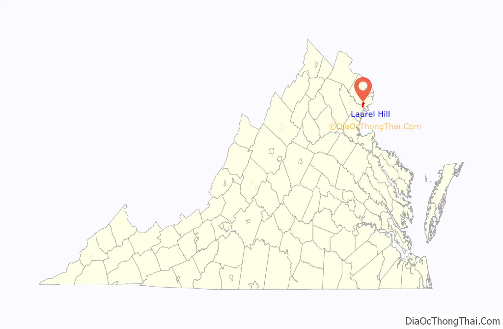
| State: | Virginia |
| County: | Fairfax County |
| Elevation: | 220 ft (70 m) |
| Total Area: | 4.53 sq mi (11.73 km²) |
| Land Area: | 4.46 sq mi (11.55 km²) |
| Water Area: | 0.07 sq mi (0.18 km²) |
| Total Population: | 6,855 |
| Population Density: | 1,537/sq mi (593.5/km²) |
| ZIP code: | 22079 |
| FIPS code: | 5144430 |
| GNISfeature ID: | 2585798 |
Online Interactive Map
Click on ![]() to view map in "full screen" mode.
to view map in "full screen" mode.
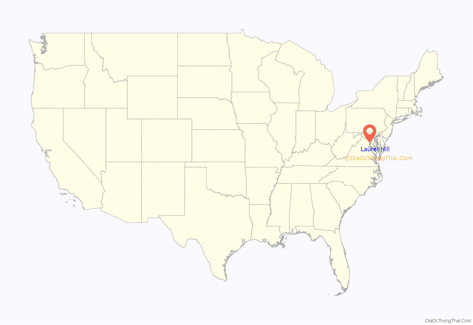
Laurel Hill location map. Where is Laurel Hill CDP?
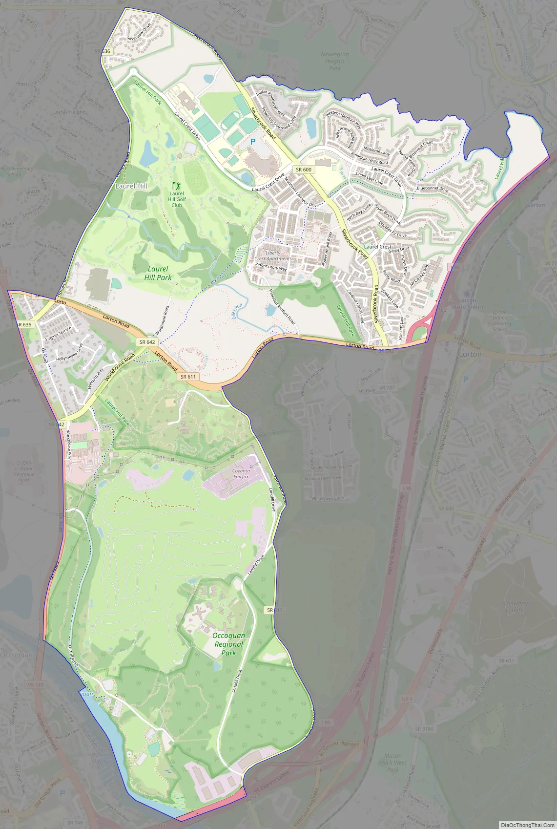
Laurel Hill Road Map
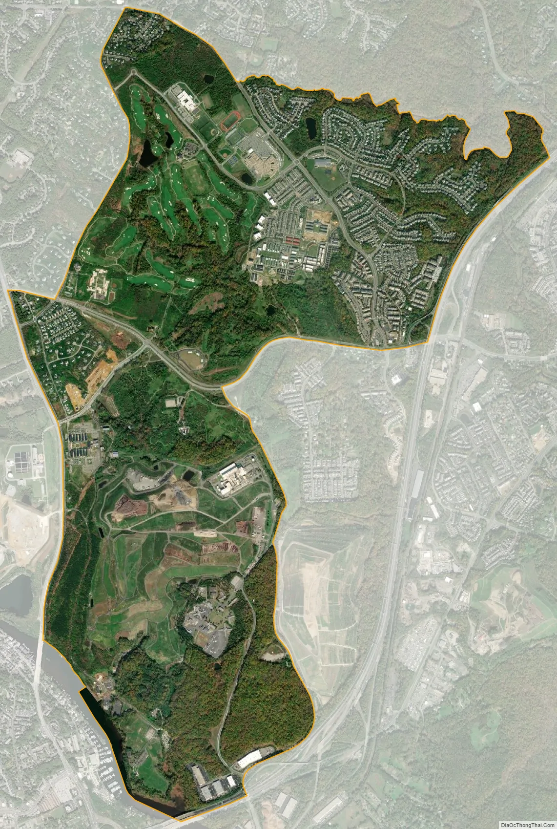
Laurel Hill city Satellite Map
Geography
Laurel Hill is in southern Fairfax County and is bordered to the northwest by Crosspointe, to the north by Newington Forest, to the east by Lorton, and to the south by Prince William County. Via Interstate 95 and Interstate 395 it is 19 miles (31 km) northeast to Washington, D.C.
According to the U.S. Census Bureau, the Laurel Hill CDP has a total area of 4.5 square miles (11.7 km), of which 4.46 square miles (11.55 km) is land and 0.069 square miles (0.18 km), or 1.51%, is water.
See also
Map of Virginia State and its subdivision:- Accomack
- Albemarle
- Alexandria
- Alleghany
- Amelia
- Amherst
- Appomattox
- Arlington
- Augusta
- Bath
- Bedford
- Bedford City
- Bland
- Botetourt
- Bristol
- Brunswick
- Buchanan
- Buckingham
- Buena Vista
- Campbell
- Caroline
- Carroll
- Charles City
- Charlotte
- Charlottesville
- Chesapeake
- Chesterfield
- Clarke
- Clifton Forge City
- Colonial Heights
- Covington
- Craig
- Culpeper
- Cumberland
- Danville
- Dickenson
- Dinwiddie
- Emporia
- Essex
- Fairfax
- Fairfax City
- Falls Church
- Fauquier
- Floyd
- Fluvanna
- Franklin
- Frederick
- Fredericksburg
- Galax
- Giles
- Gloucester
- Goochland
- Grayson
- Greene
- Greensville
- Halifax
- Hampton
- Hanover
- Harrisonburg
- Henrico
- Henry
- Highland
- Hopewell
- Isle of Wight
- James City
- King and Queen
- King George
- King William
- Lancaster
- Lee
- Lexington
- Loudoun
- Louisa
- Lunenburg
- Lynchburg
- Madison
- Manassas
- Manassas Park
- Martinsville
- Mathews
- Mecklenburg
- Middlesex
- Montgomery
- Nelson
- New Kent
- Newport News
- Norfolk
- Northampton
- Northumberland
- Norton
- Nottoway
- Orange
- Page
- Patrick
- Petersburg
- Pittsylvania
- Poquoson
- Portsmouth
- Powhatan
- Prince Edward
- Prince George
- Prince William
- Pulaski
- Radford
- Rappahannock
- Richmond
- Roanoke
- Roanoke City
- Rockbridge
- Rockingham
- Russell
- Salem
- Scott
- Shenandoah
- Smyth
- Southampton
- Spotsylvania
- Stafford
- Staunton
- Suffolk
- Surry
- Sussex
- Tazewell
- Virginia Beach
- Warren
- Washington
- Waynesboro
- Westmoreland
- Williamsburg
- Winchester
- Wise
- Wythe
- York
- Alabama
- Alaska
- Arizona
- Arkansas
- California
- Colorado
- Connecticut
- Delaware
- District of Columbia
- Florida
- Georgia
- Hawaii
- Idaho
- Illinois
- Indiana
- Iowa
- Kansas
- Kentucky
- Louisiana
- Maine
- Maryland
- Massachusetts
- Michigan
- Minnesota
- Mississippi
- Missouri
- Montana
- Nebraska
- Nevada
- New Hampshire
- New Jersey
- New Mexico
- New York
- North Carolina
- North Dakota
- Ohio
- Oklahoma
- Oregon
- Pennsylvania
- Rhode Island
- South Carolina
- South Dakota
- Tennessee
- Texas
- Utah
- Vermont
- Virginia
- Washington
- West Virginia
- Wisconsin
- Wyoming


