Mantua is a census-designated place (CDP) in Fairfax County, Virginia, United States. Mantua is a bedroom community serving as a suburb to the Washington, D.C. metropolitan area. Most of the homes in Mantua were built between the 1950s and the 1980s. The population was 7,503 at the 2020 census.
| Name: | Mantua CDP |
|---|---|
| LSAD Code: | 57 |
| LSAD Description: | CDP (suffix) |
| State: | Virginia |
| County: | Fairfax County |
| Elevation: | 371 ft (113 m) |
| Total Area: | 2.37 sq mi (6.15 km²) |
| Land Area: | 2.36 sq mi (6.10 km²) |
| Water Area: | 0.02 sq mi (0.06 km²) |
| Total Population: | 7,503 |
| Population Density: | 3,165.8/sq mi (1,222.3/km²) |
| FIPS code: | 5149144 |
| GNISfeature ID: | 1495049 |
Online Interactive Map
Click on ![]() to view map in "full screen" mode.
to view map in "full screen" mode.
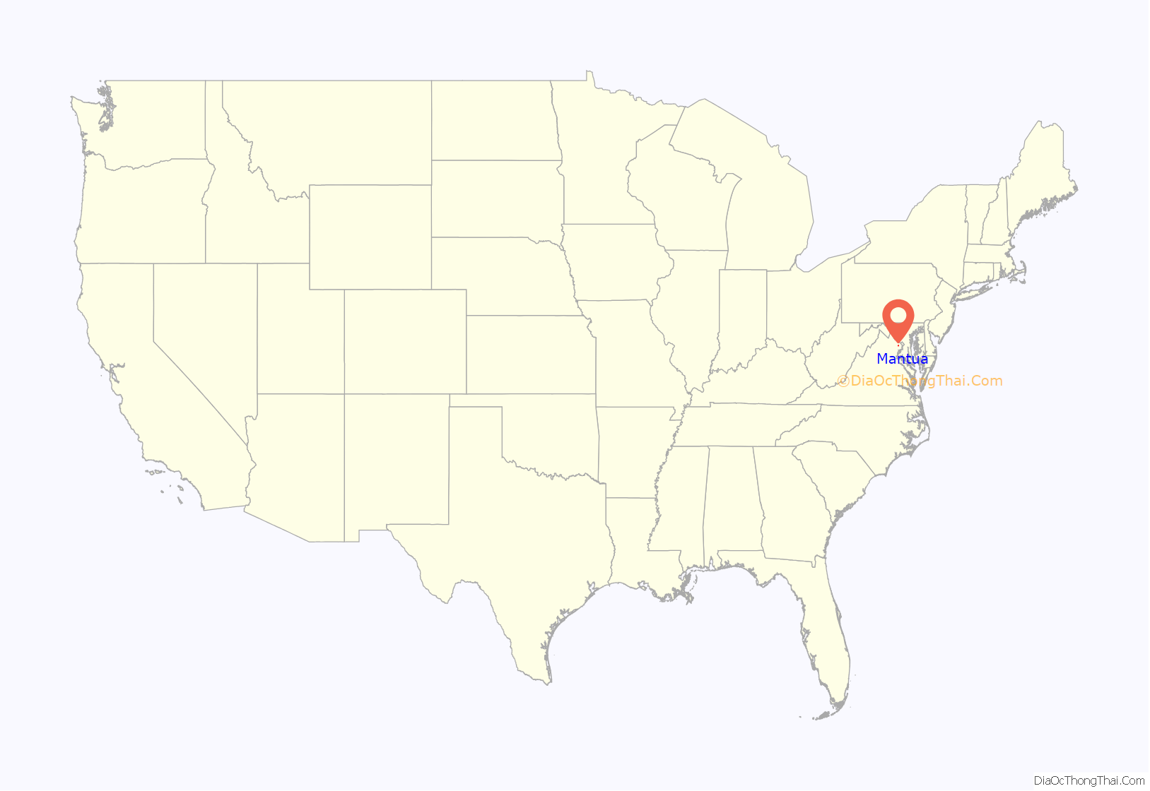
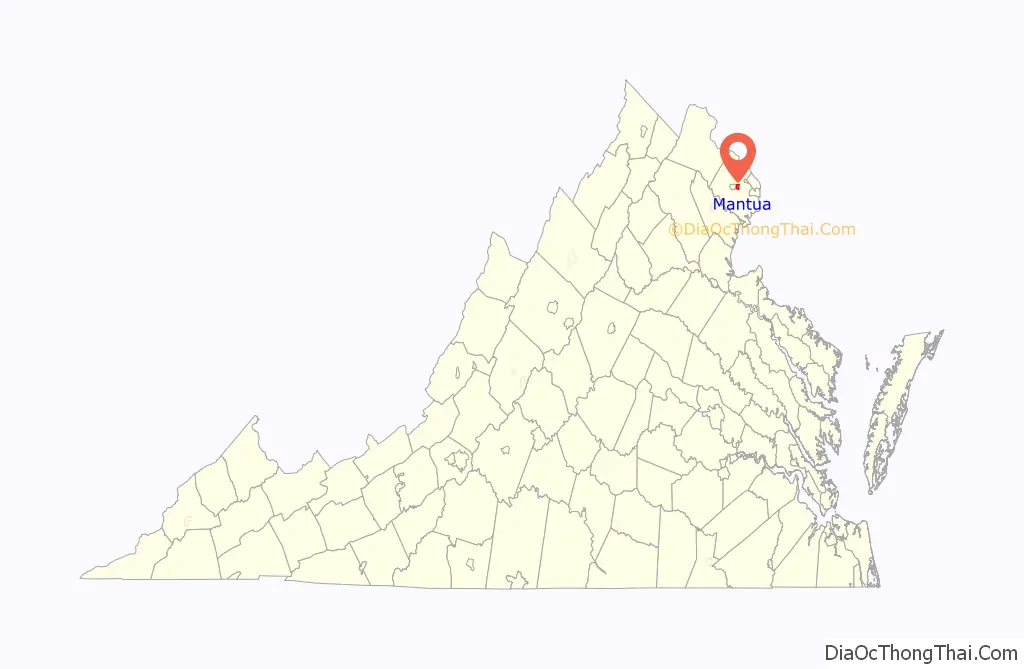
Mantua location map. Where is Mantua CDP?
History
Texaco oil leak
An oil distribution plant, located 2,000 feet (610 m) west of the community along Pickett Road in Fairfax City, was found in 1990 to have leaked approximately 200,000 gallons (approximately 4,700 barrels) of petroleum into 22 acres (0.089 km) of the soil and groundwater of the Crook Branch watershed. At the time, the distribution plant was owned in part by a subsidiary of Texaco. The oil leakage may have occurred over up to twenty-five years, as the distribution plant had opened in April 1965. Four families were evacuated, and approximately 100 homes were connected to public water and sewer lines. The Environmental Protection Agency (EPA) directed the installation of a “pump-and-treat” groundwater remediation system, which was augmented in 2000 by digging of horizontal infiltration wells, intended to wash contaminated groundwater into the remediation system. Storm sewers in the area were checked for leaks and relining was performed to prevent further contamination of surface water. By 2013, a four-year temporary shutdown test had shown that benzene vapor intrusion in homes directly above the contaminated groundwater plume did not exceed the screening limit, and that groundwater contamination east of the distribution plant had fallen to levels controllable by natural degradation. The offsite remediation system was removed by 2016, but cleanup at the distribution plant is ongoing. The oil distribution plant remains in operation as of 2023 using nine reinforced surface tanks, despite objections that community members and a task force appointed by Governor L. Douglas Wilder had raised at the time the leak was being investigated. All underground tanks have since been removed and piping for trucks to discharge oil residual into at the loading rack was installed in 1991: both the underground tanks and the loading rack had been suspected sources of the leak. Groundwater in the Crook Branch watershed continues to be tested annually by the EPA and storm sewers are inspected for cracks.
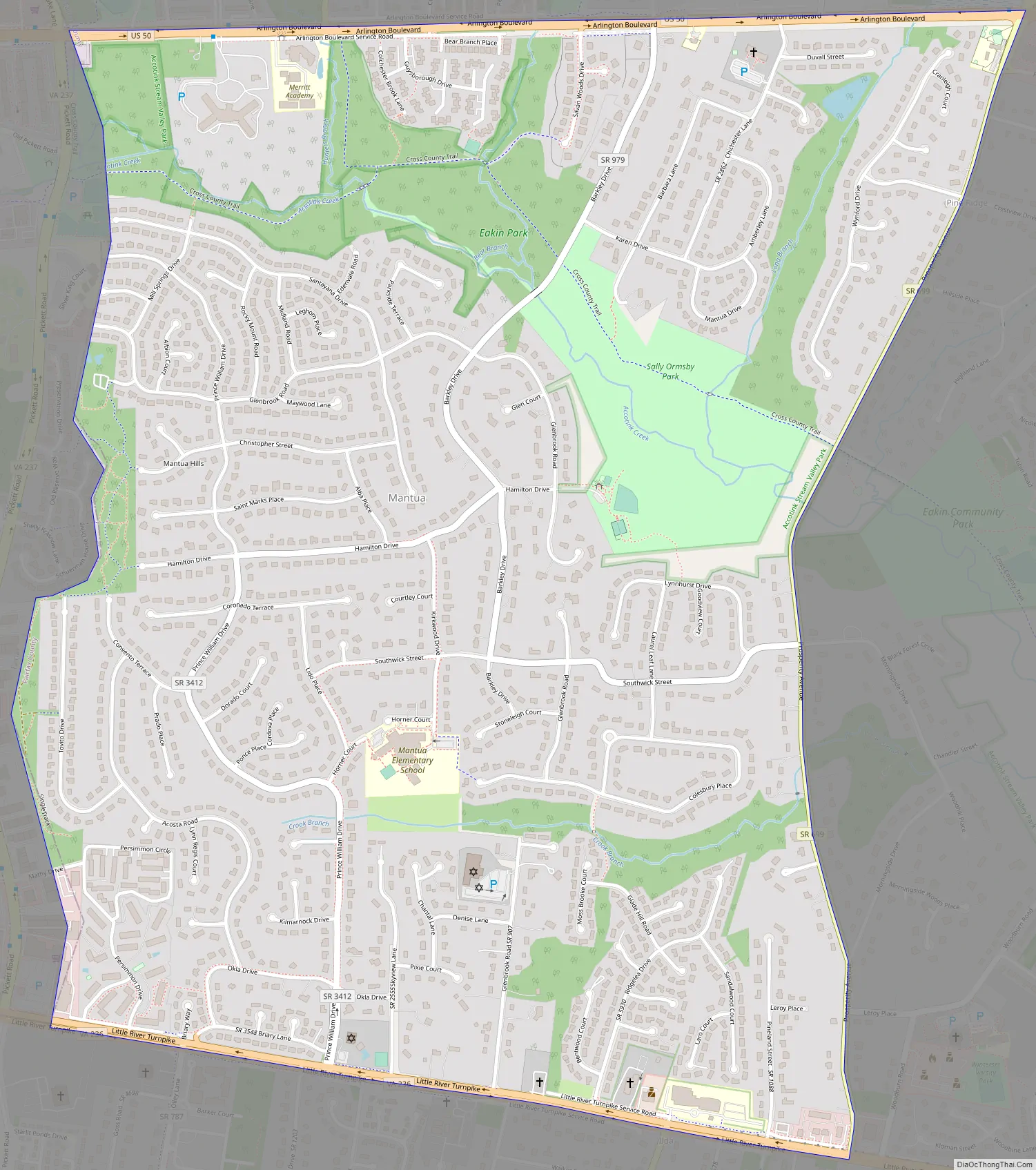
Mantua Road Map
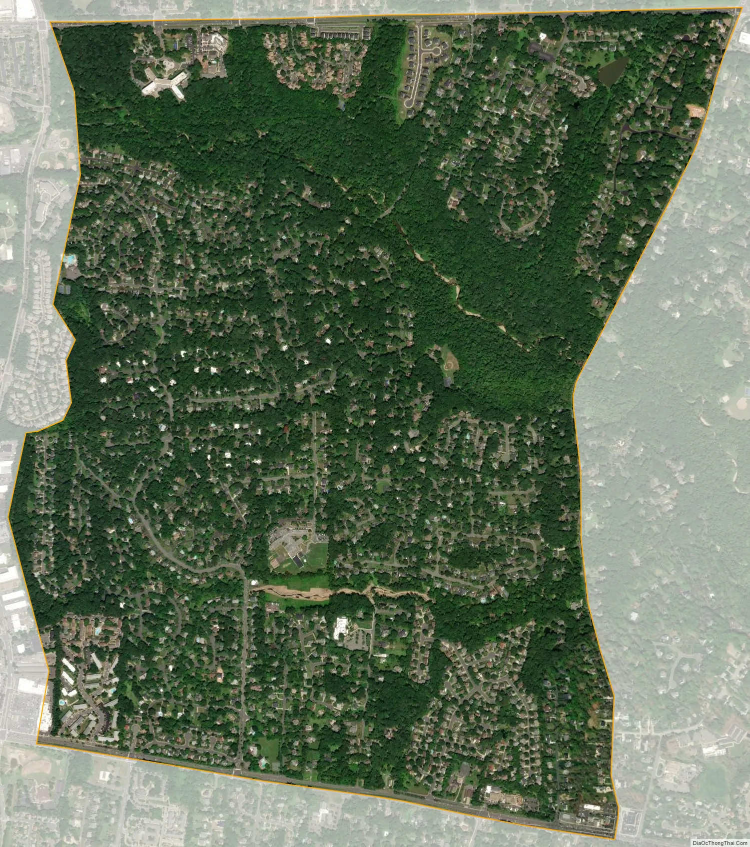
Mantua city Satellite Map
Geography
Mantua is located in central Fairfax County at 38°51′7″N 77°15′28″W / 38.85194°N 77.25778°W / 38.85194; -77.25778 (38.852012, −77.257675). It is bordered to the west by the city of Fairfax, to the north by Merrifield, to the east by Woodburn, to the southeast by Wakefield, and to the south by Long Branch. The northern border of the CDP follows U.S. Route 50 (Arlington Boulevard), the southern border follows Virginia State Route 236 (Little River Turnpike), and the eastern border follows Prosperity Avenue. The Capital Beltway (Interstate 495) is 2 miles (3 km) to the east, and downtown Washington is 14 miles (23 km) to the east.
According to the United States Census Bureau, the Mantua CDP has a total area of 2.4 square miles (6.2 km), of which 0.023 square miles (0.06 km), or 0.91%, is water. Accotink Creek, a tributary of the Potomac River, flows through the northern part of the CDP, and Crook Branch, a tributary of Accotink Creek, flows through the southern part.
See also
Map of Virginia State and its subdivision:- Accomack
- Albemarle
- Alexandria
- Alleghany
- Amelia
- Amherst
- Appomattox
- Arlington
- Augusta
- Bath
- Bedford
- Bedford City
- Bland
- Botetourt
- Bristol
- Brunswick
- Buchanan
- Buckingham
- Buena Vista
- Campbell
- Caroline
- Carroll
- Charles City
- Charlotte
- Charlottesville
- Chesapeake
- Chesterfield
- Clarke
- Clifton Forge City
- Colonial Heights
- Covington
- Craig
- Culpeper
- Cumberland
- Danville
- Dickenson
- Dinwiddie
- Emporia
- Essex
- Fairfax
- Fairfax City
- Falls Church
- Fauquier
- Floyd
- Fluvanna
- Franklin
- Frederick
- Fredericksburg
- Galax
- Giles
- Gloucester
- Goochland
- Grayson
- Greene
- Greensville
- Halifax
- Hampton
- Hanover
- Harrisonburg
- Henrico
- Henry
- Highland
- Hopewell
- Isle of Wight
- James City
- King and Queen
- King George
- King William
- Lancaster
- Lee
- Lexington
- Loudoun
- Louisa
- Lunenburg
- Lynchburg
- Madison
- Manassas
- Manassas Park
- Martinsville
- Mathews
- Mecklenburg
- Middlesex
- Montgomery
- Nelson
- New Kent
- Newport News
- Norfolk
- Northampton
- Northumberland
- Norton
- Nottoway
- Orange
- Page
- Patrick
- Petersburg
- Pittsylvania
- Poquoson
- Portsmouth
- Powhatan
- Prince Edward
- Prince George
- Prince William
- Pulaski
- Radford
- Rappahannock
- Richmond
- Roanoke
- Roanoke City
- Rockbridge
- Rockingham
- Russell
- Salem
- Scott
- Shenandoah
- Smyth
- Southampton
- Spotsylvania
- Stafford
- Staunton
- Suffolk
- Surry
- Sussex
- Tazewell
- Virginia Beach
- Warren
- Washington
- Waynesboro
- Westmoreland
- Williamsburg
- Winchester
- Wise
- Wythe
- York
- Alabama
- Alaska
- Arizona
- Arkansas
- California
- Colorado
- Connecticut
- Delaware
- District of Columbia
- Florida
- Georgia
- Hawaii
- Idaho
- Illinois
- Indiana
- Iowa
- Kansas
- Kentucky
- Louisiana
- Maine
- Maryland
- Massachusetts
- Michigan
- Minnesota
- Mississippi
- Missouri
- Montana
- Nebraska
- Nevada
- New Hampshire
- New Jersey
- New Mexico
- New York
- North Carolina
- North Dakota
- Ohio
- Oklahoma
- Oregon
- Pennsylvania
- Rhode Island
- South Carolina
- South Dakota
- Tennessee
- Texas
- Utah
- Vermont
- Virginia
- Washington
- West Virginia
- Wisconsin
- Wyoming


