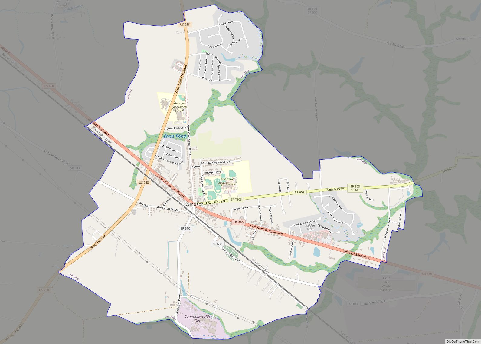
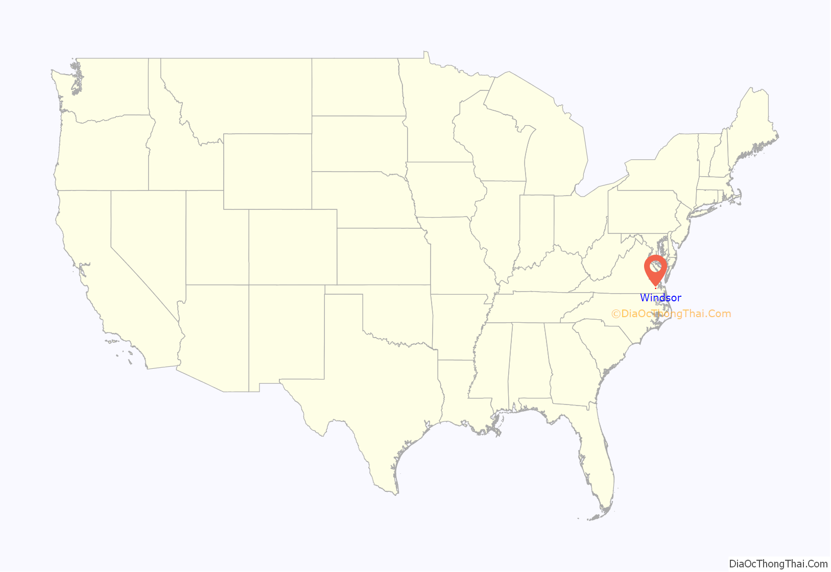
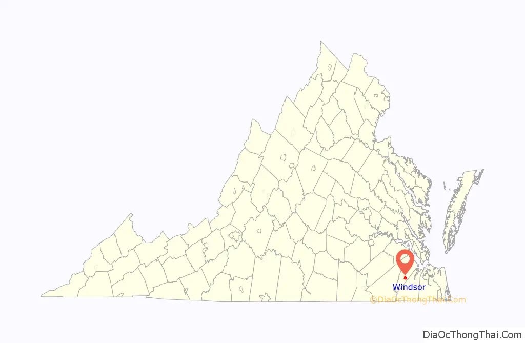
Windsor is an incorporated town in Isle of Wight County in the Hampton Roads region of southeastern Virginia in the United States. It is located near the crossroads of U.S. Route 460 and U.S. Route 258. The population was 2,626 at the 2010 census, up from 916 at the 2000 census.
| Name: | Windsor town |
|---|---|
| LSAD Code: | 43 |
| LSAD Description: | town (suffix) |
| State: | Virginia |
| County: | Isle of Wight County |
| Founded: | 1902 |
| Elevation: | 79 ft (24 m) |
| Total Area: | 4.03 sq mi (10.44 km²) |
| Land Area: | 4.01 sq mi (10.39 km²) |
| Water Area: | 0.02 sq mi (0.04 km²) |
| Total Population: | 2,626 |
| Population Density: | 687.44/sq mi (265.39/km²) |
| ZIP code: | 23487 |
| Area code: | 757, 948 (planned) |
| FIPS code: | 5186784 |
| GNISfeature ID: | 1500328 |
| Website: | www.windsor-va.gov |
Online Interactive Map
Click on ![]() to view map in "full screen" mode.
to view map in "full screen" mode.
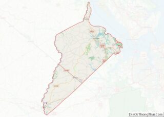
Windsor location map. Where is Windsor town?
History
Windsor was established next to the Norfolk Southern Corporation’s railroad. The town of Windsor was chartered on March 15, 1902. Windsor established a volunteer fire department in 1947 and its police department in 1990. In 2001, the town annexed 2.8 square miles (7.3 km) of Isle of Wight County, which nearly tripled its population.
The Henry Saunders House and William Scott Farmstead are listed on the National Register of Historic Places.
In 2021, it was reported that Windsor had developed a reputation for ticketing and fining passing motorists. Nearly 10 percent of the town’s local revenue comes from traffic fines. The town obtained national media coverage when Windsor police stopped and pepper-sprayed Lt. Caron Nazario, a black man driving through Windsor. As a result of the Nazario incident, the Attorney General of Virginia filed suit against Windsor for its “pattern of unconstitutional and discriminatory policing” in December, 2021.
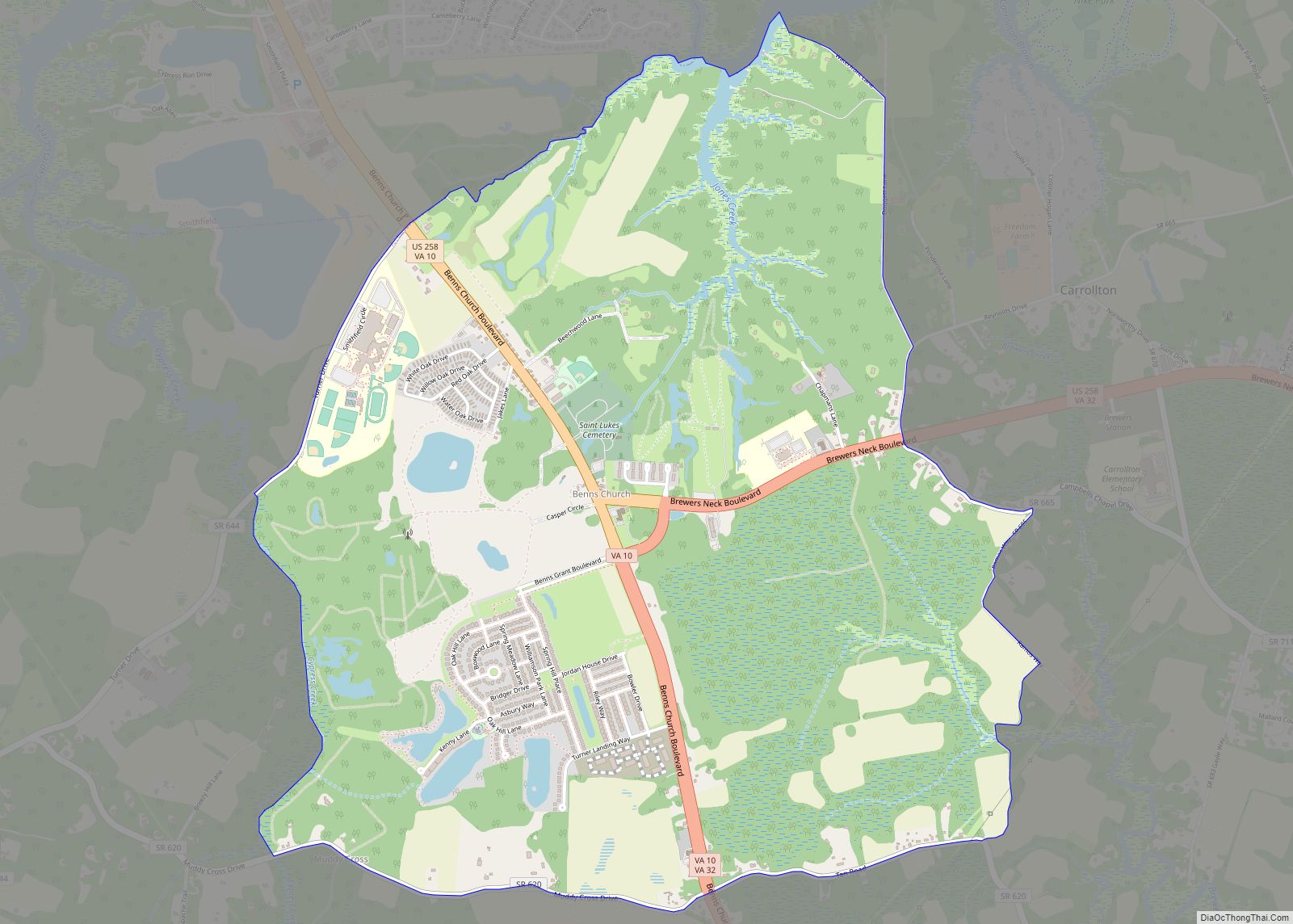
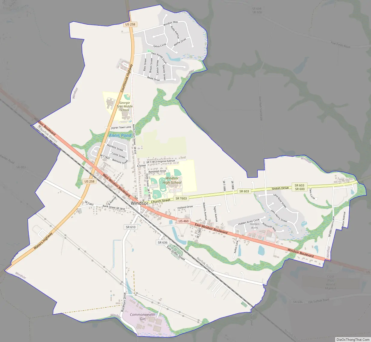
Windsor Road Map
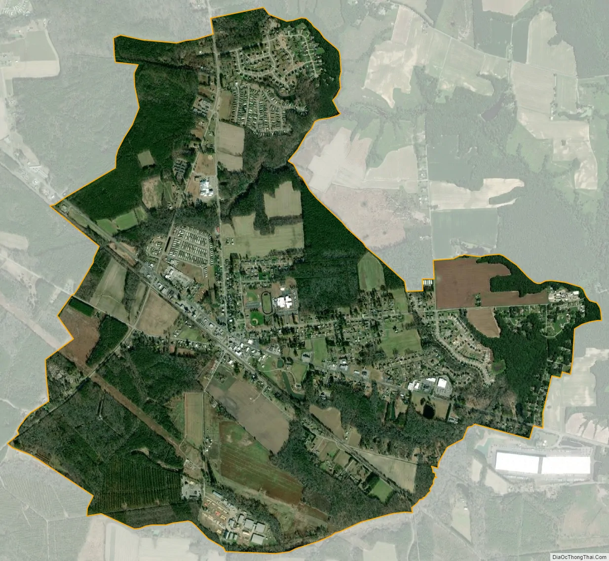
Windsor city Satellite Map
Geography
Windsor is located in southern Isle of Wight County at 36°48′40″N 76°44′37″W / 36.81111°N 76.74361°W / 36.81111; -76.74361 (36.811175, −76.743658). U.S. Route 460 passes through the center of town, leading southeast 11 miles (18 km) to Suffolk and northwest 47 miles (76 km) to Petersburg. Norfolk is 29 miles (47 km) east of Windsor via US-460 and U.S. Route 58. U.S. Route 258 crosses US-460 on the western side of Windsor, leading north 15 miles (24 km) to Smithfield and southwest the same distance to Franklin.
According to the United States Census Bureau, Windsor has a total area of 4.0 square miles (10.4 km), of which 0.02 square miles (0.04 km), or 0.41%, are water.
See also
Map of Virginia State and its subdivision:- Accomack
- Albemarle
- Alexandria
- Alleghany
- Amelia
- Amherst
- Appomattox
- Arlington
- Augusta
- Bath
- Bedford
- Bedford City
- Bland
- Botetourt
- Bristol
- Brunswick
- Buchanan
- Buckingham
- Buena Vista
- Campbell
- Caroline
- Carroll
- Charles City
- Charlotte
- Charlottesville
- Chesapeake
- Chesterfield
- Clarke
- Clifton Forge City
- Colonial Heights
- Covington
- Craig
- Culpeper
- Cumberland
- Danville
- Dickenson
- Dinwiddie
- Emporia
- Essex
- Fairfax
- Fairfax City
- Falls Church
- Fauquier
- Floyd
- Fluvanna
- Franklin
- Frederick
- Fredericksburg
- Galax
- Giles
- Gloucester
- Goochland
- Grayson
- Greene
- Greensville
- Halifax
- Hampton
- Hanover
- Harrisonburg
- Henrico
- Henry
- Highland
- Hopewell
- Isle of Wight
- James City
- King and Queen
- King George
- King William
- Lancaster
- Lee
- Lexington
- Loudoun
- Louisa
- Lunenburg
- Lynchburg
- Madison
- Manassas
- Manassas Park
- Martinsville
- Mathews
- Mecklenburg
- Middlesex
- Montgomery
- Nelson
- New Kent
- Newport News
- Norfolk
- Northampton
- Northumberland
- Norton
- Nottoway
- Orange
- Page
- Patrick
- Petersburg
- Pittsylvania
- Poquoson
- Portsmouth
- Powhatan
- Prince Edward
- Prince George
- Prince William
- Pulaski
- Radford
- Rappahannock
- Richmond
- Roanoke
- Roanoke City
- Rockbridge
- Rockingham
- Russell
- Salem
- Scott
- Shenandoah
- Smyth
- Southampton
- Spotsylvania
- Stafford
- Staunton
- Suffolk
- Surry
- Sussex
- Tazewell
- Virginia Beach
- Warren
- Washington
- Waynesboro
- Westmoreland
- Williamsburg
- Winchester
- Wise
- Wythe
- York
- Alabama
- Alaska
- Arizona
- Arkansas
- California
- Colorado
- Connecticut
- Delaware
- District of Columbia
- Florida
- Georgia
- Hawaii
- Idaho
- Illinois
- Indiana
- Iowa
- Kansas
- Kentucky
- Louisiana
- Maine
- Maryland
- Massachusetts
- Michigan
- Minnesota
- Mississippi
- Missouri
- Montana
- Nebraska
- Nevada
- New Hampshire
- New Jersey
- New Mexico
- New York
- North Carolina
- North Dakota
- Ohio
- Oklahoma
- Oregon
- Pennsylvania
- Rhode Island
- South Carolina
- South Dakota
- Tennessee
- Texas
- Utah
- Vermont
- Virginia
- Washington
- West Virginia
- Wisconsin
- Wyoming