Oglethorpe is a city in Macon County, Georgia, United States. The population was 995 at the 2020 census, down from 1,328 in 2010. The city is the county seat of Macon County. It was named for Georgia‘s founder, James Oglethorpe.
| Name: | Oglethorpe city |
|---|---|
| LSAD Code: | 25 |
| LSAD Description: | city (suffix) |
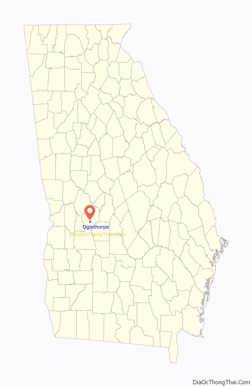
| State: | Georgia |
| County: | Macon County |
| Elevation: | 341 ft (104 m) |
| Total Area: | 2.05 sq mi (5.32 km²) |
| Land Area: | 2.01 sq mi (5.20 km²) |
| Water Area: | 0.05 sq mi (0.12 km²) |
| Total Population: | 995 |
| Population Density: | 496.01/sq mi (191.49/km²) |
| ZIP code: | 31068 |
| Area code: | 478 |
| FIPS code: | 1357736 |
| GNISfeature ID: | 0332561 |
| Website: | www.cityofoglethorpe.com |
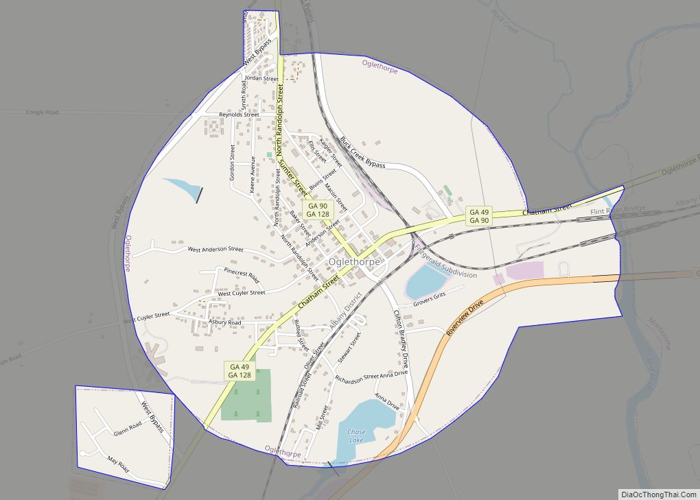
Online Interactive Map
Click on ![]() to view map in "full screen" mode.
to view map in "full screen" mode.
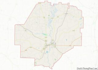
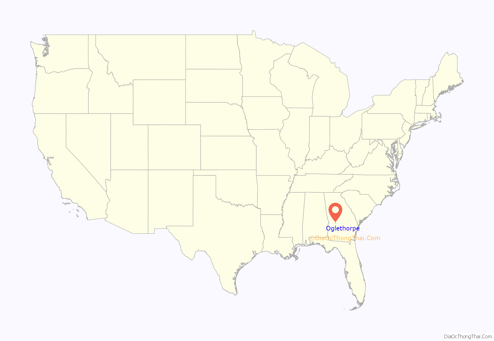
Oglethorpe location map. Where is Oglethorpe city?
History
Oglethorpe was founded in 1838. It was located in the Black Belt of Georgia, where slaves outnumbered whites and did the work to support cultivation of cotton as a commodity crop. Oglethorpe was incorporated as a town in 1849 and as a city in 1852. In 1857, the seat of Macon County was transferred to Oglethorpe from Lanier.
Oglethorpe was once one of the largest cities in southwestern Georgia. Epidemics of malaria and smallpox caused high fatalities in the early 1860s; the remaining residents in Oglethorpe fled south to Americus to escape more disease.
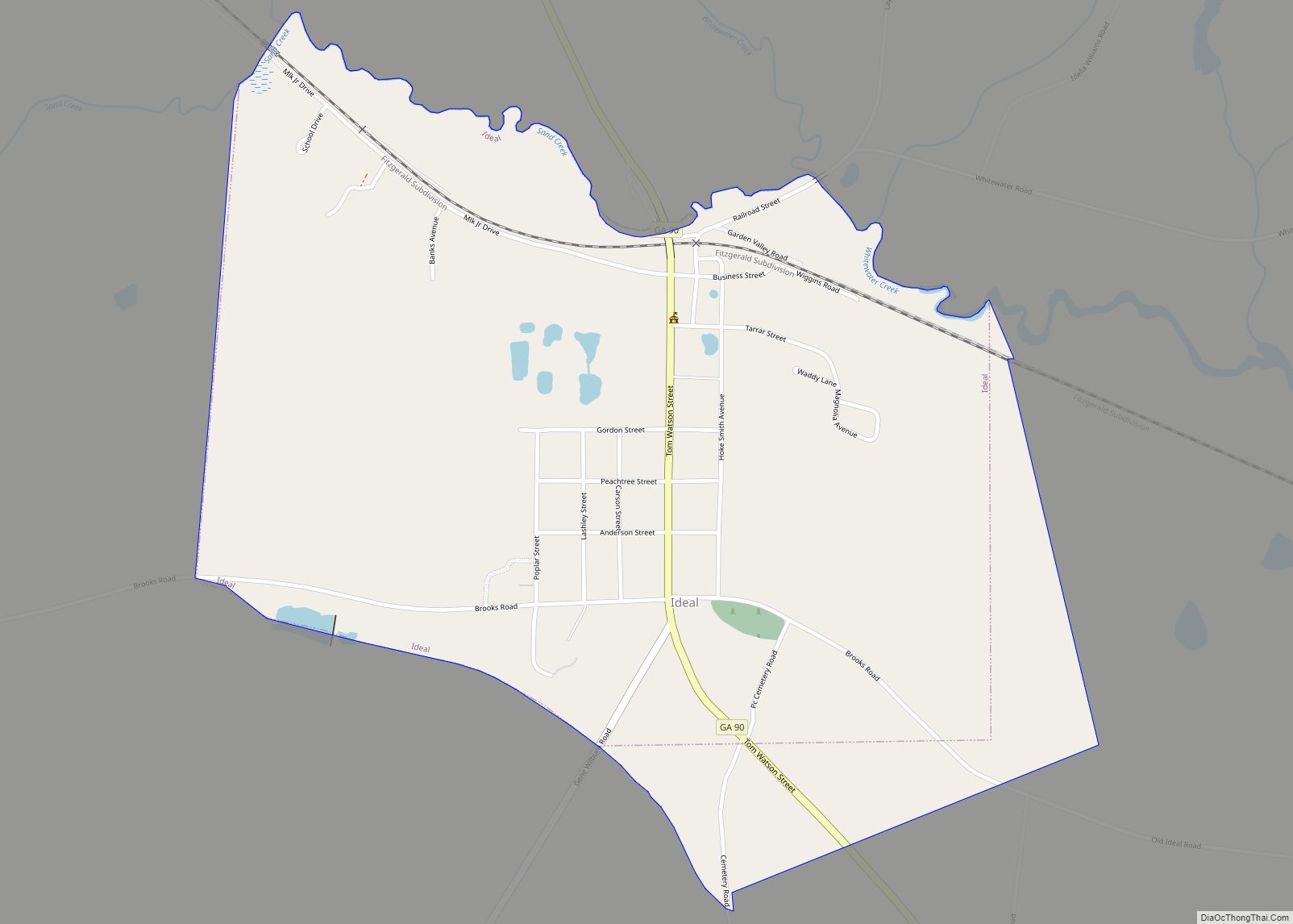
Oglethorpe Road Map
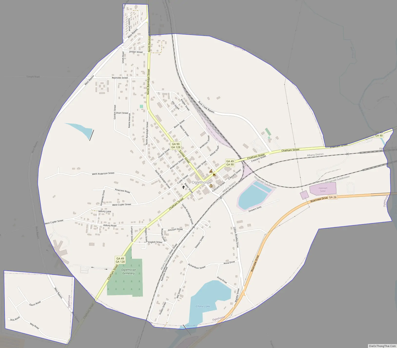
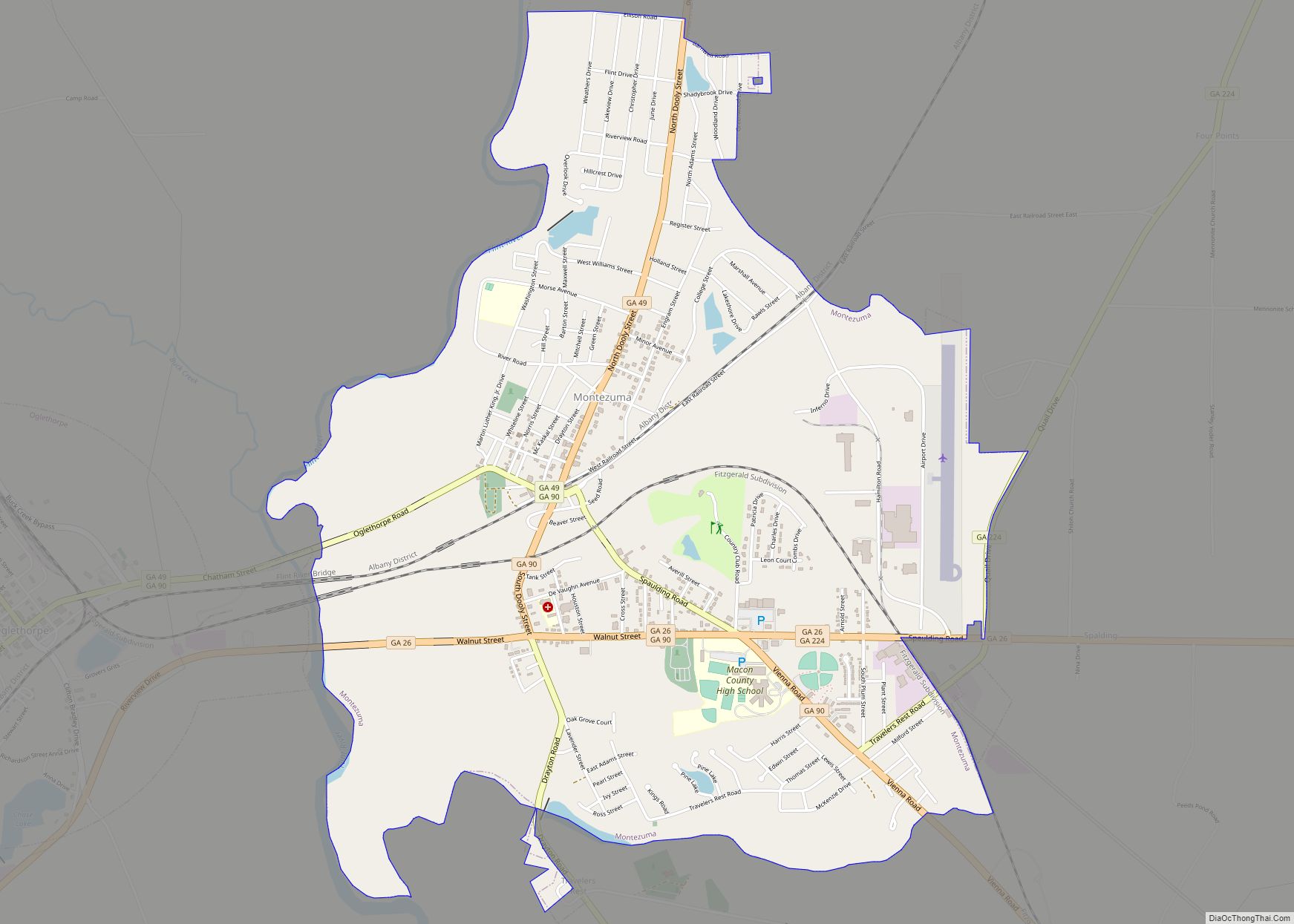
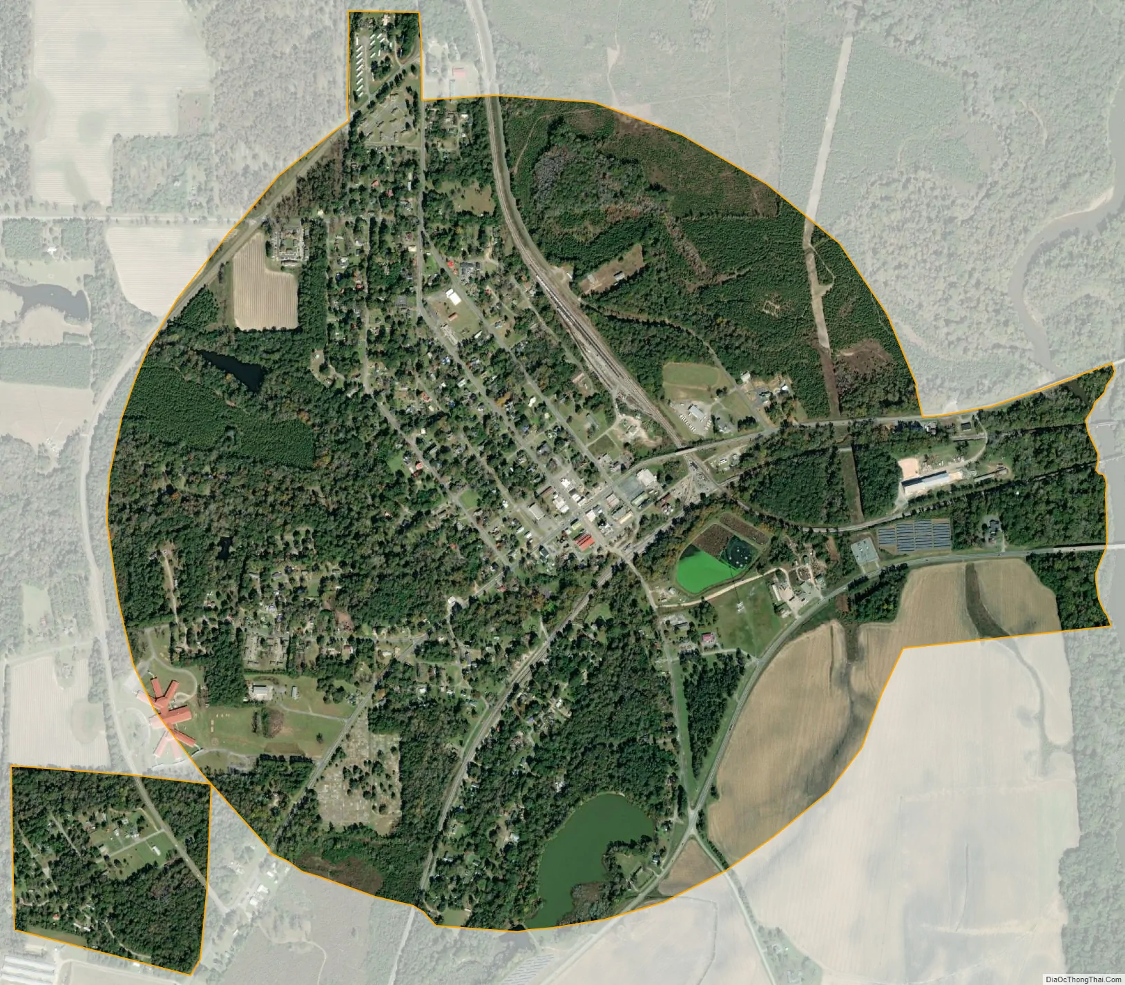
Oglethorpe city Satellite Map
Geography
Oglethorpe is located in south-central Macon County at 32°17′36″N 84°3′45″W / 32.29333°N 84.06250°W / 32.29333; -84.06250 (32.293328, -84.062616). It sits on high ground west of the Flint River, which forms the boundary between Oglethorpe and the larger city of Montezuma.
Georgia State Route 49 passes through the center of town as Chatham Street. It leads east into Montezuma and northeast 15 miles (24 km) to Marshallville, while to the southwest it leads 20 miles (32 km) to Americus. State Route 90 enters from the north on North Randolph Street and Sumter Street and leaves to the east on Chatham Street. It connects Oglethorpe with Rupert 18 miles (29 km) to the northwest and with Vienna 23 miles (37 km) to the southeast. State Route 128 leaves Oglethorpe to the north with SR 90 but leads 19 miles (31 km) to Reynolds. State Route 26 (Riverview Drive) passes through the south side of Oglethorpe, leading east through Montezuma 36 miles (58 km) to Hawkinsville and west 17 miles (27 km) to Ellaville.
According to the U.S. Census Bureau, Oglethorpe has a total area of 2.1 square miles (5.4 km), of which 0.05 square miles (0.13 km), or 2.34%, are water.
See also
Map of Georgia State and its subdivision:- Appling
- Atkinson
- Bacon
- Baker
- Baldwin
- Banks
- Barrow
- Bartow
- Ben Hill
- Berrien
- Bibb
- Bleckley
- Brantley
- Brooks
- Bryan
- Bulloch
- Burke
- Butts
- Calhoun
- Camden
- Candler
- Carroll
- Catoosa
- Charlton
- Chatham
- Chattahoochee
- Chattooga
- Cherokee
- Clarke
- Clay
- Clayton
- Clinch
- Cobb
- Coffee
- Colquitt
- Columbia
- Cook
- Coweta
- Crawford
- Crisp
- Dade
- Dawson
- Decatur
- DeKalb
- Dodge
- Dooly
- Dougherty
- Douglas
- Early
- Echols
- Effingham
- Elbert
- Emanuel
- Evans
- Fannin
- Fayette
- Floyd
- Forsyth
- Franklin
- Fulton
- Gilmer
- Glascock
- Glynn
- Gordon
- Grady
- Greene
- Gwinnett
- Habersham
- Hall
- Hancock
- Haralson
- Harris
- Hart
- Heard
- Henry
- Houston
- Irwin
- Jackson
- Jasper
- Jeff Davis
- Jefferson
- Jenkins
- Johnson
- Jones
- Lamar
- Lanier
- Laurens
- Lee
- Liberty
- Lincoln
- Long
- Lowndes
- Lumpkin
- Macon
- Madison
- Marion
- McDuffie
- McIntosh
- Meriwether
- Miller
- Mitchell
- Monroe
- Montgomery
- Morgan
- Murray
- Muscogee
- Newton
- Oconee
- Oglethorpe
- Paulding
- Peach
- Pickens
- Pierce
- Pike
- Polk
- Pulaski
- Putnam
- Quitman
- Rabun
- Randolph
- Richmond
- Rockdale
- Schley
- Screven
- Seminole
- Spalding
- Stephens
- Stewart
- Sumter
- Talbot
- Taliaferro
- Tattnall
- Taylor
- Telfair
- Terrell
- Thomas
- Tift
- Toombs
- Towns
- Treutlen
- Troup
- Turner
- Twiggs
- Union
- Upson
- Walker
- Walton
- Ware
- Warren
- Washington
- Wayne
- Webster
- Wheeler
- White
- Whitfield
- Wilcox
- Wilkes
- Wilkinson
- Worth
- Alabama
- Alaska
- Arizona
- Arkansas
- California
- Colorado
- Connecticut
- Delaware
- District of Columbia
- Florida
- Georgia
- Hawaii
- Idaho
- Illinois
- Indiana
- Iowa
- Kansas
- Kentucky
- Louisiana
- Maine
- Maryland
- Massachusetts
- Michigan
- Minnesota
- Mississippi
- Missouri
- Montana
- Nebraska
- Nevada
- New Hampshire
- New Jersey
- New Mexico
- New York
- North Carolina
- North Dakota
- Ohio
- Oklahoma
- Oregon
- Pennsylvania
- Rhode Island
- South Carolina
- South Dakota
- Tennessee
- Texas
- Utah
- Vermont
- Virginia
- Washington
- West Virginia
- Wisconsin
- Wyoming