Montezuma is a city in Macon County, Georgia (ZIP code 31063). The population was 3,047 at the 2020 census, down from 3,460 in 2010. It is home to the armory of Bravo Company, 648th Engineers of the Georgia Army National Guard.
| Name: | Montezuma city |
|---|---|
| LSAD Code: | 25 |
| LSAD Description: | city (suffix) |
| State: | Georgia |
| County: | Macon County |
| Elevation: | 364 ft (111 m) |
| Total Area: | 4.63 sq mi (12.00 km²) |
| Land Area: | 4.57 sq mi (11.82 km²) |
| Water Area: | 0.07 sq mi (0.18 km²) |
| Total Population: | 3,047 |
| Population Density: | 667.47/sq mi (257.73/km²) |
| ZIP code: | 31063 |
| Area code: | 478 |
| FIPS code: | 1352304 |
| GNISfeature ID: | 0332410 |
| Website: | www.montezuma-ga.org |
Online Interactive Map
Click on ![]() to view map in "full screen" mode.
to view map in "full screen" mode.
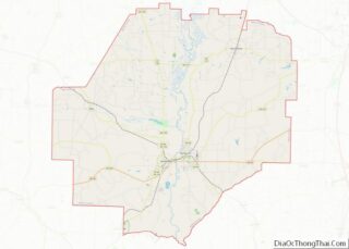
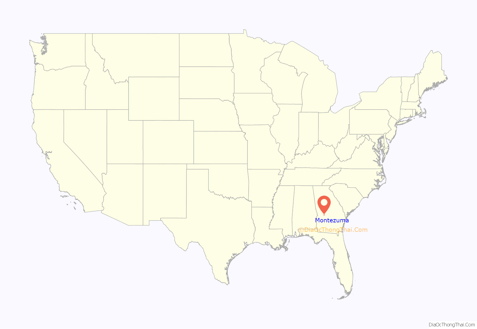
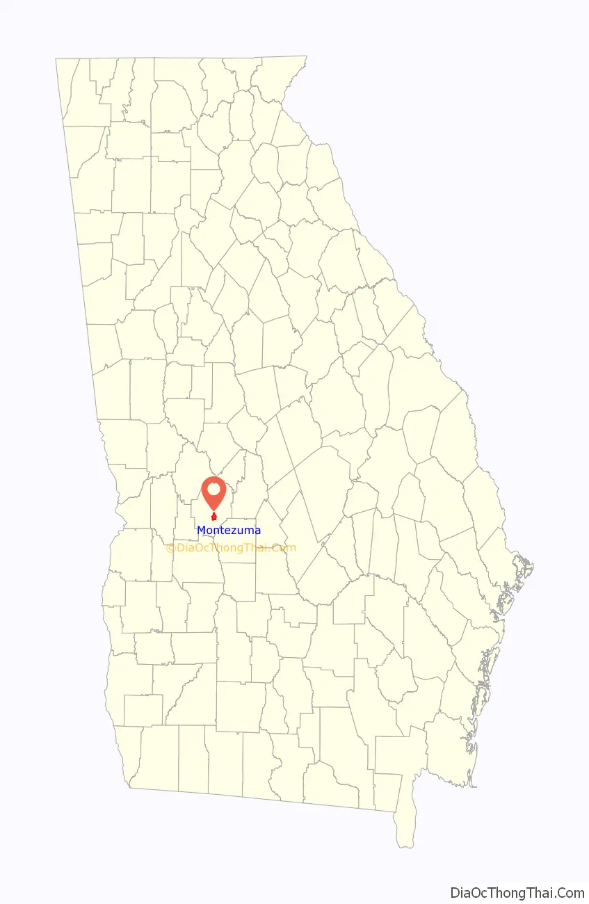
Montezuma location map. Where is Montezuma city?
History
Montezuma had its start in 1851, when the railroad was extended to that point. The city was named after the famous Aztec leader by soldiers returning from the Mexican–American War. It was incorporated in 1854.
Montezuma is home to a thriving Mennonite community, founded when 10 to 15 Mennonite families moved from Virginia in the 1950s.
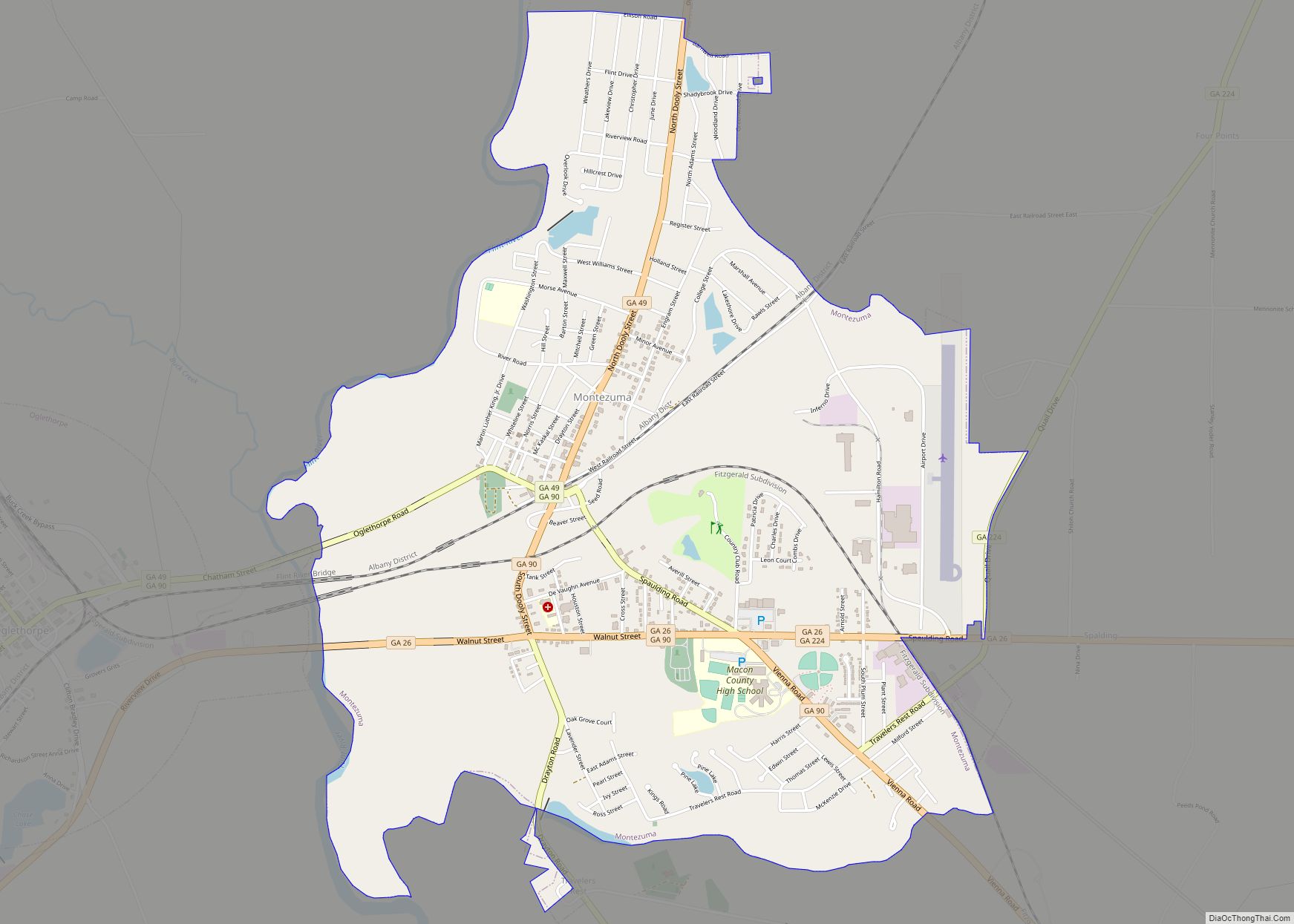
Montezuma Road Map
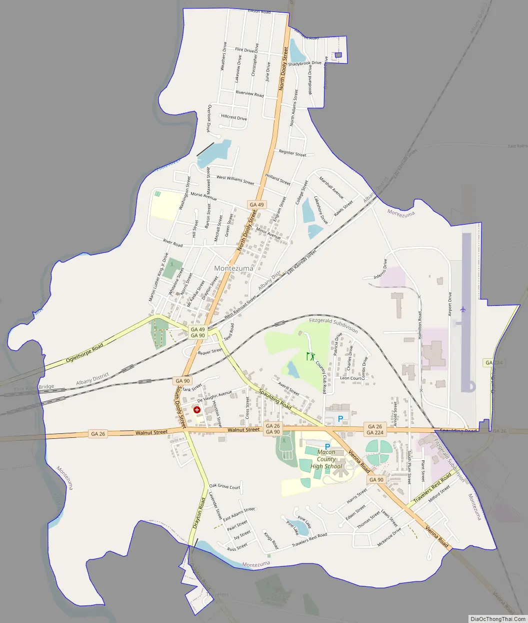
Montezuma city Satellite Map

Geography
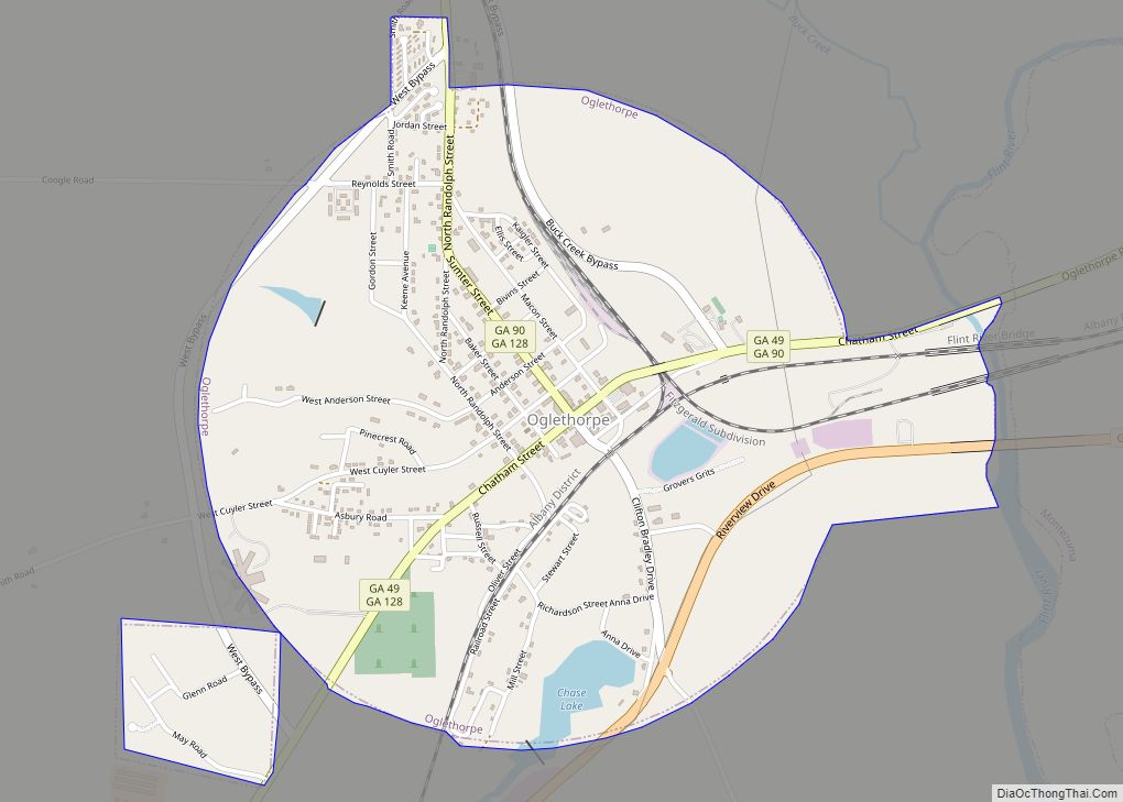
Montezuma is in south-central Macon County, on the east side of the Flint River. It is bordered to the west across the river by Oglethorpe, the Macon county seat. Several state highways converge in Montezuma. State Route 26 (Walnut Street) passes through the south side of the city, leading east 35 miles (56 km) to Hawkinsville and west past Oglethorpe 18 miles (29 km) to Ellaville. State Route 90 passes through the center of Montezuma, leading southeast 21 miles (34 km) to Vienna and northwest 20 miles (32 km) to Rupert. State Route 49 also passes through the city center, leading northeast 13 miles (21 km) to Marshallville and southwest 11 miles (18 km) to Andersonville.
According to the United States Census Bureau, the city has a total area of 4.6 square miles (12 km), of which 0.07 square miles (0.18 km), or 1.49%, are water.
See also
Map of Georgia State and its subdivision:- Appling
- Atkinson
- Bacon
- Baker
- Baldwin
- Banks
- Barrow
- Bartow
- Ben Hill
- Berrien
- Bibb
- Bleckley
- Brantley
- Brooks
- Bryan
- Bulloch
- Burke
- Butts
- Calhoun
- Camden
- Candler
- Carroll
- Catoosa
- Charlton
- Chatham
- Chattahoochee
- Chattooga
- Cherokee
- Clarke
- Clay
- Clayton
- Clinch
- Cobb
- Coffee
- Colquitt
- Columbia
- Cook
- Coweta
- Crawford
- Crisp
- Dade
- Dawson
- Decatur
- DeKalb
- Dodge
- Dooly
- Dougherty
- Douglas
- Early
- Echols
- Effingham
- Elbert
- Emanuel
- Evans
- Fannin
- Fayette
- Floyd
- Forsyth
- Franklin
- Fulton
- Gilmer
- Glascock
- Glynn
- Gordon
- Grady
- Greene
- Gwinnett
- Habersham
- Hall
- Hancock
- Haralson
- Harris
- Hart
- Heard
- Henry
- Houston
- Irwin
- Jackson
- Jasper
- Jeff Davis
- Jefferson
- Jenkins
- Johnson
- Jones
- Lamar
- Lanier
- Laurens
- Lee
- Liberty
- Lincoln
- Long
- Lowndes
- Lumpkin
- Macon
- Madison
- Marion
- McDuffie
- McIntosh
- Meriwether
- Miller
- Mitchell
- Monroe
- Montgomery
- Morgan
- Murray
- Muscogee
- Newton
- Oconee
- Oglethorpe
- Paulding
- Peach
- Pickens
- Pierce
- Pike
- Polk
- Pulaski
- Putnam
- Quitman
- Rabun
- Randolph
- Richmond
- Rockdale
- Schley
- Screven
- Seminole
- Spalding
- Stephens
- Stewart
- Sumter
- Talbot
- Taliaferro
- Tattnall
- Taylor
- Telfair
- Terrell
- Thomas
- Tift
- Toombs
- Towns
- Treutlen
- Troup
- Turner
- Twiggs
- Union
- Upson
- Walker
- Walton
- Ware
- Warren
- Washington
- Wayne
- Webster
- Wheeler
- White
- Whitfield
- Wilcox
- Wilkes
- Wilkinson
- Worth
- Alabama
- Alaska
- Arizona
- Arkansas
- California
- Colorado
- Connecticut
- Delaware
- District of Columbia
- Florida
- Georgia
- Hawaii
- Idaho
- Illinois
- Indiana
- Iowa
- Kansas
- Kentucky
- Louisiana
- Maine
- Maryland
- Massachusetts
- Michigan
- Minnesota
- Mississippi
- Missouri
- Montana
- Nebraska
- Nevada
- New Hampshire
- New Jersey
- New Mexico
- New York
- North Carolina
- North Dakota
- Ohio
- Oklahoma
- Oregon
- Pennsylvania
- Rhode Island
- South Carolina
- South Dakota
- Tennessee
- Texas
- Utah
- Vermont
- Virginia
- Washington
- West Virginia
- Wisconsin
- Wyoming