Americus is the county seat of Sumter County, Georgia, United States. As of the 2020 census, the city had a population of 16,230. It is the principal city of the Americus Micropolitan Statistical Area, a micropolitan area that covers Schley and Sumter counties and had a combined population of 36,966 at the 2000 census.
Americus is the home of Habitat for Humanity’s international headquarters, Georgia Southwestern State University, the Windsor Hotel, The Fuller Center for Housing’s international headquarters, The Rosalynn Carter Institute for Caregivers, Cafe Campesino, and many other organizations. The city is notable for its rich history, including a large business and residential historic district, and its close proximity to Jimmy Carter National Historic Site, Andersonville National Historic Site, and Koinonia Farm.
| Name: | Americus city |
|---|---|
| LSAD Code: | 25 |
| LSAD Description: | city (suffix) |
| State: | Georgia |
| County: | Sumter County |
| Elevation: | 479 ft (146 m) |
| Total Area: | 11.57 sq mi (29.96 km²) |
| Land Area: | 11.35 sq mi (29.40 km²) |
| Water Area: | 0.22 sq mi (0.57 km²) |
| Total Population: | 16,230 |
| Population Density: | 1,429.96/sq mi (552.13/km²) |
| ZIP code: | 31709, 31710, 31719 |
| Area code: | 229 |
| FIPS code: | 1302116 |
| GNISfeature ID: | 0331037 |
| Website: | www.cityofamericus.net |
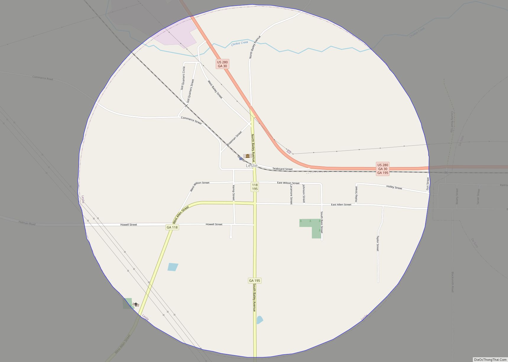
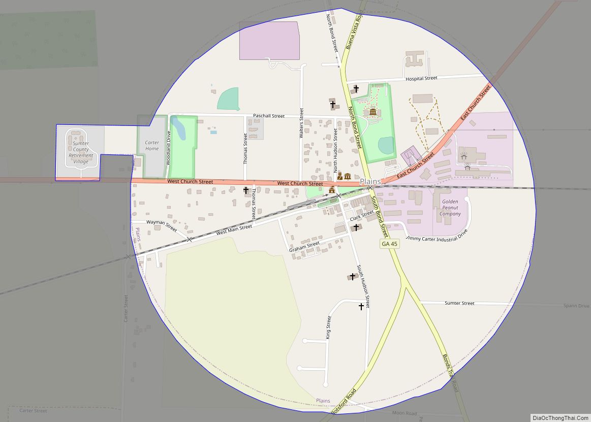
Online Interactive Map
Click on ![]() to view map in "full screen" mode.
to view map in "full screen" mode.
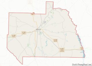
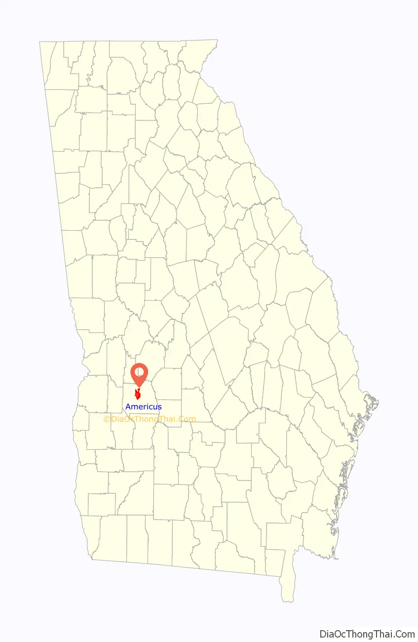
Americus location map. Where is Americus city?

History
Early years
For its first two decades, Americus was a small courthouse town. The arrival of the railroad in 1854 and, three decades later, local attorney Samuel H. Hawkins’ construction of the only privately financed railroad in state history made Americus the eighth largest city in Georgia into the 20th century. It was known as the “Metropolis of Southwest Georgia,” a reflection of its status as a cotton distribution center.
In 1890, Georgia’s first chartered electric street car system went into operation in Americus. One of its restored cars is on permanent display at the Lake Blackshear Regional Library, a gift from the Robert T. Crabb family who acquired the street car in the 1940s.
The town was already graced with an abundance of antebellum and Victorian architecture when local capitalists opened the Windsor Hotel in 1892. A five-story Queen Anne edifice, it was designed by a Swedish architect, Gottfried L. Norrman, in Atlanta. Vice-President Thomas R. Marshall gave a speech from the balcony in 1917, and soon to be New York Governor Franklin D. Roosevelt spoke in the dining room in 1928.
On January 1, 1976, the city center was listed on the National Register of Historic Places as the Americus Historic District. The district boundaries were extended in 1979.
Into the 20th century
For the local minority community, Rev. Dr. Major W. Reddick established the Americus Institute (1897–1932). Booker T. Washington was a guest speaker there in May 1908. Rev. Alfred S. Staley was responsible for locating the state Masonic Orphanage in Americus, which served its function from 1898 to 1940. Both men engineered the unification of the General Missionary Baptist Convention of Georgia in 1915, the former as president and the latter as recording secretary. The public school named in honor of A.S. Staley was designated a National School of Excellence in 1990.
Two other colleges were also established in Americus, the Third District Agricultural and Mechanical School in 1906 (now Georgia Southwestern State University), and the South Georgia Trade and Vocational School in 1948 (now South Georgia Technical College). South Georgia Technical College is located on the original site of Souther Field.
In World War I, an Army Air Service training facility, Souther Field (now Jimmy Carter Regional Airport), was commissioned northeast of the city limits. Charles A. Lindbergh, the “Lone Eagle,” bought his first airplane and made his first solo flight there during a two-week stay in May 1923. Recommissioned for World War II, Souther Field was used for RAF pilot training (1941–1942) as well as US pilot training before ending the war as a German prisoner-of-war camp. The town was incorporated in 1832, and the name Americus was picked out of a hat.
Shoeless Joe Jackson served as the field manager for the local baseball team after his banishment from professional baseball. A plaque at Thomas Bell Stadium commemorates his contribution to the local baseball program.
Americus and the Civil Rights Movement
Koinonia Farm, an interracial Christian community, was organized near Americus in 1942. Founder Clarence Jordan was a mentor to Millard and Linda Fuller, who founded Habitat for Humanity International at Koinonia in 1976 before moving into Americus the following year. In 2005, they founded The Fuller Center for Housing, also in Americus. Koinonia Farm is currently located southwest of Americus on Hwy. 49.
The Civil Rights Era in Americus was a time of great turmoil; violent opposition to Koinonia by racist elements led to the bombing of a store uptown in 1957. Rev. Dr. Martin Luther King Jr. spent a weekend in the courthouse jail in 1961, after an arrest in Albany. The “Sumter Movement” to end racial segregation was organized and led by Rev. Joseph R. Campbell in 1963. As a direct result, two Georgia laws were subsequently declared unconstitutional by a federal tribunal meeting in Americus. Color barriers were first removed in 1965 when J.W. Jones and Henry L. Williams joined the Americus police force. Lewis M. Lowe was elected as the first black city councilman ten years later. With their election in 1995, Eloise R. Paschal and Eddie Rhea Walker broke the gender barrier on the city’s governing body.
In 1971, the city was featured in a Marshall Frady article, “Discovering One Another in a Georgia Town”, in Life magazine. The portrayal of the city’s school integration was relatively benign, especially considering the community’s history of troubled race relations. Americus’ nadir in this respect had occurred in 1913, when a young black man named Will Redding was lynched by a white mob. A group of young African Americans were standing on the corner of Cotton Avenue and Lamar Street. One of those men was Will Redding. Police chief Barrow ordered them to move away from the corner, all complied except Redding. The chief tried to arrest him and a struggle ensued. Redding was then hit with the chief’s gun, after which Redding grabbed the gun and shot the police chief. He was then chased down, shot, and put in jail. An angry mob went into the jail and tore down the door to Redding’s cell. When the door was completely torn down, the mob dragged him out onto Forsyth street and beat him to death with crow bars and hammers.
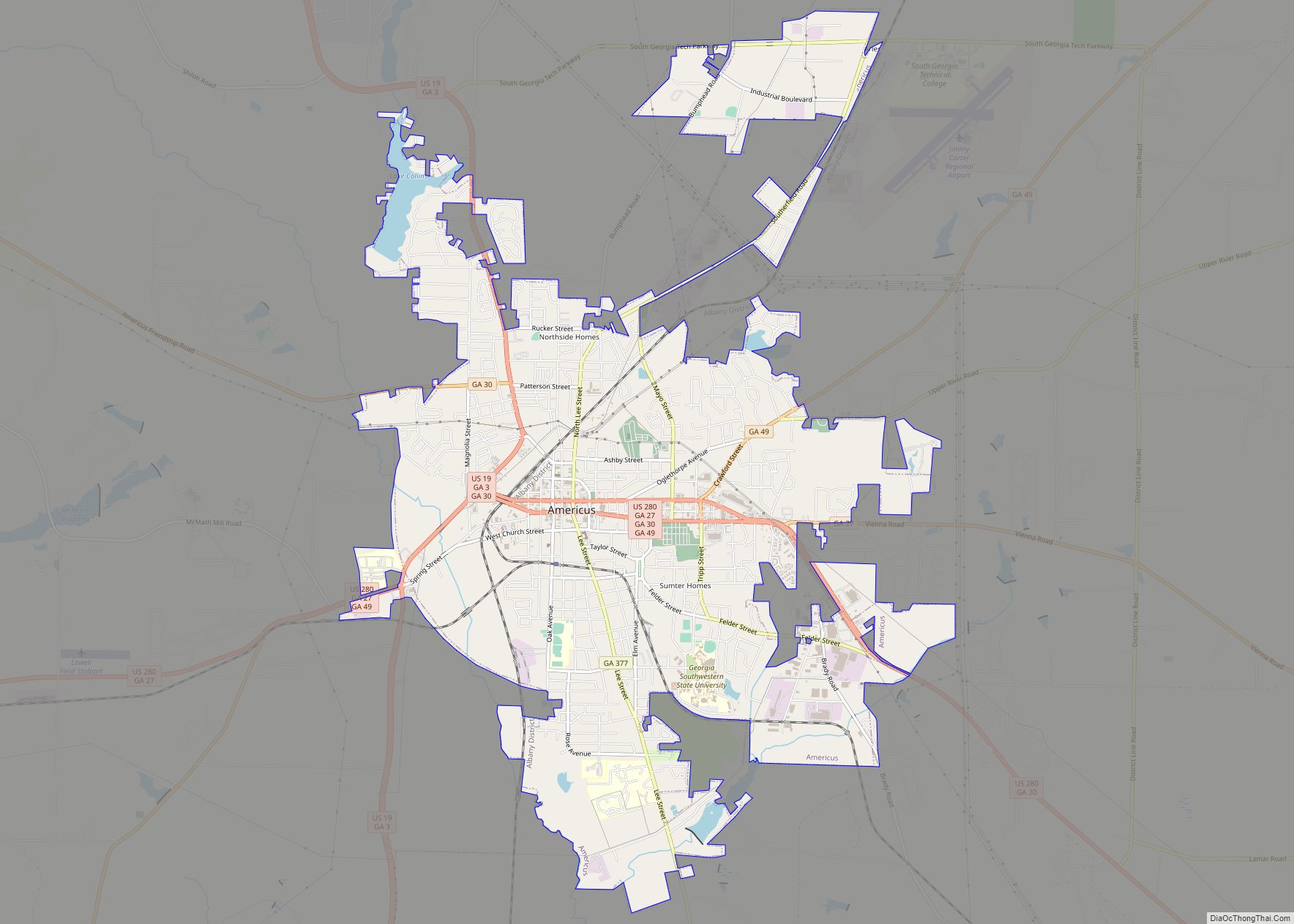
Americus Road Map
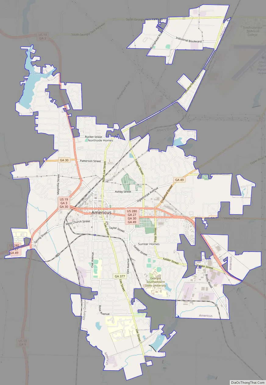
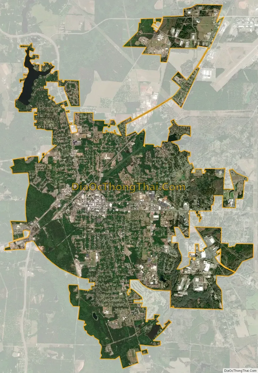
Americus city Satellite Map
Geography
Americus is located at 32°4′31″N 84°13′36″W / 32.07528°N 84.22667°W / 32.07528; -84.22667 (32.075221, -84.226602).
According to the United States Census Bureau, the city has a total area of 10.7 square miles (28 km), of which 10.5 square miles (27 km) is land and 0.2 square miles (0.52 km) (1.87%) is water.
Climate
See also
Map of Georgia State and its subdivision:- Appling
- Atkinson
- Bacon
- Baker
- Baldwin
- Banks
- Barrow
- Bartow
- Ben Hill
- Berrien
- Bibb
- Bleckley
- Brantley
- Brooks
- Bryan
- Bulloch
- Burke
- Butts
- Calhoun
- Camden
- Candler
- Carroll
- Catoosa
- Charlton
- Chatham
- Chattahoochee
- Chattooga
- Cherokee
- Clarke
- Clay
- Clayton
- Clinch
- Cobb
- Coffee
- Colquitt
- Columbia
- Cook
- Coweta
- Crawford
- Crisp
- Dade
- Dawson
- Decatur
- DeKalb
- Dodge
- Dooly
- Dougherty
- Douglas
- Early
- Echols
- Effingham
- Elbert
- Emanuel
- Evans
- Fannin
- Fayette
- Floyd
- Forsyth
- Franklin
- Fulton
- Gilmer
- Glascock
- Glynn
- Gordon
- Grady
- Greene
- Gwinnett
- Habersham
- Hall
- Hancock
- Haralson
- Harris
- Hart
- Heard
- Henry
- Houston
- Irwin
- Jackson
- Jasper
- Jeff Davis
- Jefferson
- Jenkins
- Johnson
- Jones
- Lamar
- Lanier
- Laurens
- Lee
- Liberty
- Lincoln
- Long
- Lowndes
- Lumpkin
- Macon
- Madison
- Marion
- McDuffie
- McIntosh
- Meriwether
- Miller
- Mitchell
- Monroe
- Montgomery
- Morgan
- Murray
- Muscogee
- Newton
- Oconee
- Oglethorpe
- Paulding
- Peach
- Pickens
- Pierce
- Pike
- Polk
- Pulaski
- Putnam
- Quitman
- Rabun
- Randolph
- Richmond
- Rockdale
- Schley
- Screven
- Seminole
- Spalding
- Stephens
- Stewart
- Sumter
- Talbot
- Taliaferro
- Tattnall
- Taylor
- Telfair
- Terrell
- Thomas
- Tift
- Toombs
- Towns
- Treutlen
- Troup
- Turner
- Twiggs
- Union
- Upson
- Walker
- Walton
- Ware
- Warren
- Washington
- Wayne
- Webster
- Wheeler
- White
- Whitfield
- Wilcox
- Wilkes
- Wilkinson
- Worth
- Alabama
- Alaska
- Arizona
- Arkansas
- California
- Colorado
- Connecticut
- Delaware
- District of Columbia
- Florida
- Georgia
- Hawaii
- Idaho
- Illinois
- Indiana
- Iowa
- Kansas
- Kentucky
- Louisiana
- Maine
- Maryland
- Massachusetts
- Michigan
- Minnesota
- Mississippi
- Missouri
- Montana
- Nebraska
- Nevada
- New Hampshire
- New Jersey
- New Mexico
- New York
- North Carolina
- North Dakota
- Ohio
- Oklahoma
- Oregon
- Pennsylvania
- Rhode Island
- South Carolina
- South Dakota
- Tennessee
- Texas
- Utah
- Vermont
- Virginia
- Washington
- West Virginia
- Wisconsin
- Wyoming