Hanson is a home rule-class city in Hopkins County, Kentucky, in the United States. The population was 742 at the 2010 census, up from 625 at the 2000 census.
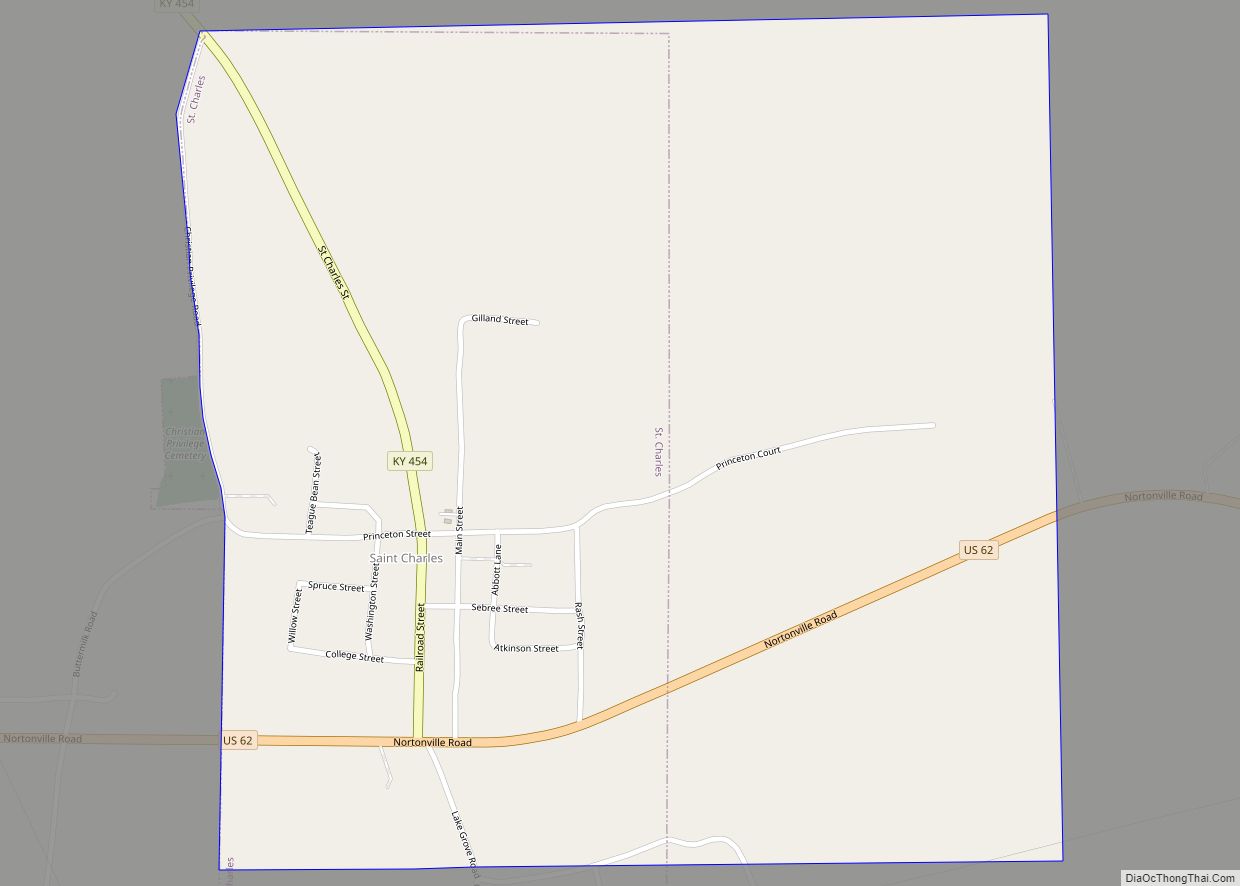
The Hanson Historic District is located in the city. The companies that supply power to Hanson residents are Kentucky Utilities and Kenergy.
| Name: | Hanson city |
|---|---|
| LSAD Code: | 25 |
| LSAD Description: | city (suffix) |
| State: | Kentucky |
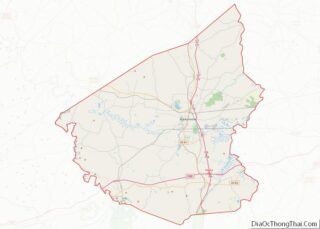
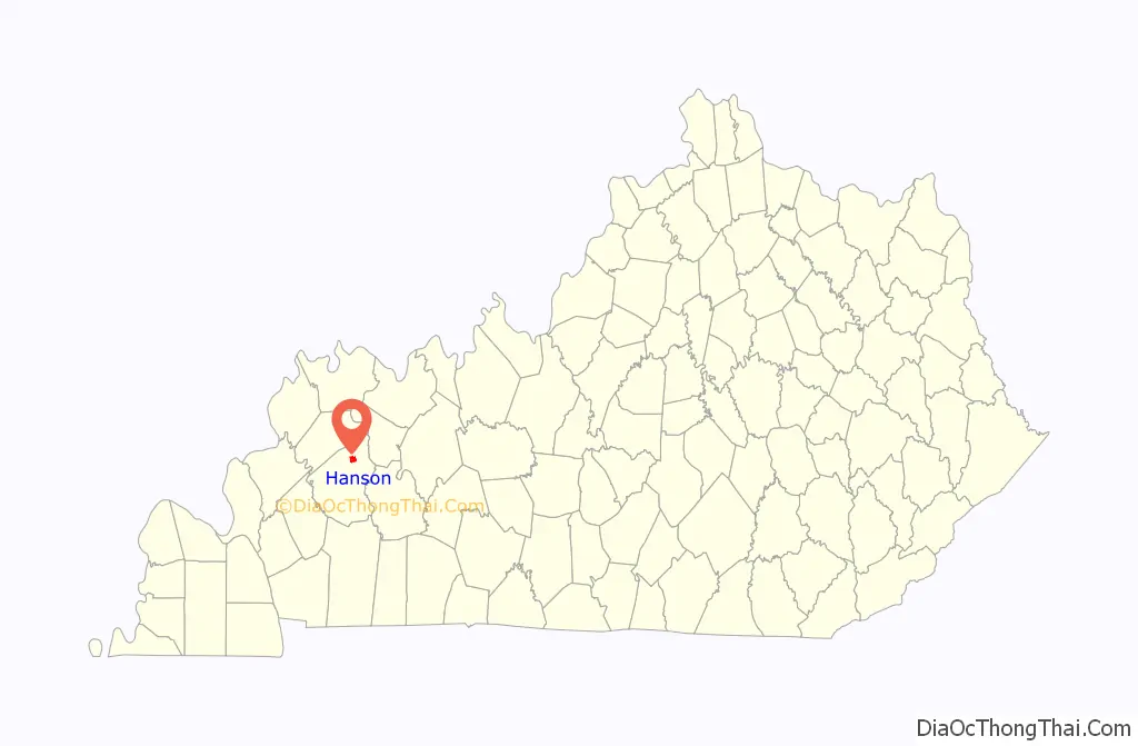
| County: | Hopkins County |
| Founded: | 1869 |
| Incorporated: | 1873 |
| Elevation: | 436 ft (133 m) |
| Total Area: | 2.37 sq mi (6.13 km²) |
| Land Area: | 2.35 sq mi (6.10 km²) |
| Water Area: | 0.01 sq mi (0.03 km²) |
| Total Population: | 758 |
| Population Density: | 321.87/sq mi (124.27/km²) |
| ZIP code: | 42413 |
| Area code: | 270 & 364 |
| FIPS code: | 2134390 |
| GNISfeature ID: | 0493695 |
| Website: | www.cityofhanson.com |
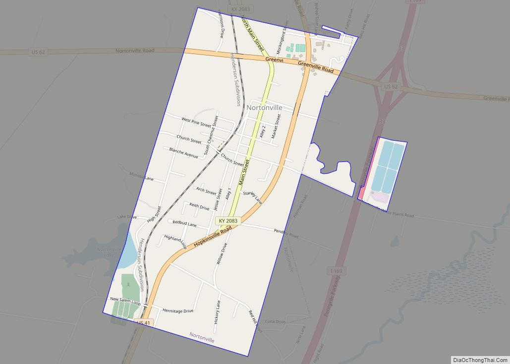
Online Interactive Map
Click on ![]() to view map in "full screen" mode.
to view map in "full screen" mode.
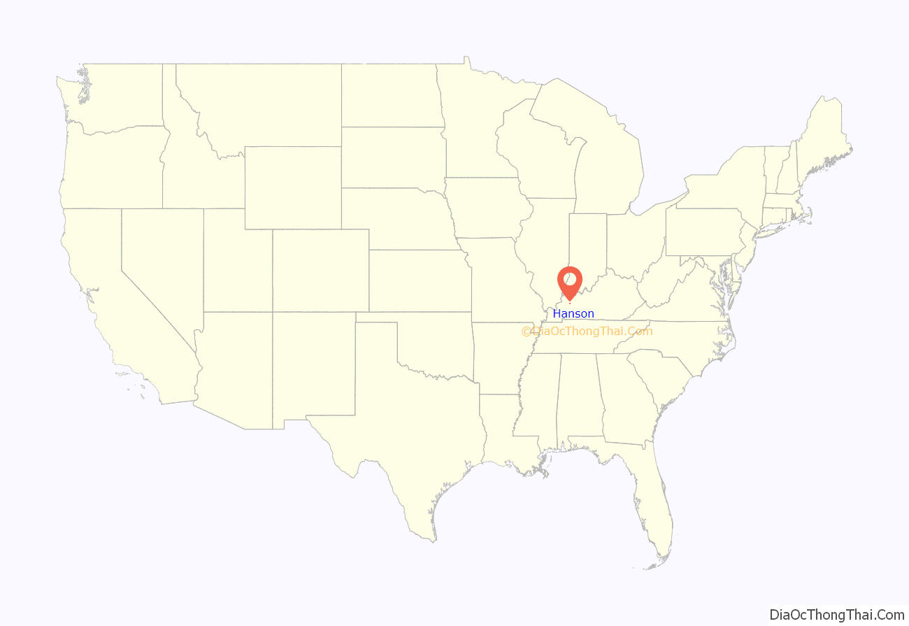
Hanson location map. Where is Hanson city?
History
The town was founded in 1869 on a 50-acre (20 ha) grant from two local landowners, judge Robert Eastwood and pastor Roland Gooch, in order to function as a stop on the Evansville, Henderson, and Nashville Railroad. The city was laid out by (and named for) a railway’s engineer and surveyor named Henry B. Hanson. The community received its post office on December 7, 1869, and was incorporated by the state assembly on March 31, 1873.
The Evansville, Henderson, & Nashville was purchased by the St. Louis and Southeastern in 1872, which (following a reorganization) was purchased in turn by the L&N in 1879.
The city was essentially destroyed by a fire in 1889, and the present historic district dates from the rebuilding that followed. Today, the former L&N network makes up part of CSX Transportation, which operates a siding track in Hanson.
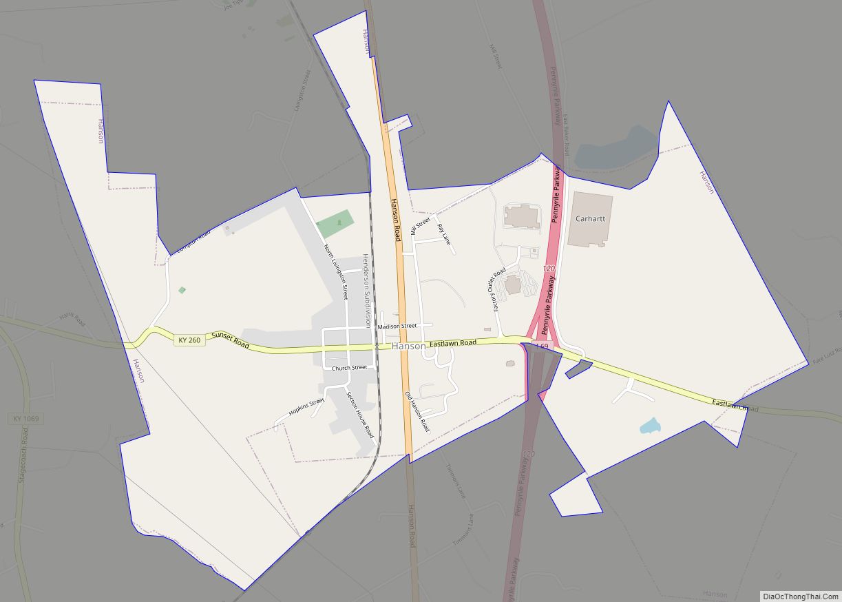
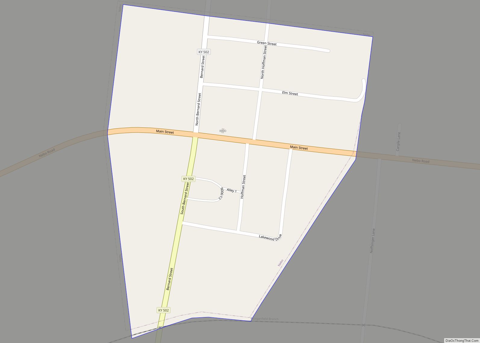
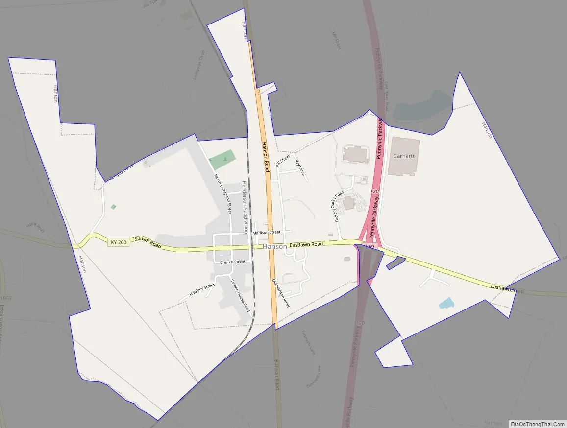
Hanson Road Map
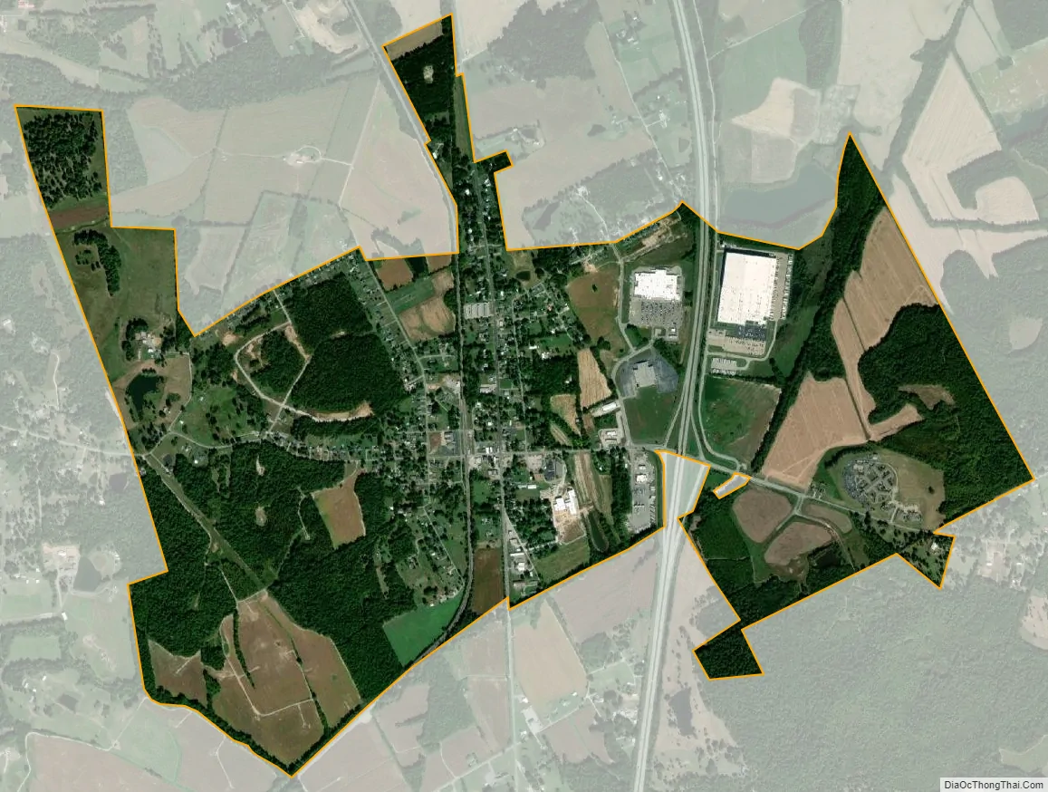
Hanson city Satellite Map
Geography
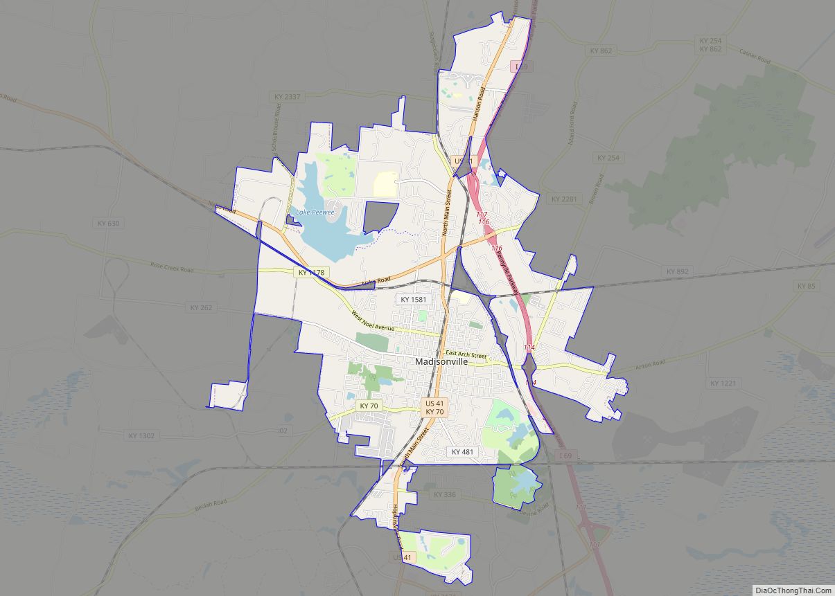
Hanson is located in northern Hopkins County at 37°25′4″N 87°28′50″W / 37.41778°N 87.48056°W / 37.41778; -87.48056 (37.417794, -87.480647). U.S. Route 41 (Hanson Road) passes through the center of town, and Interstate 69 passes through the eastern part, with access from Exit 120. Madisonville, the county seat, is 6 miles (10 km) to the south, and Henderson is 32 miles (51 km) to the north, via either highway.
According to the United States Census Bureau, Hanson has a total area of 2.6 square miles (6.8 km), of which 0.01 square miles (0.03 km), or 0.50%, are water.
See also
Map of Kentucky State and its subdivision:- Adair
- Allen
- Anderson
- Ballard
- Barren
- Bath
- Bell
- Boone
- Bourbon
- Boyd
- Boyle
- Bracken
- Breathitt
- Breckinridge
- Bullitt
- Butler
- Caldwell
- Calloway
- Campbell
- Carlisle
- Carroll
- Carter
- Casey
- Christian
- Clark
- Clay
- Clinton
- Crittenden
- Cumberland
- Daviess
- Edmonson
- Elliott
- Estill
- Fayette
- Fleming
- Floyd
- Franklin
- Fulton
- Gallatin
- Garrard
- Grant
- Graves
- Grayson
- Green
- Greenup
- Hancock
- Hardin
- Harlan
- Harrison
- Hart
- Henderson
- Henry
- Hickman
- Hopkins
- Jackson
- Jefferson
- Jessamine
- Johnson
- Kenton
- Knott
- Knox
- Larue
- Laurel
- Lawrence
- Lee
- Leslie
- Letcher
- Lewis
- Lincoln
- Livingston
- Logan
- Lyon
- Madison
- Magoffin
- Marion
- Marshall
- Martin
- Mason
- McCracken
- McCreary
- McLean
- Meade
- Menifee
- Mercer
- Metcalfe
- Monroe
- Montgomery
- Morgan
- Muhlenberg
- Nelson
- Nicholas
- Ohio
- Oldham
- Owen
- Owsley
- Pendleton
- Perry
- Pike
- Powell
- Pulaski
- Robertson
- Rockcastle
- Rowan
- Russell
- Scott
- Shelby
- Simpson
- Spencer
- Taylor
- Todd
- Trigg
- Trimble
- Union
- Warren
- Washington
- Wayne
- Webster
- Whitley
- Wolfe
- Woodford
- Alabama
- Alaska
- Arizona
- Arkansas
- California
- Colorado
- Connecticut
- Delaware
- District of Columbia
- Florida
- Georgia
- Hawaii
- Idaho
- Illinois
- Indiana
- Iowa
- Kansas
- Kentucky
- Louisiana
- Maine
- Maryland
- Massachusetts
- Michigan
- Minnesota
- Mississippi
- Missouri
- Montana
- Nebraska
- Nevada
- New Hampshire
- New Jersey
- New Mexico
- New York
- North Carolina
- North Dakota
- Ohio
- Oklahoma
- Oregon
- Pennsylvania
- Rhode Island
- South Carolina
- South Dakota
- Tennessee
- Texas
- Utah
- Vermont
- Virginia
- Washington
- West Virginia
- Wisconsin
- Wyoming