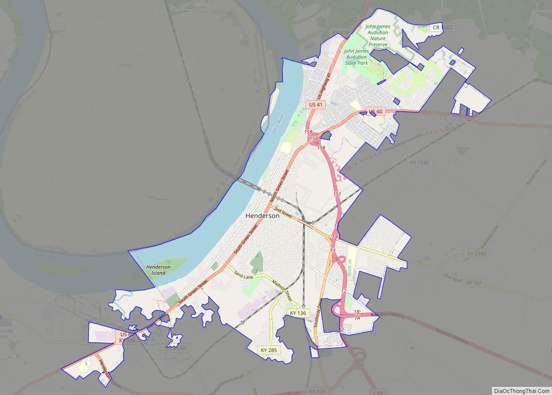
Henderson is a home rule-class city along the Ohio River and the county seat of Henderson County, Kentucky, United States. The population was 28,757 at the 2010 U.S. census. It is part of the Evansville Metropolitan Area, locally known as the “Tri-State Area,” and is considered the southernmost suburb of Evansville, Indiana.
| Name: | Henderson city |
|---|---|
| LSAD Code: | 25 |
| LSAD Description: | city (suffix) |
| State: | Kentucky |
| County: | Henderson County |
| Incorporated: | 1840 |
| Elevation: | 407 ft (124 m) |
| Total Area: | 18.39 sq mi (47.63 km²) |
| Land Area: | 16.11 sq mi (41.73 km²) |
| Water Area: | 2.28 sq mi (5.90 km²) 13.01% |
| Total Population: | 27,981 |
| Population Density: | 1,736.66/sq mi (670.51/km²) |
| Area code: | 270 & 364 |
| FIPS code: | 2135866 |
| GNISfeature ID: | 0494023 |
| Website: | www.cityofhendersonky.org |
Online Interactive Map
Click on ![]() to view map in "full screen" mode.
to view map in "full screen" mode.
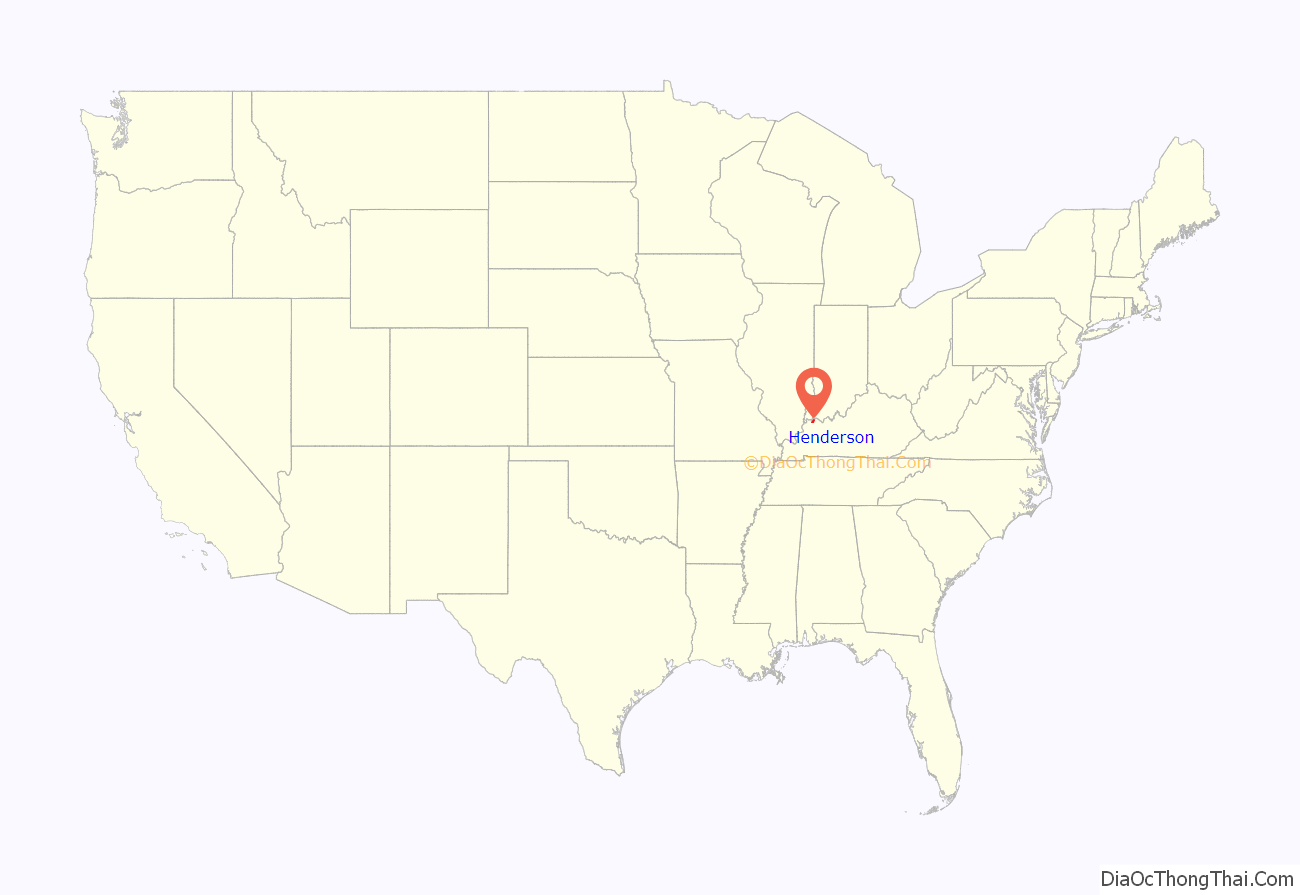
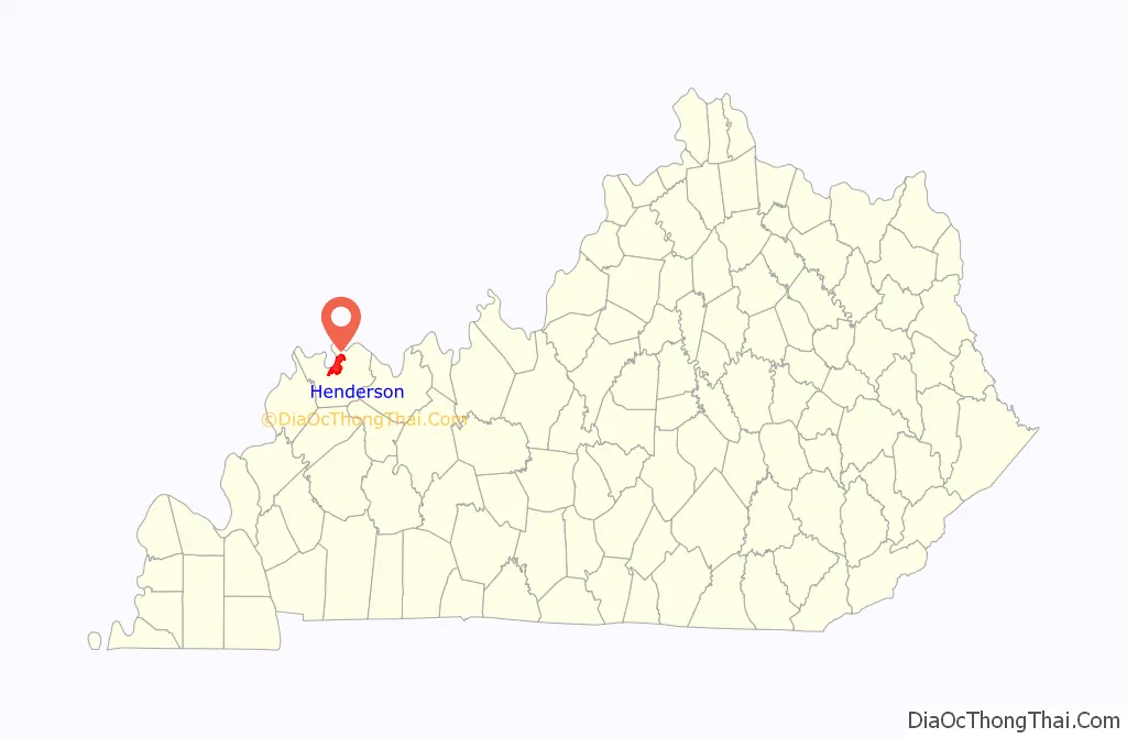
Henderson location map. Where is Henderson city?
History
Early settlements
Archaeological research shows that people were living in what is now Kentucky by at least 9,500 BCE, although they may have arrived much earlier.
The settlers of the area after the start of the 1st millennium CE were of the Mississippian culture, a Native American civilization that flourished throughout what is now the Midwestern, Eastern, and Southeastern United States, from approximately 800 CE to 1600 CE. The population of most settlements of this culture had dispersed or were experiencing severe social and environmental stress by 1500.
The area that is now Henderson County was later inhabited by the Yuchi, Shawnee and the Eastern Band of Cherokee Indians. Significant artifacts from these tribes and earlier peoples, including from mounds, have been found by white settlers and their descendants since the 1700s.
18th century
Henderson has its roots in a small, block-wide strip of land high above the Ohio River, the site of the present-day Audubon Mill Park directly south of the city’s riverfront boat dock. A village on this site was called “Red Banks” because of the reddish clay soil of the bluffs overlooking the Ohio River. The future city was named after Richard Henderson, an eighteenth-century pioneer and land speculator, by his associates Samuel Hopkins and Thomas Allin. Henderson County also shares this namesake. On March 17, 1775, North Carolina judge Richard Henderson and his Transylvania Company had met with 1,200 Cherokee in a council at Sycamore Shoals (present-day Elizabethton, Tennessee) to purchase over 17,000,000 acres (69,000 km) of land between the Ohio, Cumberland, and Kentucky rivers in present-day Kentucky and Tennessee to resell it to white settlers. Known as the Transylvania Purchase, the sale was voided by the Virginia General Assembly, since the territory (and the sole right to purchase land from Indians within its bounds) was part of Virginia’s royal charter. However, the commonwealth granted Henderson and his company an area of 200,000 acres (810 km) to develop. It was located at the confluence of the Green and Ohio rivers. Henderson hired Daniel Boone to survey the country and select favorable sites, but Henderson died before the town was developed.
By the early 1790s, Red Banks had a tavern and several European-American families co-existing with the local Cherokee. On November 16, 1792, resident Robert Simpson wrote to Alexander D. Orr in Lexington, requesting help to appoint a magistrate for Red Banks to deal with some of its 30 families he felt were of dubious (criminal) character. During this period, the Red Banks settlement had gained notoriety as a frontier haven for westward-moving outlaws and their families. One such family was that of Squire Samuel Mason. By that time, excluding the Cherokee, the free male inhabitants of Red Bank totaled 62. Later, in 1797, Captain Young of Mercer County, Kentucky and the “Exterminators”, a group of regulators under his leadership swiftly and violently drove out the remaining outlaw element in Red Banks.
Samuel Hopkins and the surveyor Thomas Allin visited Red Banks in 1797 and laid out plans for the future town of Henderson. It was formally established by the Kentucky legislature the same year. A distinguishing characteristic of the new town plan was unusually wide streets, reportedly to prevent a fire in one block from easily spreading to another. Even with diagonal parking spaces outlined on downtown streets today, the streets are wide enough to include two-way traffic and space left over for delivery trucks to park in the center of the streets without interfering. By October 29, 1799, a census for the city of Henderson showed a population of 183. The county had 423 residents, 207 slaves, and 412 horses.
19th century
A post office was established in the town in 1801; the city was formally incorporated on January 21, 1840.
By mid-century, Henderson County had become a major producer of tobacco, much of which was exported to Great Britain. The area was reported to be the largest dark tobacco producer in the world; large tobacco warehouses and stemmeries dotted the downtown Henderson area. Postcards from the era show long lines of horse- and mule-drawn wagons piled high with tobacco, waiting their turn to unload for shipment downriver. Some tobacco processors accumulated considerable fortunes.
20th century
Shortly before World War I, Henderson was said to have more millionaires per capita than any other city in the world. Great Britain, however, imposed a high tariff on imported tobacco after the war, wrecking the county and city’s export market. Tobacco warehouses and plants closed, and the community’s economic fortunes reversed. The last tobacco facility, the Soaper Tobacco Warehouse on Pennell Street, closed in 1984.
Henderson continued as a regional center into the 20th century. Businesses were concentrated in the downtown area. In the early 20th century, recognizable neighborhoods (unincorporated places) within the city and the outlying edges of town included Audubon, Weaverton, and Audubon Heights. Segments of Audubon and Weaverton were sometimes referred to as the “East End”, which held the second-largest business area after downtown Henderson.
21st century
A workplace shooting occurred at an Atlantis Plastics factory in Henderson on June 25, 2008. The gunman, 25-year-old Wesley Neal Higdon, shot and killed five people and critically injured a sixth person before taking his own life. The shooting is the worst in the history of Henderson County in terms of casualties, surpassing triple homicides occurring in 1799 and 1955.
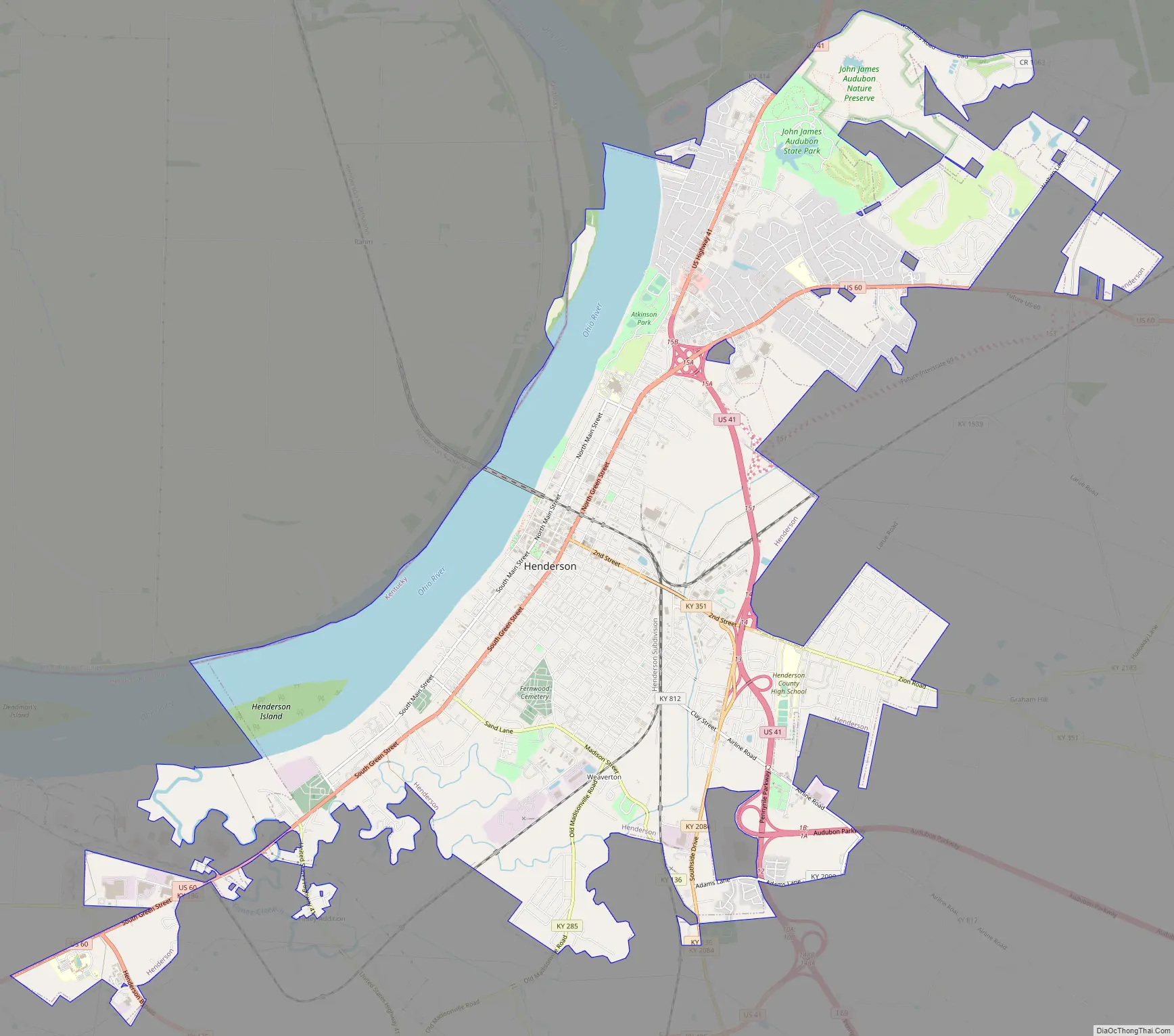
Henderson Road Map
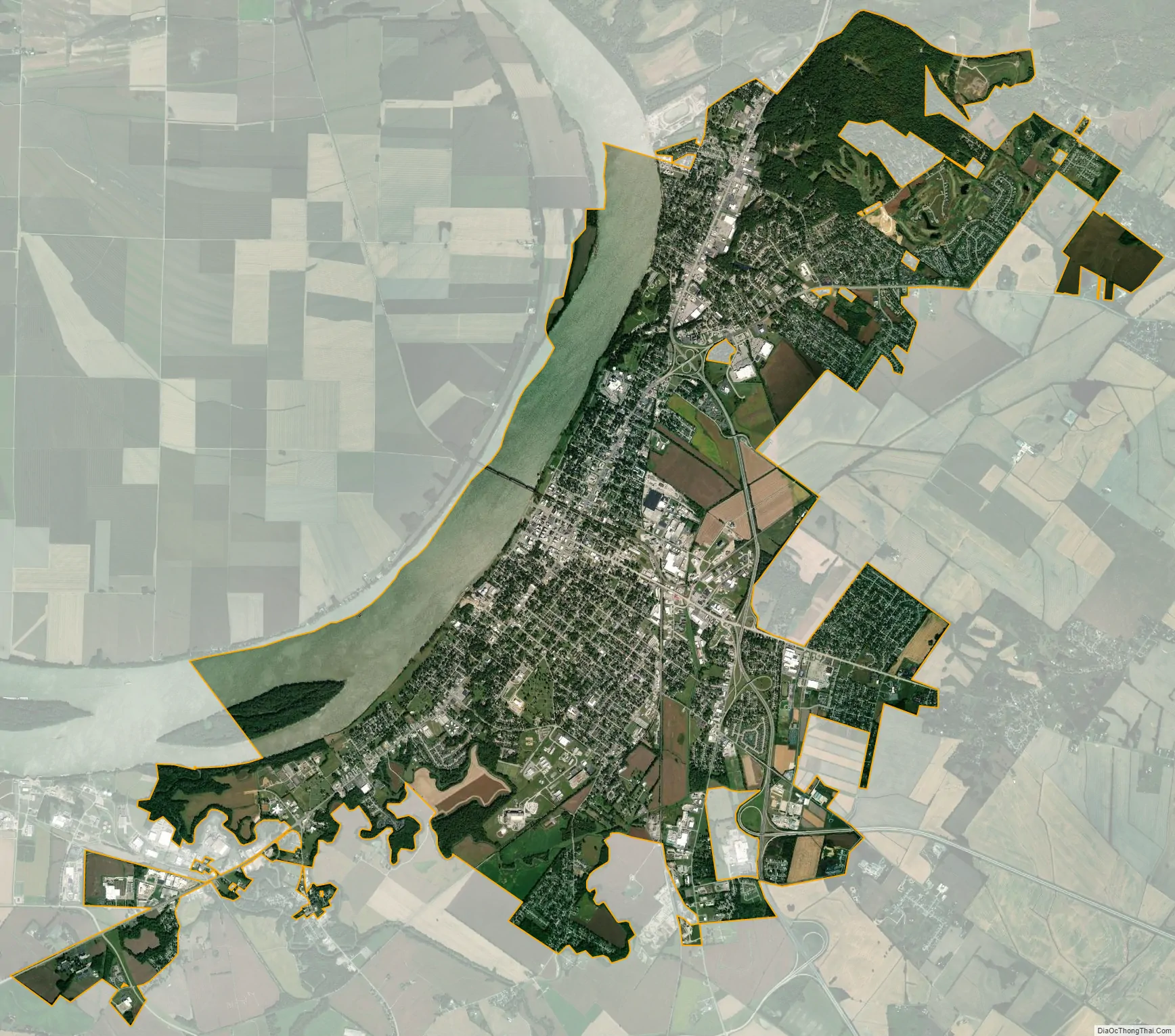
Henderson city Satellite Map
Geography
Henderson is located in north-central Henderson County, 10 miles (16 km) south of Evansville, Indiana, and 30 miles (48 km) west of Owensboro, Kentucky. According to the United States Census Bureau, Henderson has a total area of 17.6 square miles (45.6 km), of which 15.3 square miles (39.6 km) are land and 2.3 square miles (5.9 km), or 13.01%, are water. As the state line tends to follow the Indiana side of the river, most of the Ohio River going past Henderson is within the city limits.
Because the Indiana–Kentucky border is defined as the low-water mark on the north bank of the Ohio River as of 1792, and because the river changed course as a result of the New Madrid earthquake of 1812, a small portion of Henderson County (approximately 4 miles (6 km) long and 1 mile (1.6 km) wide), lies north of the current course of the river in what would appear to be part of Indiana. Both the Bi-State Vietnam Gold Star Bridges and the Ellis Park Race Course horse racing track are located entirely within Kentucky. The racetrack uses Indiana’s 812 area code despite officially being located in Kentucky.
Natural disasters
Henderson had unusual weather patterns in the late 1800s and early 1900s. The “great sleet” of 1901 fell for three weeks in February. “Horses had to have special shoes to keep their footing on local roads.”
In 1908 the Henderson area had high temperatures and a drought, which markedly reduced the flow of the Ohio River. The Henderson Daily Gleaner reported that “boys were playing baseball every day in the middle of the old riverbed.” All businesses were challenged and forced to close. A Henderson reporter wrote, “[I]t is almost hazardous for even small gasoline boats to run”.
On June 20, 1914, Henderson was hit by a “baby cyclone”. Jack Hudgions, local historian and newsman, wrote that “hail as large as partridge eggs” fell for ten minutes and that powerful winds uprooted giant trees “and twisted limbs from shade trees in the city.” In the northern part of Henderson, several buildings were blown down and wheat stocks were scattered. The storm lasted for more than 30 minutes, laying crops low throughout the county. Telephone lines were damaged and windows broken in the city and county by the hailstones. 26 days later, the city was hit by a tornado that left two dead and much of the city in ruins.
In 1937, 21 inches (530 mm) of precipitation fell in 18 days over the Ohio River watershed, resulting in the Ohio River flood of 1937 and extensive damage. Henderson, on its bluff, was spared much of the damage that Pittsburgh, Cincinnati, Louisville, Evansville, Paducah and other river cities suffered. Leigh Harris, the publisher of the Henderson Gleaner and Evening Journal newspapers, wrote, “Henderson is on the river but never in it!” Its favorable location helped the city attract new industries.
Climate
The climate in this area is characterized by hot, humid summers and generally mild to cool winters. According to the Köppen Climate Classification system, Henderson has a humid subtropical climate, abbreviated “Cfa” on climate maps.
See also
Map of Kentucky State and its subdivision:- Adair
- Allen
- Anderson
- Ballard
- Barren
- Bath
- Bell
- Boone
- Bourbon
- Boyd
- Boyle
- Bracken
- Breathitt
- Breckinridge
- Bullitt
- Butler
- Caldwell
- Calloway
- Campbell
- Carlisle
- Carroll
- Carter
- Casey
- Christian
- Clark
- Clay
- Clinton
- Crittenden
- Cumberland
- Daviess
- Edmonson
- Elliott
- Estill
- Fayette
- Fleming
- Floyd
- Franklin
- Fulton
- Gallatin
- Garrard
- Grant
- Graves
- Grayson
- Green
- Greenup
- Hancock
- Hardin
- Harlan
- Harrison
- Hart
- Henderson
- Henry
- Hickman
- Hopkins
- Jackson
- Jefferson
- Jessamine
- Johnson
- Kenton
- Knott
- Knox
- Larue
- Laurel
- Lawrence
- Lee
- Leslie
- Letcher
- Lewis
- Lincoln
- Livingston
- Logan
- Lyon
- Madison
- Magoffin
- Marion
- Marshall
- Martin
- Mason
- McCracken
- McCreary
- McLean
- Meade
- Menifee
- Mercer
- Metcalfe
- Monroe
- Montgomery
- Morgan
- Muhlenberg
- Nelson
- Nicholas
- Ohio
- Oldham
- Owen
- Owsley
- Pendleton
- Perry
- Pike
- Powell
- Pulaski
- Robertson
- Rockcastle
- Rowan
- Russell
- Scott
- Shelby
- Simpson
- Spencer
- Taylor
- Todd
- Trigg
- Trimble
- Union
- Warren
- Washington
- Wayne
- Webster
- Whitley
- Wolfe
- Woodford
- Alabama
- Alaska
- Arizona
- Arkansas
- California
- Colorado
- Connecticut
- Delaware
- District of Columbia
- Florida
- Georgia
- Hawaii
- Idaho
- Illinois
- Indiana
- Iowa
- Kansas
- Kentucky
- Louisiana
- Maine
- Maryland
- Massachusetts
- Michigan
- Minnesota
- Mississippi
- Missouri
- Montana
- Nebraska
- Nevada
- New Hampshire
- New Jersey
- New Mexico
- New York
- North Carolina
- North Dakota
- Ohio
- Oklahoma
- Oregon
- Pennsylvania
- Rhode Island
- South Carolina
- South Dakota
- Tennessee
- Texas
- Utah
- Vermont
- Virginia
- Washington
- West Virginia
- Wisconsin
- Wyoming