Appomattox is a town in Appomattox County, Virginia, United States. The population was 1,733 at the 2010 census. It is the county seat of Appomattox County.
Appomattox is part of the Lynchburg Metropolitan Statistical Area.
| Name: | Appomattox town |
|---|---|
| LSAD Code: | 43 |
| LSAD Description: | town (suffix) |
| State: | Virginia |
| County: | Appomattox County |
| Elevation: | 850 ft (259 m) |
| Total Area: | 2.20 sq mi (5.71 km²) |
| Land Area: | 2.19 sq mi (5.68 km²) |
| Water Area: | 0.01 sq mi (0.02 km²) |
| Total Population: | 1,733 |
| Population Density: | 817.31/sq mi (315.60/km²) |
| ZIP code: | 24522 |
| Area code: | 434 |
| FIPS code: | 5102072 |
| GNISfeature ID: | 1498448 |
| Website: | townofappomattox.com |
Online Interactive Map
Click on ![]() to view map in "full screen" mode.
to view map in "full screen" mode.
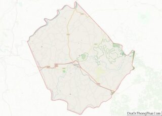
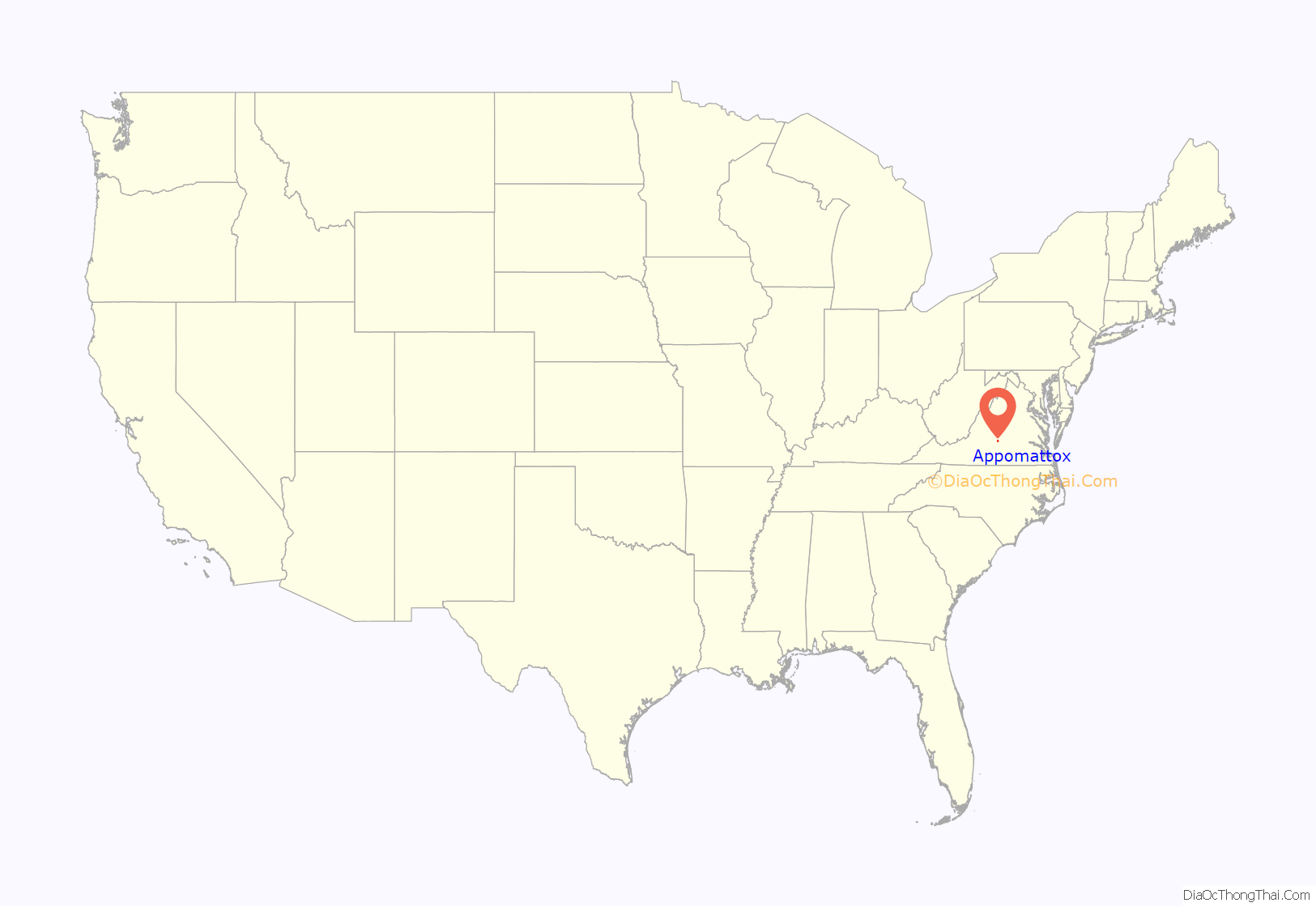
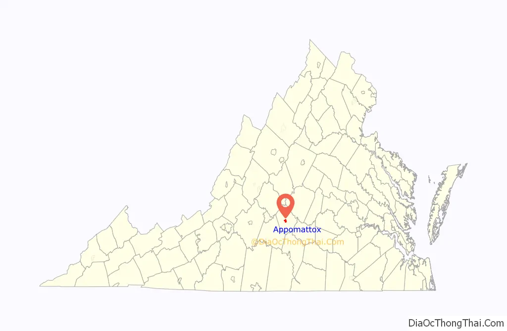
Appomattox location map. Where is Appomattox town?
History
The town was named for the Appomattox River. The river was named after the Appomattoc Native American tribe, one of the Algonquian-speaking Powhatan Confederacy, historically based in the coastal area and encountered by the English before the tribes of the Piedmont. The Appamatuck historically lived somewhat to the east of the present town, around the area of present-day Petersburg. At the time of European encounter, the area of Appomattox County above the Fall Line was part of the territory of the Manahoac tribe, who spoke a Siouan language. The town was the site of Appomattox Station and is located three miles west of the restored historic village of Appomattox Court House, the site of Confederate General Robert E. Lee’s surrender to Union General Ulysses S. Grant on April 9, 1865, which essentially ended the American Civil War. The area is preserved as Appomattox Court House National Historical Park and is administered by the National Park Service.
At the time of the Civil War, the present community of Appomattox was the site of a railroad depot on the line between Petersburg and Lynchburg, a stop on the Southside Railroad. The town was first named “Nebraska” in 1855. In 1895 it was renamed “West Appomattox”. The first postmaster of “Nebraska, Virginia”, was Samuel D. McDearmon.
Near the end of the Civil War, Robert E. Lee made a last attempt to reach the depot, hoping to transport the Army of Northern Virginia south by railroad to meet Joseph E. Johnston’s larger Army of Tennessee, then located in Greensboro, North Carolina. The arrival of Federal troops and their blocking Lee’s army from the depot led to Lee’s surrender in the home of Wilmer McLean, on April 9. Johnston later surrendered 98,270 Confederate troops (the largest surrender of the war) on April 26, 1865.
Though President Lincoln had issued the Emancipation Proclamation on January 1, 1863, slaves in the southern states were not freed until the surrender at Appomattox Court House on April 9, though the last of the slaves were not freed until June 19. Today, each April, the Appomattox Court House National Historical Park commemorates this event with a luminary ceremony, wherein a lantern is lit for each of the 4,600 slaves freed in Appomattox County alone.
The railroad became the Atlantic, Mississippi and Ohio Railroad in 1870. The inconvenience of the railroad’s location to the original Appomattox Court House in the village of Clover Hill led to the decline of the courthouse community. After fire destroyed the courthouse building in 1892, the county relocated the court to the depot area, which formally became the county seat in 1894. The railroad became a line in the Norfolk and Western Railway and then the Norfolk Southern Railway.
In 1990, there were 11,971 residents reported for Appomattox County; the Town of Appomattox had 1,703 residents.
In addition to Appomattox Court House National Historical Park, the Appomattox River Bridge, Appomattox Historic District, Holiday Lake 4-H Educational Center, and Holliday Lake State Park are listed on the National Register of Historic Places.
The 2010 Appomattox shootings occurred from January 17 to 20 and left eight people dead.
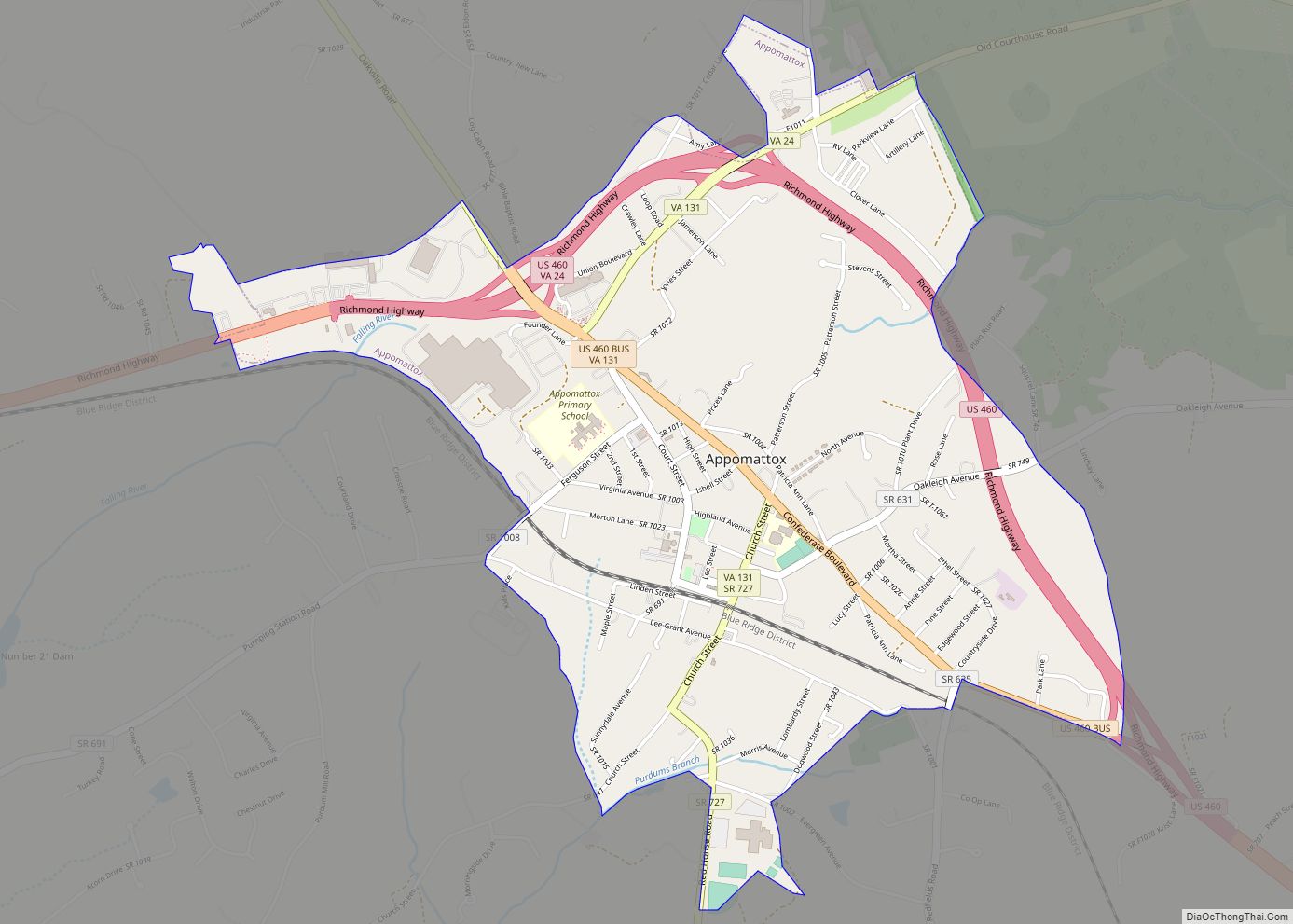
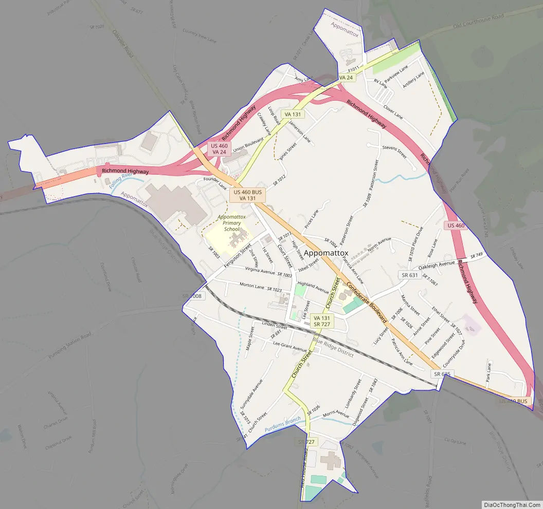
Appomattox Road Map
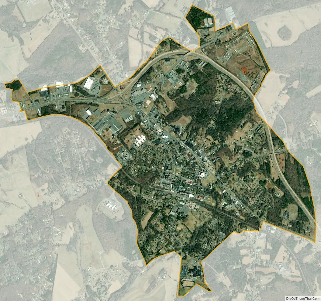
Appomattox city Satellite Map
Geography
Appomattox is located at 37°21′32″N 78°49′35″W / 37.35889°N 78.82639°W / 37.35889; -78.82639 (37.358973, −78.826438).
According to the United States Census Bureau, the town has a total area of 2.2 square miles (5.6 km).
See also
Map of Virginia State and its subdivision:- Accomack
- Albemarle
- Alexandria
- Alleghany
- Amelia
- Amherst
- Appomattox
- Arlington
- Augusta
- Bath
- Bedford
- Bedford City
- Bland
- Botetourt
- Bristol
- Brunswick
- Buchanan
- Buckingham
- Buena Vista
- Campbell
- Caroline
- Carroll
- Charles City
- Charlotte
- Charlottesville
- Chesapeake
- Chesterfield
- Clarke
- Clifton Forge City
- Colonial Heights
- Covington
- Craig
- Culpeper
- Cumberland
- Danville
- Dickenson
- Dinwiddie
- Emporia
- Essex
- Fairfax
- Fairfax City
- Falls Church
- Fauquier
- Floyd
- Fluvanna
- Franklin
- Frederick
- Fredericksburg
- Galax
- Giles
- Gloucester
- Goochland
- Grayson
- Greene
- Greensville
- Halifax
- Hampton
- Hanover
- Harrisonburg
- Henrico
- Henry
- Highland
- Hopewell
- Isle of Wight
- James City
- King and Queen
- King George
- King William
- Lancaster
- Lee
- Lexington
- Loudoun
- Louisa
- Lunenburg
- Lynchburg
- Madison
- Manassas
- Manassas Park
- Martinsville
- Mathews
- Mecklenburg
- Middlesex
- Montgomery
- Nelson
- New Kent
- Newport News
- Norfolk
- Northampton
- Northumberland
- Norton
- Nottoway
- Orange
- Page
- Patrick
- Petersburg
- Pittsylvania
- Poquoson
- Portsmouth
- Powhatan
- Prince Edward
- Prince George
- Prince William
- Pulaski
- Radford
- Rappahannock
- Richmond
- Roanoke
- Roanoke City
- Rockbridge
- Rockingham
- Russell
- Salem
- Scott
- Shenandoah
- Smyth
- Southampton
- Spotsylvania
- Stafford
- Staunton
- Suffolk
- Surry
- Sussex
- Tazewell
- Virginia Beach
- Warren
- Washington
- Waynesboro
- Westmoreland
- Williamsburg
- Winchester
- Wise
- Wythe
- York
- Alabama
- Alaska
- Arizona
- Arkansas
- California
- Colorado
- Connecticut
- Delaware
- District of Columbia
- Florida
- Georgia
- Hawaii
- Idaho
- Illinois
- Indiana
- Iowa
- Kansas
- Kentucky
- Louisiana
- Maine
- Maryland
- Massachusetts
- Michigan
- Minnesota
- Mississippi
- Missouri
- Montana
- Nebraska
- Nevada
- New Hampshire
- New Jersey
- New Mexico
- New York
- North Carolina
- North Dakota
- Ohio
- Oklahoma
- Oregon
- Pennsylvania
- Rhode Island
- South Carolina
- South Dakota
- Tennessee
- Texas
- Utah
- Vermont
- Virginia
- Washington
- West Virginia
- Wisconsin
- Wyoming