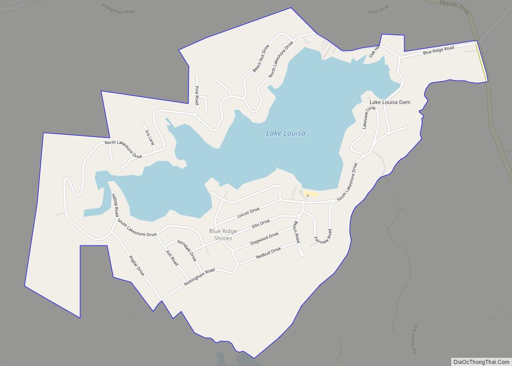
Blue Ridge Shores is a census-designated place (CDP) in Louisa County, Virginia, United States. The population as of the 2010 census was 813. It was built beginning in 1960 as a resort community around Lake Louisa.
| Name: | Blue Ridge Shores CDP |
|---|---|
| LSAD Code: | 57 |
| LSAD Description: | CDP (suffix) |
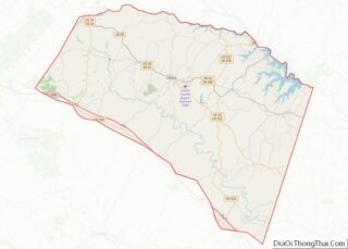
| State: | Virginia |
| County: | Louisa County |
| Elevation: | 310 ft (90 m) |
| Total Area: | 1.80 sq mi (4.67 km²) |
| Land Area: | 1.37 sq mi (3.55 km²) |
| Water Area: | 0.43 sq mi (1.12 km²) |
| Total Population: | 813 |
| Population Density: | 593/sq mi (229.0/km²) |
| ZIP code: | 23093 (Louisa) |
| FIPS code: | 5108264 |
| GNISfeature ID: | 2630622 |
Online Interactive Map
Click on ![]() to view map in "full screen" mode.
to view map in "full screen" mode.
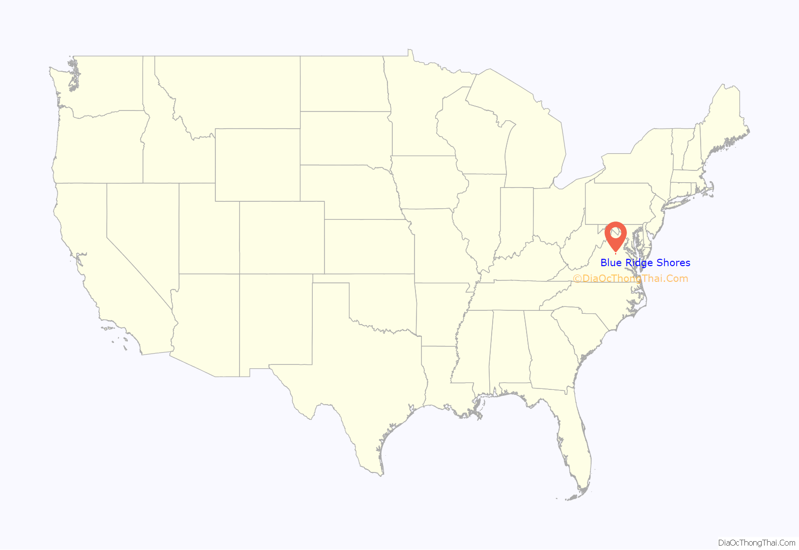
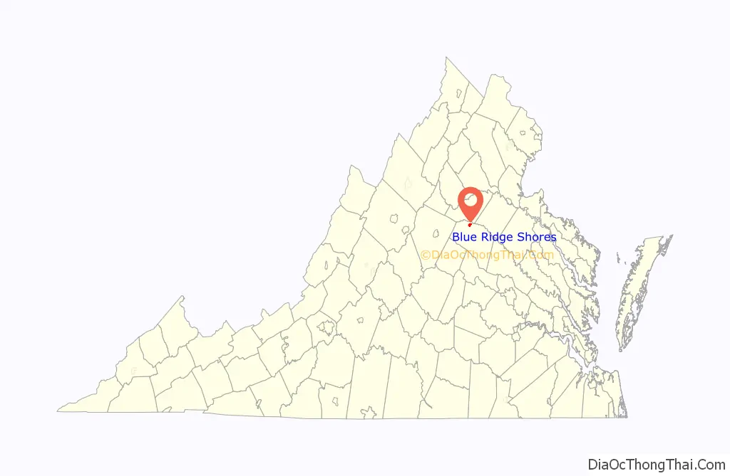
Blue Ridge Shores location map. Where is Blue Ridge Shores CDP?
History
A history of the community can be found at the Blue Ridge Shores community website.
Blue Ridge Shores Road Map
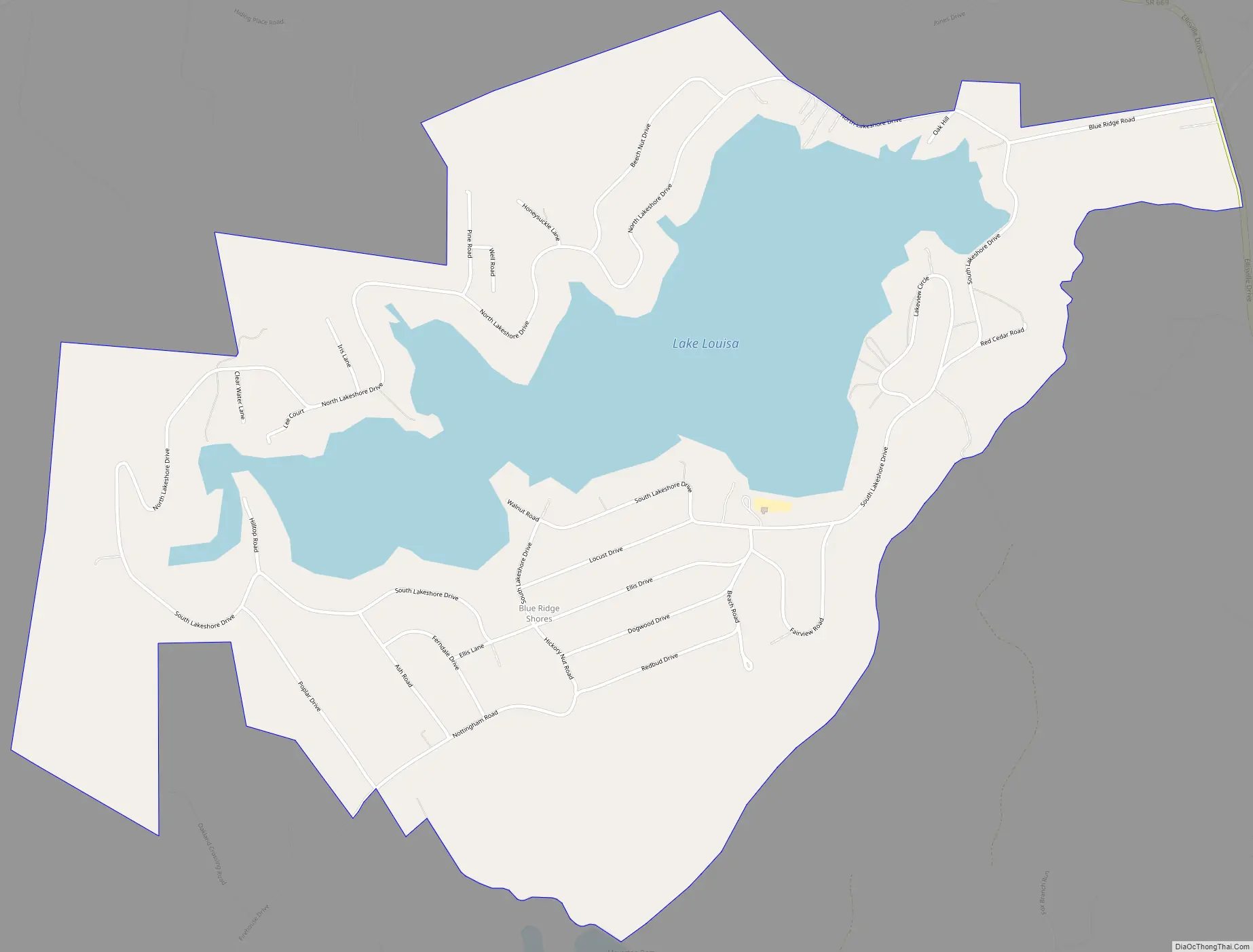
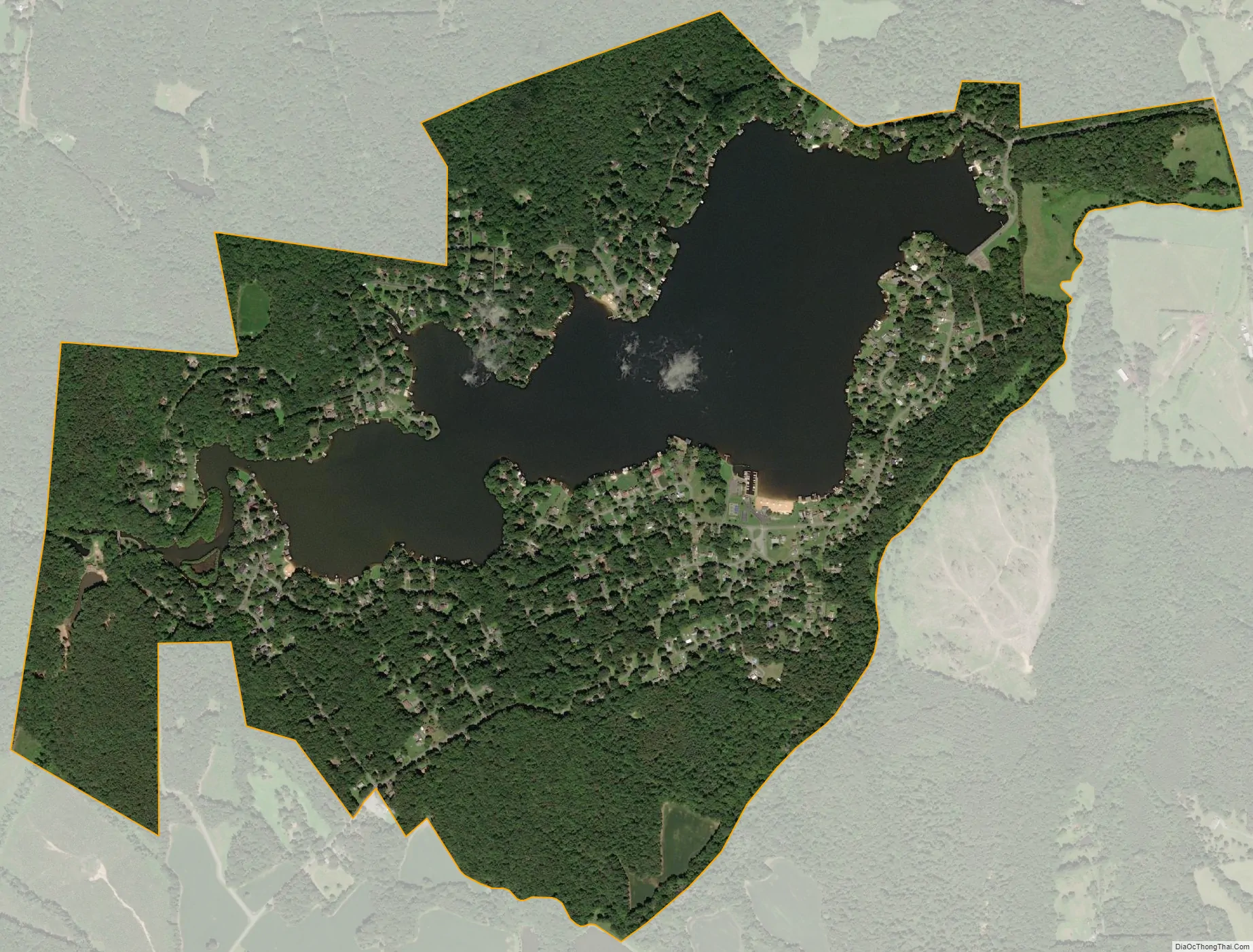
Blue Ridge Shores city Satellite Map
Geography
Blue Ridge Shores is in northern Louisa County, in the Piedmont region of Virginia. It is 8 miles (13 km) north of Louisa, the county seat, 30 miles (48 km) east of Charlottesville, and 63 miles (101 km) northwest of Richmond.
According to the U.S. Census Bureau, the CDP has a total area of 1.8 square miles (4.7 km), of which 1.4 square miles (3.6 km) are land and 0.4 square miles (1.1 km), or 23.90%, are water. Lake Louisa, a reservoir built on Hickory Creek, is in the center of the community. Hickory Creek flows northeast to the North Anna River and is part of the Pamunkey River watershed, leading to the tidal York River and Chesapeake Bay.
See also
Map of Virginia State and its subdivision:- Accomack
- Albemarle
- Alexandria
- Alleghany
- Amelia
- Amherst
- Appomattox
- Arlington
- Augusta
- Bath
- Bedford
- Bedford City
- Bland
- Botetourt
- Bristol
- Brunswick
- Buchanan
- Buckingham
- Buena Vista
- Campbell
- Caroline
- Carroll
- Charles City
- Charlotte
- Charlottesville
- Chesapeake
- Chesterfield
- Clarke
- Clifton Forge City
- Colonial Heights
- Covington
- Craig
- Culpeper
- Cumberland
- Danville
- Dickenson
- Dinwiddie
- Emporia
- Essex
- Fairfax
- Fairfax City
- Falls Church
- Fauquier
- Floyd
- Fluvanna
- Franklin
- Frederick
- Fredericksburg
- Galax
- Giles
- Gloucester
- Goochland
- Grayson
- Greene
- Greensville
- Halifax
- Hampton
- Hanover
- Harrisonburg
- Henrico
- Henry
- Highland
- Hopewell
- Isle of Wight
- James City
- King and Queen
- King George
- King William
- Lancaster
- Lee
- Lexington
- Loudoun
- Louisa
- Lunenburg
- Lynchburg
- Madison
- Manassas
- Manassas Park
- Martinsville
- Mathews
- Mecklenburg
- Middlesex
- Montgomery
- Nelson
- New Kent
- Newport News
- Norfolk
- Northampton
- Northumberland
- Norton
- Nottoway
- Orange
- Page
- Patrick
- Petersburg
- Pittsylvania
- Poquoson
- Portsmouth
- Powhatan
- Prince Edward
- Prince George
- Prince William
- Pulaski
- Radford
- Rappahannock
- Richmond
- Roanoke
- Roanoke City
- Rockbridge
- Rockingham
- Russell
- Salem
- Scott
- Shenandoah
- Smyth
- Southampton
- Spotsylvania
- Stafford
- Staunton
- Suffolk
- Surry
- Sussex
- Tazewell
- Virginia Beach
- Warren
- Washington
- Waynesboro
- Westmoreland
- Williamsburg
- Winchester
- Wise
- Wythe
- York
- Alabama
- Alaska
- Arizona
- Arkansas
- California
- Colorado
- Connecticut
- Delaware
- District of Columbia
- Florida
- Georgia
- Hawaii
- Idaho
- Illinois
- Indiana
- Iowa
- Kansas
- Kentucky
- Louisiana
- Maine
- Maryland
- Massachusetts
- Michigan
- Minnesota
- Mississippi
- Missouri
- Montana
- Nebraska
- Nevada
- New Hampshire
- New Jersey
- New Mexico
- New York
- North Carolina
- North Dakota
- Ohio
- Oklahoma
- Oregon
- Pennsylvania
- Rhode Island
- South Carolina
- South Dakota
- Tennessee
- Texas
- Utah
- Vermont
- Virginia
- Washington
- West Virginia
- Wisconsin
- Wyoming