Brookneal is an incorporated town in Campbell County, Virginia, United States. The population was 1,112 as of the 2010 census. It is part of the Lynchburg Metropolitan Statistical Area.
| Name: | Brookneal town |
|---|---|
| LSAD Code: | 43 |
| LSAD Description: | town (suffix) |
| State: | Virginia |
| County: | Campbell County |
| Elevation: | 568 ft (173 m) |
| Total Area: | 3.59 sq mi (9.30 km²) |
| Land Area: | 3.50 sq mi (9.05 km²) |
| Water Area: | 0.10 sq mi (0.25 km²) |
| Total Population: | 1,112 |
| Population Density: | 314.16/sq mi (121.31/km²) |
| ZIP code: | 24528 |
| Area code: | 434 |
| FIPS code: | 5110296 |
| GNISfeature ID: | 1463884 |
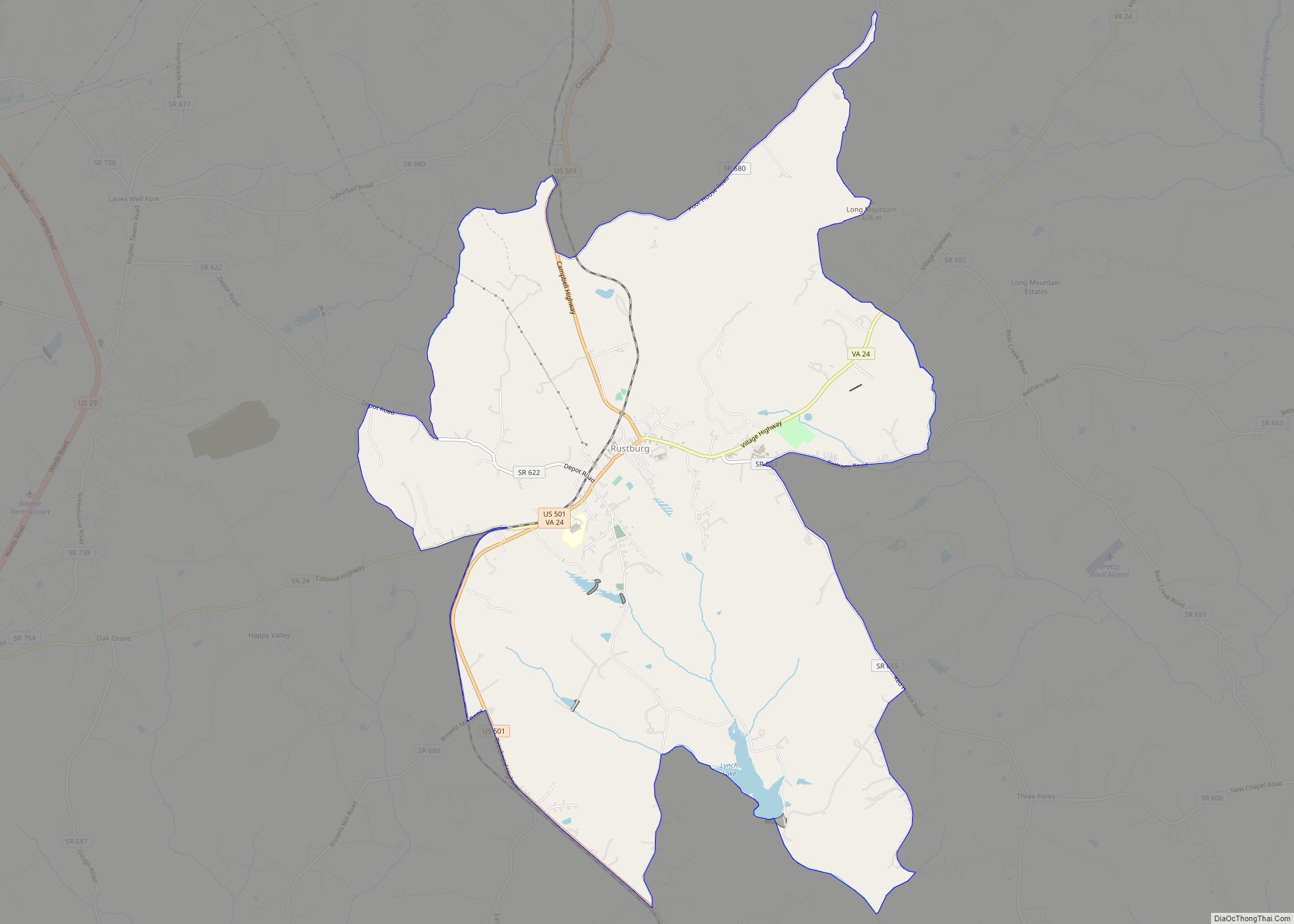
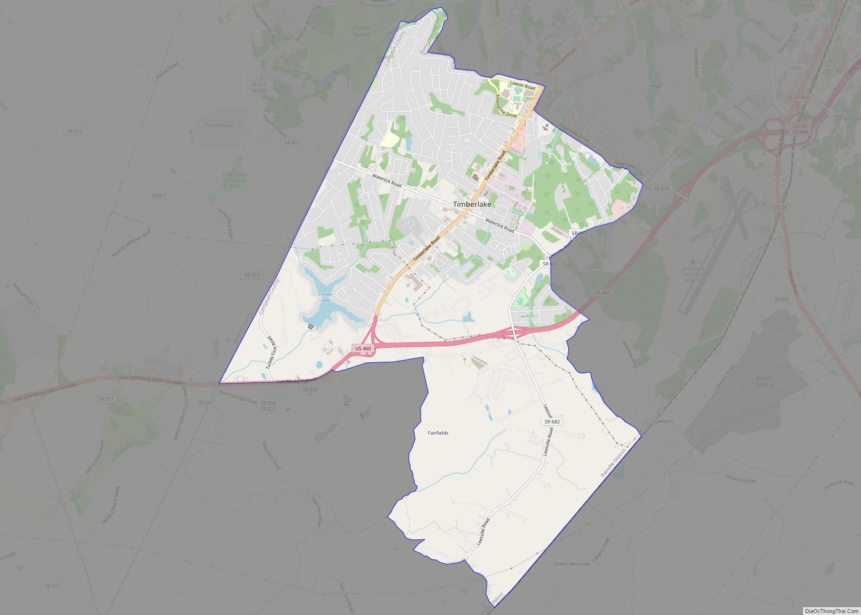
Online Interactive Map
Click on ![]() to view map in "full screen" mode.
to view map in "full screen" mode.
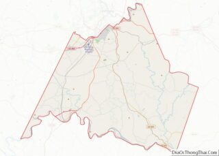
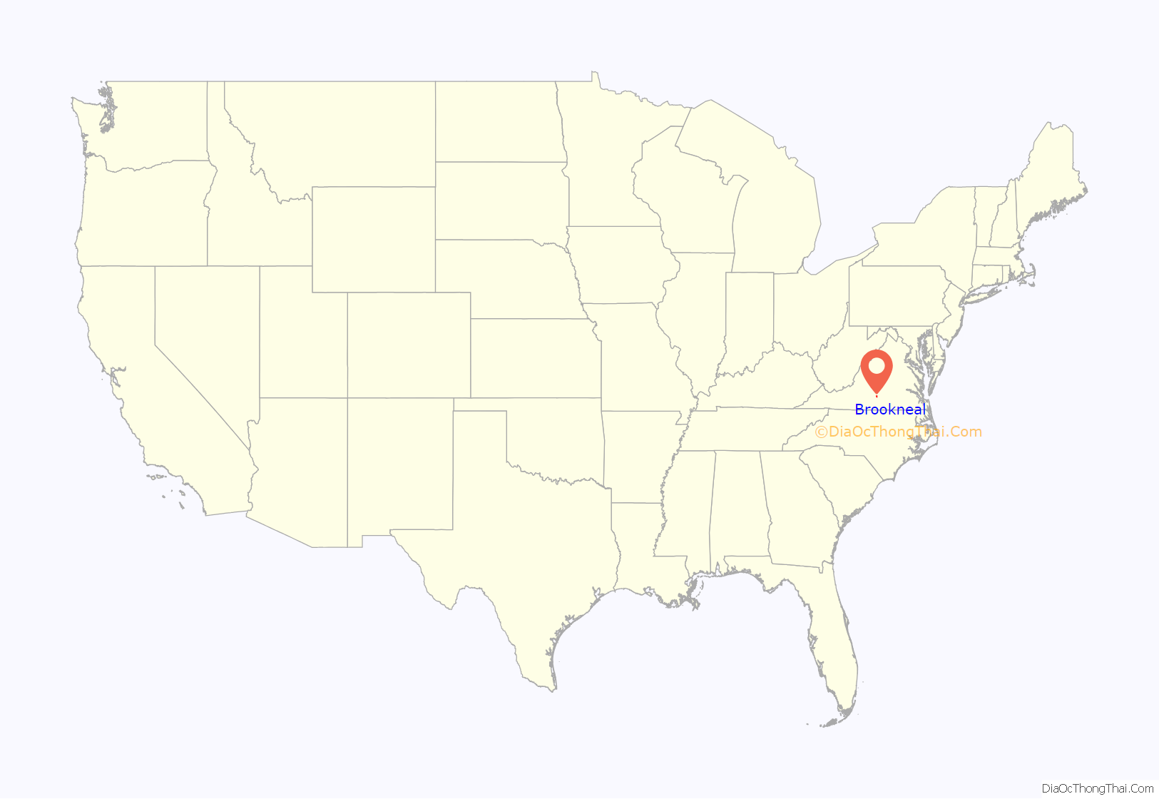
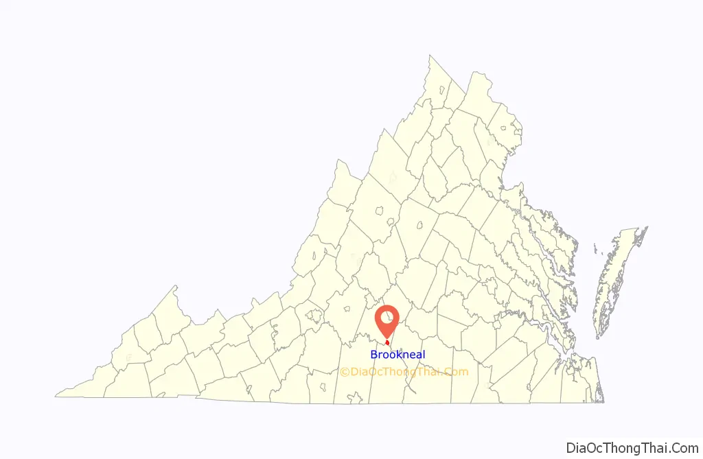
Brookneal location map. Where is Brookneal town?
History
On January 14, 1802, “Brooke Neal” was established by the Commonwealth of Virginia in Chapter 65 of the Acts of Assembly. It was named after John Brooke and his wife, Sarah (née Neal) Brooke, who established a tobacco warehouse which became known as “Brooke’s Warehouse”. It was located near the boat landing and ferry crossing on the Staunton River.
The “Town of Brookneal” was incorporated and a charter issued in 1908. Later to become the smallest incorporated town in the Central Virginia region, Brookneal served as the closest center of commerce for portions of Campbell, Charlotte, and Halifax counties. As transportation modes developed, Brookneal’s location offered proximity to waterways, roads and railroads.
From the earliest days of settlement of the area by Europeans in the Colony of Virginia, through the Revolutionary War era, and extending through most of the first half of the 19th century in Virginia, waterways were a major transportation resource for commerce. Roads were primitive and poorly maintained. Upstream from the fall line, which marked the western reaches of the coastal plain of Virginia (and adjacent areas of North Carolina), canals and other improvements were constructed to aid navigation upriver by batteaux and other watercraft. In the later 19th century, railroads supplanted river transportation in the Piedmont region east of the mountains.
Just south of Brookneal lies the Roanoke River (also known as the Staunton River), which flows east to its mouth at Plymouth, North Carolina, and the Atlantic Ocean via the sounds in eastern North Carolina. Through the efforts of the Roanoke Navigation Company, established with the assistance of both states in 1815, passage was made possible to as far west as Salem in Roanoke County. By 1828, boats were traversing 124 miles (200 km) of “tolerable good and safe navigation” of the Roanoke River between Brookneal and Salem.
Patrick Henry, the first Governor of Virginia after statehood, was an early advocate of the waterway. In 1794 he retired to the 520-acre Red Hill Plantation, located near Brookneal in rural Charlotte County. (The plantation is now operated as a historic museum known as the Red Hill Patrick Henry National Memorial). He established a ferry on the Staunton River to connect Red Hill Plantation with Campbell and Halifax counties on the other side.
By the 1850s, the new technology of railroads was rapidly overtaking the canal systems in many areas; it provided access to additional places. In 1887 the construction of the Lynchburg and Durham Railroad began at Lynchburg, passing south through Brookneal. Just south of town, the railroad crossed the Staunton River into Halifax County. It was completed in 1892, and almost immediately was leased to the Norfolk and Western Railway, and merged into it in 1896. In 1904, the Tidewater Railway was formed by the industrialist financier Henry Huttleston Rogers, to transport bituminous coal from southern West Virginia to coal piers on the ice-free harbor of Hampton Roads. Planned by William Nelson Page of Campbell County, the right-of-way selected for favorable grades passed along the north bank of the river, crossing the L&D track. In 1907, the Tidewater Railway was combined with the Deepwater Railway (initially a West Virginia short line railroad) to form the new Virginian Railway. By 1908, construction was nearing completion, and the new line officially began service on July 1, 1909. In 1959, the Virginia Railway was merged with the Norfolk and Western. Each later became part of the modern Norfolk Southern system in the early 1980s.
In the late 19th century, Brookneal became the site of textile mills that used the water power of the river. These were important to the Piedmont economy for decades. The town of Brookneal suffered a series of disasters in 1912, culminating in a fire that destroyed much of the town. When residents rebuilt, they constructed substantial brick houses to replace many of the old wooden structures. Soon, the small town resumed its growth.
Served for many years by passenger trains and freight service on both railroad lines, and later by U.S. Highway 501 and State Route 40, Brookneal developed a diverse economy with manufacturing, agriculture, service firms and retail offerings. The proximity to the river enhanced its recreational opportunities for residents and visitors as well.
Brookneal has suffered an economic downturn due largely to the dissolution of the Virginia Tobacco Co-Op, which made tobacco warehouses defunct, and the late-20th century decline of the American textile industry, which resulted in the closing of the Dan River mill in Brookneal. The Dan River textile mill employed nearly 400 workers.
Along with Red Hill, the Brookneal Historic District, Cat Rock Sluice of the Roanoke Navigation, Staunton Hill, and Westview are listed on the National Register of Historic Places.
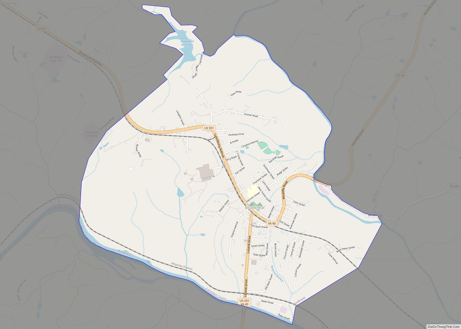
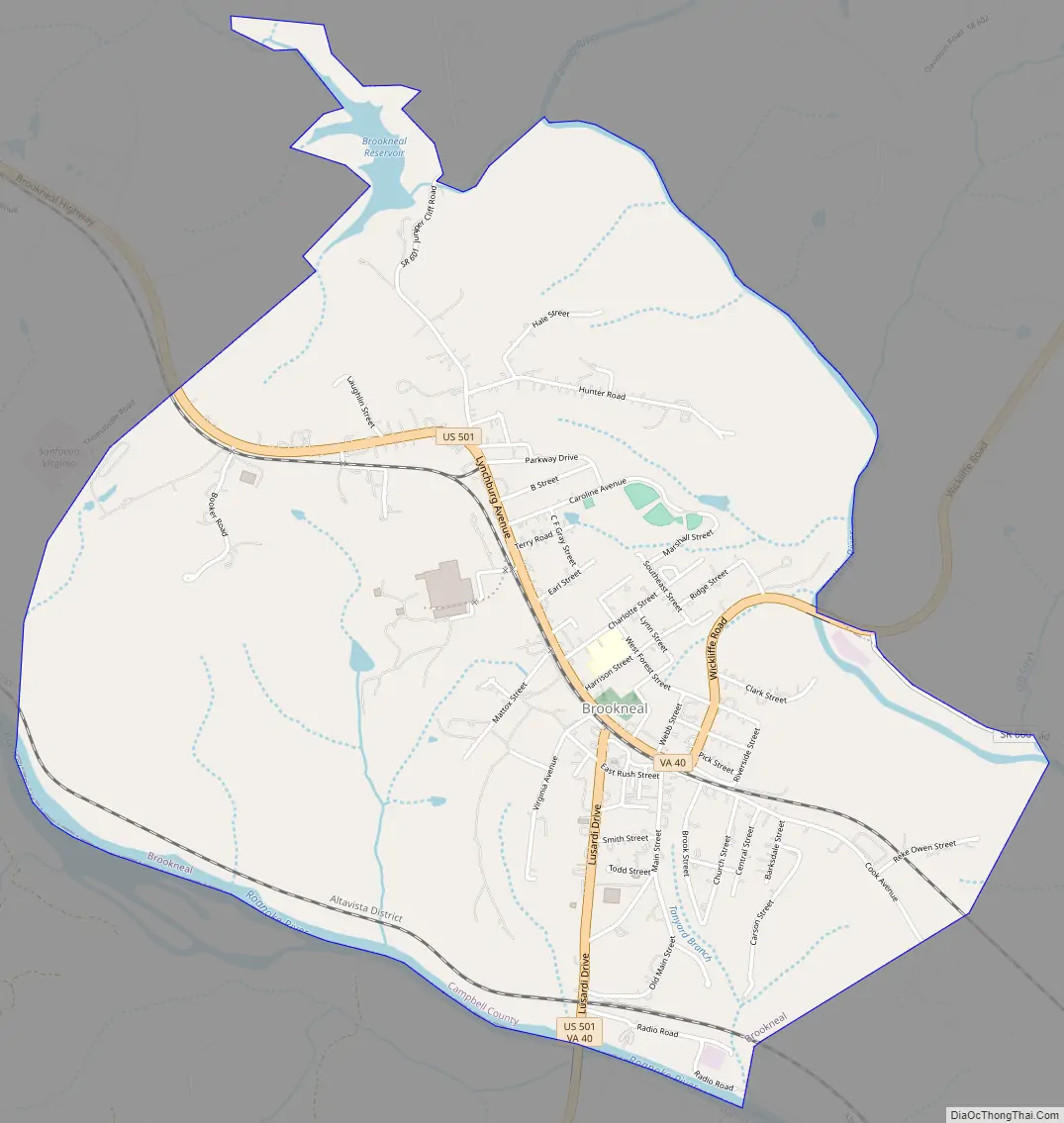
Brookneal Road Map
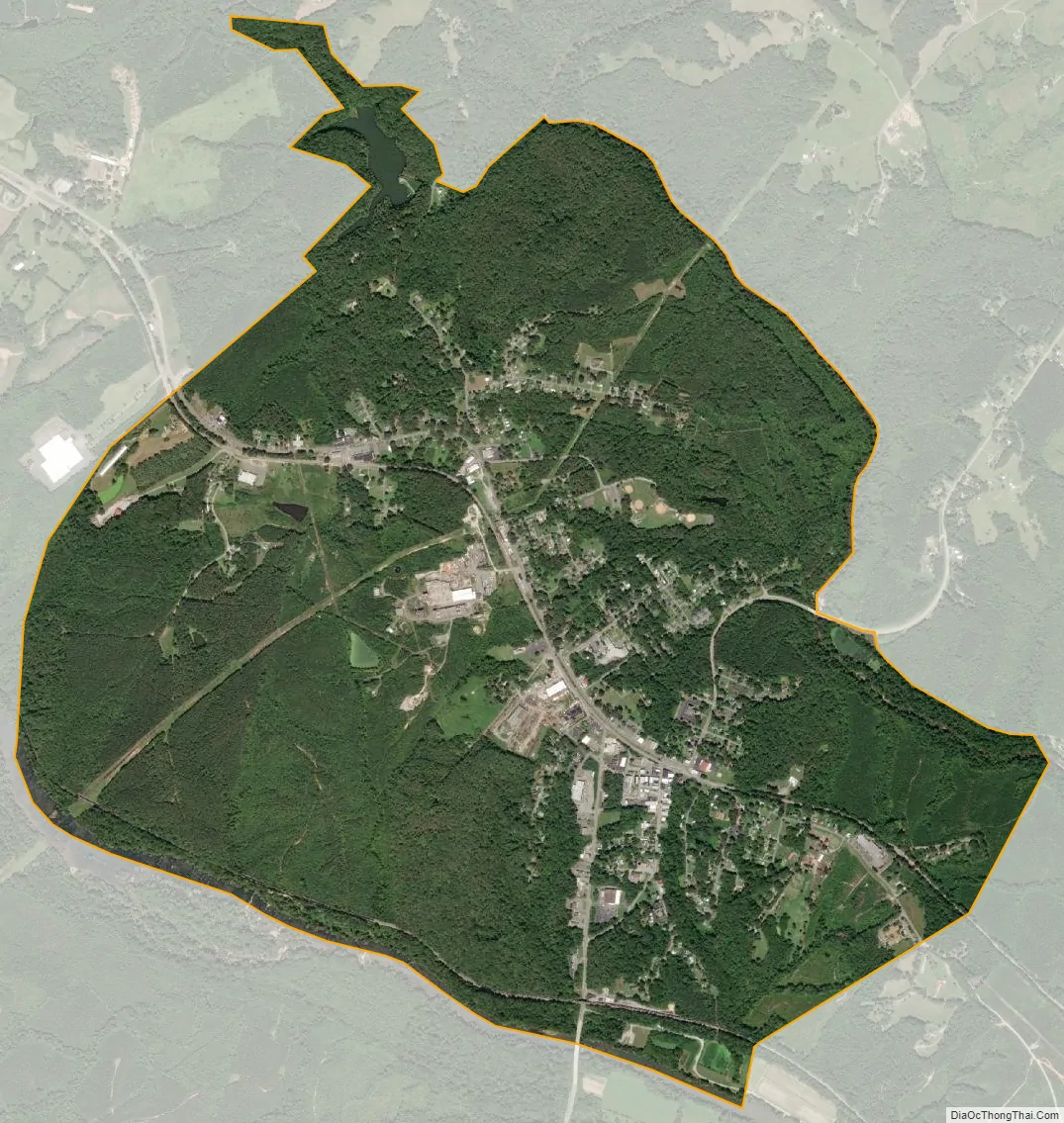
Brookneal city Satellite Map
Geography
Brookneal is located at 37°3′7″N 78°56′42″W / 37.05194°N 78.94500°W / 37.05194; -78.94500 (37.052001, -78.944958).
According to the United States Census Bureau, the town has a total area of 3.6 square miles (9.4 km), of which 3.5 square miles (9.1 km) is land and 0.12 square miles (0.3 km), or 3.31%, is water.
See also
Map of Virginia State and its subdivision:- Accomack
- Albemarle
- Alexandria
- Alleghany
- Amelia
- Amherst
- Appomattox
- Arlington
- Augusta
- Bath
- Bedford
- Bedford City
- Bland
- Botetourt
- Bristol
- Brunswick
- Buchanan
- Buckingham
- Buena Vista
- Campbell
- Caroline
- Carroll
- Charles City
- Charlotte
- Charlottesville
- Chesapeake
- Chesterfield
- Clarke
- Clifton Forge City
- Colonial Heights
- Covington
- Craig
- Culpeper
- Cumberland
- Danville
- Dickenson
- Dinwiddie
- Emporia
- Essex
- Fairfax
- Fairfax City
- Falls Church
- Fauquier
- Floyd
- Fluvanna
- Franklin
- Frederick
- Fredericksburg
- Galax
- Giles
- Gloucester
- Goochland
- Grayson
- Greene
- Greensville
- Halifax
- Hampton
- Hanover
- Harrisonburg
- Henrico
- Henry
- Highland
- Hopewell
- Isle of Wight
- James City
- King and Queen
- King George
- King William
- Lancaster
- Lee
- Lexington
- Loudoun
- Louisa
- Lunenburg
- Lynchburg
- Madison
- Manassas
- Manassas Park
- Martinsville
- Mathews
- Mecklenburg
- Middlesex
- Montgomery
- Nelson
- New Kent
- Newport News
- Norfolk
- Northampton
- Northumberland
- Norton
- Nottoway
- Orange
- Page
- Patrick
- Petersburg
- Pittsylvania
- Poquoson
- Portsmouth
- Powhatan
- Prince Edward
- Prince George
- Prince William
- Pulaski
- Radford
- Rappahannock
- Richmond
- Roanoke
- Roanoke City
- Rockbridge
- Rockingham
- Russell
- Salem
- Scott
- Shenandoah
- Smyth
- Southampton
- Spotsylvania
- Stafford
- Staunton
- Suffolk
- Surry
- Sussex
- Tazewell
- Virginia Beach
- Warren
- Washington
- Waynesboro
- Westmoreland
- Williamsburg
- Winchester
- Wise
- Wythe
- York
- Alabama
- Alaska
- Arizona
- Arkansas
- California
- Colorado
- Connecticut
- Delaware
- District of Columbia
- Florida
- Georgia
- Hawaii
- Idaho
- Illinois
- Indiana
- Iowa
- Kansas
- Kentucky
- Louisiana
- Maine
- Maryland
- Massachusetts
- Michigan
- Minnesota
- Mississippi
- Missouri
- Montana
- Nebraska
- Nevada
- New Hampshire
- New Jersey
- New Mexico
- New York
- North Carolina
- North Dakota
- Ohio
- Oklahoma
- Oregon
- Pennsylvania
- Rhode Island
- South Carolina
- South Dakota
- Tennessee
- Texas
- Utah
- Vermont
- Virginia
- Washington
- West Virginia
- Wisconsin
- Wyoming