Altavista is an incorporated town in Campbell County, Virginia, United States. The population was 3,450 at the 2010 census. It is part of the Lynchburg Metropolitan Statistical Area.
| Name: | Altavista town |
|---|---|
| LSAD Code: | 43 |
| LSAD Description: | town (suffix) |
| State: | Virginia |
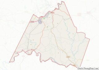
| County: | Campbell County |
| Elevation: | 548 ft (167 m) |
| Total Area: | 5.24 sq mi (13.58 km²) |
| Land Area: | 5.13 sq mi (13.28 km²) |
| Water Area: | 0.11 sq mi (0.29 km²) |
| Total Population: | 3,450 |
| Population Density: | 664.07/sq mi (256.40/km²) |
| ZIP code: | 24517 |
| Area code: | 434 |
| FIPS code: | 5101528 |
| GNISfeature ID: | 1462426 |
| Website: | www.altavistava.gov |
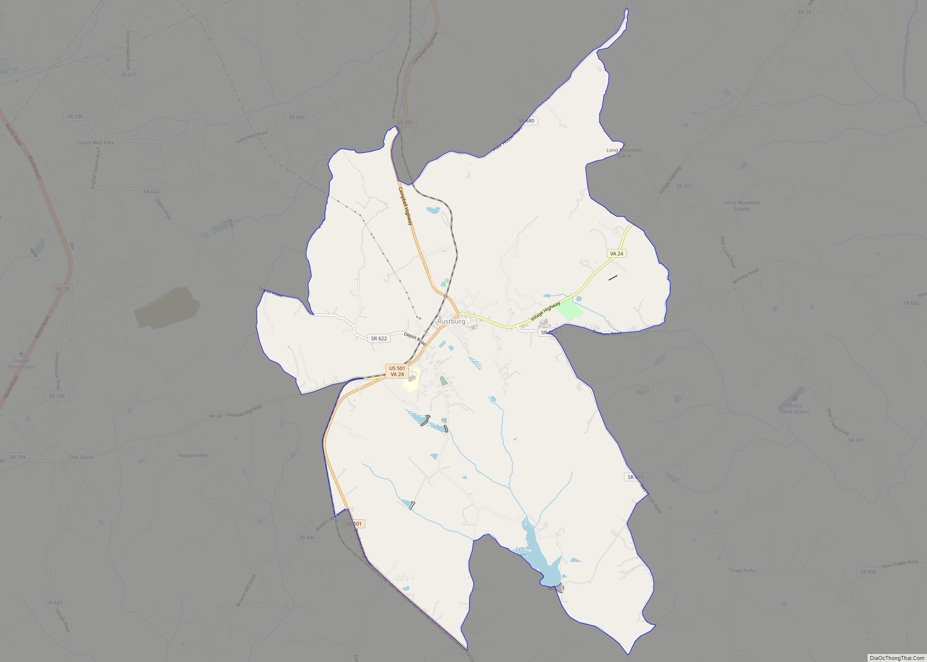
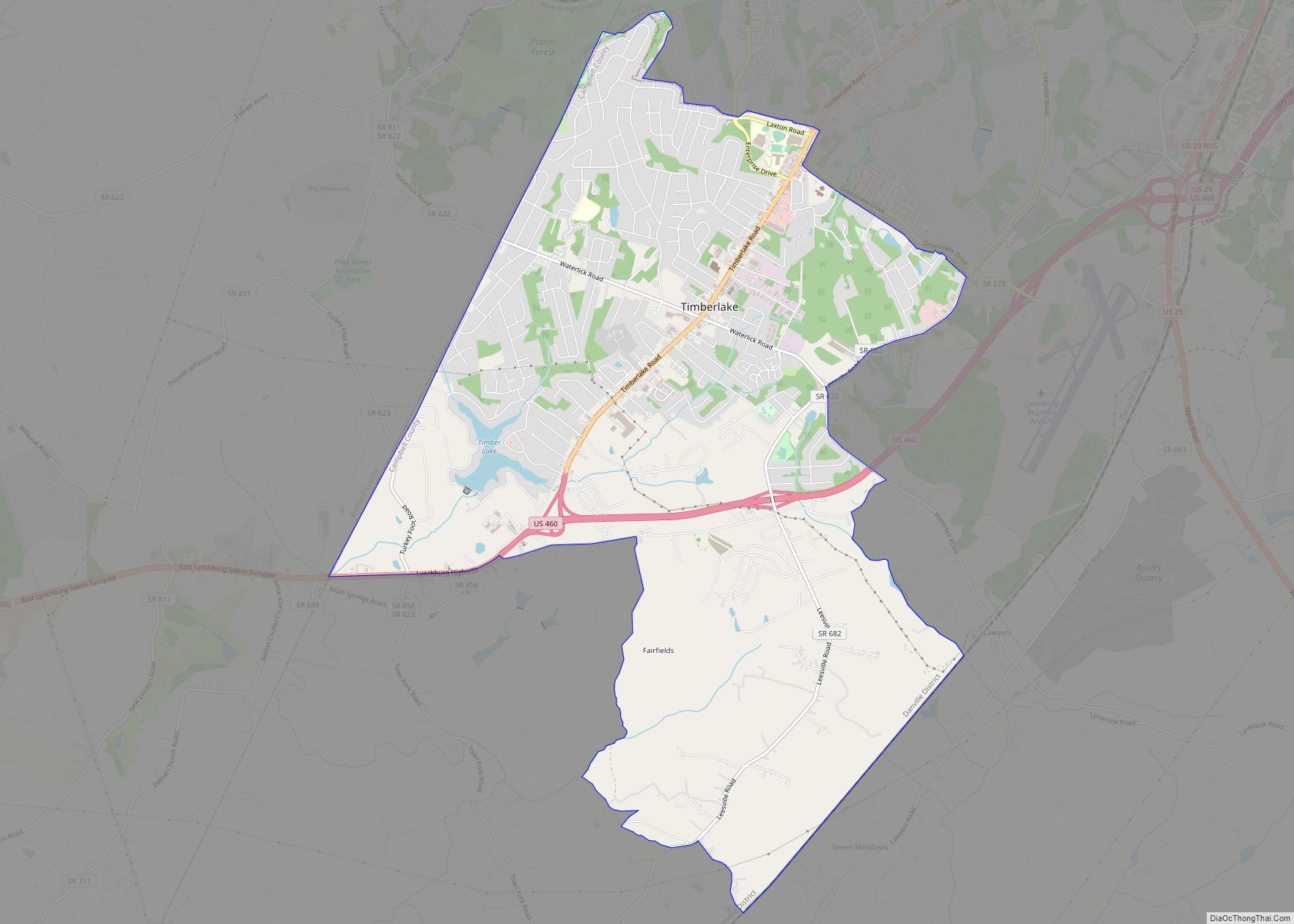
Online Interactive Map
Click on ![]() to view map in "full screen" mode.
to view map in "full screen" mode.
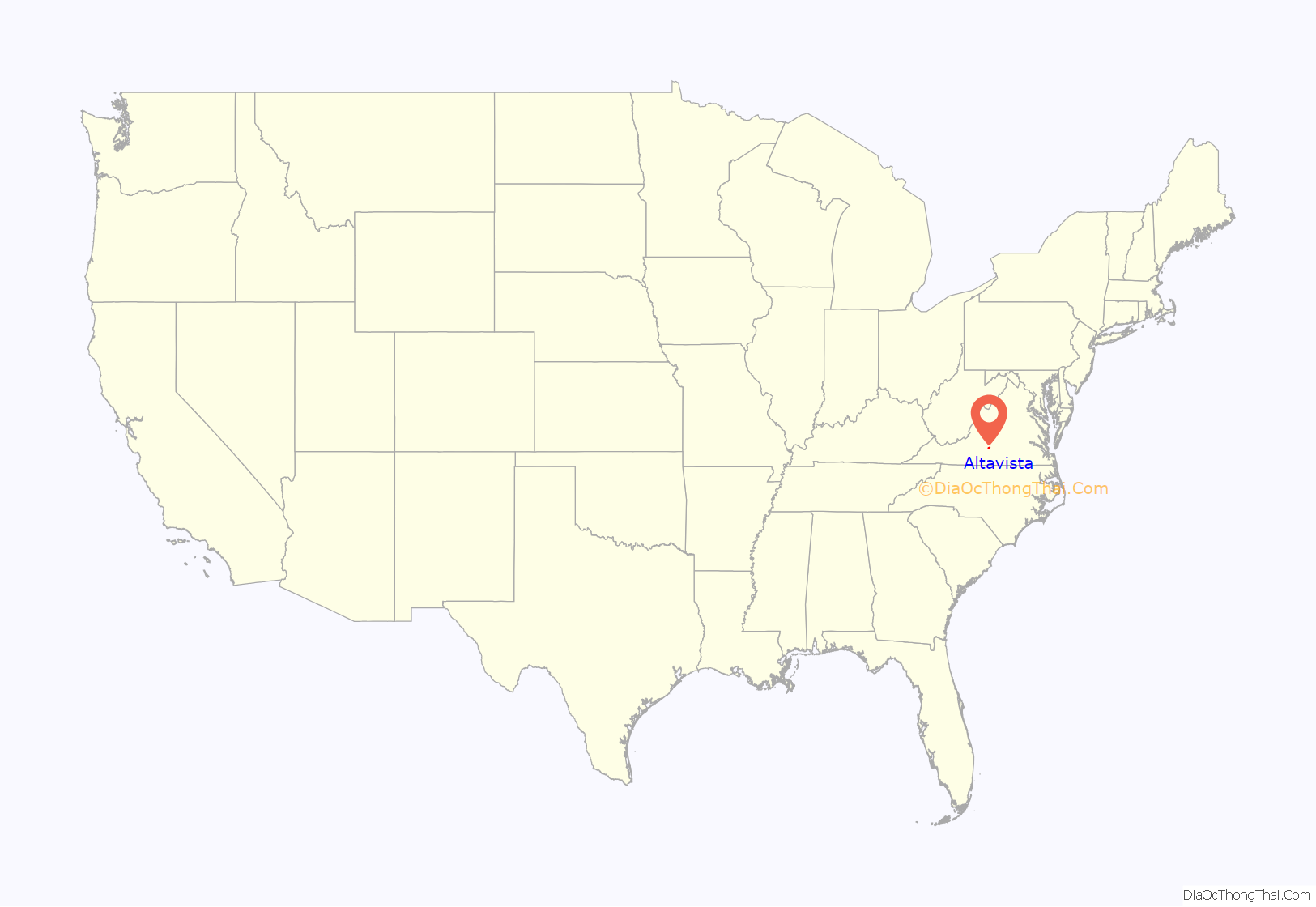
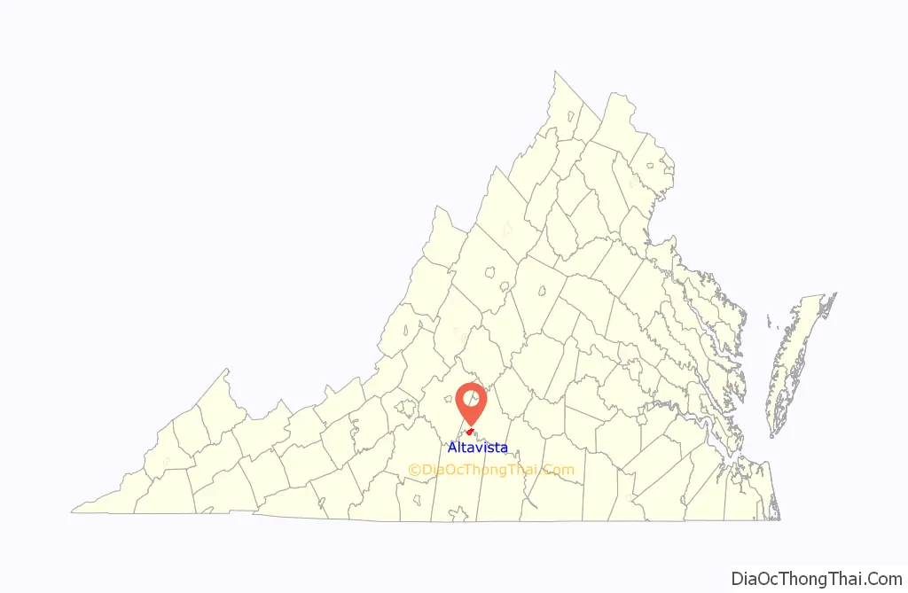
Altavista location map. Where is Altavista town?
History
A new town on a new railroad
The town of Altavista was created in 1905 during the construction of the east-west Tidewater Railway between Giles County (on the border with West Virginia) and Sewell’s Point in what was at the time Norfolk County. Planned by Campbell County native William Nelson Page and financier and industrialist Henry Huttleston Rogers, the Tidewater Railway was combined with the Deepwater Railway in West Virginia to form the new Virginian Railway in 1907. Although it was a common carrier and offered limited passenger service until 1956, the main purpose of the Virginian Railway was to haul bituminous coal from the mountains to coal piers on the ice-free harbor of Hampton Roads.
Lane Brothers Construction Company was the contractor for constructing 32 miles (51 km) of the Tidewater Railway, including its crossing of the existing north-south Southern Railway in Campbell County. Three Lane brothers purchased 2,000 acres (8.1 km) of land near the point where the railroads would intersect, and had civil engineers lay out a new town with streets and lots, complete with water, sewer, telephone service, and electric lines. Settlement was encouraged by the awarding of free lots. Named for the Lane family farm in Albemarle County, the new town of Altavista was incorporated in 1912.
The former Virginian Railway became part of the Norfolk and Western Railway in 1959, and it and the Southern Railway were combined in the early 1980s to form the current Norfolk Southern Railway. Now operated by the same company, both railroad lines are still very active in the Altavista area.
Lane Home Furnishings
In March 1912, John Lane had purchased a bankrupt box plant in Altavista for $500. His son Ed Lane, 21 at the time and with little manufacturing experience, was encouraged by his father to try his hand at starting a chest factory in the newly acquired plant. Since the Lanes did not know how successful their new venture was going to be, they chose not to put their name on it, instead incorporating the little company as the Standard Red Cedar Chest Company, with John Lane as president and Ed Lane as vice president and general manager. From cedar chests, Lane expanded to occasional tables in 1951, case goods in 1956, and accent pieces in 1965.
In 1972, Lane bought a small reclining chair company in Tupelo, Mississippi, named Action Industries, which had been founded in 1970 by Bo Bland and Mickey Holliman. Action sustained tremendous growth through gains in market share and product diversification over the next 20 years, becoming a major force in the upholstered furniture industry. Today, the wood and upholstered divisions have become Lane Home Furnishings and a leading maker of Virginia furniture. Lane Furniture Industries was later owned by Heritage Home Group, which also owned other well-known brand name companies such as Broyhill, Thomasville, Drexel Heritage and Maitland Smith. It was purchased by United Furniture Industries.
Lane was most famous for their Lane cedar chests made at the original plant in Altavista. At the beginning of the 21st century the company headquarters were moved from Altavista and the plant there closed. Soon afterwards the last commemorative cedar chests were made as the plant shut down. The old plant now sits mostly vacant, but certain sections have become occupied by new companies, and Central Virginia Community College has moved into parts of the office building. A fire occurred in an empty section in early 2006.
Historic sites
The Avoca Museum and Altavista Downtown Historic District are listed on the National Register of Historic Places.
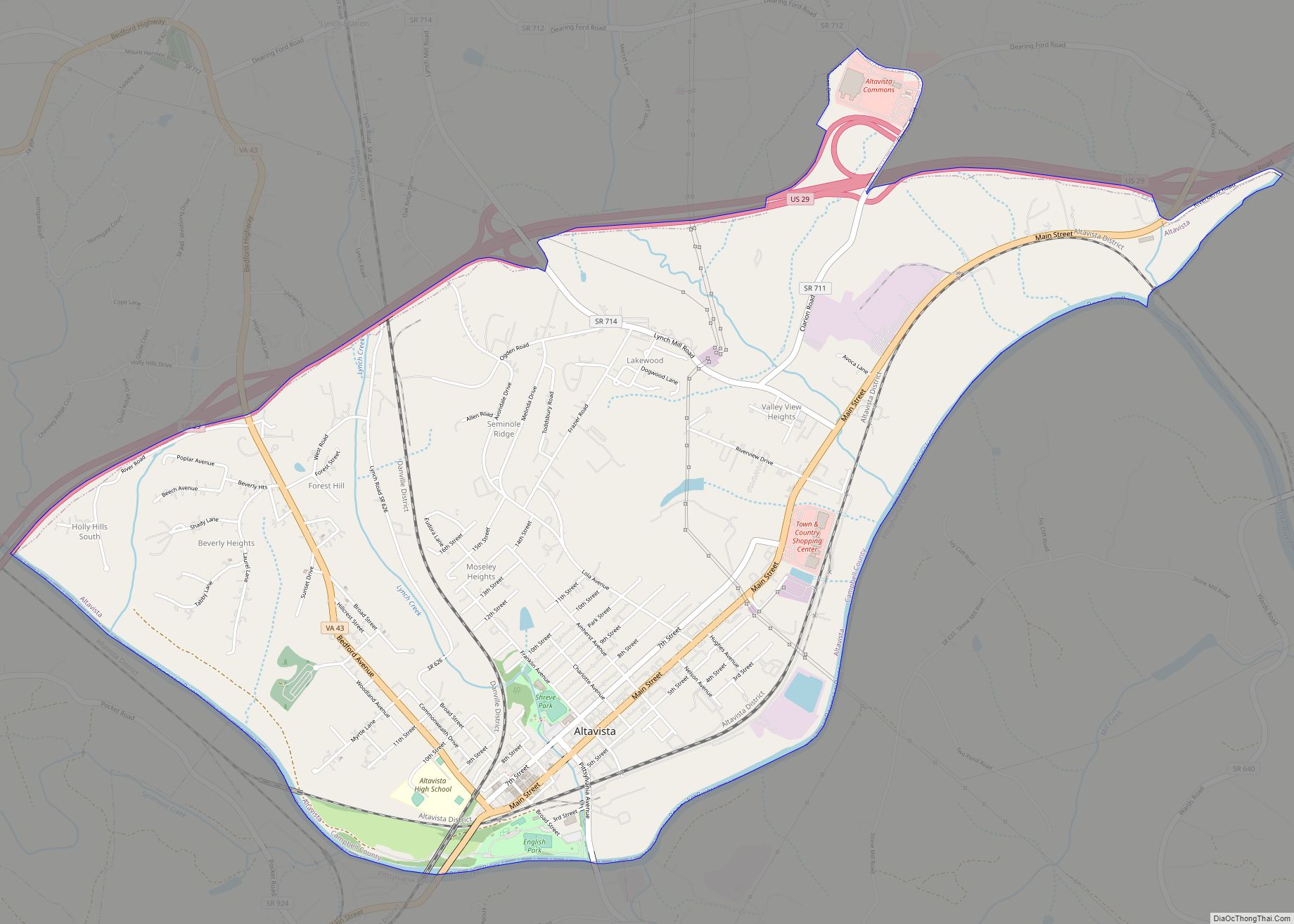
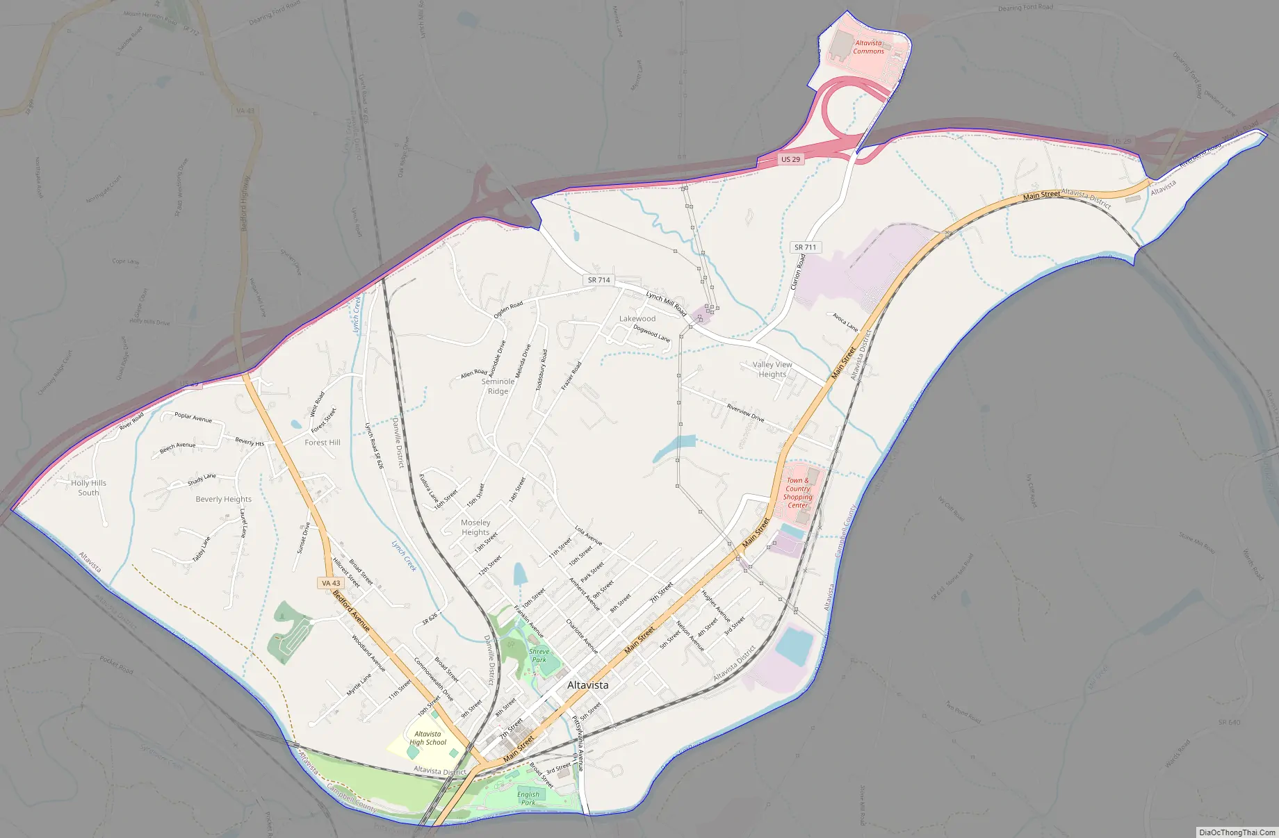
Altavista Road Map
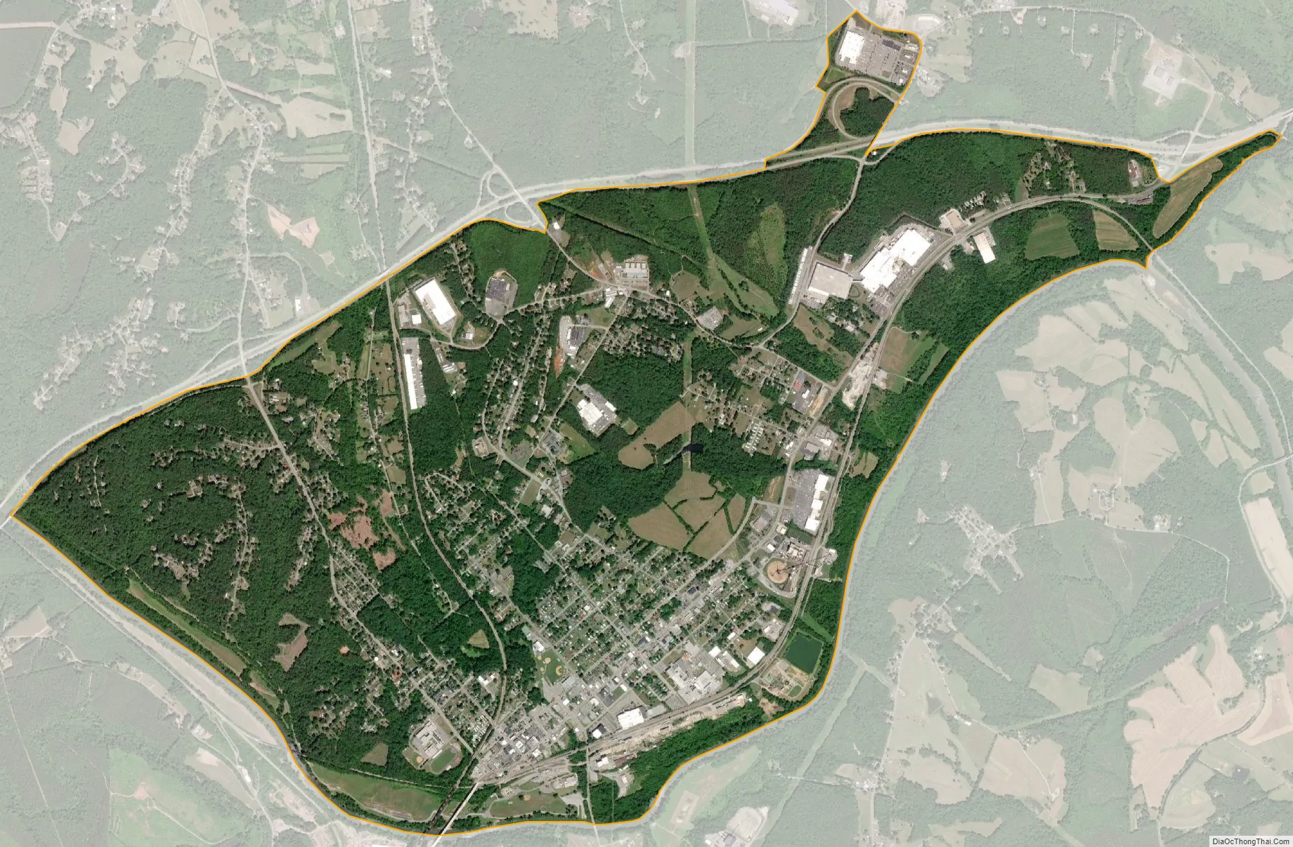
Altavista city Satellite Map
Geography
Altavista is located in southwestern Campbell County at 37°7′3″N 79°17′23″W / 37.11750°N 79.28972°W / 37.11750; -79.28972 (37.117622, −79.289632). It is bordered to the south by the Roanoke River, which forms the boundary with Pittsylvania County. The town of Hurt is directly to the south across the river.
U.S. Route 29, a four-lane expressway, forms the northern border of the town and provides access from four exits. US 29 leads north 25 miles (40 km) to Lynchburg and south 43 miles (69 km) to Danville.
According to the United States Census Bureau, Altavista has a total area of 5.0 square miles (13.0 km), of which 4.9 square miles (12.7 km) is land and 0.12 square miles (0.3 km), or 2.24%, is water.
See also
Map of Virginia State and its subdivision:- Accomack
- Albemarle
- Alexandria
- Alleghany
- Amelia
- Amherst
- Appomattox
- Arlington
- Augusta
- Bath
- Bedford
- Bedford City
- Bland
- Botetourt
- Bristol
- Brunswick
- Buchanan
- Buckingham
- Buena Vista
- Campbell
- Caroline
- Carroll
- Charles City
- Charlotte
- Charlottesville
- Chesapeake
- Chesterfield
- Clarke
- Clifton Forge City
- Colonial Heights
- Covington
- Craig
- Culpeper
- Cumberland
- Danville
- Dickenson
- Dinwiddie
- Emporia
- Essex
- Fairfax
- Fairfax City
- Falls Church
- Fauquier
- Floyd
- Fluvanna
- Franklin
- Frederick
- Fredericksburg
- Galax
- Giles
- Gloucester
- Goochland
- Grayson
- Greene
- Greensville
- Halifax
- Hampton
- Hanover
- Harrisonburg
- Henrico
- Henry
- Highland
- Hopewell
- Isle of Wight
- James City
- King and Queen
- King George
- King William
- Lancaster
- Lee
- Lexington
- Loudoun
- Louisa
- Lunenburg
- Lynchburg
- Madison
- Manassas
- Manassas Park
- Martinsville
- Mathews
- Mecklenburg
- Middlesex
- Montgomery
- Nelson
- New Kent
- Newport News
- Norfolk
- Northampton
- Northumberland
- Norton
- Nottoway
- Orange
- Page
- Patrick
- Petersburg
- Pittsylvania
- Poquoson
- Portsmouth
- Powhatan
- Prince Edward
- Prince George
- Prince William
- Pulaski
- Radford
- Rappahannock
- Richmond
- Roanoke
- Roanoke City
- Rockbridge
- Rockingham
- Russell
- Salem
- Scott
- Shenandoah
- Smyth
- Southampton
- Spotsylvania
- Stafford
- Staunton
- Suffolk
- Surry
- Sussex
- Tazewell
- Virginia Beach
- Warren
- Washington
- Waynesboro
- Westmoreland
- Williamsburg
- Winchester
- Wise
- Wythe
- York
- Alabama
- Alaska
- Arizona
- Arkansas
- California
- Colorado
- Connecticut
- Delaware
- District of Columbia
- Florida
- Georgia
- Hawaii
- Idaho
- Illinois
- Indiana
- Iowa
- Kansas
- Kentucky
- Louisiana
- Maine
- Maryland
- Massachusetts
- Michigan
- Minnesota
- Mississippi
- Missouri
- Montana
- Nebraska
- Nevada
- New Hampshire
- New Jersey
- New Mexico
- New York
- North Carolina
- North Dakota
- Ohio
- Oklahoma
- Oregon
- Pennsylvania
- Rhode Island
- South Carolina
- South Dakota
- Tennessee
- Texas
- Utah
- Vermont
- Virginia
- Washington
- West Virginia
- Wisconsin
- Wyoming