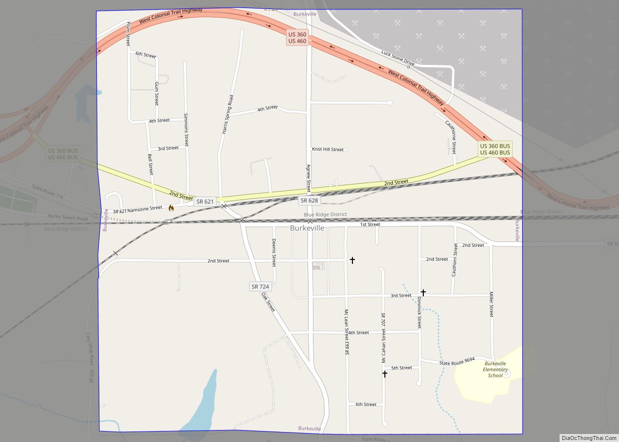
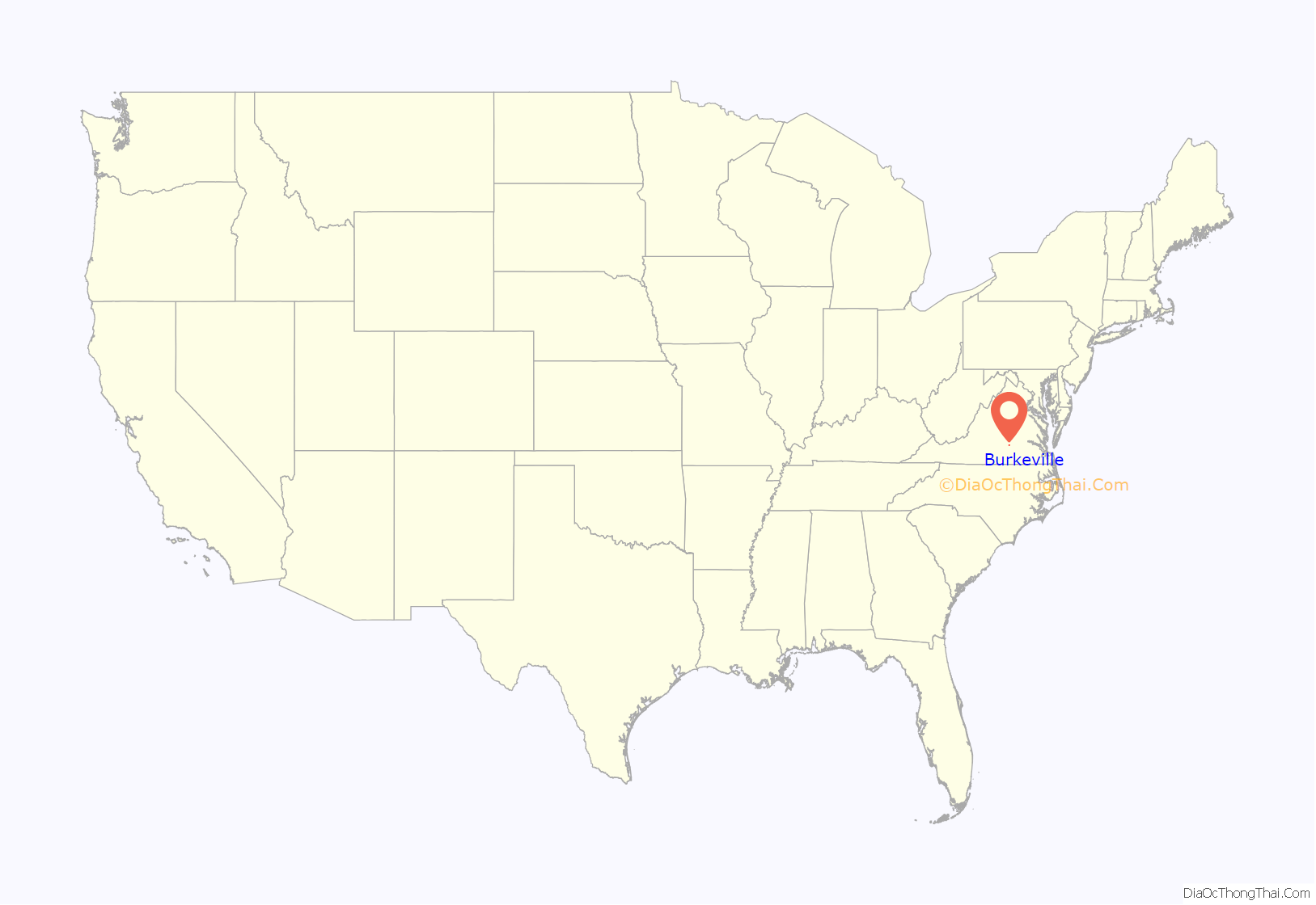
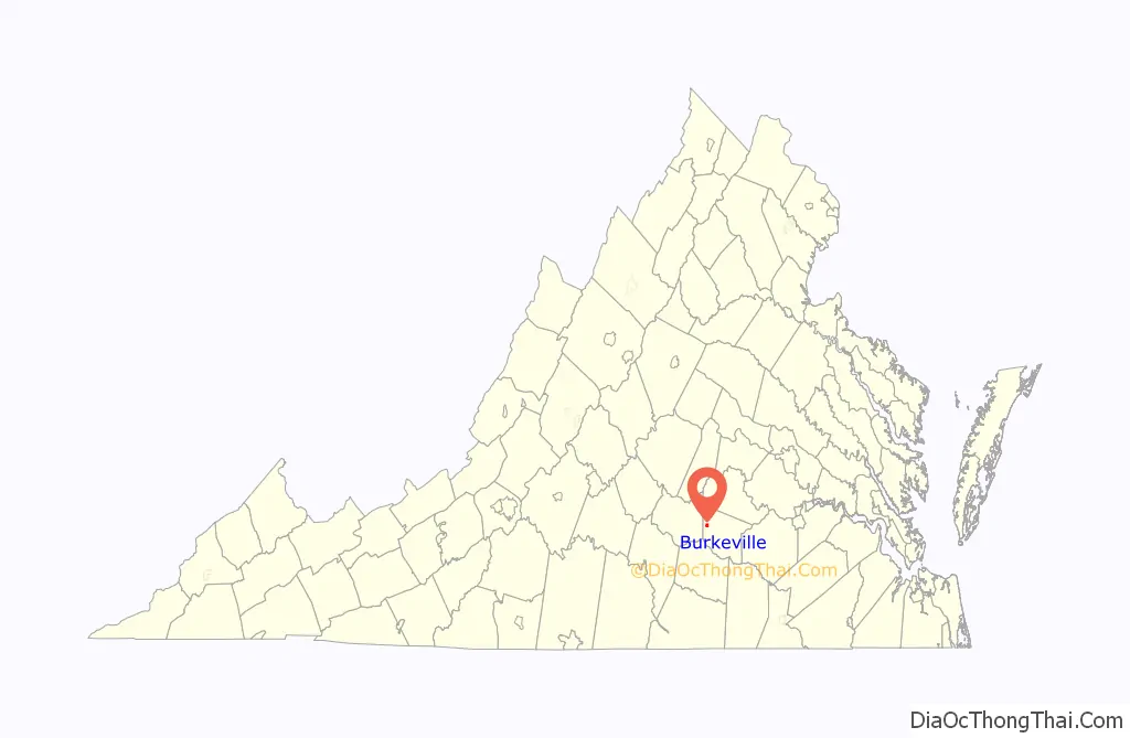
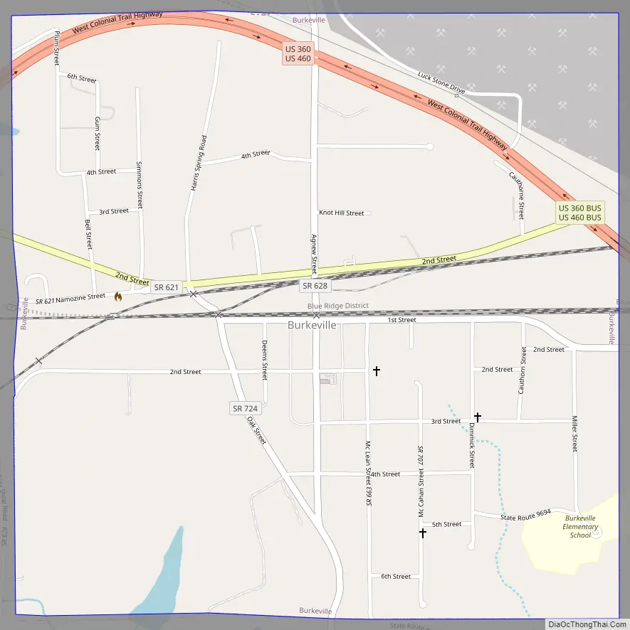
Burkeville is a town in Nottoway County, Virginia, United States. The population was 432 at the 2010 census. The source of the town name is disputed. The town is located on the crossroads of U.S. Routes 360 and 460.
Businesses in the small town of Burkeville include a stone quarry, a Southern States Cooperative store, and a John Deere dealership. Bassett Furniture operated a veneer factory in Burkeville for many years but it has closed. The Nottoway Correctional Center is located in Burkeville as is the Piedmont Geriatric Hospital. There is also a camp retreat for the blind.
| Name: | Burkeville town |
|---|---|
| LSAD Code: | 43 |
| LSAD Description: | town (suffix) |
| State: | Virginia |
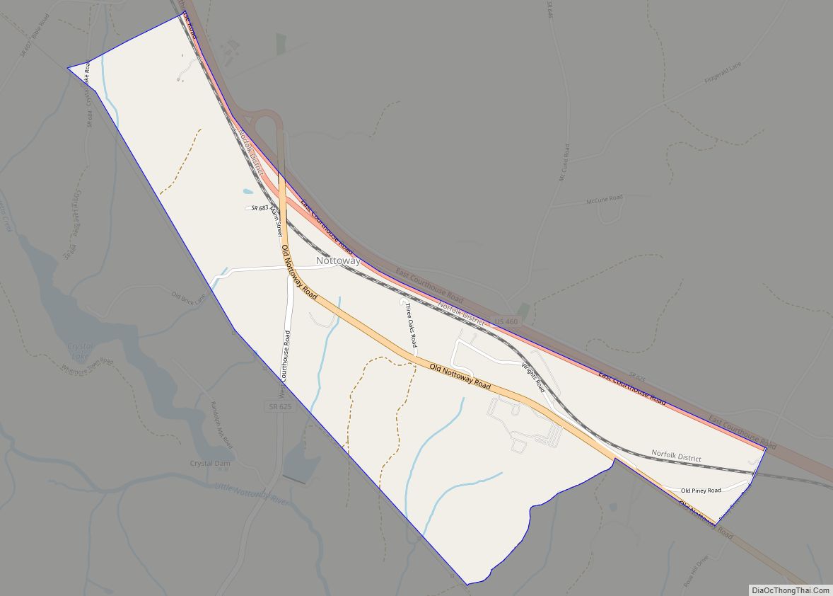
| County: | Nottoway County |
| Elevation: | 548 ft (167 m) |
| Total Area: | 1.01 sq mi (2.61 km²) |
| Land Area: | 1.00 sq mi (2.59 km²) |
| Water Area: | 0.01 sq mi (0.02 km²) |
| Total Population: | 432 |
| Population Density: | 398.60/sq mi (153.92/km²) |
| ZIP code: | 23922 |
| Area code: | 434 |
| FIPS code: | 5111560 |
| GNISfeature ID: | 1464115 |
Online Interactive Map
Click on ![]() to view map in "full screen" mode.
to view map in "full screen" mode.
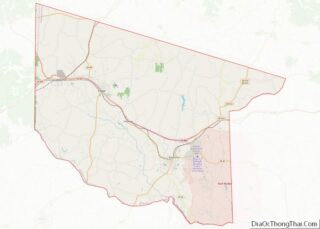
Burkeville location map. Where is Burkeville town?
History
The town was named either for a tavern or a Samuel Burke. It was formerly “Burke’s Junction.” It formed at the junction of the Richmond and Danville Railroad and the Southside Railroad in the mid-nineteenth century. The Southside became the Atlantic, Mississippi and Ohio Railroad in 1870 and then a line in the Norfolk and Western Railway and the Norfolk Southern Railway. The rail line from Burkville to Pamplin City was converted by the Virginia Department of Parks and Recreation into High Bridge Trail State Park.
The last Civil War battle before the surrender at Appomattox was fought nearby at Sayler’s Creek on April 6, 1865. Here were surrendered more men (without terms) than in any other battle on American soil. General Robert E. Lee’s depleted forces lost over 7,000 men killed, wounded, or taken prisoner at either Sayler’s Creek or at General Gordon’s engagement the same day, a few miles west. This led Lee to surrender at Appomattox three days later.
Ella Grahamn Agnew, in 1910 in Burkeville, was appointed the first State Agent for women by the United States Department of Agriculture and was the first woman to be appointed by the Department to represent it in the field. She had moved to the town as a baby and was later buried in the community’s Sunset Cemetery.
Polk Miller, renowned old time banjo-player, story-teller, veterinarian, and Confederate veteran, was born on a plantation just west of Burkeville in 1844. Though he moved to Richmond shortly before the Civil War, he paid homage to his Southside roots through his music and story-telling, in which he engaged himself professionally in the late 19th and early 20th centuries, sharing a stage on occasion with Mark Twain, and becoming the first known artist to record music with a mixed-race ensemble.
Burke’s Tavern, Hyde Park, and Inverness are listed on the National Register of Historic Places.
Burkeville Road Map
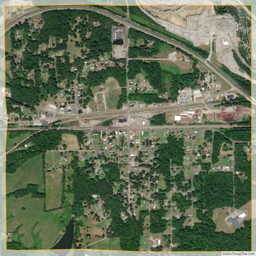
Burkeville city Satellite Map
Geography
Burkeville is located at 37°11′14″N 78°12′6″W / 37.18722°N 78.20167°W / 37.18722; -78.20167 (37.187131, -78.201702).
According to the United States Census Bureau, the town has a total area of 1.0 square miles (2.6 km), of which, 1.0 square miles (2.6 km) of it is land and 0.99% is water.
Twin Lakes State Park (formerly Prince Edward-Goodwin Lake State Park) is to the west of town.
See also
Map of Virginia State and its subdivision:- Accomack
- Albemarle
- Alexandria
- Alleghany
- Amelia
- Amherst
- Appomattox
- Arlington
- Augusta
- Bath
- Bedford
- Bedford City
- Bland
- Botetourt
- Bristol
- Brunswick
- Buchanan
- Buckingham
- Buena Vista
- Campbell
- Caroline
- Carroll
- Charles City
- Charlotte
- Charlottesville
- Chesapeake
- Chesterfield
- Clarke
- Clifton Forge City
- Colonial Heights
- Covington
- Craig
- Culpeper
- Cumberland
- Danville
- Dickenson
- Dinwiddie
- Emporia
- Essex
- Fairfax
- Fairfax City
- Falls Church
- Fauquier
- Floyd
- Fluvanna
- Franklin
- Frederick
- Fredericksburg
- Galax
- Giles
- Gloucester
- Goochland
- Grayson
- Greene
- Greensville
- Halifax
- Hampton
- Hanover
- Harrisonburg
- Henrico
- Henry
- Highland
- Hopewell
- Isle of Wight
- James City
- King and Queen
- King George
- King William
- Lancaster
- Lee
- Lexington
- Loudoun
- Louisa
- Lunenburg
- Lynchburg
- Madison
- Manassas
- Manassas Park
- Martinsville
- Mathews
- Mecklenburg
- Middlesex
- Montgomery
- Nelson
- New Kent
- Newport News
- Norfolk
- Northampton
- Northumberland
- Norton
- Nottoway
- Orange
- Page
- Patrick
- Petersburg
- Pittsylvania
- Poquoson
- Portsmouth
- Powhatan
- Prince Edward
- Prince George
- Prince William
- Pulaski
- Radford
- Rappahannock
- Richmond
- Roanoke
- Roanoke City
- Rockbridge
- Rockingham
- Russell
- Salem
- Scott
- Shenandoah
- Smyth
- Southampton
- Spotsylvania
- Stafford
- Staunton
- Suffolk
- Surry
- Sussex
- Tazewell
- Virginia Beach
- Warren
- Washington
- Waynesboro
- Westmoreland
- Williamsburg
- Winchester
- Wise
- Wythe
- York
- Alabama
- Alaska
- Arizona
- Arkansas
- California
- Colorado
- Connecticut
- Delaware
- District of Columbia
- Florida
- Georgia
- Hawaii
- Idaho
- Illinois
- Indiana
- Iowa
- Kansas
- Kentucky
- Louisiana
- Maine
- Maryland
- Massachusetts
- Michigan
- Minnesota
- Mississippi
- Missouri
- Montana
- Nebraska
- Nevada
- New Hampshire
- New Jersey
- New Mexico
- New York
- North Carolina
- North Dakota
- Ohio
- Oklahoma
- Oregon
- Pennsylvania
- Rhode Island
- South Carolina
- South Dakota
- Tennessee
- Texas
- Utah
- Vermont
- Virginia
- Washington
- West Virginia
- Wisconsin
- Wyoming