Cape Charles is a town / municipal corporation in Northampton County, Virginia, United States. The population was 1,009 as of the 2010 Census.
| Name: | Cape Charles town |
|---|---|
| LSAD Code: | 43 |
| LSAD Description: | town (suffix) |
| State: | Virginia |
| County: | Northampton County |
| Elevation: | 3 ft (0.9 m) |
| Total Area: | 3.62 sq mi (9.36 km²) |
| Land Area: | 3.55 sq mi (9.20 km²) |
| Water Area: | 0.06 sq mi (0.16 km²) |
| Total Population: | 1,178 |
| Population Density: | 286.80/sq mi (110.73/km²) |
| FIPS code: | 5112808 |
| GNISfeature ID: | 1492707 |
| Website: | capecharles.org |
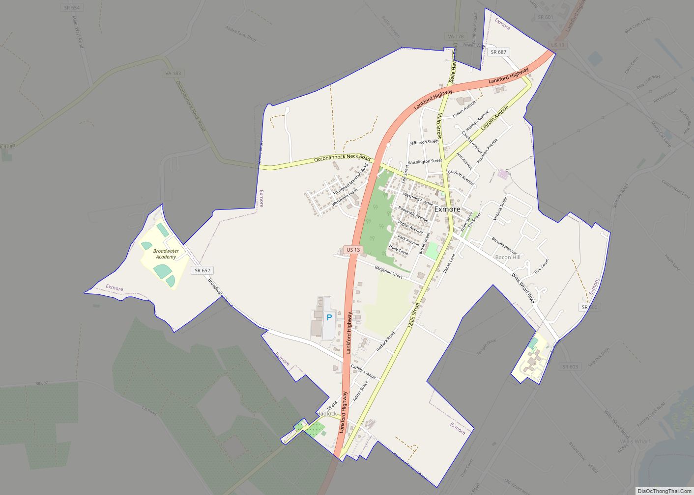
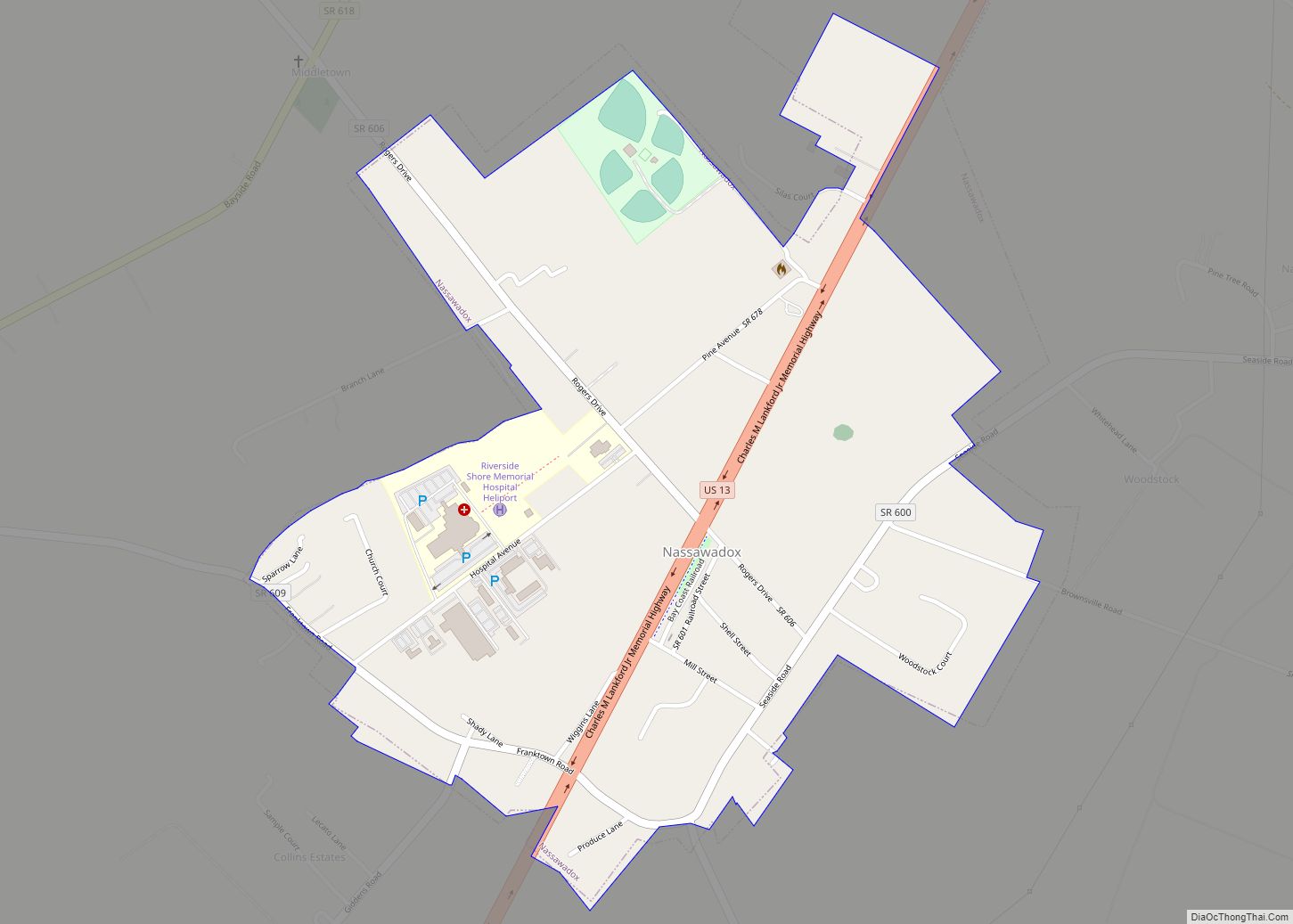
Online Interactive Map
Click on ![]() to view map in "full screen" mode.
to view map in "full screen" mode.
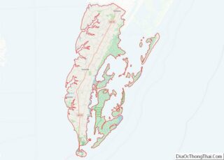
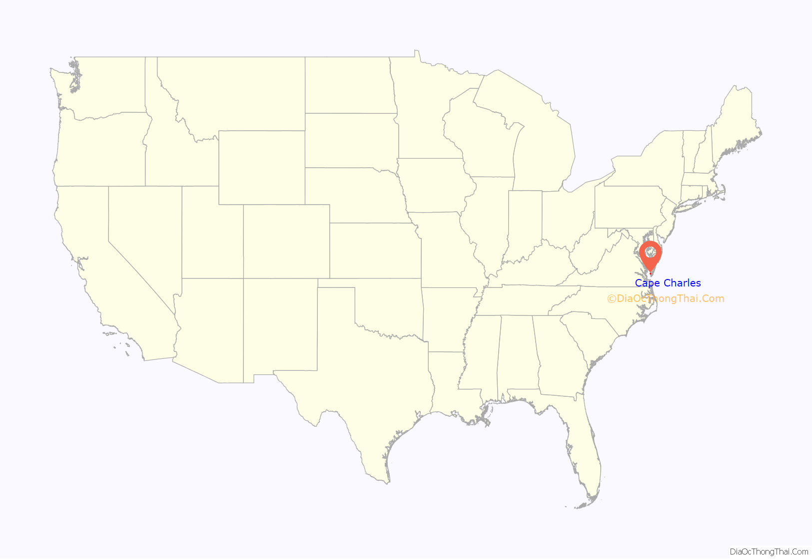
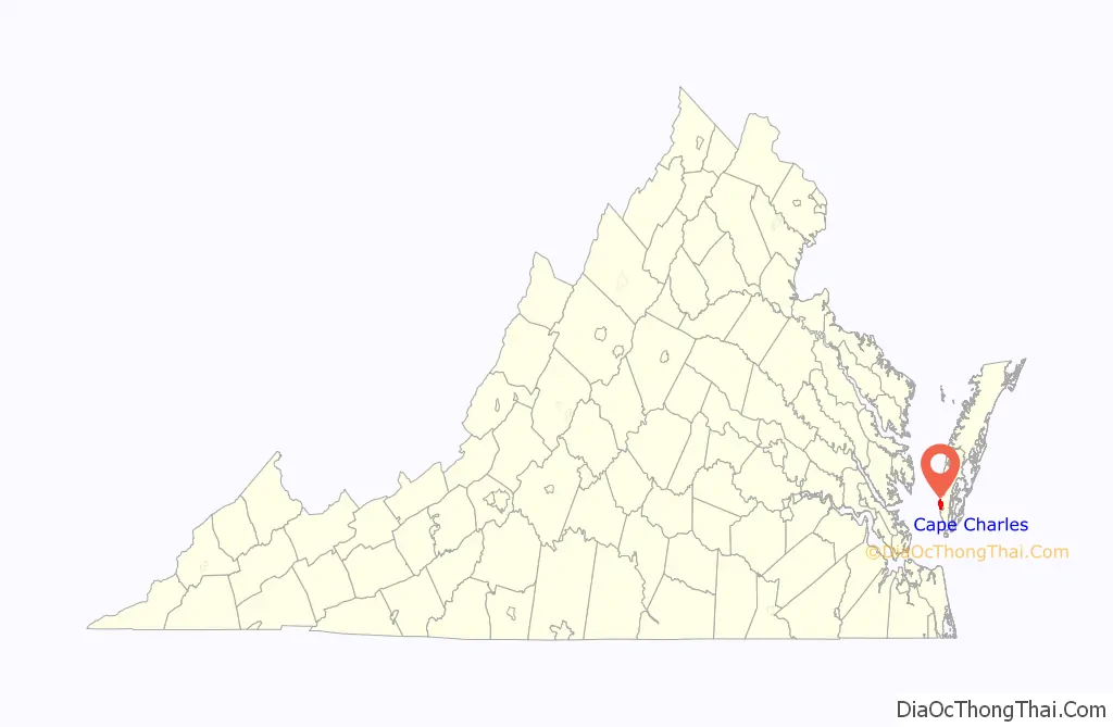
Cape Charles location map. Where is Cape Charles town?
History
Cape Charles, located close to the mouth of the Chesapeake Bay, on Virginia’s Eastern Shore, was founded in 1884 as a planned community by railroad and ferry interests. In 1883, William Lawrence Scott became president of the New York, Philadelphia and Norfolk Railroad Company (NYP&N), and purchased three plantations comprising approximately 2,509 acres from the heirs of former Virginia Governor Littleton Waller Tazewell. Of this land, 40 acres were ceded to the NYP&N, and 136 acres went to create the Town of Cape Charles (technically known as the “Municipal Corporation of Cape Charles”). Some of this land, named Cape Charles for the geographical cape found on the Point and headland to the south, Scott sold to the Railroad Company to serve as the southern terminus of the line on the Delmarva Peninsula from the Northeast states. In that same year, construction of the railroad began. In Cape Charles, the Railroad Company built a harbor port to handle steamships and freighters from Cape Charles to Norfolk.
The original Town was surveyed, platted, and laid out with approximately 136 acres divided into 644 equal lots. Seven wider avenues which run from east to west were named for Virginia statesmen and political leaders; the streets which run north and south were named for fruits. The original layout of the Town is still very visible today.
Historian William G. Thomas writes, “At a cost of nearly $300,000, the New York, Pennsylvania, and Norfolk Railroad (N.Y.P. & N. R.R.) was dredging a new harbor out of a large fresh-water lagoon between King’s and Old Plantation creeks in lower Northampton County, and Scott planned to develop a new town around it called Cape Charles City. The appellation “City” for any place on the Eastern Shore was romantic, a vision of the future that the railroad might make possible….In 1890, the United States Army Corps of Engineers dredged the harbor basin, its entrance, and a channel through Cherrystone Inlet and built stone jetties protecting the harbor outlet. By 1912 the Engineer Corps estimated that Cape Charles harbor handled 2,500,000 tons of freight a year.”
Cape Charles was, for many years, the terminal for the Little Creek-Cape Charles Ferry, providing passenger and car ferry service across the mouth of the Bay to Norfolk Portsmouth, Virginia Beach and Chesapeake on the SouthSide / Tidewater and across Hampton Roads harbor to Hampton – Newport News on the northern Virginia Peninsula. The last ferry left Cape Charles in 1963. Cape Charles served as a terminal for railway freight barges that carried rail cars from the former Eastern Shore Railroad which later became Bay Coast Railroad across the mouth of the Bay to Norfolk. The Bay Coast Railroad ceased operations in 2018. There is also a cement factory nearby.
The town hosted the Northampton Red Sox in the old Eastern Shore Baseball League.
The Cape Charles Historic District and Stratton Manor are listed on the National Register of Historic Places.
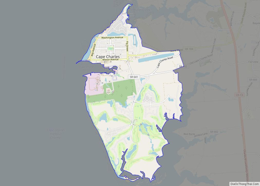
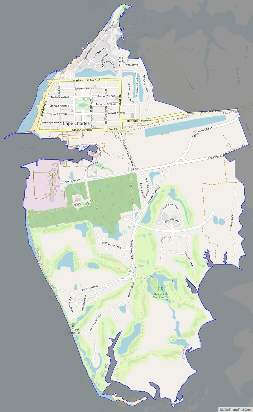
Cape Charles Road Map
Cape Charles city Satellite Map
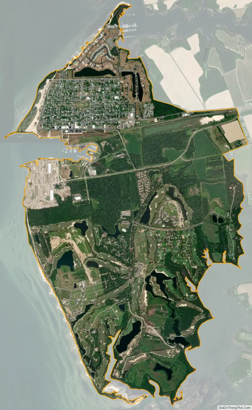
Geography
Cape Charles is located at 37°16′03″N 76°00′51″W / 37.267522°N 76.014125°W / 37.267522; -76.014125 (37.267522, −76.014125).
Cape Charles lies on a peninsula and is surrounded by water on three sides. The town is situated directly on the Chesapeake Bay, bordered by King’s Creek to the north and Old Plantation Creek to the south. The land in town is low lying and relatively flat, with the highest point of elevation at 15 feet, and a slope of less than 1%. Most of the developed land in town is between 5 and 10 feet in elevation.
According to the United States Census Bureau, the town has a total area of 4.4 square miles (11.3 km), of which, 3.7 square miles (9.5 km) of it is land and 0.7 square miles (1.8 km) of it (16.06%) is water.
The Chesapeake Bay impact crater formed about 35 million years ago during the late Eocene when a comet fragment or asteroid struck the U.S. Atlantic continental shelf in the area now occupied by the southern part of Chesapeake Bay and adjacent landmasses in the Virginia Coastal Plain. The resulting structure is an approximately circular, 53-mile-diameter crater centered near the town of Cape Charles.
Climate
Under the Köppen climate classification, Cape Charles features a humid subtropical climate with hot, humid summers and chilly, but not very cold winters. Temperatures routinely exceed 90 °F in the summer and typically dip below the freezing point during the winter, though it is somewhat rare for temperatures to dip far below freezing. Cape Charles on average receives roughly 45 inches of precipitation annually.
See also
Map of Virginia State and its subdivision:- Accomack
- Albemarle
- Alexandria
- Alleghany
- Amelia
- Amherst
- Appomattox
- Arlington
- Augusta
- Bath
- Bedford
- Bedford City
- Bland
- Botetourt
- Bristol
- Brunswick
- Buchanan
- Buckingham
- Buena Vista
- Campbell
- Caroline
- Carroll
- Charles City
- Charlotte
- Charlottesville
- Chesapeake
- Chesterfield
- Clarke
- Clifton Forge City
- Colonial Heights
- Covington
- Craig
- Culpeper
- Cumberland
- Danville
- Dickenson
- Dinwiddie
- Emporia
- Essex
- Fairfax
- Fairfax City
- Falls Church
- Fauquier
- Floyd
- Fluvanna
- Franklin
- Frederick
- Fredericksburg
- Galax
- Giles
- Gloucester
- Goochland
- Grayson
- Greene
- Greensville
- Halifax
- Hampton
- Hanover
- Harrisonburg
- Henrico
- Henry
- Highland
- Hopewell
- Isle of Wight
- James City
- King and Queen
- King George
- King William
- Lancaster
- Lee
- Lexington
- Loudoun
- Louisa
- Lunenburg
- Lynchburg
- Madison
- Manassas
- Manassas Park
- Martinsville
- Mathews
- Mecklenburg
- Middlesex
- Montgomery
- Nelson
- New Kent
- Newport News
- Norfolk
- Northampton
- Northumberland
- Norton
- Nottoway
- Orange
- Page
- Patrick
- Petersburg
- Pittsylvania
- Poquoson
- Portsmouth
- Powhatan
- Prince Edward
- Prince George
- Prince William
- Pulaski
- Radford
- Rappahannock
- Richmond
- Roanoke
- Roanoke City
- Rockbridge
- Rockingham
- Russell
- Salem
- Scott
- Shenandoah
- Smyth
- Southampton
- Spotsylvania
- Stafford
- Staunton
- Suffolk
- Surry
- Sussex
- Tazewell
- Virginia Beach
- Warren
- Washington
- Waynesboro
- Westmoreland
- Williamsburg
- Winchester
- Wise
- Wythe
- York
- Alabama
- Alaska
- Arizona
- Arkansas
- California
- Colorado
- Connecticut
- Delaware
- District of Columbia
- Florida
- Georgia
- Hawaii
- Idaho
- Illinois
- Indiana
- Iowa
- Kansas
- Kentucky
- Louisiana
- Maine
- Maryland
- Massachusetts
- Michigan
- Minnesota
- Mississippi
- Missouri
- Montana
- Nebraska
- Nevada
- New Hampshire
- New Jersey
- New Mexico
- New York
- North Carolina
- North Dakota
- Ohio
- Oklahoma
- Oregon
- Pennsylvania
- Rhode Island
- South Carolina
- South Dakota
- Tennessee
- Texas
- Utah
- Vermont
- Virginia
- Washington
- West Virginia
- Wisconsin
- Wyoming