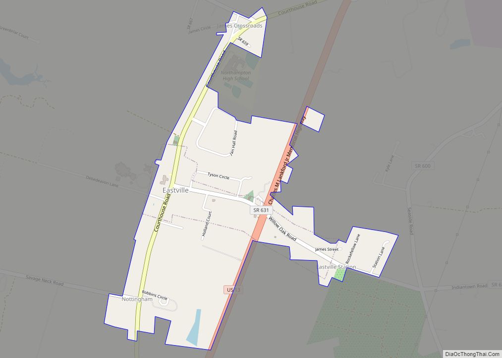
Eastville is a town in Northampton County, Virginia, United States. The population was 203 at the 2000 census. It is the county seat of Northampton County. The Northampton County Courthouse Historic District is part of the Eastville Historic District at the county seat.
| Name: | Eastville town |
|---|---|
| LSAD Code: | 43 |
| LSAD Description: | town (suffix) |
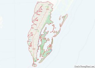
| State: | Virginia |
| County: | Northampton County |
| Elevation: | 30 ft (9 m) |
| Total Area: | 0.79 sq mi (2.06 km²) |
| Land Area: | 0.79 sq mi (2.04 km²) |
| Water Area: | 0.01 sq mi (0.02 km²) |
| Total Population: | 305 |
| Population Density: | 431.30/sq mi (166.42/km²) |
| ZIP code: | 23347 |
| Area code: | 757, 948 (planned) |
| FIPS code: | 5124752 |
| GNISfeature ID: | 1498474 |
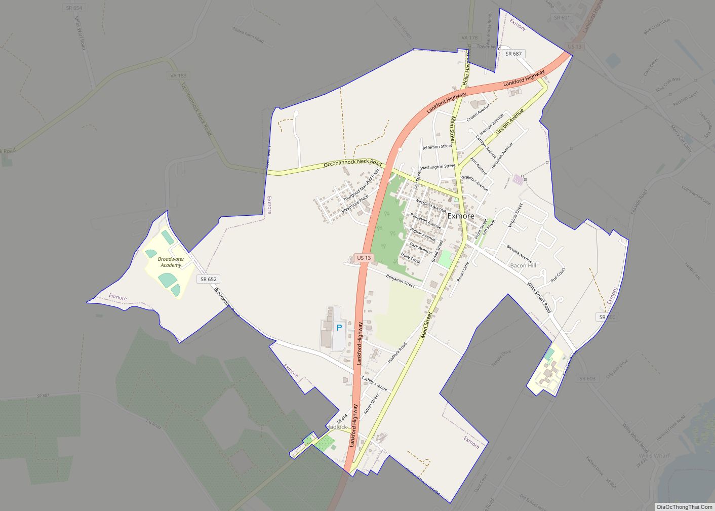
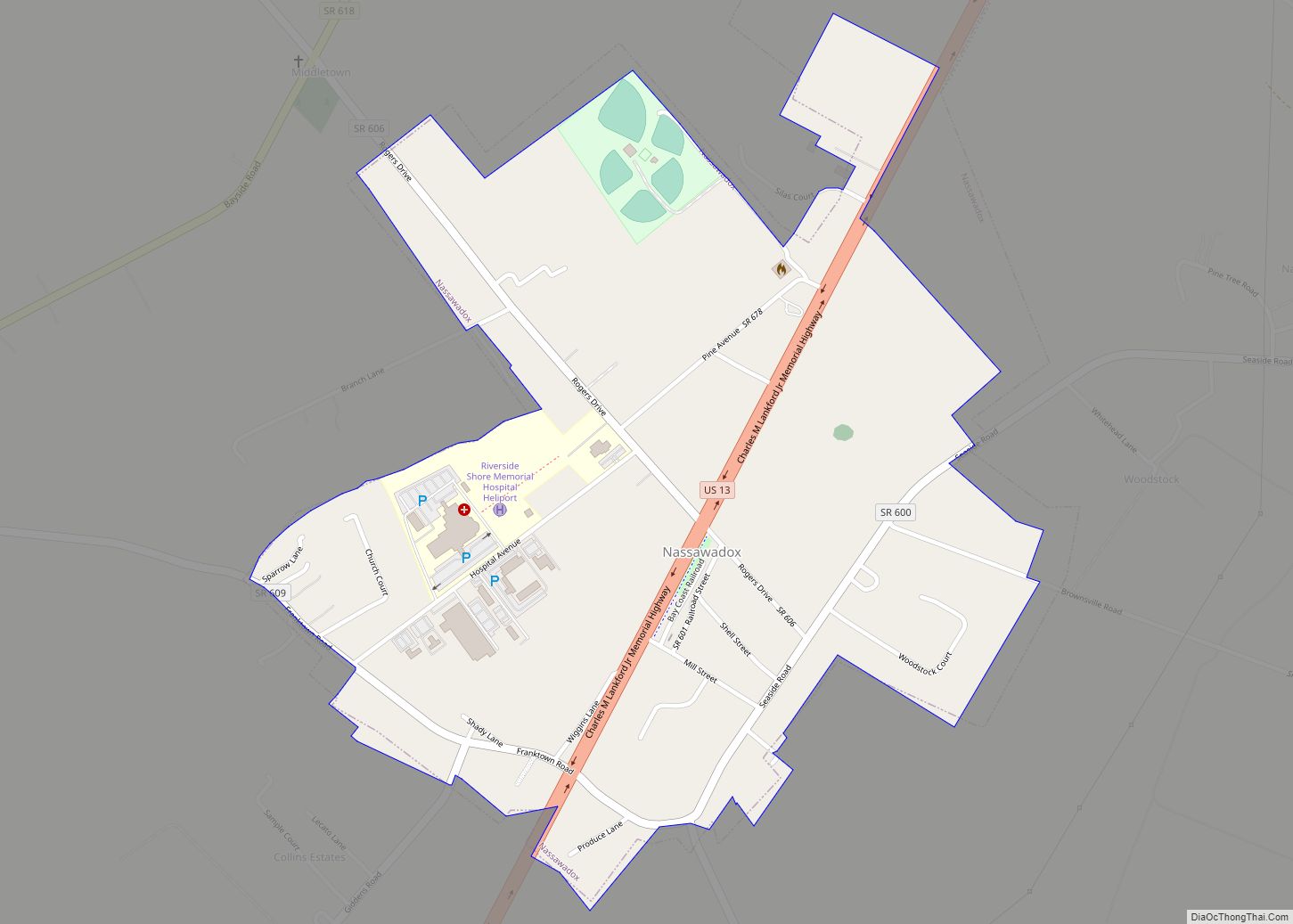
Online Interactive Map
Click on ![]() to view map in "full screen" mode.
to view map in "full screen" mode.
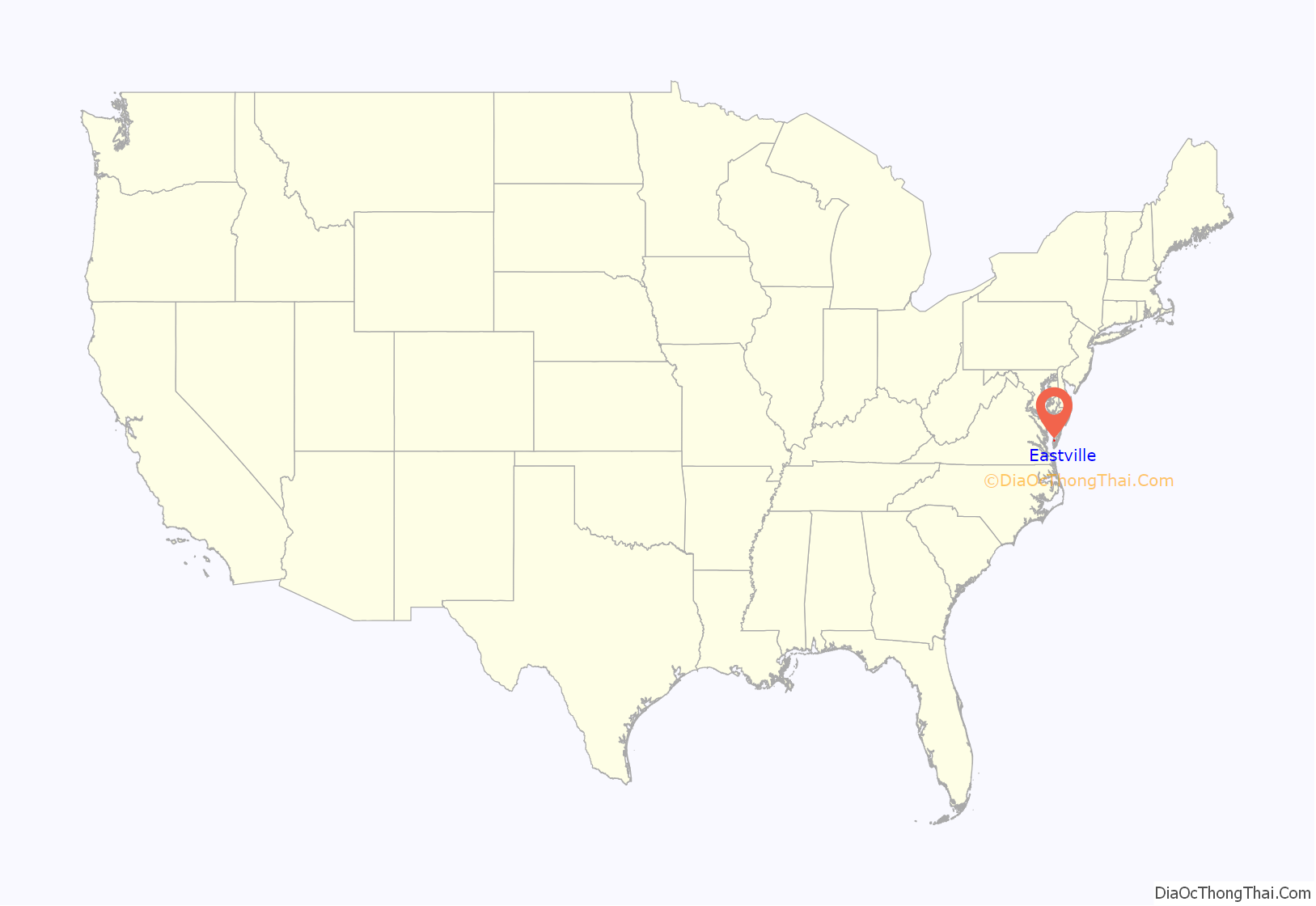
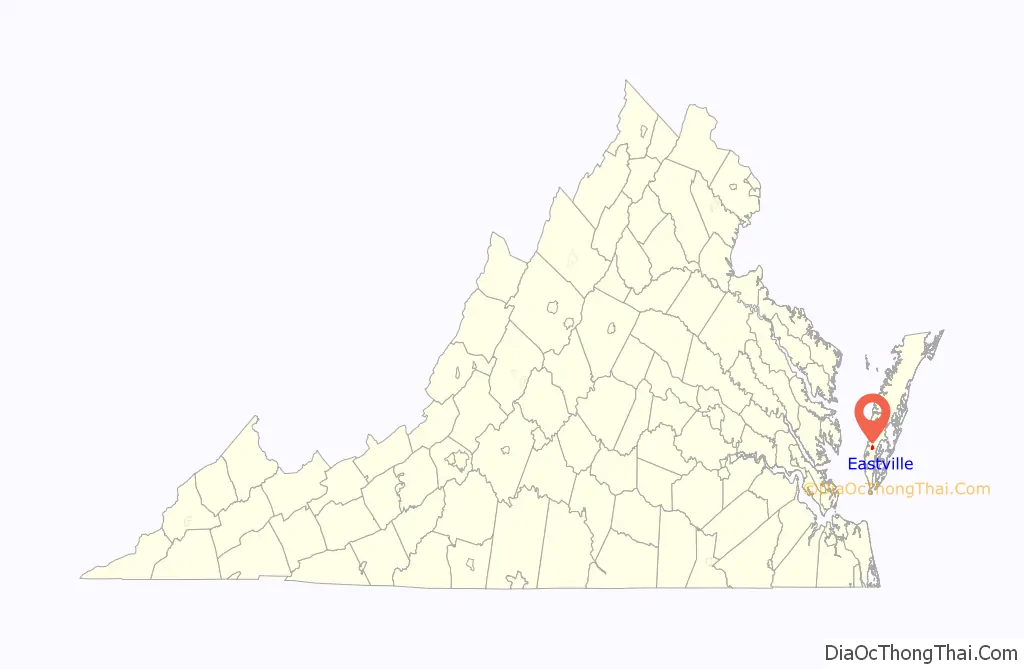
Eastville location map. Where is Eastville town?
History
The present town of Eastville is situated near the sites of the first European settlements established on the Eastern Shore of Virginia. In 1620, Thomas Savage, having been trained as an interpreter and working with the Virginia Company to secure land on the shore from the indigenous cultures there, settled on land that in time came to be known as “Savage Neck,” a few miles southwest of Eastville. By the last quarter of the 17th century, Henry Matthews had settled on the tract of land covering the present town. In 1677, Northampton County residents petitioned for the county court to be moved to a more central location, suggesting Matthew’s home. The first courthouse was completed in 1690 and a small community developed to serve the needs of the court called “The Horns,” named for the several peninsulas of land which extended west into the Chesapeake Bay from the area. Not until almost a century later in 1773 was the town laid out and officially named Northampton Court House. The last decade of the 18th century and the first quarter of the 19th century saw significant growth and development, including the construction of a third courthouse in 1795, the building of a tavern adjacent to the court green, and several large homes which remain a core part of the town’s historic landscape today, including Cessford, Park Hall, and Ingleside, all examples of Georgian and Federal architecture. The town was known as Northampton Court House and Peachburg until the name Eastville was officially given to the community around 1800.
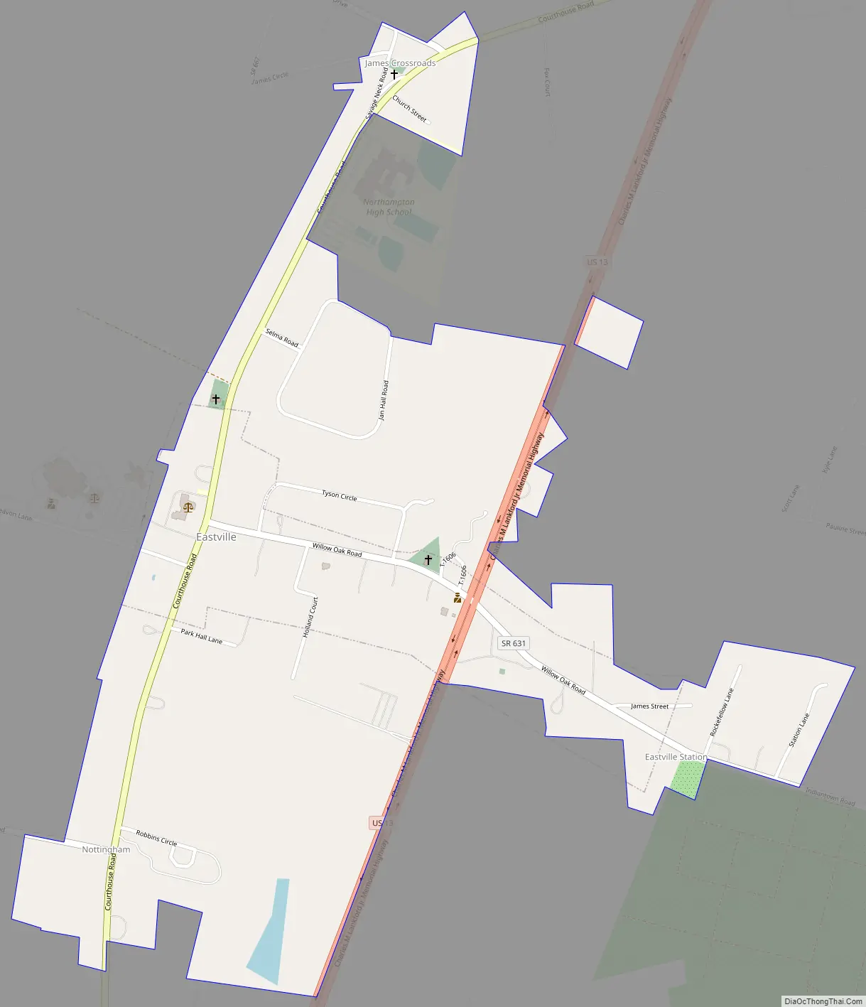
Eastville Road Map
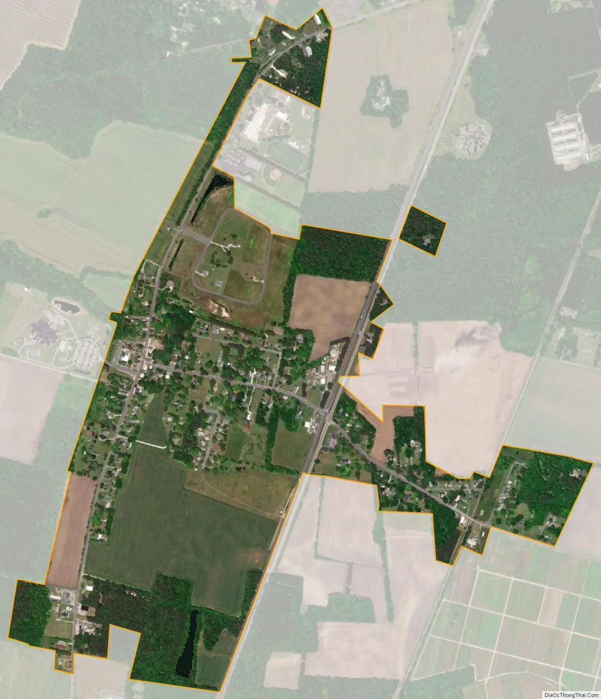
Eastville city Satellite Map
Geography
Eastville is located at 37°21′3″N 75°56′24″W / 37.35083°N 75.94000°W / 37.35083; -75.94000 (37.350961, −75.940056).
According to the United States Census Bureau, the town has a total area of 0.2 square miles (0.6 km), all of it land.
See also
Map of Virginia State and its subdivision:- Accomack
- Albemarle
- Alexandria
- Alleghany
- Amelia
- Amherst
- Appomattox
- Arlington
- Augusta
- Bath
- Bedford
- Bedford City
- Bland
- Botetourt
- Bristol
- Brunswick
- Buchanan
- Buckingham
- Buena Vista
- Campbell
- Caroline
- Carroll
- Charles City
- Charlotte
- Charlottesville
- Chesapeake
- Chesterfield
- Clarke
- Clifton Forge City
- Colonial Heights
- Covington
- Craig
- Culpeper
- Cumberland
- Danville
- Dickenson
- Dinwiddie
- Emporia
- Essex
- Fairfax
- Fairfax City
- Falls Church
- Fauquier
- Floyd
- Fluvanna
- Franklin
- Frederick
- Fredericksburg
- Galax
- Giles
- Gloucester
- Goochland
- Grayson
- Greene
- Greensville
- Halifax
- Hampton
- Hanover
- Harrisonburg
- Henrico
- Henry
- Highland
- Hopewell
- Isle of Wight
- James City
- King and Queen
- King George
- King William
- Lancaster
- Lee
- Lexington
- Loudoun
- Louisa
- Lunenburg
- Lynchburg
- Madison
- Manassas
- Manassas Park
- Martinsville
- Mathews
- Mecklenburg
- Middlesex
- Montgomery
- Nelson
- New Kent
- Newport News
- Norfolk
- Northampton
- Northumberland
- Norton
- Nottoway
- Orange
- Page
- Patrick
- Petersburg
- Pittsylvania
- Poquoson
- Portsmouth
- Powhatan
- Prince Edward
- Prince George
- Prince William
- Pulaski
- Radford
- Rappahannock
- Richmond
- Roanoke
- Roanoke City
- Rockbridge
- Rockingham
- Russell
- Salem
- Scott
- Shenandoah
- Smyth
- Southampton
- Spotsylvania
- Stafford
- Staunton
- Suffolk
- Surry
- Sussex
- Tazewell
- Virginia Beach
- Warren
- Washington
- Waynesboro
- Westmoreland
- Williamsburg
- Winchester
- Wise
- Wythe
- York
- Alabama
- Alaska
- Arizona
- Arkansas
- California
- Colorado
- Connecticut
- Delaware
- District of Columbia
- Florida
- Georgia
- Hawaii
- Idaho
- Illinois
- Indiana
- Iowa
- Kansas
- Kentucky
- Louisiana
- Maine
- Maryland
- Massachusetts
- Michigan
- Minnesota
- Mississippi
- Missouri
- Montana
- Nebraska
- Nevada
- New Hampshire
- New Jersey
- New Mexico
- New York
- North Carolina
- North Dakota
- Ohio
- Oklahoma
- Oregon
- Pennsylvania
- Rhode Island
- South Carolina
- South Dakota
- Tennessee
- Texas
- Utah
- Vermont
- Virginia
- Washington
- West Virginia
- Wisconsin
- Wyoming