Exmore is the largest town in Northampton County on the Eastern Shore of the U.S. state of Virginia. The population was 1,460 at the 2010 census. A popular story is that Exmore received its name because it is the tenth railroad station south of the Delaware state line, so there were “X more” stations to go. The same website also states another theory behind the town’s name—that it was named for Exmoor, Devon, in south west England. This theory is more plausible because many towns and counties in Virginia were named for places in England. Northampton County itself was named for Northamptonshire.
| Name: | Exmore town |
|---|---|
| LSAD Code: | 43 |
| LSAD Description: | town (suffix) |
| State: | Virginia |
| County: | Northampton County |
| Elevation: | 33 ft (10 m) |
| Total Area: | 2.60 sq mi (6.74 km²) |
| Land Area: | 2.60 sq mi (6.74 km²) |
| Water Area: | 0.00 sq mi (0.00 km²) |
| Total Population: | 1,460 |
| Population Density: | 527.49/sq mi (203.64/km²) |
| ZIP code: | 23350 |
| Area code: | 757, 948 (auto) |
| FIPS code: | 5126416 |
| GNISfeature ID: | 1466377 |
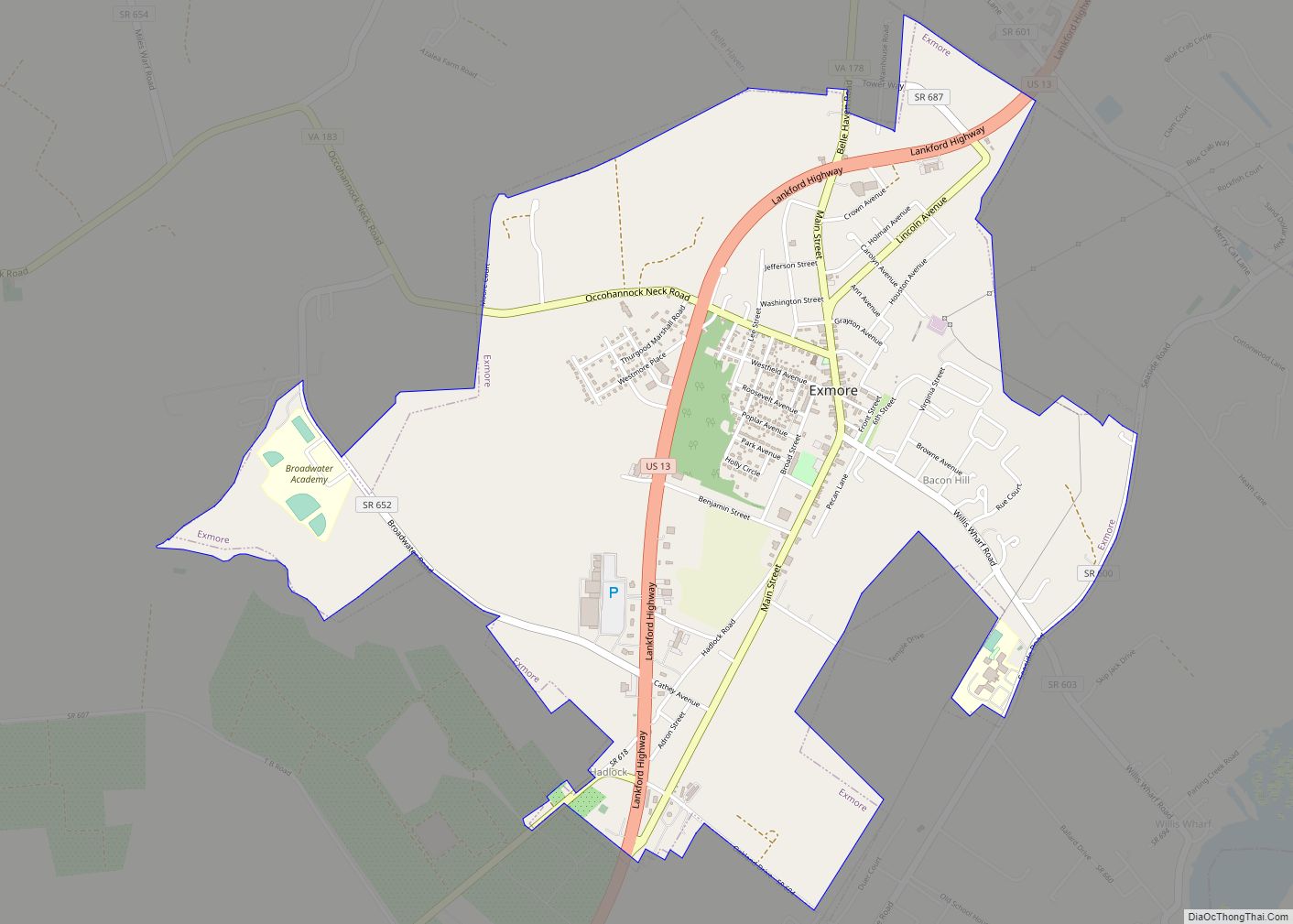
Online Interactive Map
Click on ![]() to view map in "full screen" mode.
to view map in "full screen" mode.
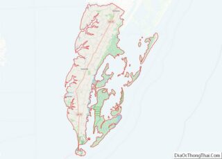
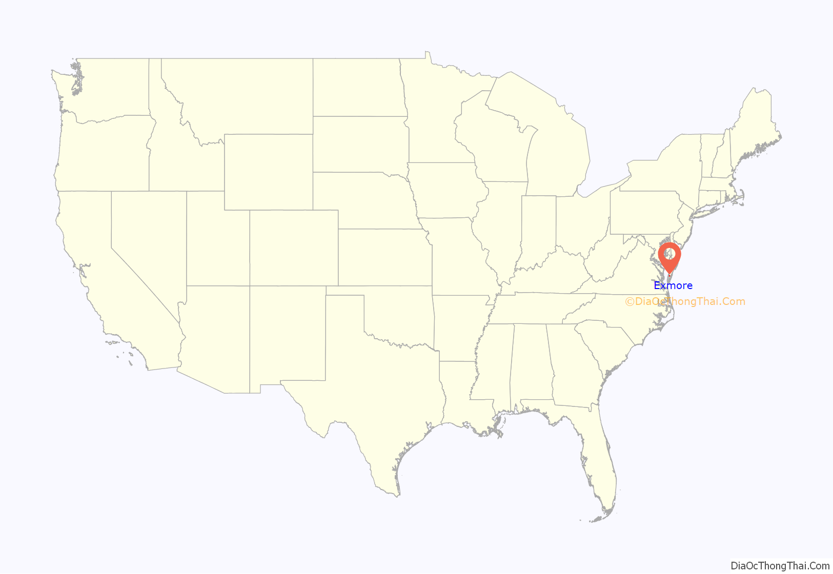
Exmore location map. Where is Exmore town?
History
Benjamin’s Department Store and the John W. Chandler House are listed on the National Register of Historic Places.
The Virginia Barrier Island Center (BIC) offers exhaustive information on the local culture and history. Founded in 1996 and opened to visitors in 2002 on the former site of the Almshouse Farm in Machipongo 10 miles south of the town of Exmore and 20 miles north of the Chesapeake Bay Bridge-Tunnel, the BIC is a cultural center, a museum and a meeting and event place. Its mission is to preserve and perpetuate the culture and history of Virginia’s barrier islands through education and the collection and interpretation of artifacts. The museum holds more than 7,500 artefacts and showcases a permanent exhibition.
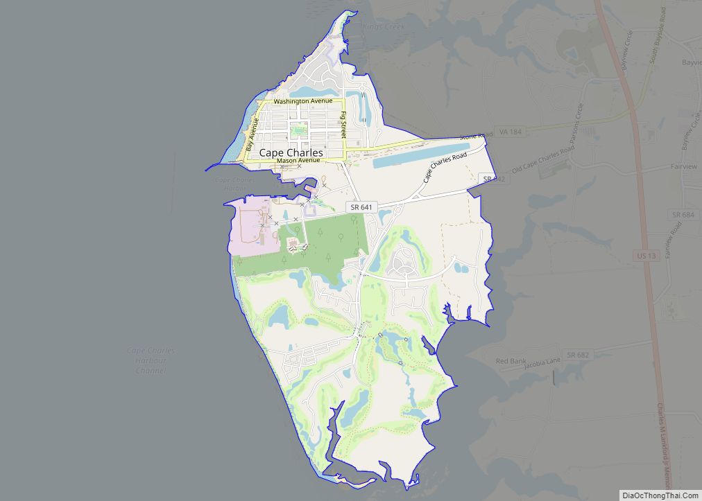
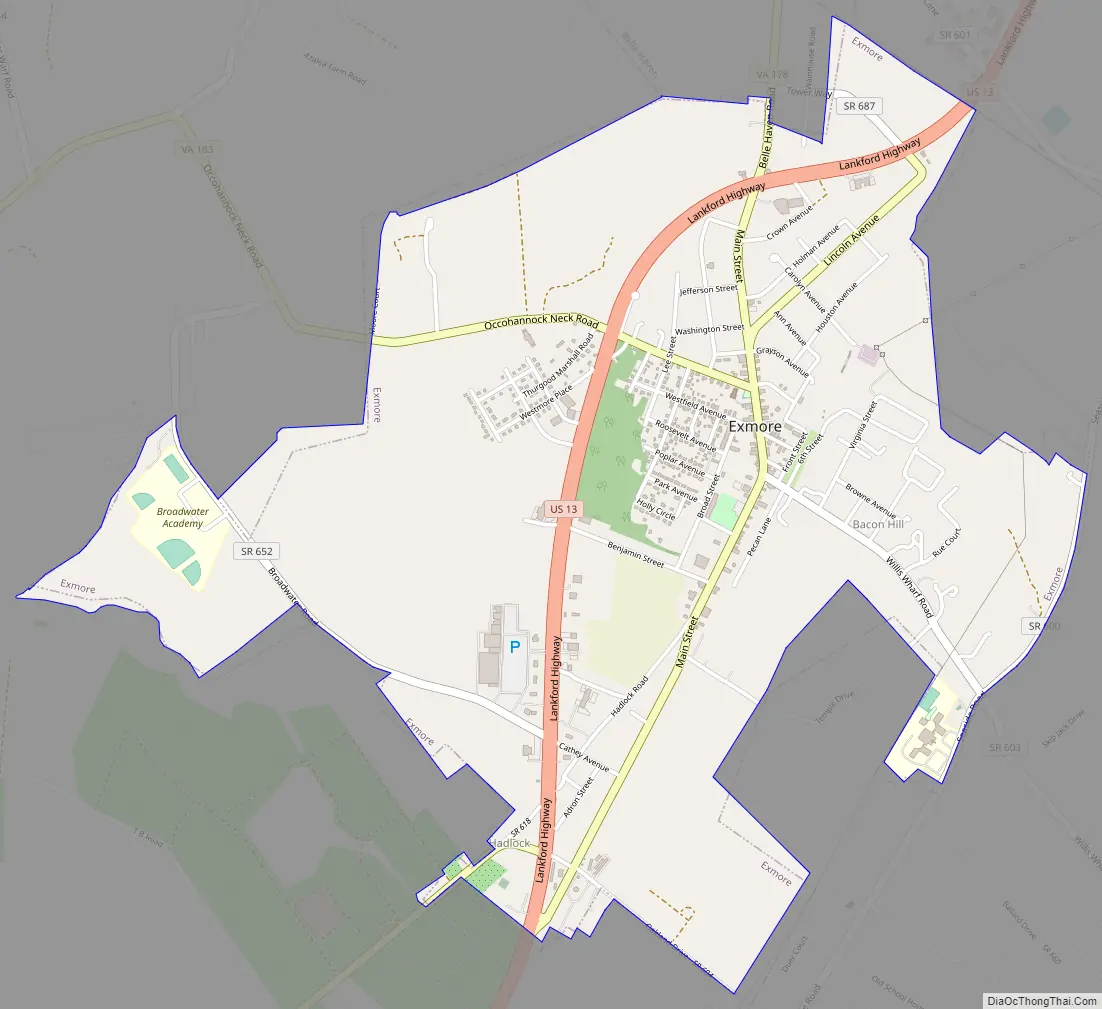
Exmore Road Map
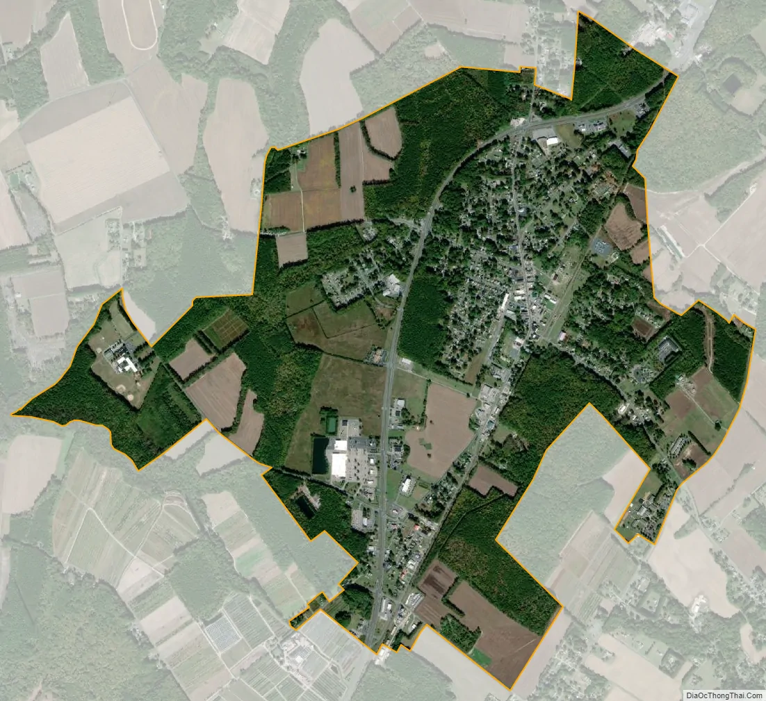
Exmore city Satellite Map
Geography
According to the United States Census Bureau, the town has a total area of 0.8 square miles (2.1 km), all of it land.
See also
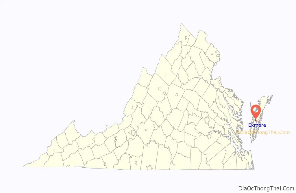
Map of Virginia State and its subdivision:- Accomack
- Albemarle
- Alexandria
- Alleghany
- Amelia
- Amherst
- Appomattox
- Arlington
- Augusta
- Bath
- Bedford
- Bedford City
- Bland
- Botetourt
- Bristol
- Brunswick
- Buchanan
- Buckingham
- Buena Vista
- Campbell
- Caroline
- Carroll
- Charles City
- Charlotte
- Charlottesville
- Chesapeake
- Chesterfield
- Clarke
- Clifton Forge City
- Colonial Heights
- Covington
- Craig
- Culpeper
- Cumberland
- Danville
- Dickenson
- Dinwiddie
- Emporia
- Essex
- Fairfax
- Fairfax City
- Falls Church
- Fauquier
- Floyd
- Fluvanna
- Franklin
- Frederick
- Fredericksburg
- Galax
- Giles
- Gloucester
- Goochland
- Grayson
- Greene
- Greensville
- Halifax
- Hampton
- Hanover
- Harrisonburg
- Henrico
- Henry
- Highland
- Hopewell
- Isle of Wight
- James City
- King and Queen
- King George
- King William
- Lancaster
- Lee
- Lexington
- Loudoun
- Louisa
- Lunenburg
- Lynchburg
- Madison
- Manassas
- Manassas Park
- Martinsville
- Mathews
- Mecklenburg
- Middlesex
- Montgomery
- Nelson
- New Kent
- Newport News
- Norfolk
- Northampton
- Northumberland
- Norton
- Nottoway
- Orange
- Page
- Patrick
- Petersburg
- Pittsylvania
- Poquoson
- Portsmouth
- Powhatan
- Prince Edward
- Prince George
- Prince William
- Pulaski
- Radford
- Rappahannock
- Richmond
- Roanoke
- Roanoke City
- Rockbridge
- Rockingham
- Russell
- Salem
- Scott
- Shenandoah
- Smyth
- Southampton
- Spotsylvania
- Stafford
- Staunton
- Suffolk
- Surry
- Sussex
- Tazewell
- Virginia Beach
- Warren
- Washington
- Waynesboro
- Westmoreland
- Williamsburg
- Winchester
- Wise
- Wythe
- York
- Alabama
- Alaska
- Arizona
- Arkansas
- California
- Colorado
- Connecticut
- Delaware
- District of Columbia
- Florida
- Georgia
- Hawaii
- Idaho
- Illinois
- Indiana
- Iowa
- Kansas
- Kentucky
- Louisiana
- Maine
- Maryland
- Massachusetts
- Michigan
- Minnesota
- Mississippi
- Missouri
- Montana
- Nebraska
- Nevada
- New Hampshire
- New Jersey
- New Mexico
- New York
- North Carolina
- North Dakota
- Ohio
- Oklahoma
- Oregon
- Pennsylvania
- Rhode Island
- South Carolina
- South Dakota
- Tennessee
- Texas
- Utah
- Vermont
- Virginia
- Washington
- West Virginia
- Wisconsin
- Wyoming