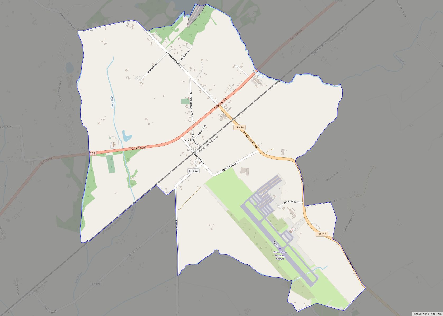
Catlett is a census-designated place (CDP) in Fauquier County, Virginia, United States. The population as of the 2010 census was 297. It is located west of the Prince William County line. Catlett was formerly a rail stop on the Orange and Alexandria Railroad, and the area was the site of many raids on the railroad during the American Civil War.
The Catlett Historic District was listed on the National Register of Historic Places in 2008, and Auburn Battlefield in 2011.
| Name: | Catlett CDP |
|---|---|
| LSAD Code: | 57 |
| LSAD Description: | CDP (suffix) |
| State: | Virginia |
| County: | Fauquier County |
| Elevation: | 270 ft (80 m) |
| Total Area: | 3.24 sq mi (8.40 km²) |
| Land Area: | 3.22 sq mi (8.33 km²) |
| Water Area: | 0.03 sq mi (0.07 km²) |
| Total Population: | 297 |
| Population Density: | 92/sq mi (35.5/km²) |
| ZIP code: | 20119 |
| FIPS code: | 5113624 |
| GNISfeature ID: | 1492729 |
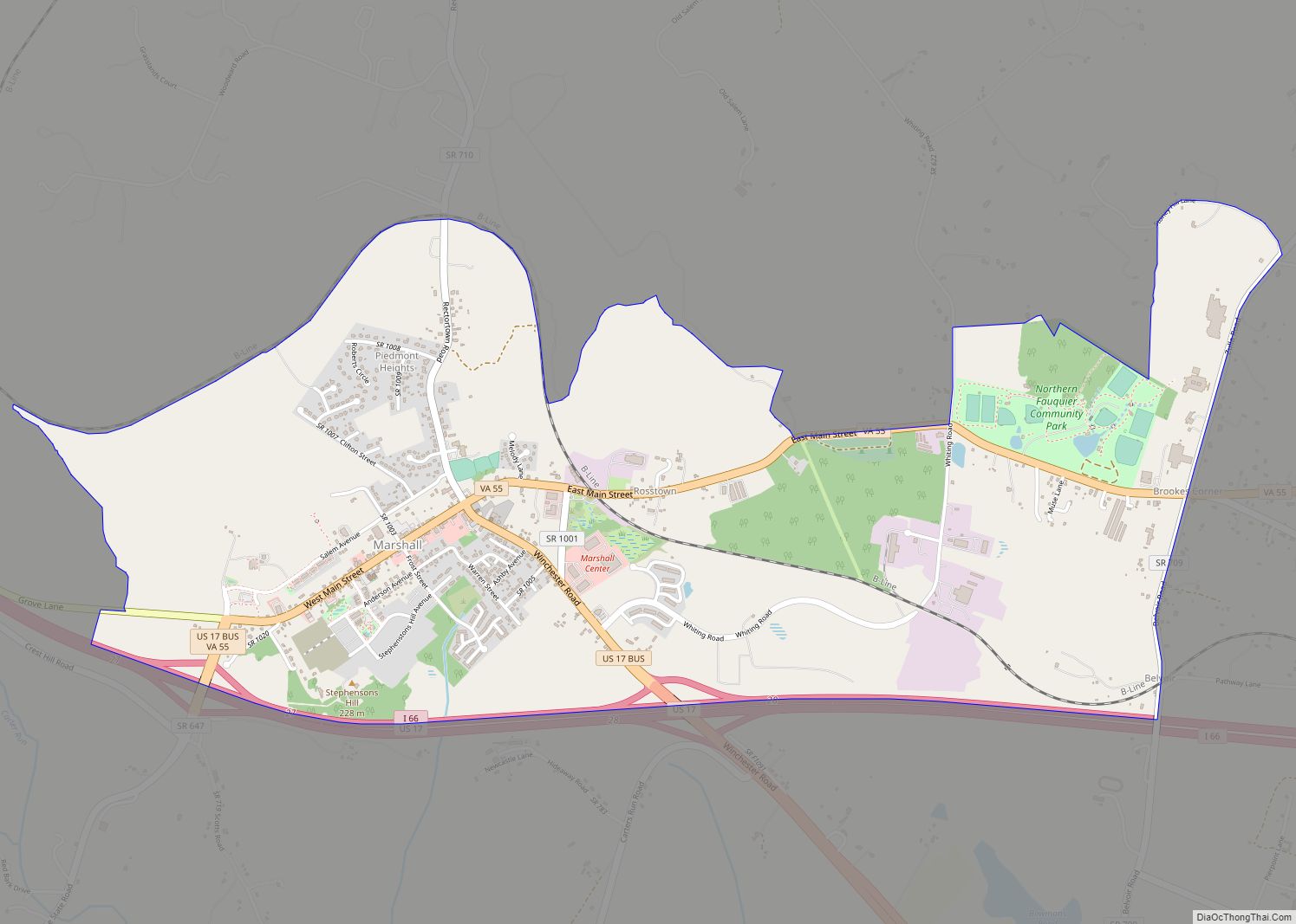
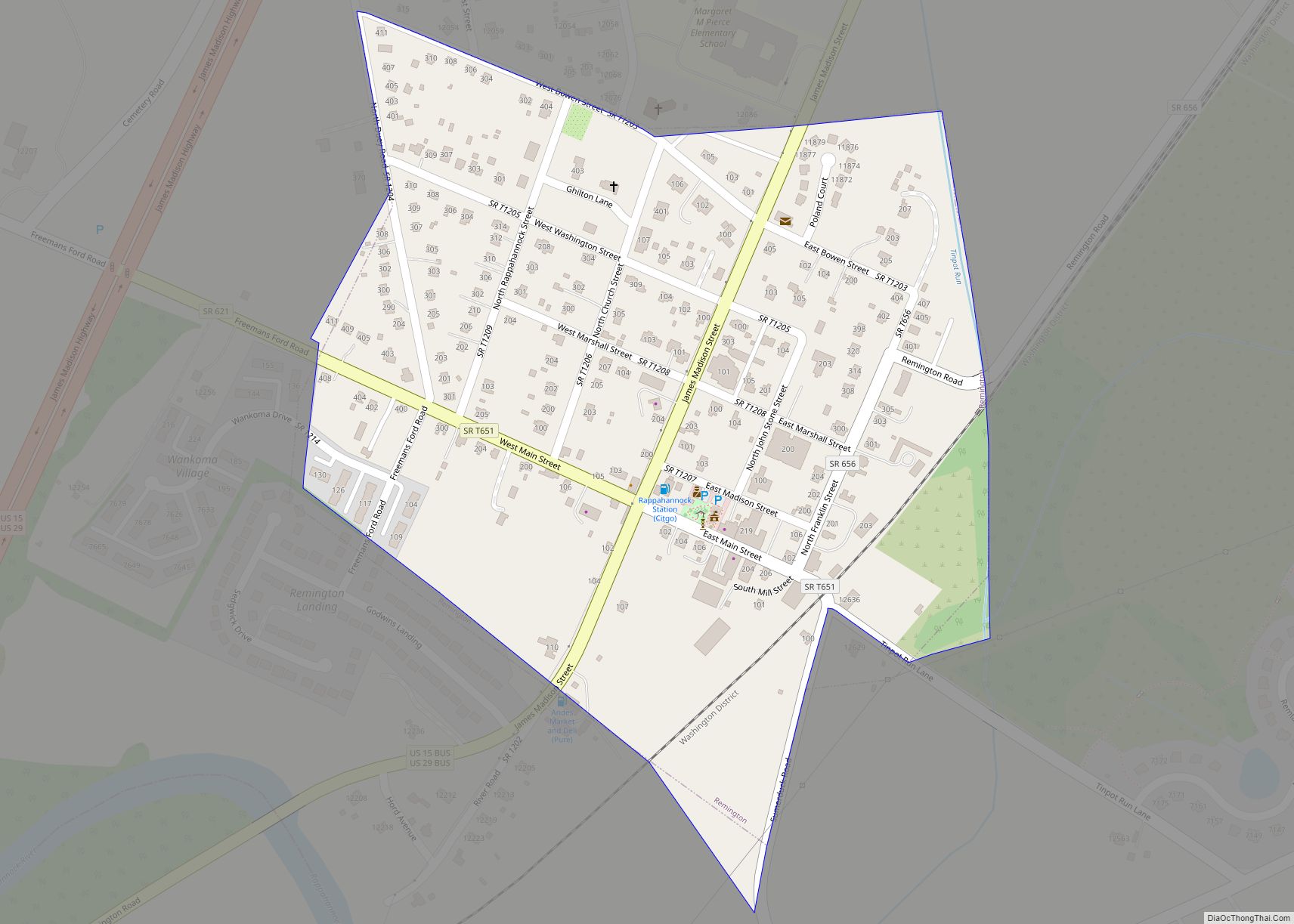
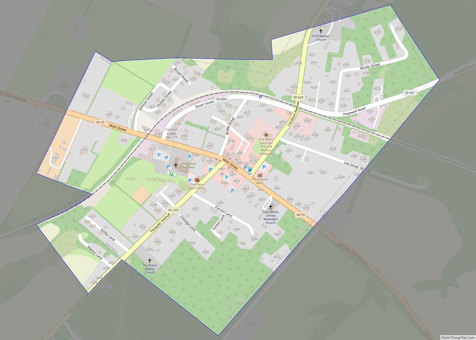
Online Interactive Map
Click on ![]() to view map in "full screen" mode.
to view map in "full screen" mode.
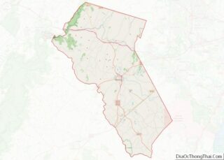
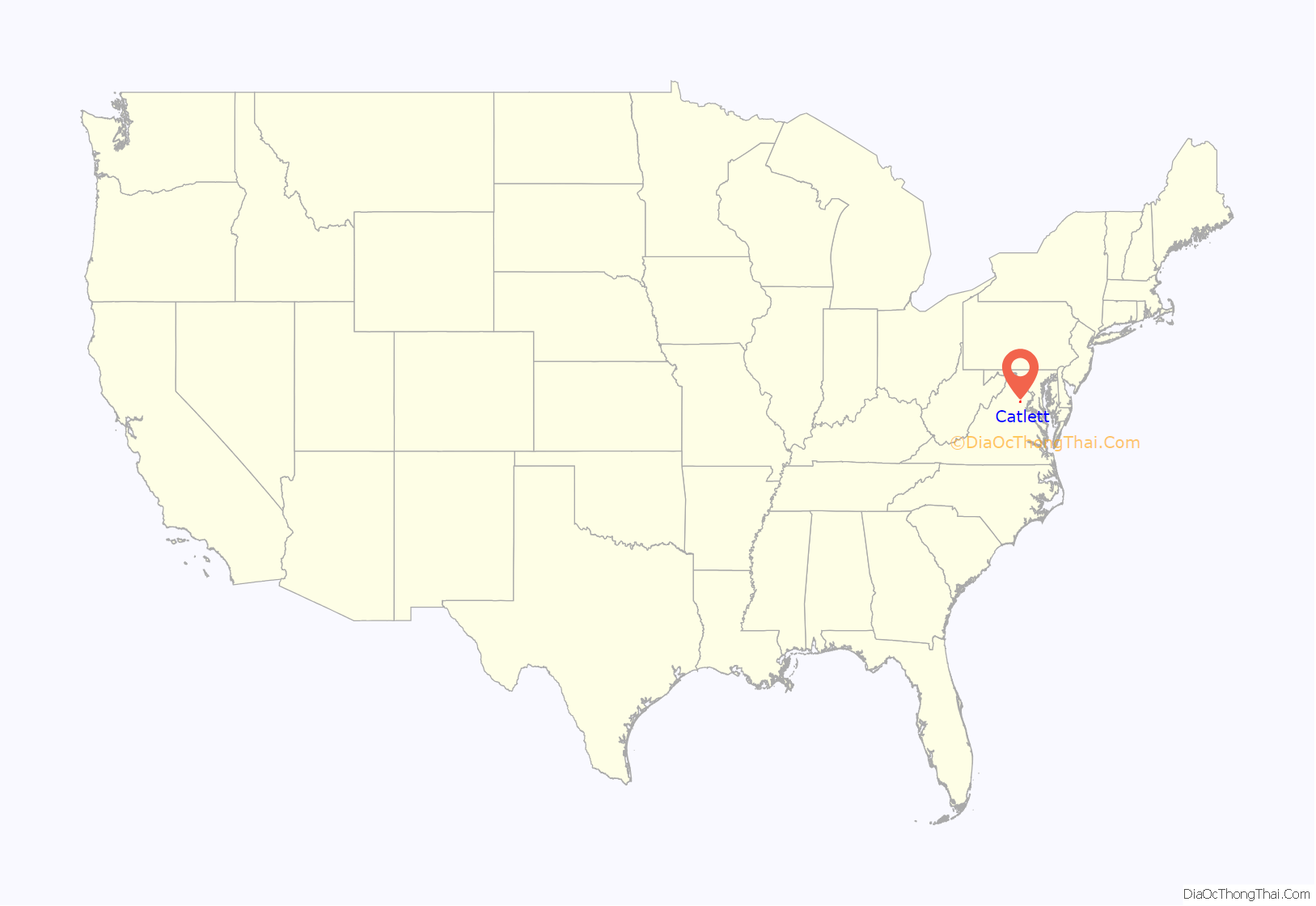
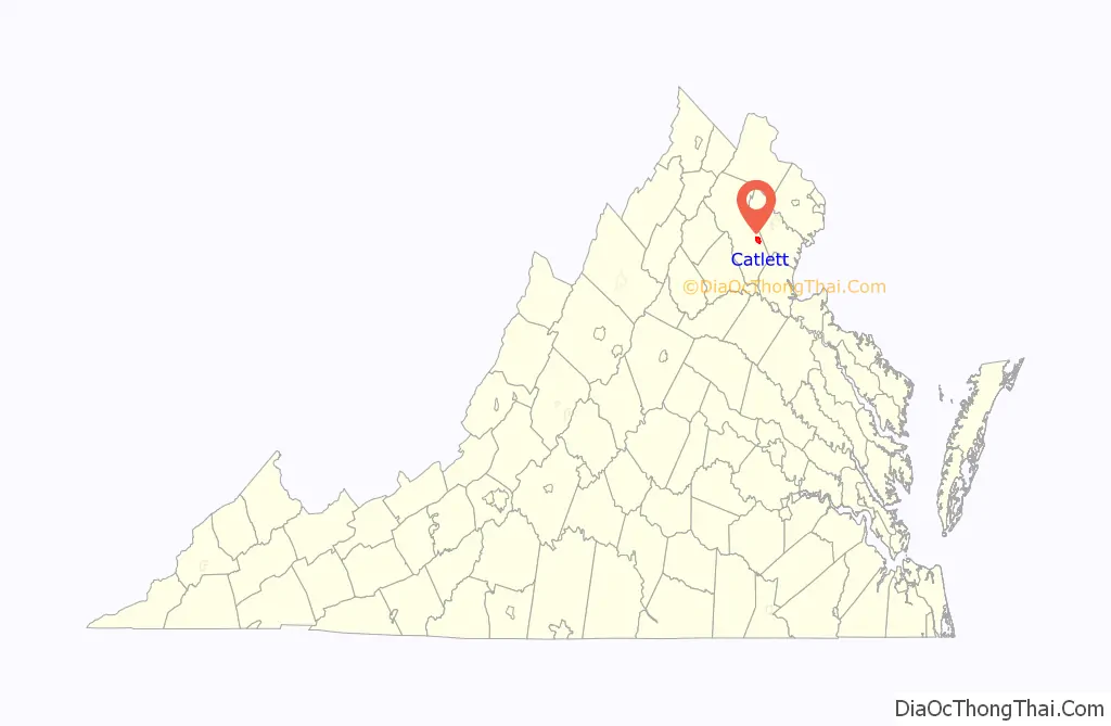
Catlett location map. Where is Catlett CDP?
History
Thanks to the creation of a railroad system that was essential to travel and supply in Virginia, many small towns including Catlett sprung up as stops. During its heyday, Catlett was a busy telegraph outpost and mail stop along the Orange and Alexandria Railroad. The land that the town was built on had originally been granted to John Catlett in 1715, but was not named for him at first. The post office and town were first known as Colvin’s Station after the Colvin family, but over the years this was changed to Catlett Station and then to simply Catlett.
Catlett was the site of a pivotal skirmish in the Civil War between Major General J. E. B. Stuart of the Confederacy and the Union’s Major General John Pope. The Confederates raided the Union camp at Catlett on August 22, 1862, in an effort to disrupt the Union’s rail supply lines. Stuart and his men began their attack during what Stuart referred to as the “darkest night I ever knew”. He and his men rode into town and using sabers and fire were able to destroy the Federal encampment, cut telegraph wires, obtain wagons-full of supplies and capture almost 300 Union troops, but were unable to destroy the railroad bridge on the outskirts of the town. A heavy thunderstorm prevented them from burning it, so they attempted to use axes, but were turned away by Union riflemen. The most important prize that the Confederates gained were General Pope’s orders, which contained critical information about the Union campaign. These orders were taken by Stuart to General Robert E. Lee and played a pivotal role in securing the South’s victory in the Battle of Second Manassas.
Later in the war, Colonel John S. Mosby conducted a raid with his cavalry unit in an attempt to disable an engine on the same rail line that Stuart had attacked in August 1862. This skirmish on May 20, 1863, went in favor of the superior numbers of the Union troops. Mosby’s unit retreated after disabling the engine with a Howitzer cannon that they had captured the previous day. The Confederate troops took 5 fatalities, 20 injuries, and 10 men captured by the Federals.
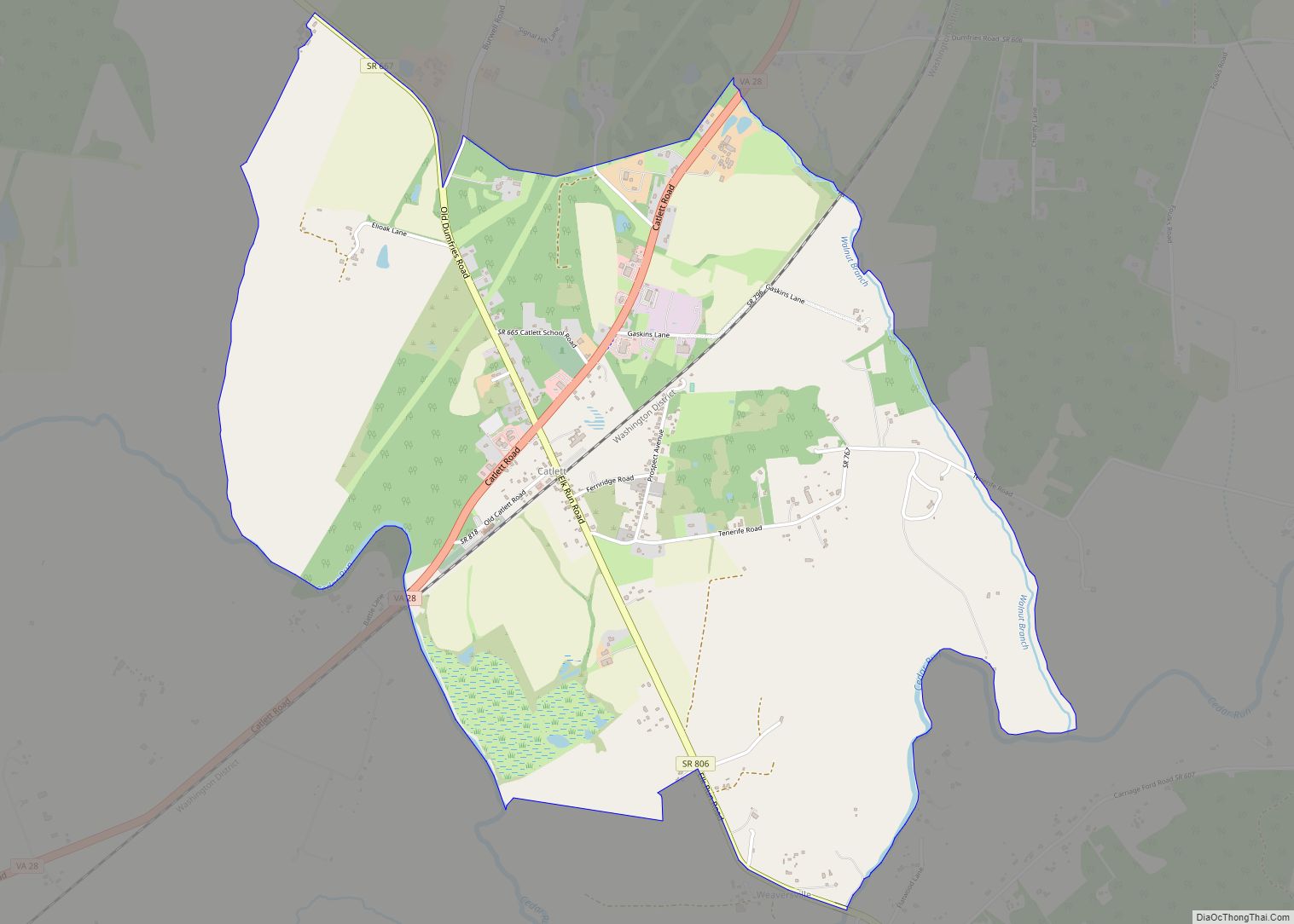
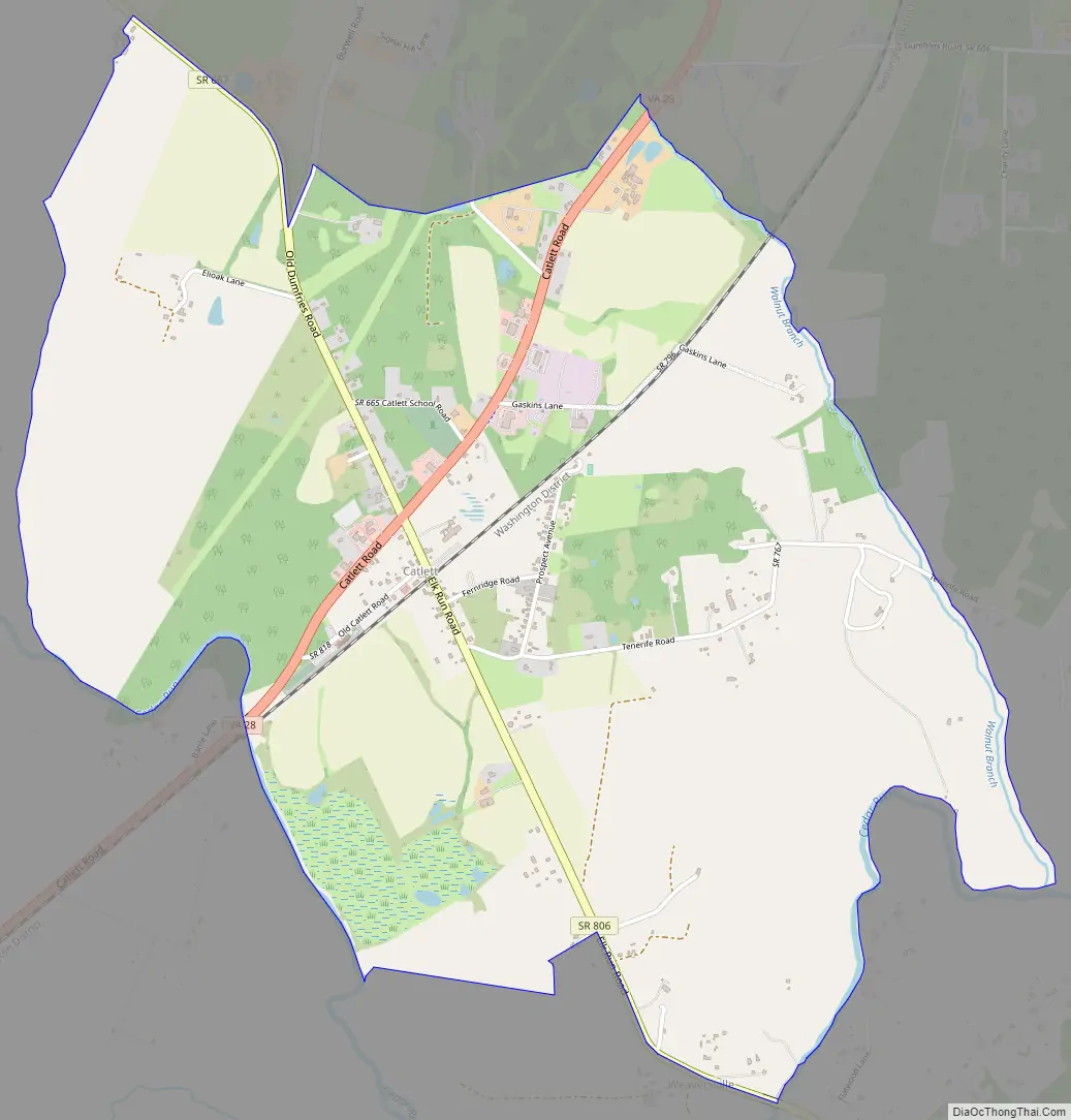
Catlett Road Map
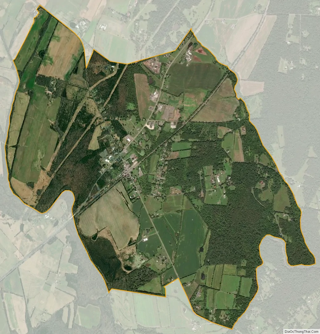
Catlett city Satellite Map
Geography
Catlett is located in southeastern Fauquier County, bordered to the southwest by Calverton. Virginia State Route 28 passes through the community, leading southwest through Calverton to Midland and Bealeton; to the northeast it leads through Nokesville in Prince William County to the city of Manassas. Warrenton, the Fauquier County seat, is 12 miles (19 km) to the northwest via local roads.
According to the U.S. Census Bureau, the Catlett CDP has a total area of 3.2 square miles (8.4 km), of which 0.03 square miles (0.07 km), or 0.84%, is water. The western and southern edge of Catlett is formed by Cedar Run, a tributary of the Occoquan River, which flows southeast to the Potomac.
See also
Map of Virginia State and its subdivision:- Accomack
- Albemarle
- Alexandria
- Alleghany
- Amelia
- Amherst
- Appomattox
- Arlington
- Augusta
- Bath
- Bedford
- Bedford City
- Bland
- Botetourt
- Bristol
- Brunswick
- Buchanan
- Buckingham
- Buena Vista
- Campbell
- Caroline
- Carroll
- Charles City
- Charlotte
- Charlottesville
- Chesapeake
- Chesterfield
- Clarke
- Clifton Forge City
- Colonial Heights
- Covington
- Craig
- Culpeper
- Cumberland
- Danville
- Dickenson
- Dinwiddie
- Emporia
- Essex
- Fairfax
- Fairfax City
- Falls Church
- Fauquier
- Floyd
- Fluvanna
- Franklin
- Frederick
- Fredericksburg
- Galax
- Giles
- Gloucester
- Goochland
- Grayson
- Greene
- Greensville
- Halifax
- Hampton
- Hanover
- Harrisonburg
- Henrico
- Henry
- Highland
- Hopewell
- Isle of Wight
- James City
- King and Queen
- King George
- King William
- Lancaster
- Lee
- Lexington
- Loudoun
- Louisa
- Lunenburg
- Lynchburg
- Madison
- Manassas
- Manassas Park
- Martinsville
- Mathews
- Mecklenburg
- Middlesex
- Montgomery
- Nelson
- New Kent
- Newport News
- Norfolk
- Northampton
- Northumberland
- Norton
- Nottoway
- Orange
- Page
- Patrick
- Petersburg
- Pittsylvania
- Poquoson
- Portsmouth
- Powhatan
- Prince Edward
- Prince George
- Prince William
- Pulaski
- Radford
- Rappahannock
- Richmond
- Roanoke
- Roanoke City
- Rockbridge
- Rockingham
- Russell
- Salem
- Scott
- Shenandoah
- Smyth
- Southampton
- Spotsylvania
- Stafford
- Staunton
- Suffolk
- Surry
- Sussex
- Tazewell
- Virginia Beach
- Warren
- Washington
- Waynesboro
- Westmoreland
- Williamsburg
- Winchester
- Wise
- Wythe
- York
- Alabama
- Alaska
- Arizona
- Arkansas
- California
- Colorado
- Connecticut
- Delaware
- District of Columbia
- Florida
- Georgia
- Hawaii
- Idaho
- Illinois
- Indiana
- Iowa
- Kansas
- Kentucky
- Louisiana
- Maine
- Maryland
- Massachusetts
- Michigan
- Minnesota
- Mississippi
- Missouri
- Montana
- Nebraska
- Nevada
- New Hampshire
- New Jersey
- New Mexico
- New York
- North Carolina
- North Dakota
- Ohio
- Oklahoma
- Oregon
- Pennsylvania
- Rhode Island
- South Carolina
- South Dakota
- Tennessee
- Texas
- Utah
- Vermont
- Virginia
- Washington
- West Virginia
- Wisconsin
- Wyoming