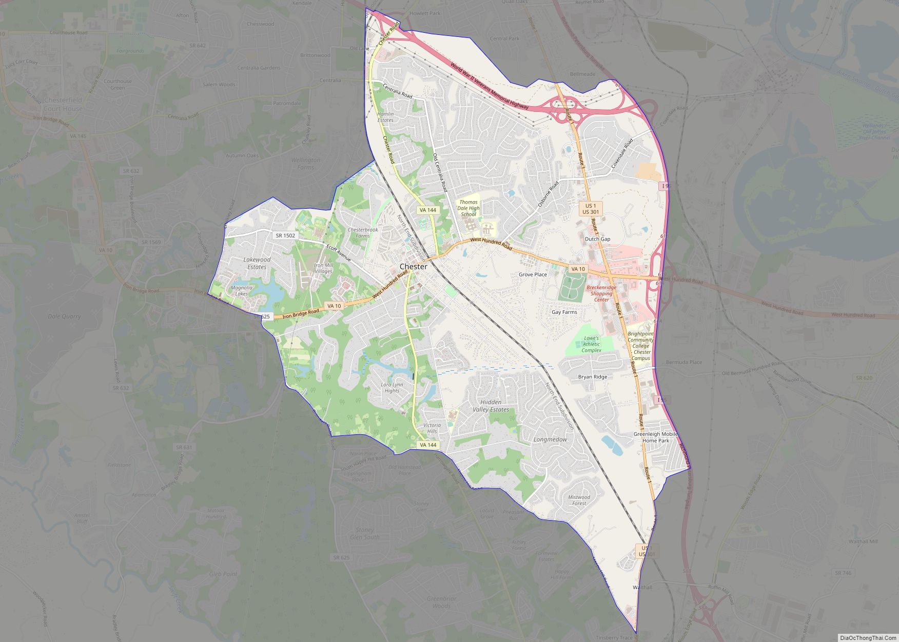
Chester is a census-designated place (CDP) in Chesterfield County, Virginia, United States. Per the 2020 census, the population was 23,414.
| Name: | Chester CDP |
|---|---|
| LSAD Code: | 57 |
| LSAD Description: | CDP (suffix) |
| State: | Virginia |
| County: | Chesterfield County |
| Elevation: | 174 ft (53 m) |
| Total Area: | 13.3 sq mi (34.4 km²) |
| Land Area: | 13.2 sq mi (34.1 km²) |
| Water Area: | 0.1 sq mi (0.3 km²) |
| Total Population: | 23,414 |
| Population Density: | 1,800/sq mi (680/km²) |
| ZIP code: | 23831, 23836 |
| Area code: | 804 |
| FIPS code: | 5116096 |
| GNISfeature ID: | 1492754 |
Online Interactive Map
Click on ![]() to view map in "full screen" mode.
to view map in "full screen" mode.
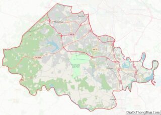
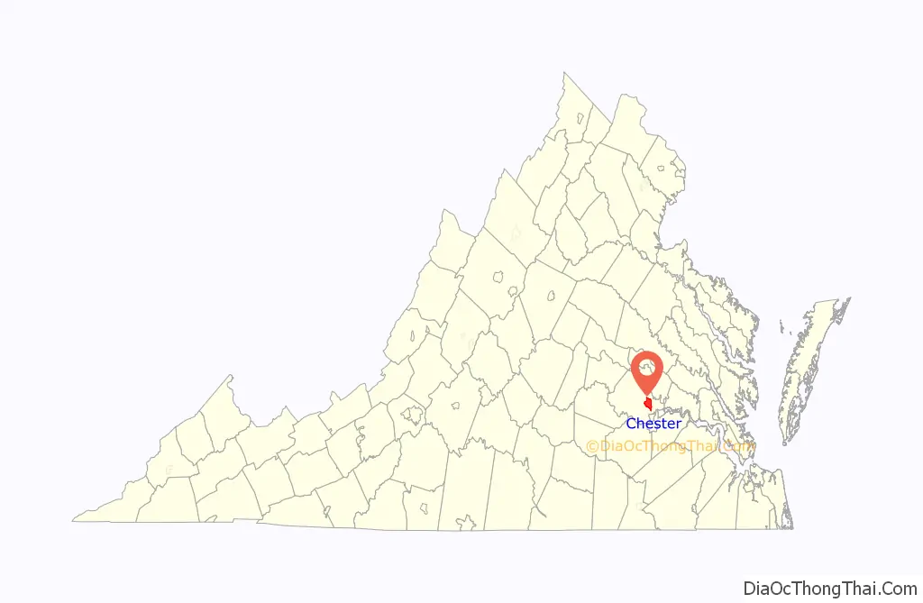
Chester location map. Where is Chester CDP?

History
Chester’s original “downtown” was a stop which was an intersection of the Richmond and Petersburg Railroad, running north to south, and the Clover Hill Railroad, which became the Brighthope Railway, then the Farmville and Powhatan Railroad. In 1900, when the Richmond and Petersburg merged with the Atlantic Coast Line, that new railroad intersected the same east west railroad which became the Tidewater and Western Railroad in 1905.
The Seaboard Air Line also passed through in 1900 running north to south which to day is replaced with Chester Linear Park. Chester today is a bedroom community along State Route 10. Recent commercial development in Chester has emerged at the sprawling intersection of SR 10 and U.S. Route 1 (Jefferson Davis Highway) near the on-ramp to Interstate 95.
In April, 1781, during the American Revolution, the Osborne’s Landing area of Chester was the site of the Action at Osborne’s in which General Benedict Arnold destroyed much of Virginia’s navy.
In May, 1864, the Chester Station was the scene of the Battle of Chester Station during the Bermuda Hundred Campaign of the American Civil War. The area was damaged by Hurricane Isabel in 2003.
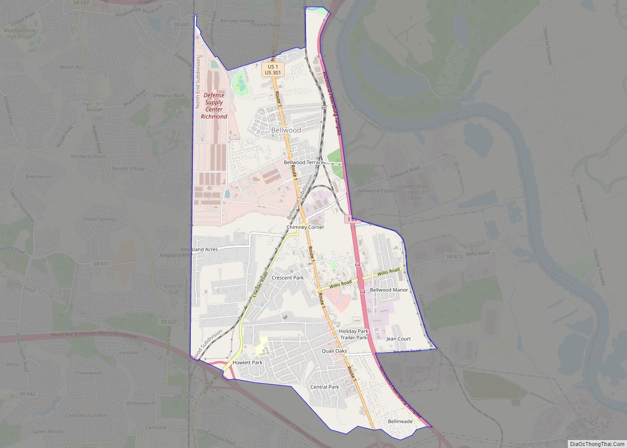
Chester Road Map
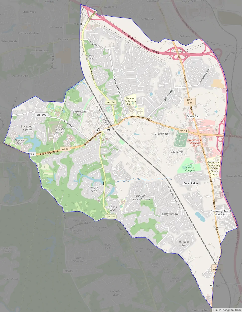
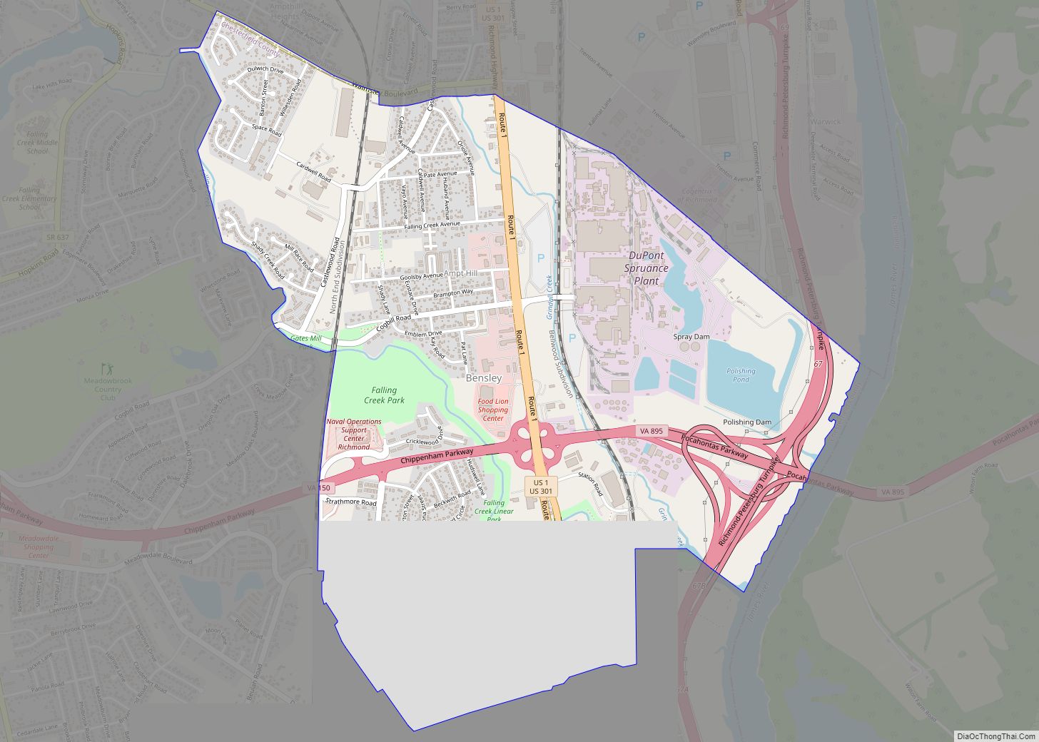
Chester city Satellite Map

Geography
Chester is located at 37°21′12″N 77°26′9″W / 37.35333°N 77.43583°W / 37.35333; -77.43583 (37.353449, -77.435767).
According to the United States Census Bureau, the CDP has a total area of 13.3 square miles (34.4 km), of which 13.2 square miles (34.1 km) is land, and 0.12 square miles (0.3 km) (0.90%) is water.
See also
Map of Virginia State and its subdivision:- Accomack
- Albemarle
- Alexandria
- Alleghany
- Amelia
- Amherst
- Appomattox
- Arlington
- Augusta
- Bath
- Bedford
- Bedford City
- Bland
- Botetourt
- Bristol
- Brunswick
- Buchanan
- Buckingham
- Buena Vista
- Campbell
- Caroline
- Carroll
- Charles City
- Charlotte
- Charlottesville
- Chesapeake
- Chesterfield
- Clarke
- Clifton Forge City
- Colonial Heights
- Covington
- Craig
- Culpeper
- Cumberland
- Danville
- Dickenson
- Dinwiddie
- Emporia
- Essex
- Fairfax
- Fairfax City
- Falls Church
- Fauquier
- Floyd
- Fluvanna
- Franklin
- Frederick
- Fredericksburg
- Galax
- Giles
- Gloucester
- Goochland
- Grayson
- Greene
- Greensville
- Halifax
- Hampton
- Hanover
- Harrisonburg
- Henrico
- Henry
- Highland
- Hopewell
- Isle of Wight
- James City
- King and Queen
- King George
- King William
- Lancaster
- Lee
- Lexington
- Loudoun
- Louisa
- Lunenburg
- Lynchburg
- Madison
- Manassas
- Manassas Park
- Martinsville
- Mathews
- Mecklenburg
- Middlesex
- Montgomery
- Nelson
- New Kent
- Newport News
- Norfolk
- Northampton
- Northumberland
- Norton
- Nottoway
- Orange
- Page
- Patrick
- Petersburg
- Pittsylvania
- Poquoson
- Portsmouth
- Powhatan
- Prince Edward
- Prince George
- Prince William
- Pulaski
- Radford
- Rappahannock
- Richmond
- Roanoke
- Roanoke City
- Rockbridge
- Rockingham
- Russell
- Salem
- Scott
- Shenandoah
- Smyth
- Southampton
- Spotsylvania
- Stafford
- Staunton
- Suffolk
- Surry
- Sussex
- Tazewell
- Virginia Beach
- Warren
- Washington
- Waynesboro
- Westmoreland
- Williamsburg
- Winchester
- Wise
- Wythe
- York
- Alabama
- Alaska
- Arizona
- Arkansas
- California
- Colorado
- Connecticut
- Delaware
- District of Columbia
- Florida
- Georgia
- Hawaii
- Idaho
- Illinois
- Indiana
- Iowa
- Kansas
- Kentucky
- Louisiana
- Maine
- Maryland
- Massachusetts
- Michigan
- Minnesota
- Mississippi
- Missouri
- Montana
- Nebraska
- Nevada
- New Hampshire
- New Jersey
- New Mexico
- New York
- North Carolina
- North Dakota
- Ohio
- Oklahoma
- Oregon
- Pennsylvania
- Rhode Island
- South Carolina
- South Dakota
- Tennessee
- Texas
- Utah
- Vermont
- Virginia
- Washington
- West Virginia
- Wisconsin
- Wyoming