Chilhowie /tʃɪlˈhaʊi/ is a town in Smyth County, Virginia, United States, on the Middle Fork of the Holston River. The population was 1,781 at the 2010 census. The name Chilhowie is said to come from a Cherokee word meaning “valley of many deer”. It is also notable for having only one traffic light in the entire city.
| Name: | Chilhowie town |
|---|---|
| LSAD Code: | 43 |
| LSAD Description: | town (suffix) |
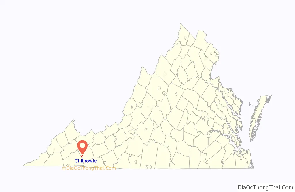
| State: | Virginia |
| County: | Smyth County |
| Elevation: | 1,952 ft (595 m) |
| Total Area: | 2.57 sq mi (6.66 km²) |
| Land Area: | 2.53 sq mi (6.56 km²) |
| Water Area: | 0.04 sq mi (0.10 km²) |
| Total Population: | 1,781 |
| Population Density: | 671.67/sq mi (259.32/km²) |
| ZIP code: | 24319 |
| Area code: | 276 |
| FIPS code: | 5116480 |
| GNISfeature ID: | 1464850 |
| Website: | http://www.chilhowie.org/ |
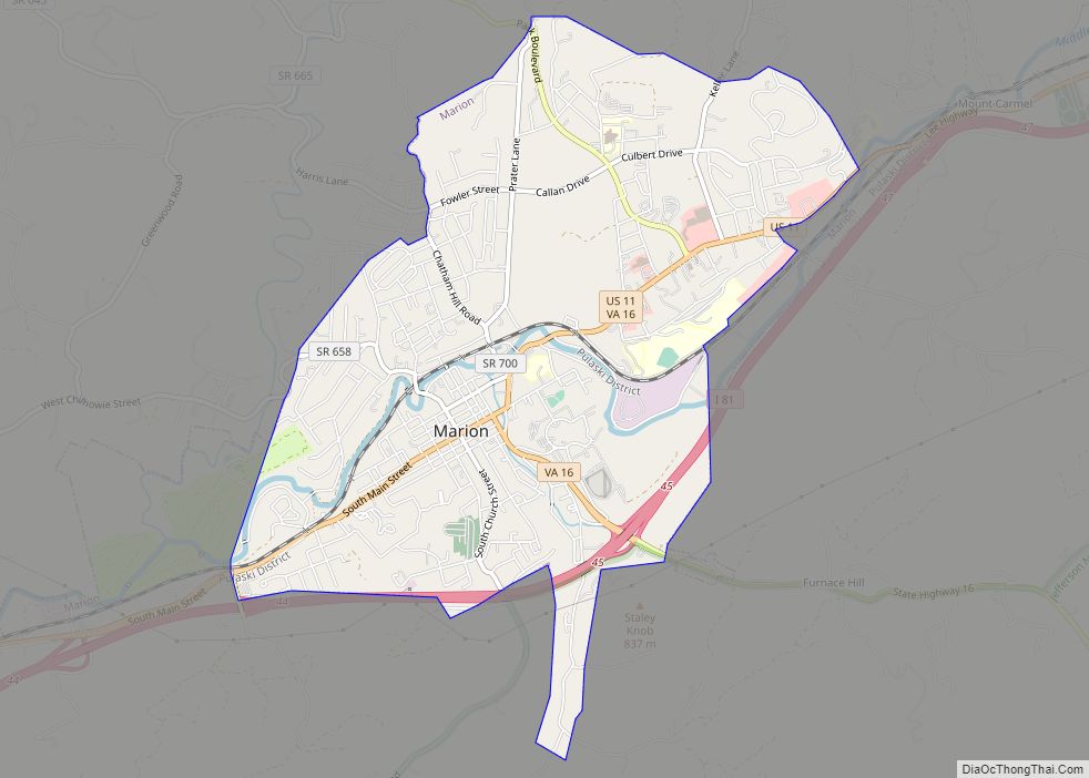
Online Interactive Map
Click on ![]() to view map in "full screen" mode.
to view map in "full screen" mode.
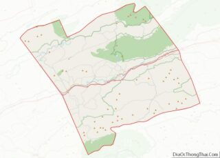
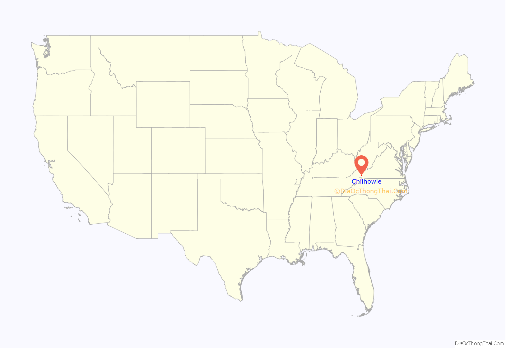
Chilhowie location map. Where is Chilhowie town?
History
Chilhowie was often the starting point of longhunter expeditions in the 1700s. In 1748 the area was visited by Colonel James Patton and Dr. Thomas Walker. They constructed a small fort, likely just a blockhouse. An early settler was Samuel Stalnaker (1715-1769) who converted Patton’s fort into a tavern known as the Town House, and lived there until the late 1760s. The town sustained severe damage from an EF-2 tornado during the 2011 Super Outbreak.
A.C. Beatie House, H.L. Bonham House, Chilhowie Methodist Episcopal Church, and the Downtown Chilhowie Historic District are listed on the National Register of Historic Places.
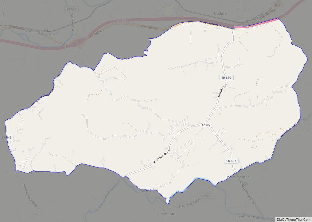
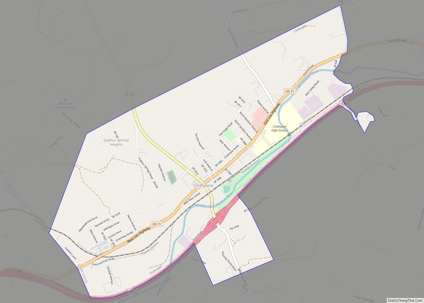
Chilhowie Road Map
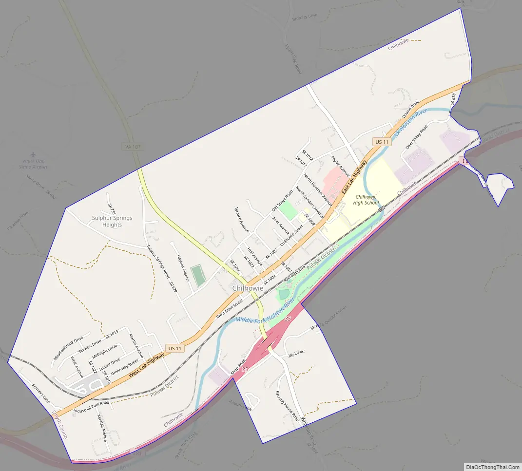
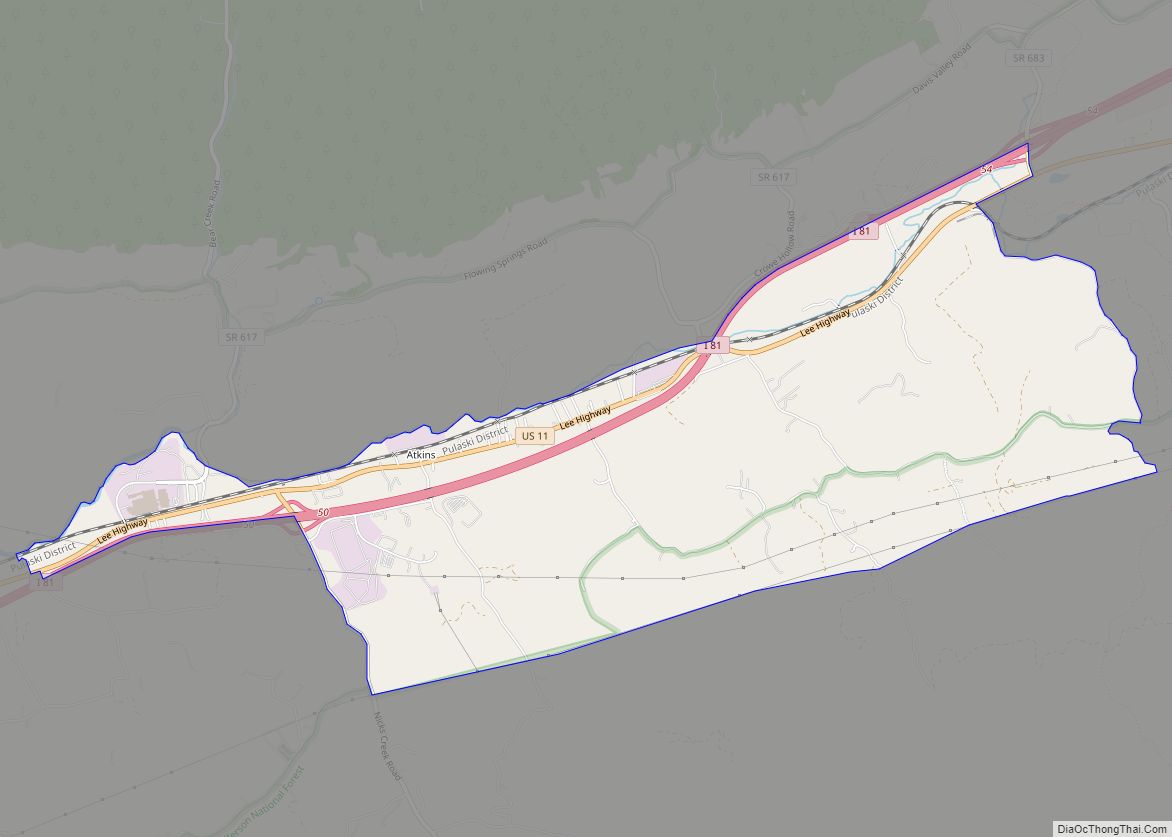
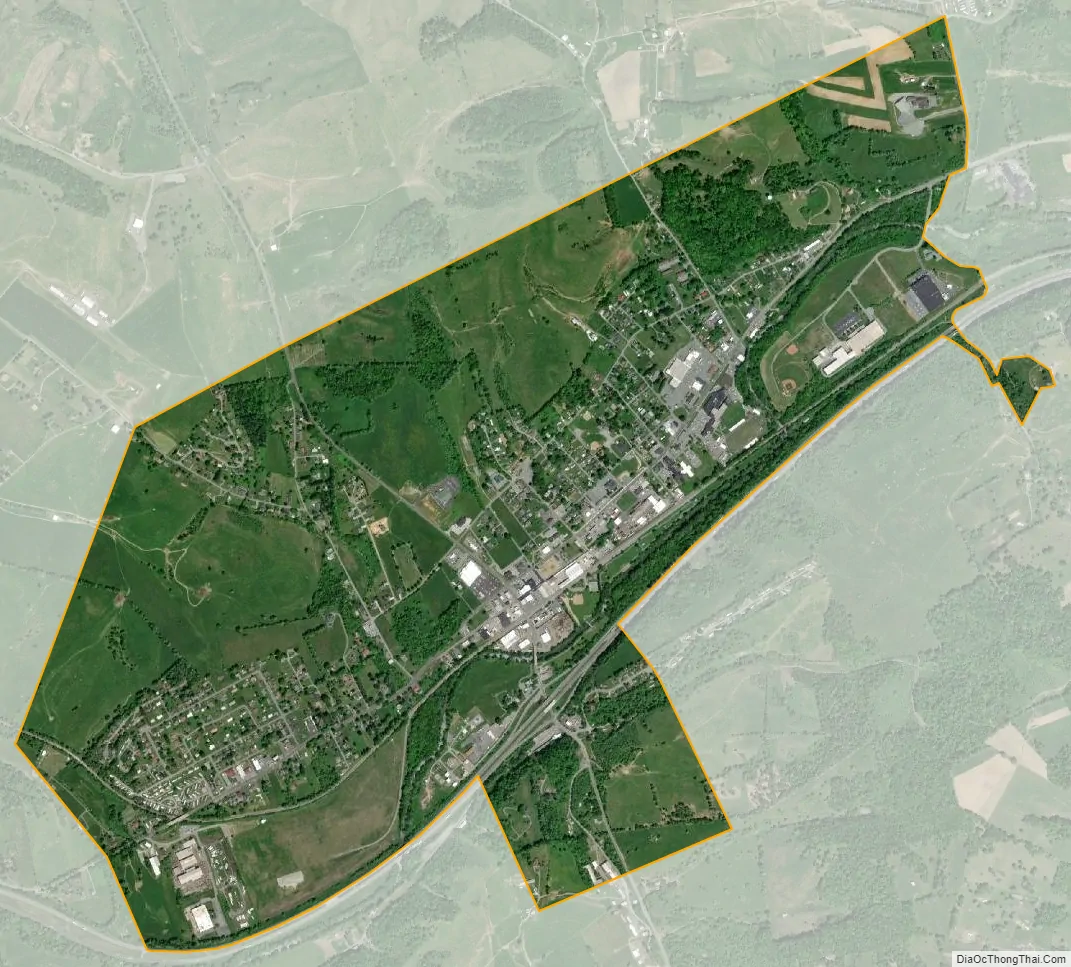
Chilhowie city Satellite Map
Geography
According to the United States Census Bureau, the town has a total area of 2.6 square miles (6.7 km), all of it land.
See also
Map of Virginia State and its subdivision:- Accomack
- Albemarle
- Alexandria
- Alleghany
- Amelia
- Amherst
- Appomattox
- Arlington
- Augusta
- Bath
- Bedford
- Bedford City
- Bland
- Botetourt
- Bristol
- Brunswick
- Buchanan
- Buckingham
- Buena Vista
- Campbell
- Caroline
- Carroll
- Charles City
- Charlotte
- Charlottesville
- Chesapeake
- Chesterfield
- Clarke
- Clifton Forge City
- Colonial Heights
- Covington
- Craig
- Culpeper
- Cumberland
- Danville
- Dickenson
- Dinwiddie
- Emporia
- Essex
- Fairfax
- Fairfax City
- Falls Church
- Fauquier
- Floyd
- Fluvanna
- Franklin
- Frederick
- Fredericksburg
- Galax
- Giles
- Gloucester
- Goochland
- Grayson
- Greene
- Greensville
- Halifax
- Hampton
- Hanover
- Harrisonburg
- Henrico
- Henry
- Highland
- Hopewell
- Isle of Wight
- James City
- King and Queen
- King George
- King William
- Lancaster
- Lee
- Lexington
- Loudoun
- Louisa
- Lunenburg
- Lynchburg
- Madison
- Manassas
- Manassas Park
- Martinsville
- Mathews
- Mecklenburg
- Middlesex
- Montgomery
- Nelson
- New Kent
- Newport News
- Norfolk
- Northampton
- Northumberland
- Norton
- Nottoway
- Orange
- Page
- Patrick
- Petersburg
- Pittsylvania
- Poquoson
- Portsmouth
- Powhatan
- Prince Edward
- Prince George
- Prince William
- Pulaski
- Radford
- Rappahannock
- Richmond
- Roanoke
- Roanoke City
- Rockbridge
- Rockingham
- Russell
- Salem
- Scott
- Shenandoah
- Smyth
- Southampton
- Spotsylvania
- Stafford
- Staunton
- Suffolk
- Surry
- Sussex
- Tazewell
- Virginia Beach
- Warren
- Washington
- Waynesboro
- Westmoreland
- Williamsburg
- Winchester
- Wise
- Wythe
- York
- Alabama
- Alaska
- Arizona
- Arkansas
- California
- Colorado
- Connecticut
- Delaware
- District of Columbia
- Florida
- Georgia
- Hawaii
- Idaho
- Illinois
- Indiana
- Iowa
- Kansas
- Kentucky
- Louisiana
- Maine
- Maryland
- Massachusetts
- Michigan
- Minnesota
- Mississippi
- Missouri
- Montana
- Nebraska
- Nevada
- New Hampshire
- New Jersey
- New Mexico
- New York
- North Carolina
- North Dakota
- Ohio
- Oklahoma
- Oregon
- Pennsylvania
- Rhode Island
- South Carolina
- South Dakota
- Tennessee
- Texas
- Utah
- Vermont
- Virginia
- Washington
- West Virginia
- Wisconsin
- Wyoming