Claremont is an incorporated town in Surry County, Virginia, United States. The population was 378 at the 2010 census. A granite marker stands as a memorial to the arrival of British settlers in the area. It received its name during the colonial era from the royal residence in Surry Shire in England. The town was incorporated in 1886, had a port on the James River, and gained railroad service as a terminus for a while before being abandoned. Claremont was home to the Temperance, Industrial, and Collegiate Institute, a school for African Americans founded by a former slave. The area includes a historical marker commemorating the institution.
| Name: | Claremont town |
|---|---|
| LSAD Code: | 43 |
| LSAD Description: | town (suffix) |
| State: | Virginia |
| County: | Surry County |
| Elevation: | 125 ft (38 m) |
| Total Area: | 2.54 sq mi (6.58 km²) |
| Land Area: | 2.54 sq mi (6.58 km²) |
| Water Area: | 0.00 sq mi (0.00 km²) |
| Total Population: | 378 |
| Population Density: | 132.34/sq mi (51.09/km²) |
| ZIP code: | 23899 |
| Area code: | 757, 948 (planned) |
| FIPS code: | 5116880 |
| GNISfeature ID: | 1464932 |
Online Interactive Map
Click on ![]() to view map in "full screen" mode.
to view map in "full screen" mode.
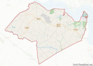
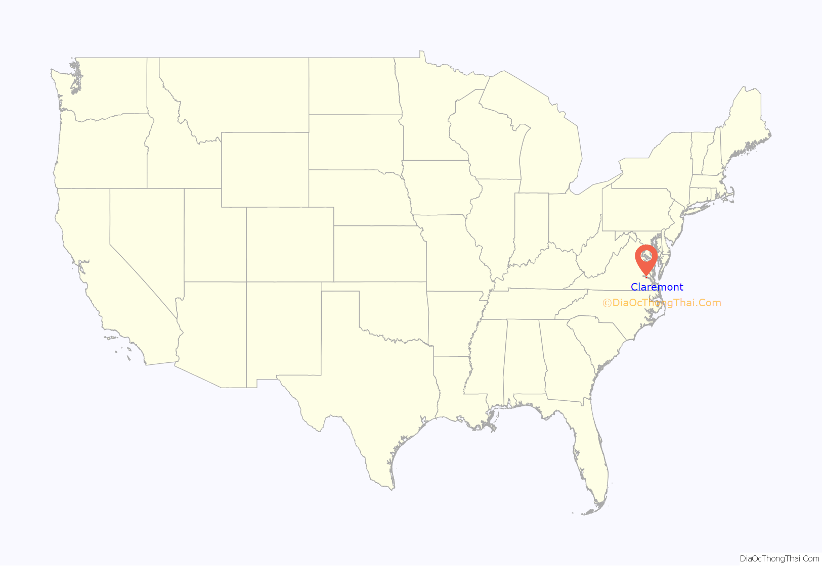
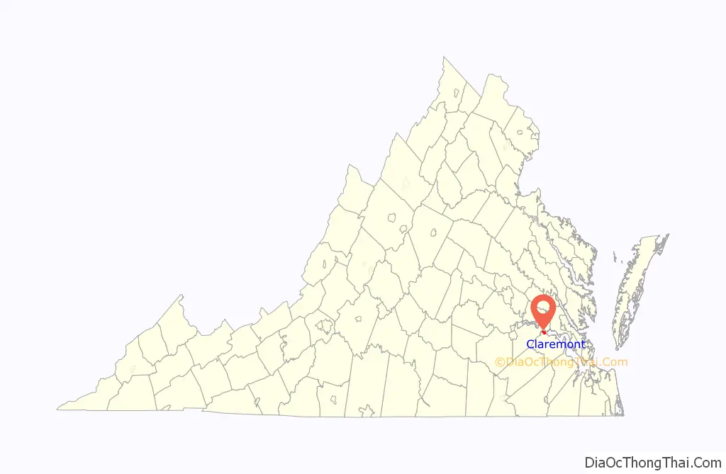
Claremont location map. Where is Claremont town?
History
A granite marker in a circle in the center of town commemorates the landing here on May 5, 1607, of English settlers, before the landing at Jamestown across the navigable portion of the James River. English and Scotch emigrants had settled there, near the principal native American village called Quioughcohanock (probably located on what later became known as “Wharf Bluff”) by 1632. In 1649 Arthur Allen patented lands in Surry County and by 1655 built Allen’s Brick House in the lower part of the county. His descendants owned this property until 1882. His son Arthur Allen II in addition to his agricultural and mercantile activities became Speaker of the House of Burgesses. By the late 17th and early 18th centuries, Claremont was a busy port town and shipped many goods, but especially hogsheads of tobacco. Colonel William Allen served in the American Revolutionary War. Speaker Allen’s grandson John Allen lived at Claremont Manor House and served in the Virginia House of Delegates and Virginia Ratifying Convention, and his principal heir Lt.Col. William Allen (1768-1831), also lived at Claremont and served many terms in the House of Delegates before the War of 1812 and supposedly became the largest land owner and slave owner in the Commonwealth of Virginia of his day. He never married, and required his great-nephew and heir, William Griffin Orgain to change his surname to Allen in order to inherit. That William Allen became a lumber magnate, built a railroad and in May 1861 became a Confederate officer and captain of the Jamestown Heavy Artillery (which he financed), Rails from his railroad were re-smelted to armor the Confederate ironclad Merrimac. However, Allen resigned his military commission in 1862.
After the Civil War, Claremont became a shipping port for railroad ties cut for the Prussian government and shipped to Hamburg. Willie Allen, who inherited Claremont Manor, moved to New York and ultimately sold the property. J. Frank Mancha, a Maryland or Delaware real estate developer began developing and subdividing the property to build a new town there in 1879. Incorporated in 1886, the town of Claremont became the eastern terminus of the new Atlantic and Danville Railway (A&D), a narrow gauge railroad, which was completed to a point near Emporia called James River Junction, where it connected with a standard gauge track towards Danville. Unfortunately for Claremont, the A&D decided to connect its western leg with a new eastern terminus in West Norfolk on the harbor of Hampton Roads, and the line to Claremont, which was never standard-gauged, went into semi-abandonment. After some use for lumber transport as the Surry, Sussex and Southampton Railway, the rails were removed in the late 1930s.
In the years since, the area has remained as a rural enclave, but some resort use developed along the bluffs and beaches of the James River. Many homes along the riverfront were badly damaged, and Claremont’s neighboring beach, Sunken Meadow’s was destroyed in 2003 by Hurricane Isabel.
In 2006, the old A&D station at Claremont Beach (village, not the wharf) was still standing.
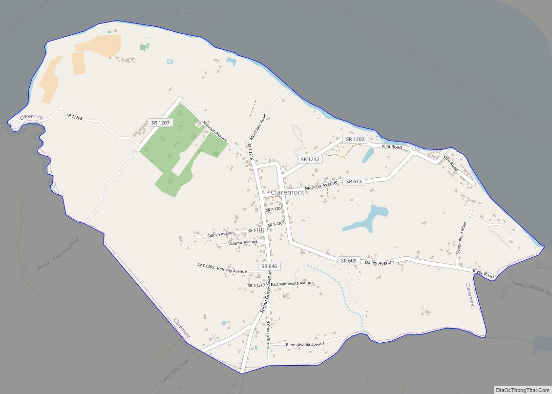
Claremont Road Map
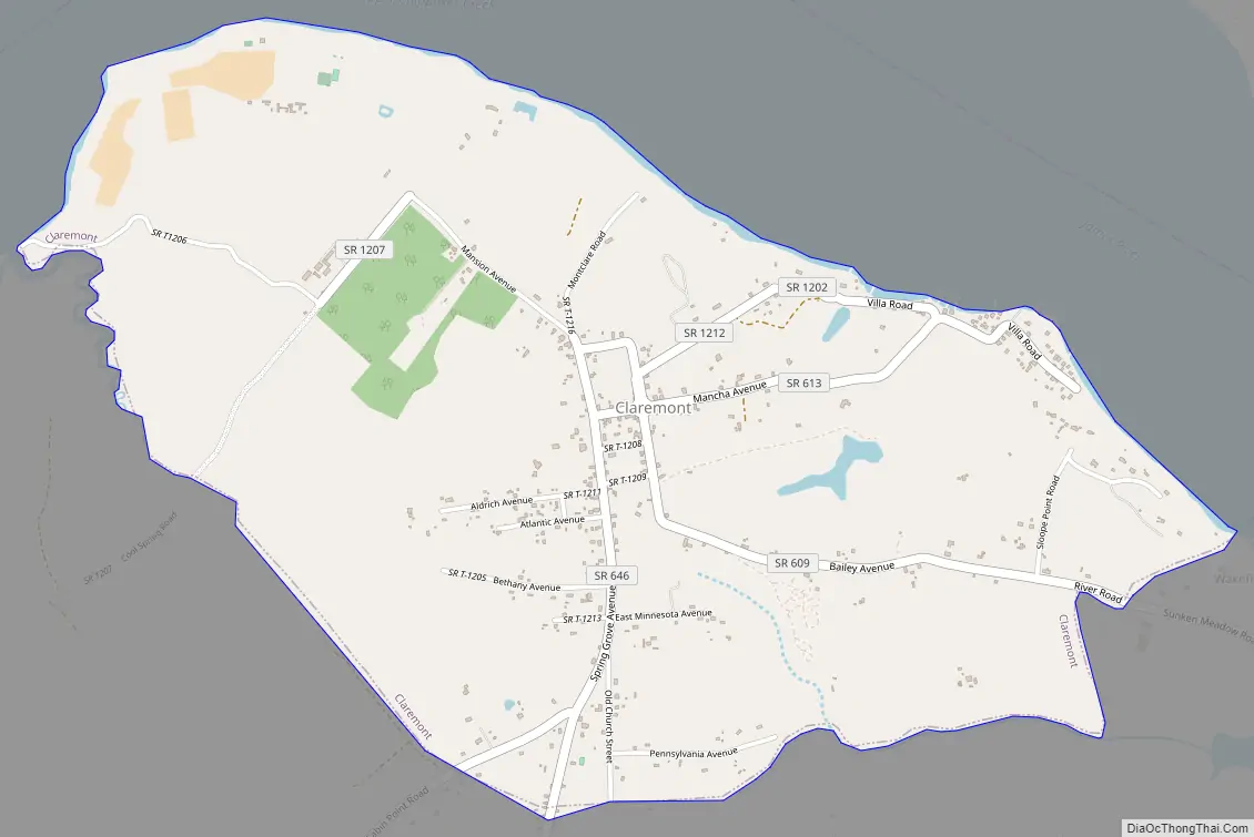
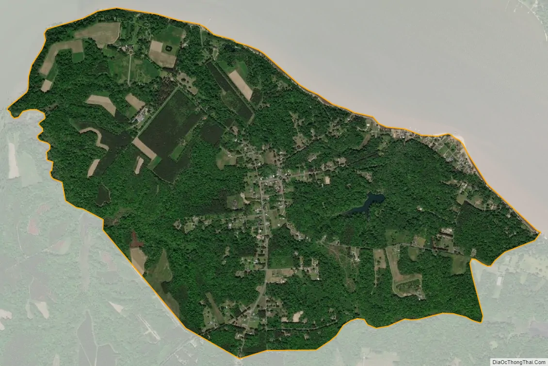
Claremont city Satellite Map
Geography
Claremont is located at 37°13′38″N 76°57′56″W / 37.22722°N 76.96556°W / 37.22722; -76.96556 (37.227291, -76.965458).
According to the United States Census Bureau, the town has a total area of 2.5 square miles (6.6 km), all of it land.
See also
Map of Virginia State and its subdivision:- Accomack
- Albemarle
- Alexandria
- Alleghany
- Amelia
- Amherst
- Appomattox
- Arlington
- Augusta
- Bath
- Bedford
- Bedford City
- Bland
- Botetourt
- Bristol
- Brunswick
- Buchanan
- Buckingham
- Buena Vista
- Campbell
- Caroline
- Carroll
- Charles City
- Charlotte
- Charlottesville
- Chesapeake
- Chesterfield
- Clarke
- Clifton Forge City
- Colonial Heights
- Covington
- Craig
- Culpeper
- Cumberland
- Danville
- Dickenson
- Dinwiddie
- Emporia
- Essex
- Fairfax
- Fairfax City
- Falls Church
- Fauquier
- Floyd
- Fluvanna
- Franklin
- Frederick
- Fredericksburg
- Galax
- Giles
- Gloucester
- Goochland
- Grayson
- Greene
- Greensville
- Halifax
- Hampton
- Hanover
- Harrisonburg
- Henrico
- Henry
- Highland
- Hopewell
- Isle of Wight
- James City
- King and Queen
- King George
- King William
- Lancaster
- Lee
- Lexington
- Loudoun
- Louisa
- Lunenburg
- Lynchburg
- Madison
- Manassas
- Manassas Park
- Martinsville
- Mathews
- Mecklenburg
- Middlesex
- Montgomery
- Nelson
- New Kent
- Newport News
- Norfolk
- Northampton
- Northumberland
- Norton
- Nottoway
- Orange
- Page
- Patrick
- Petersburg
- Pittsylvania
- Poquoson
- Portsmouth
- Powhatan
- Prince Edward
- Prince George
- Prince William
- Pulaski
- Radford
- Rappahannock
- Richmond
- Roanoke
- Roanoke City
- Rockbridge
- Rockingham
- Russell
- Salem
- Scott
- Shenandoah
- Smyth
- Southampton
- Spotsylvania
- Stafford
- Staunton
- Suffolk
- Surry
- Sussex
- Tazewell
- Virginia Beach
- Warren
- Washington
- Waynesboro
- Westmoreland
- Williamsburg
- Winchester
- Wise
- Wythe
- York
- Alabama
- Alaska
- Arizona
- Arkansas
- California
- Colorado
- Connecticut
- Delaware
- District of Columbia
- Florida
- Georgia
- Hawaii
- Idaho
- Illinois
- Indiana
- Iowa
- Kansas
- Kentucky
- Louisiana
- Maine
- Maryland
- Massachusetts
- Michigan
- Minnesota
- Mississippi
- Missouri
- Montana
- Nebraska
- Nevada
- New Hampshire
- New Jersey
- New Mexico
- New York
- North Carolina
- North Dakota
- Ohio
- Oklahoma
- Oregon
- Pennsylvania
- Rhode Island
- South Carolina
- South Dakota
- Tennessee
- Texas
- Utah
- Vermont
- Virginia
- Washington
- West Virginia
- Wisconsin
- Wyoming