Dahlgren is an unincorporated community and census-designated place (CDP) in King George County, Virginia, United States. The population was 2,946 at the time of the 2020 census, up from 2,653 at the 2010 census, and up from 997 in 2000.
| Name: | Dahlgren CDP |
|---|---|
| LSAD Code: | 57 |
| LSAD Description: | CDP (suffix) |
| State: | Virginia |
| County: | King George County |
| Elevation: | 20 ft (6 m) |
| Total Area: | 2.80 sq mi (7.24 km²) |
| Land Area: | 2.69 sq mi (6.98 km²) |
| Water Area: | 0.10 sq mi (0.25 km²) |
| Total Population: | 2,653 |
| Population Density: | 984/sq mi (380.0/km²) |
| ZIP code: | 22448, 22485 |
| Area code: | 540 |
| FIPS code: | 5121008 |
| GNISfeature ID: | 1465571 |
Online Interactive Map
Click on ![]() to view map in "full screen" mode.
to view map in "full screen" mode.
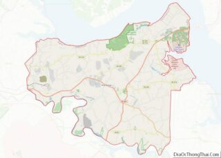
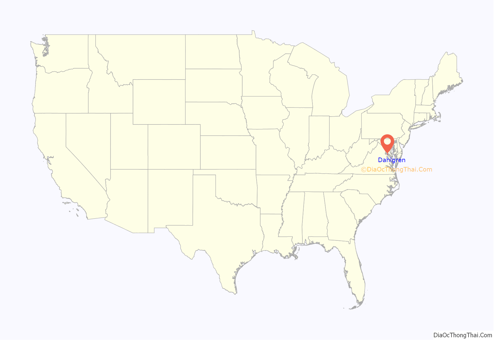
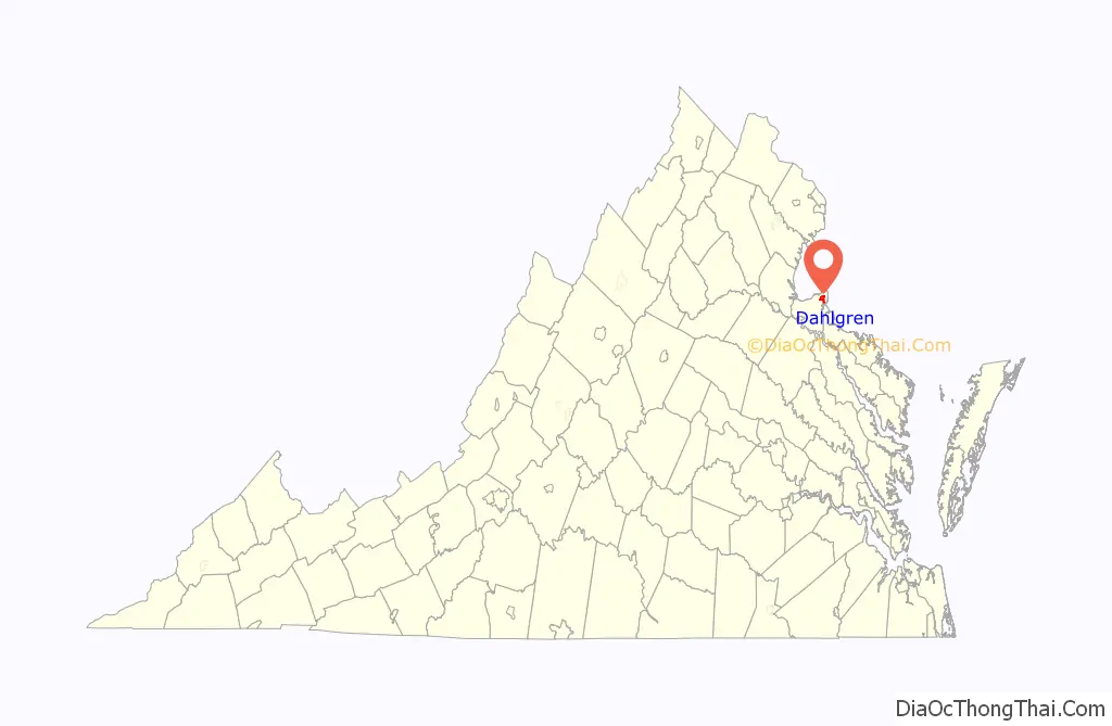
Dahlgren location map. Where is Dahlgren CDP?
History
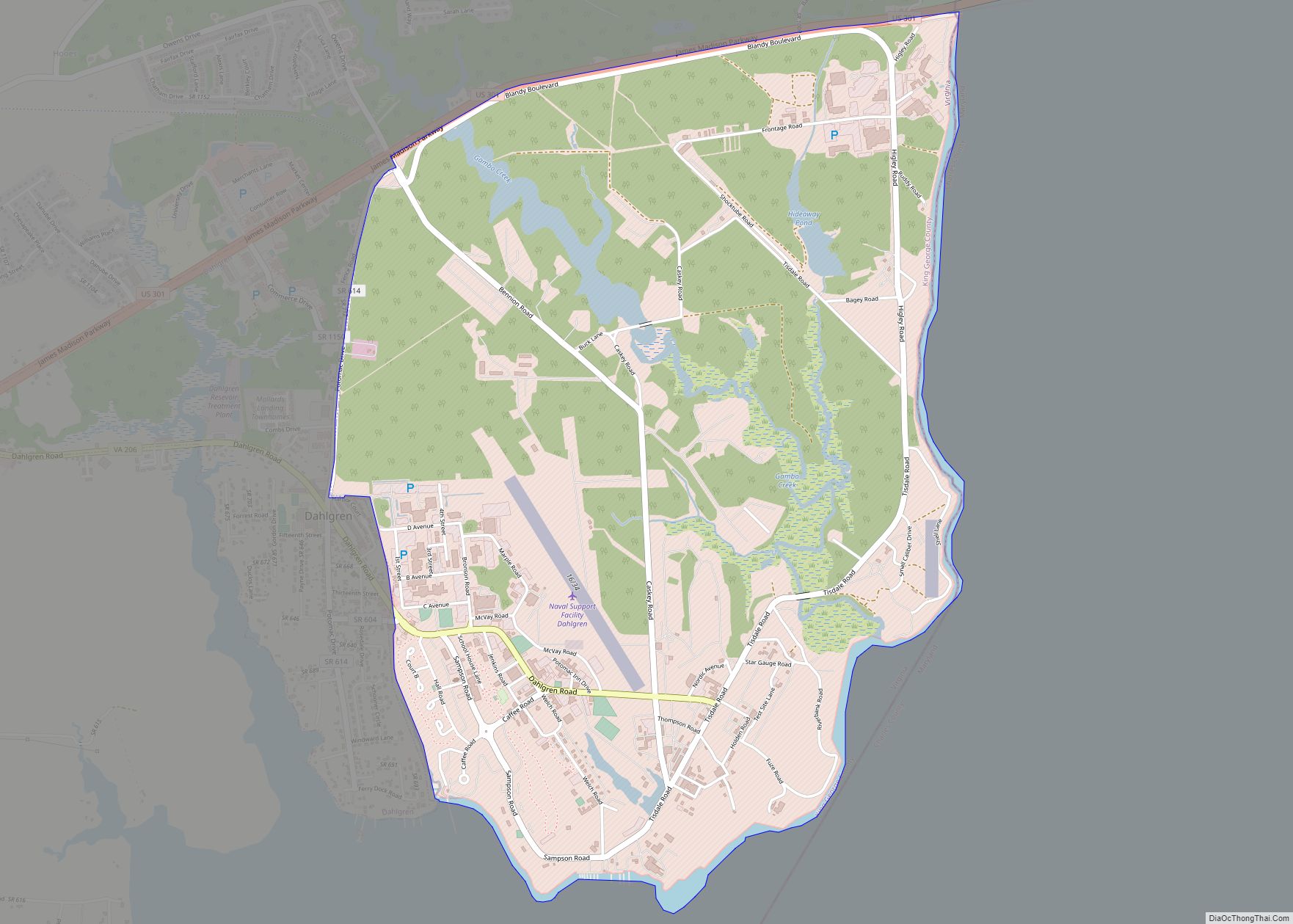
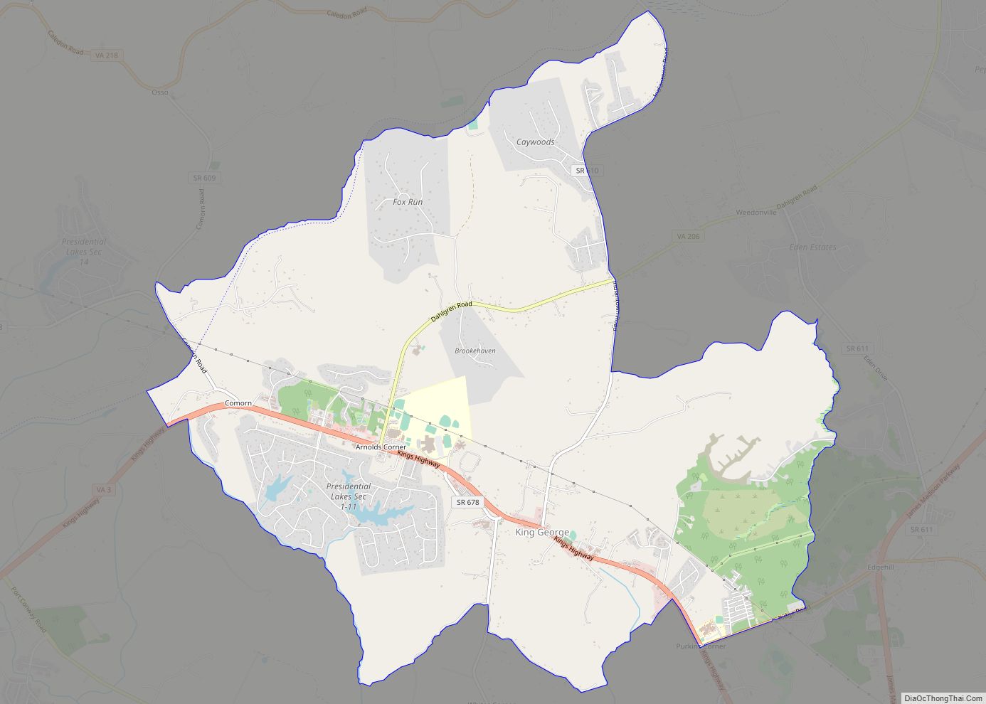
Since 1918, Dahlgren has been the site of a U.S. naval base named for Rear Admiral John A. Dahlgren. It was first the “U.S. Naval Proving Ground” but was renamed the “U.S. Naval Weapons Laboratory” after 1950, the “Naval Surface Weapons Center” in 1974, the “Naval Surface Warfare Center” in 1987, and the “U.S. Naval Surface Warfare Center Dahlgren Division (NSWCDD)” around 1990. In 2006, it was renamed “Naval Support Activity-South Potomac (NSA-SP)”, with NSWCDD becoming a tenant command of the base. The U.S. Naval Space Surveillance Systems command was located at that base, but that responsibility was transferred to the Air Force in 2004. The AEGIS Training and Readiness Center is currently a tenant command at NSA-SP. The naval base lies just east of the Dahlgren CDP within its own census-designated place, Dahlgren Center.
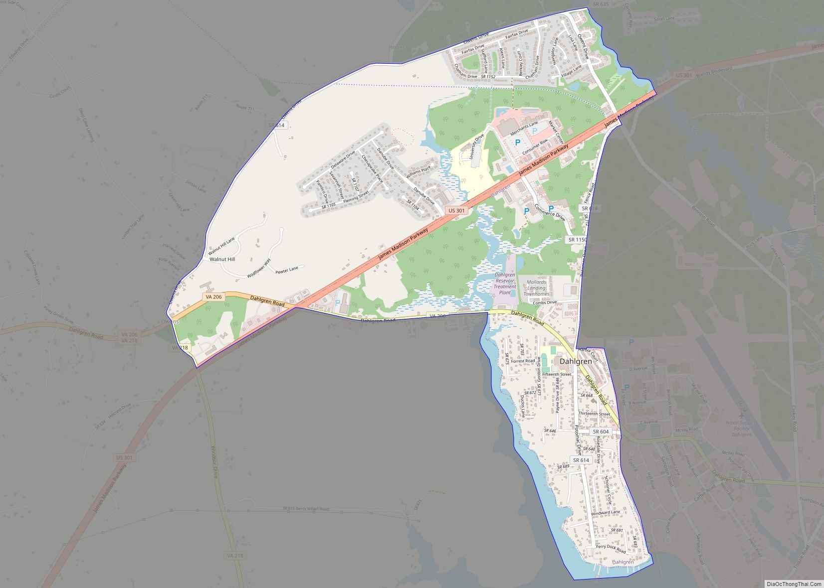
Dahlgren Road Map
Dahlgren city Satellite Map

Geography
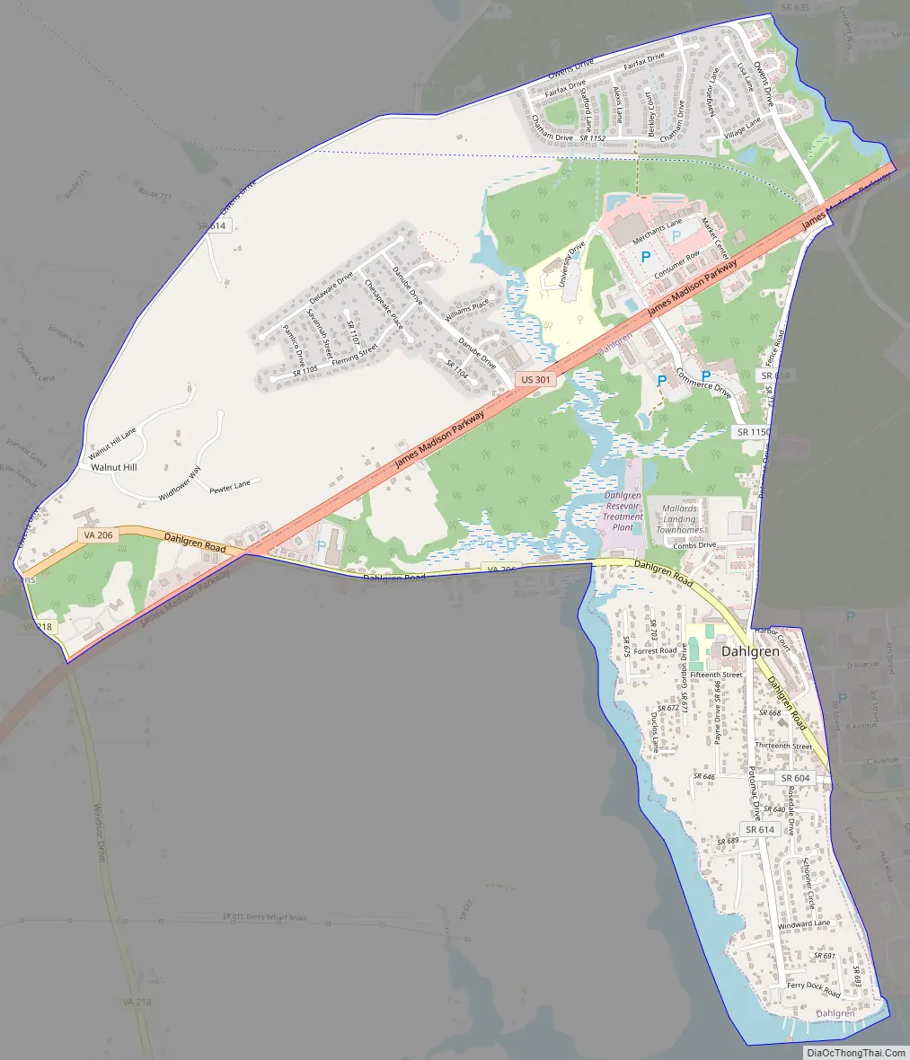
Dahlgren is in northeastern King George County, 1 mile (1.6 km) south of and 2 miles (3 km) west of the Potomac River. It is bordered to the east by the Naval Surface Warfare Center Dahlgren Division. The Dahlgren CDP extends north to state route 635, to the west to the unincorporated community of Owens, and south to the tidal Upper Machodoc Creek, an arm of the Potomac.
U.S. Route 301 (the James Madison Parkway), runs through Dahlgren, leading northeast across the Potomac 18 miles (29 km) to La Plata, Maryland, and southwest 15 miles (24 km) to Port Royal, Virginia.
According to the United States Census Bureau, the Dahlgren CDP has a total area of 2.8 square miles (7.2 km), of which 2.7 square miles (7.0 km) are land and 0.10 square miles (0.25 km), or 3.51%, are water.
See also
Map of Virginia State and its subdivision:- Accomack
- Albemarle
- Alexandria
- Alleghany
- Amelia
- Amherst
- Appomattox
- Arlington
- Augusta
- Bath
- Bedford
- Bedford City
- Bland
- Botetourt
- Bristol
- Brunswick
- Buchanan
- Buckingham
- Buena Vista
- Campbell
- Caroline
- Carroll
- Charles City
- Charlotte
- Charlottesville
- Chesapeake
- Chesterfield
- Clarke
- Clifton Forge City
- Colonial Heights
- Covington
- Craig
- Culpeper
- Cumberland
- Danville
- Dickenson
- Dinwiddie
- Emporia
- Essex
- Fairfax
- Fairfax City
- Falls Church
- Fauquier
- Floyd
- Fluvanna
- Franklin
- Frederick
- Fredericksburg
- Galax
- Giles
- Gloucester
- Goochland
- Grayson
- Greene
- Greensville
- Halifax
- Hampton
- Hanover
- Harrisonburg
- Henrico
- Henry
- Highland
- Hopewell
- Isle of Wight
- James City
- King and Queen
- King George
- King William
- Lancaster
- Lee
- Lexington
- Loudoun
- Louisa
- Lunenburg
- Lynchburg
- Madison
- Manassas
- Manassas Park
- Martinsville
- Mathews
- Mecklenburg
- Middlesex
- Montgomery
- Nelson
- New Kent
- Newport News
- Norfolk
- Northampton
- Northumberland
- Norton
- Nottoway
- Orange
- Page
- Patrick
- Petersburg
- Pittsylvania
- Poquoson
- Portsmouth
- Powhatan
- Prince Edward
- Prince George
- Prince William
- Pulaski
- Radford
- Rappahannock
- Richmond
- Roanoke
- Roanoke City
- Rockbridge
- Rockingham
- Russell
- Salem
- Scott
- Shenandoah
- Smyth
- Southampton
- Spotsylvania
- Stafford
- Staunton
- Suffolk
- Surry
- Sussex
- Tazewell
- Virginia Beach
- Warren
- Washington
- Waynesboro
- Westmoreland
- Williamsburg
- Winchester
- Wise
- Wythe
- York
- Alabama
- Alaska
- Arizona
- Arkansas
- California
- Colorado
- Connecticut
- Delaware
- District of Columbia
- Florida
- Georgia
- Hawaii
- Idaho
- Illinois
- Indiana
- Iowa
- Kansas
- Kentucky
- Louisiana
- Maine
- Maryland
- Massachusetts
- Michigan
- Minnesota
- Mississippi
- Missouri
- Montana
- Nebraska
- Nevada
- New Hampshire
- New Jersey
- New Mexico
- New York
- North Carolina
- North Dakota
- Ohio
- Oklahoma
- Oregon
- Pennsylvania
- Rhode Island
- South Carolina
- South Dakota
- Tennessee
- Texas
- Utah
- Vermont
- Virginia
- Washington
- West Virginia
- Wisconsin
- Wyoming