Fort Belvoir /ˈbɛlvwɑːr/ is a United States Army installation and a census-designated place (CDP) in Fairfax County, Virginia, United States. It was developed on the site of the former Belvoir plantation, seat of the prominent Fairfax family for whom Fairfax County was named. It was known as Camp A. A. Humphreys from 1917 to 1935 and Fort Belvoir afterward.
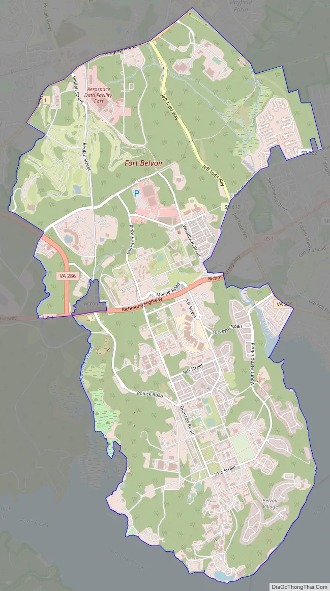
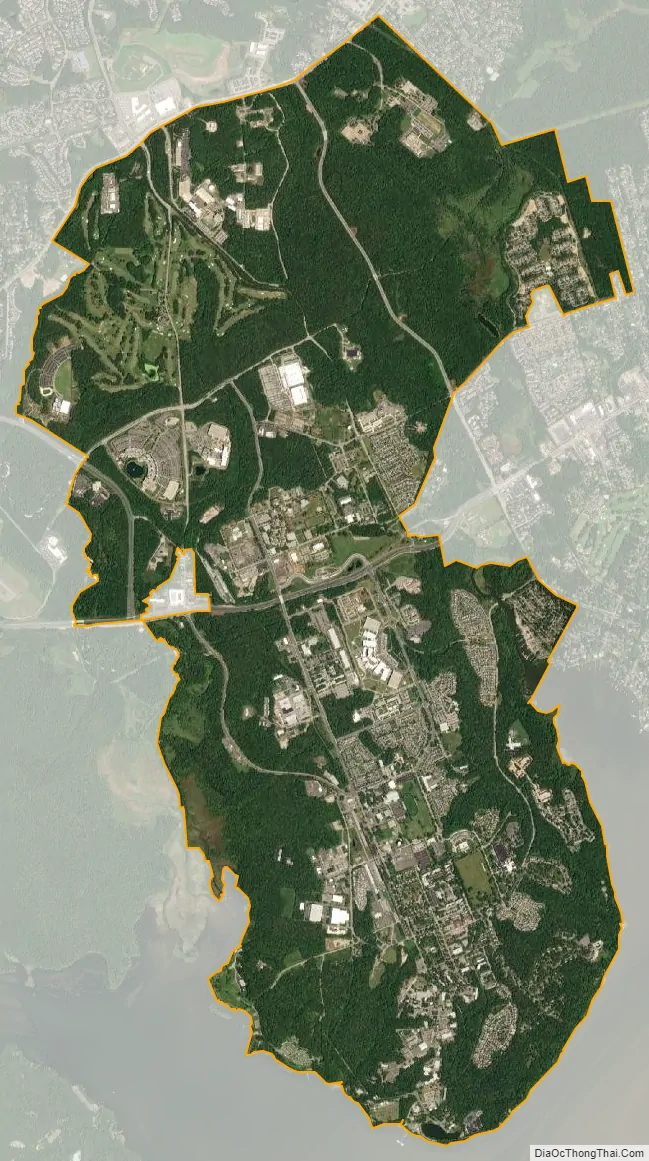
Fort Belvoir is home to a number of significant United States military organizations. With nearly twice as many workers as The Pentagon, Fort Belvoir is the largest employer in Fairfax County. Fort Belvoir comprises three geographically distinct areas: main base, Davison Army Airfield, and Fort Belvoir North.
| Name: | Fort Belvoir CDP |
|---|---|
| LSAD Code: | 57 |
| LSAD Description: | CDP (suffix) |
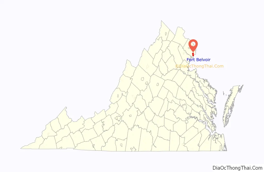
| State: | Virginia |
| County: | Fairfax County |
| FIPS code: | 5129008 |
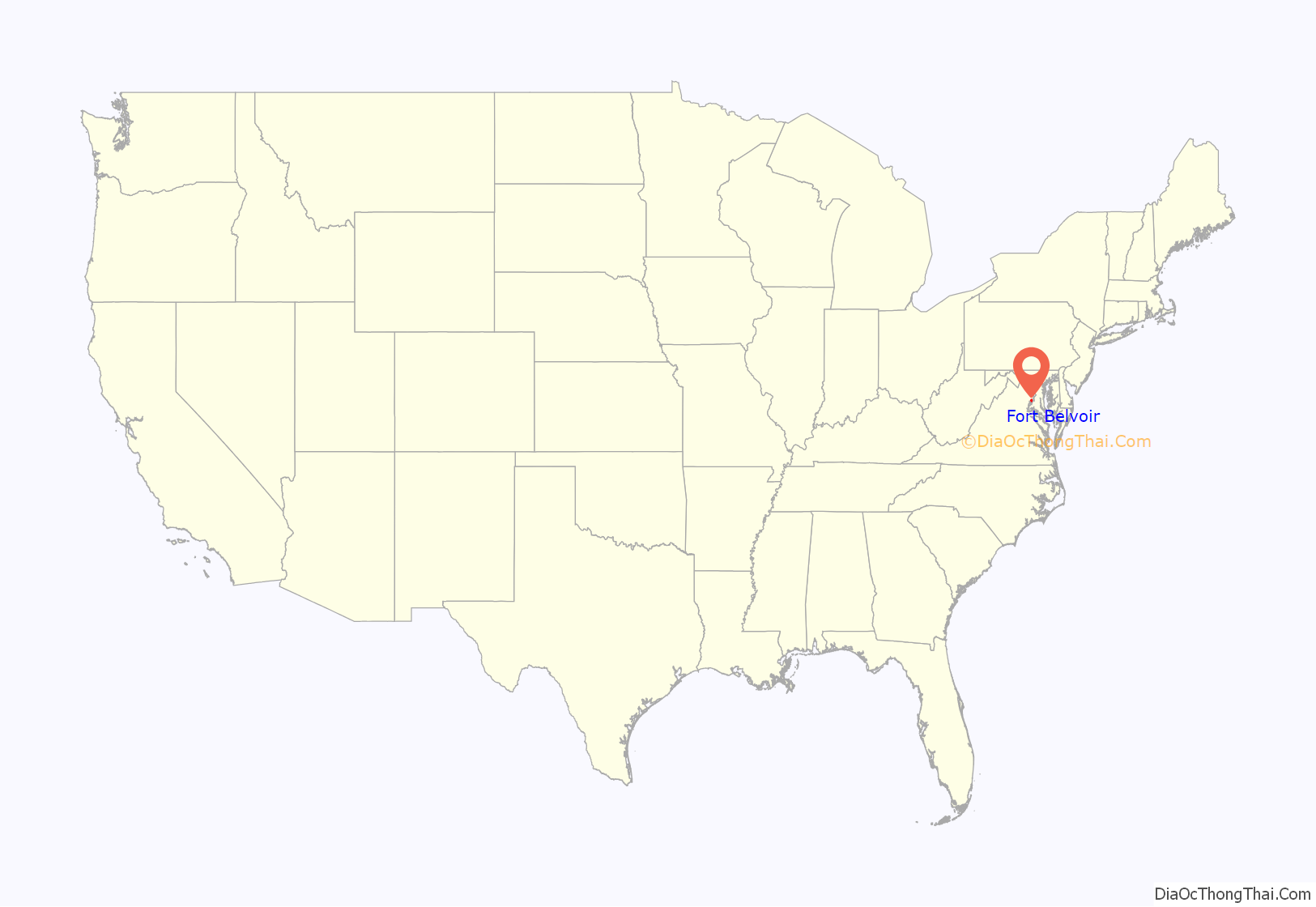
Online Interactive Map
Click on ![]() to view map in "full screen" mode.
to view map in "full screen" mode.
Fort Belvoir location map. Where is Fort Belvoir CDP?
History
Plantation
The Fort Belvoir site was originally the home of William Fairfax, the cousin and land agent of Thomas Fairfax, 6th Lord Fairfax of Cameron the proprietor of the Northern Neck, which stood on land now part of the base. William Fairfax purchased the property in 1738 when his cousin arranged for him to be appointed customs agent (tax collector) for the Potomac River, and William erected an elegant brick mansion overlooking the river, moving in with his family in 1740. Lord Fairfax came to America in 1747 and stayed less than a year at the Belvoir estate before moving to Greenway Court. The Fairfax family lived at Belvoir for over 30 years, but eldest son (and heir) George William Fairfax sailed to England on business in 1773, never to return. The manor home was destroyed by fire in 1783.
The ruins of the Belvoir Mansion and the nearby Fairfax family grave site are listed on the National Register of Historic Places.
Fort
The post was founded during World War I as Camp A. A. Humphreys, named for American Civil War Union Army general Andrew A. Humphreys, who was also Chief of Engineers. The post was renamed Fort Belvoir in the 1930s at the request of Howard W. Smith, a Congressman from Virginia, in recognition of the Belvoir plantation that once occupied the site. The adjacent United States Army Corps of Engineers Humphreys Engineer Center retains part of the original name.
Camp Humphreys was established in World War I as the U.S. Army Engineers Training School. It served as the post-graduate institution for U.S. Military Academy engineers and a finishing school for engineering troops headed to war. The school, which came to host the Engineer Officer Basic Course, relocated in 1988 from Fort Belvoir to Fort Leonard Wood, in Missouri.
As a result of the 2005 Base Realignment and Closure Commission, a substantial number of personnel were transferred to Fort Belvoir, and others were civilians employed there. All major Washington, D.C.-area National Geospatial-Intelligence Agency (NGA) facilities, including those in Bethesda, MD, Reston, VA, and Washington, D.C. were consolidated at a new facility, the NGA Campus East, situated on the former Engineer Proving Ground site. The cost of the new center was $2.4 billion.
The Army Historical Foundation announced in March 2017, its intent to begin the construction of the National Museum of the United States Army at Fort Belvoir. The museum, set on 84 acres (34 ha), will tell the story of the army since 1775. The 185,000-square-foot (17,200 m) museum will feature historical galleries, an “interactive Experiential Learning Center” and the Army Theater. There will also be outdoor venues including a Memorial Garden, Amphitheater, Parade Ground, and Army Trail. It opened to the public on November 11, 2020.
Fort Belvoir Road Map
Fort Belvoir city Satellite Map
See also
Map of Virginia State and its subdivision:- Accomack
- Albemarle
- Alexandria
- Alleghany
- Amelia
- Amherst
- Appomattox
- Arlington
- Augusta
- Bath
- Bedford
- Bedford City
- Bland
- Botetourt
- Bristol
- Brunswick
- Buchanan
- Buckingham
- Buena Vista
- Campbell
- Caroline
- Carroll
- Charles City
- Charlotte
- Charlottesville
- Chesapeake
- Chesterfield
- Clarke
- Clifton Forge City
- Colonial Heights
- Covington
- Craig
- Culpeper
- Cumberland
- Danville
- Dickenson
- Dinwiddie
- Emporia
- Essex
- Fairfax
- Fairfax City
- Falls Church
- Fauquier
- Floyd
- Fluvanna
- Franklin
- Frederick
- Fredericksburg
- Galax
- Giles
- Gloucester
- Goochland
- Grayson
- Greene
- Greensville
- Halifax
- Hampton
- Hanover
- Harrisonburg
- Henrico
- Henry
- Highland
- Hopewell
- Isle of Wight
- James City
- King and Queen
- King George
- King William
- Lancaster
- Lee
- Lexington
- Loudoun
- Louisa
- Lunenburg
- Lynchburg
- Madison
- Manassas
- Manassas Park
- Martinsville
- Mathews
- Mecklenburg
- Middlesex
- Montgomery
- Nelson
- New Kent
- Newport News
- Norfolk
- Northampton
- Northumberland
- Norton
- Nottoway
- Orange
- Page
- Patrick
- Petersburg
- Pittsylvania
- Poquoson
- Portsmouth
- Powhatan
- Prince Edward
- Prince George
- Prince William
- Pulaski
- Radford
- Rappahannock
- Richmond
- Roanoke
- Roanoke City
- Rockbridge
- Rockingham
- Russell
- Salem
- Scott
- Shenandoah
- Smyth
- Southampton
- Spotsylvania
- Stafford
- Staunton
- Suffolk
- Surry
- Sussex
- Tazewell
- Virginia Beach
- Warren
- Washington
- Waynesboro
- Westmoreland
- Williamsburg
- Winchester
- Wise
- Wythe
- York
- Alabama
- Alaska
- Arizona
- Arkansas
- California
- Colorado
- Connecticut
- Delaware
- District of Columbia
- Florida
- Georgia
- Hawaii
- Idaho
- Illinois
- Indiana
- Iowa
- Kansas
- Kentucky
- Louisiana
- Maine
- Maryland
- Massachusetts
- Michigan
- Minnesota
- Mississippi
- Missouri
- Montana
- Nebraska
- Nevada
- New Hampshire
- New Jersey
- New Mexico
- New York
- North Carolina
- North Dakota
- Ohio
- Oklahoma
- Oregon
- Pennsylvania
- Rhode Island
- South Carolina
- South Dakota
- Tennessee
- Texas
- Utah
- Vermont
- Virginia
- Washington
- West Virginia
- Wisconsin
- Wyoming


