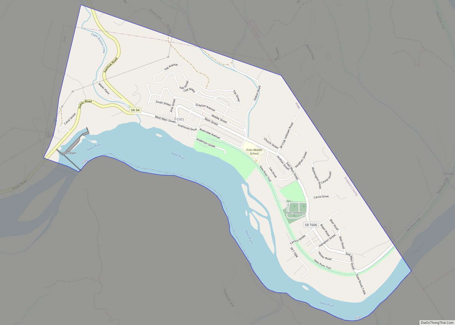
Fries (pronounced “freeze”) is an incorporated town located on the New River in Grayson County, Virginia, 24 kilometers (15.5 mi) north-east of the county seat in Independence — in Virginia’s Blue Ridge Highlands and on Virginia’s musical heritage trail, The Crooked Road.
Named after prominent cotton mill owner, Francis Henry Fries, the town is noted as the former site of Washington Mill (1903-1989); as one of three end points of the New River Trail State Park and as the host of annual music festivals reflecting its strong bluegrass and country music traditions — with its August Old-Time Fiddlers’ and Bluegrass Convention and its September Festival by the New River.
| Name: | Fries town |
|---|---|
| LSAD Code: | 43 |
| LSAD Description: | town (suffix) |
| State: | Virginia |
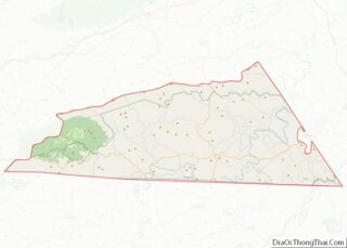
| County: | Grayson County |
| Elevation: | 2,185 ft (666 m) |
| Total Area: | 0.82 sq mi (2.13 km²) |
| Land Area: | 0.64 sq mi (1.65 km²) |
| Water Area: | 0.18 sq mi (0.48 km²) |
| Total Population: | 452 |
| Population Density: | 699.06/sq mi (269.98/km²) |
| ZIP code: | 24330 |
| Area code: | 276 |
| FIPS code: | 5129920 |
| GNISfeature ID: | 1483549 |
Online Interactive Map
Click on ![]() to view map in "full screen" mode.
to view map in "full screen" mode.
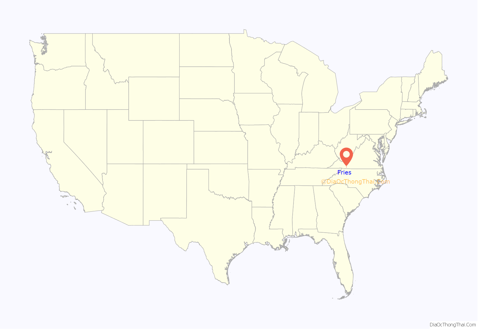
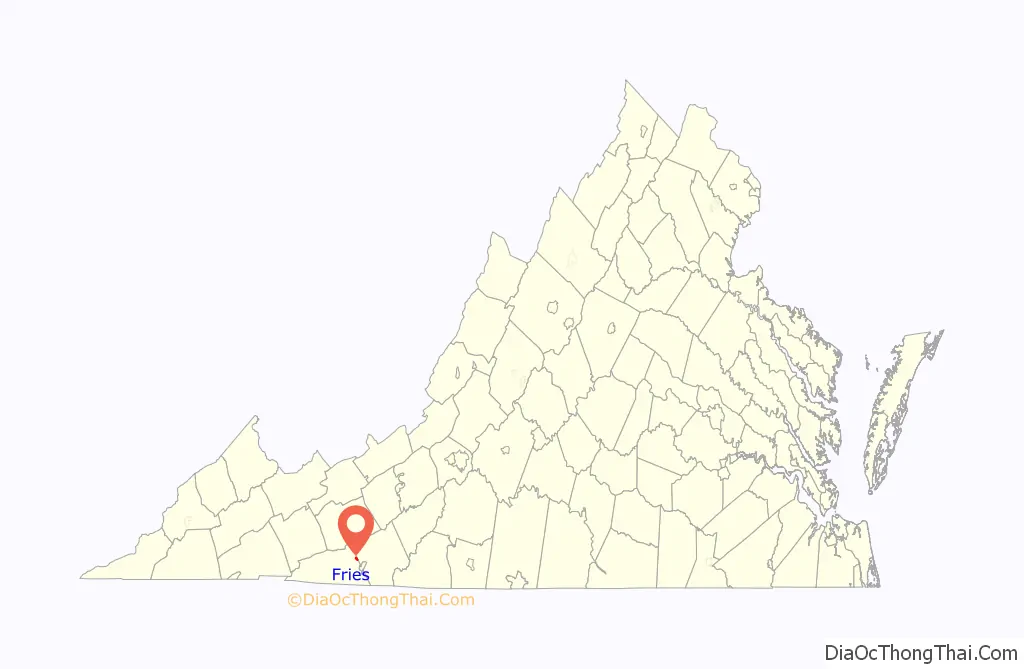
Fries location map. Where is Fries town?
History
Fries was named after North Carolina cotton mill owner Colonel Francis Henry Fries. Jim ‘Pipe’ Carico (of Stephens Creek, Virginia, the nearest incorporated town) contacted Fries in 1900 and proposed Bartlett Falls on New River as a site for a hydroelectric dam that could power a cotton mill.
Fries purchased the surrounding rural farmland then hired a local labor force to build a dam, a cotton mill and a full-service company owned town. By 1901, the New River Train was extended to the mill site and Fries petitioned the Virginia State Legislature to incorporate the new town of Carico, VA in honor of Jim ‘Pipe’ Carico. For reasons that are not well documented, the town name was instead legislatively changed to Fries, Virginia and officially incorporated in 1902.
Despite the heavy reliance on manual labor, mules and oxen, the town’s construction progressed quickly and the open call for employment spurred migration to the town. Around 300 houses, a post office, a church and a company commissary were wedged into the surrounding hillside before the mill began operation in February 1903 — with “the most sophisticated technology in the world.”
After changing hands numerous times, the mill closed in 1989. At the time the mill closed, it employed 1,700 people.
Fries High School also closed in 1989. The students from Fries, along with students from nearby Independence High School, were combined to form Grayson County High School, located in Independence.
The Stephen G. Bourne House, Fries Boarding Houses, and Spring Valley Rural Historic District are listed on the National Register of Historic Places.
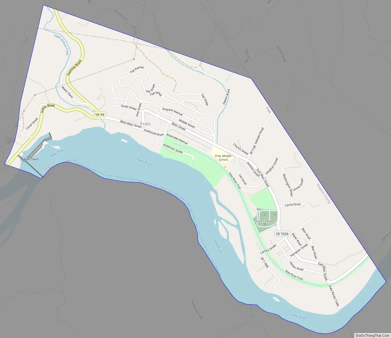
Fries Road Map
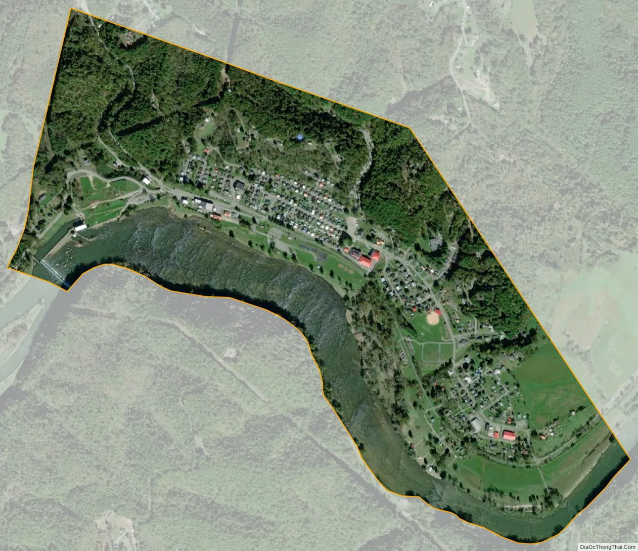
Fries city Satellite Map
Geography
Fries is located at 36°42′56″N 80°58′33″W / 36.71556°N 80.97583°W / 36.71556; -80.97583 (36.715537, −80.975849).
According to the United States Census Bureau, the town has a total area of 0.8 square miles (2.1 km), of which, 0.6 square miles (1.7 km) of it is land and 0.2 square miles (0.4 km) of it (19.75%) is water.
See also
Map of Virginia State and its subdivision:- Accomack
- Albemarle
- Alexandria
- Alleghany
- Amelia
- Amherst
- Appomattox
- Arlington
- Augusta
- Bath
- Bedford
- Bedford City
- Bland
- Botetourt
- Bristol
- Brunswick
- Buchanan
- Buckingham
- Buena Vista
- Campbell
- Caroline
- Carroll
- Charles City
- Charlotte
- Charlottesville
- Chesapeake
- Chesterfield
- Clarke
- Clifton Forge City
- Colonial Heights
- Covington
- Craig
- Culpeper
- Cumberland
- Danville
- Dickenson
- Dinwiddie
- Emporia
- Essex
- Fairfax
- Fairfax City
- Falls Church
- Fauquier
- Floyd
- Fluvanna
- Franklin
- Frederick
- Fredericksburg
- Galax
- Giles
- Gloucester
- Goochland
- Grayson
- Greene
- Greensville
- Halifax
- Hampton
- Hanover
- Harrisonburg
- Henrico
- Henry
- Highland
- Hopewell
- Isle of Wight
- James City
- King and Queen
- King George
- King William
- Lancaster
- Lee
- Lexington
- Loudoun
- Louisa
- Lunenburg
- Lynchburg
- Madison
- Manassas
- Manassas Park
- Martinsville
- Mathews
- Mecklenburg
- Middlesex
- Montgomery
- Nelson
- New Kent
- Newport News
- Norfolk
- Northampton
- Northumberland
- Norton
- Nottoway
- Orange
- Page
- Patrick
- Petersburg
- Pittsylvania
- Poquoson
- Portsmouth
- Powhatan
- Prince Edward
- Prince George
- Prince William
- Pulaski
- Radford
- Rappahannock
- Richmond
- Roanoke
- Roanoke City
- Rockbridge
- Rockingham
- Russell
- Salem
- Scott
- Shenandoah
- Smyth
- Southampton
- Spotsylvania
- Stafford
- Staunton
- Suffolk
- Surry
- Sussex
- Tazewell
- Virginia Beach
- Warren
- Washington
- Waynesboro
- Westmoreland
- Williamsburg
- Winchester
- Wise
- Wythe
- York
- Alabama
- Alaska
- Arizona
- Arkansas
- California
- Colorado
- Connecticut
- Delaware
- District of Columbia
- Florida
- Georgia
- Hawaii
- Idaho
- Illinois
- Indiana
- Iowa
- Kansas
- Kentucky
- Louisiana
- Maine
- Maryland
- Massachusetts
- Michigan
- Minnesota
- Mississippi
- Missouri
- Montana
- Nebraska
- Nevada
- New Hampshire
- New Jersey
- New Mexico
- New York
- North Carolina
- North Dakota
- Ohio
- Oklahoma
- Oregon
- Pennsylvania
- Rhode Island
- South Carolina
- South Dakota
- Tennessee
- Texas
- Utah
- Vermont
- Virginia
- Washington
- West Virginia
- Wisconsin
- Wyoming