Haysi ( /ˈheɪsaɪ/ HAY-sye) is a town in Dickenson County, Virginia, United States. The population was 498 at the 2010 census, up from 186 at the 2000 census, over which time period the town’s area tripled.
| Name: | Haysi town |
|---|---|
| LSAD Code: | 43 |
| LSAD Description: | town (suffix) |
| State: | Virginia |
| County: | Dickenson County |
| Incorporated: | February 17, 1936 |
| Elevation: | 1,270 ft (390 m) |
| Total Area: | 3.77 sq mi (9.76 km²) |
| Land Area: | 3.66 sq mi (9.48 km²) |
| Water Area: | 0.11 sq mi (0.28 km²) |
| Total Population: | 498 |
| Population Density: | 127.08/sq mi (49.06/km²) |
| ZIP code: | 24256 |
| Area code: | 276 |
| FIPS code: | 5136008 |
| GNISfeature ID: | 1483995 |
| Website: | www.haysivirginia.gov |
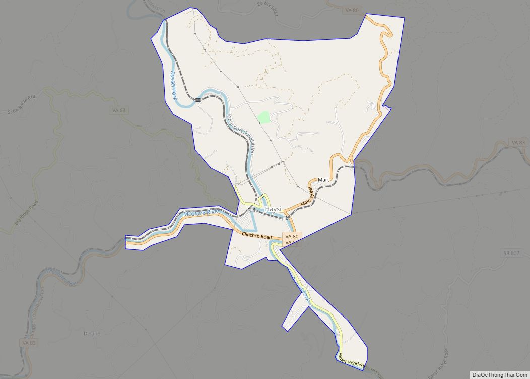
Online Interactive Map
Click on ![]() to view map in "full screen" mode.
to view map in "full screen" mode.
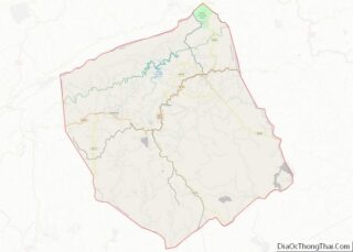
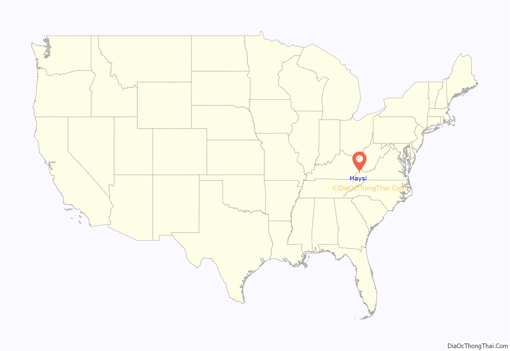
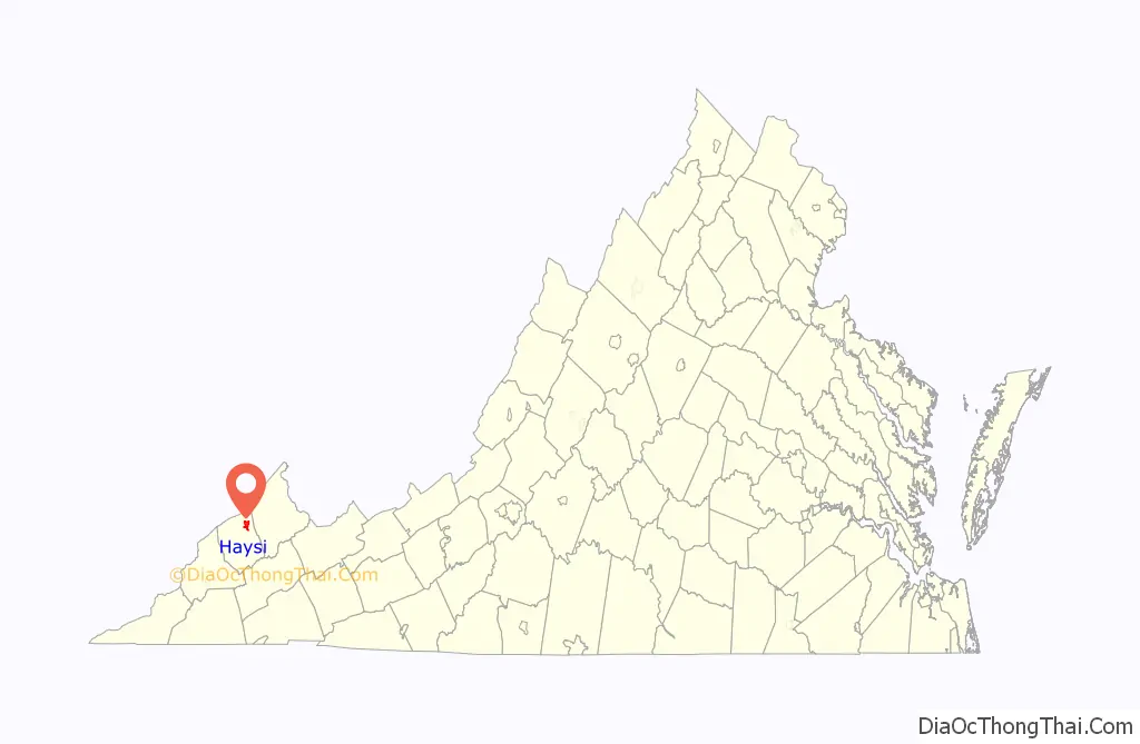
Haysi location map. Where is Haysi town?
History
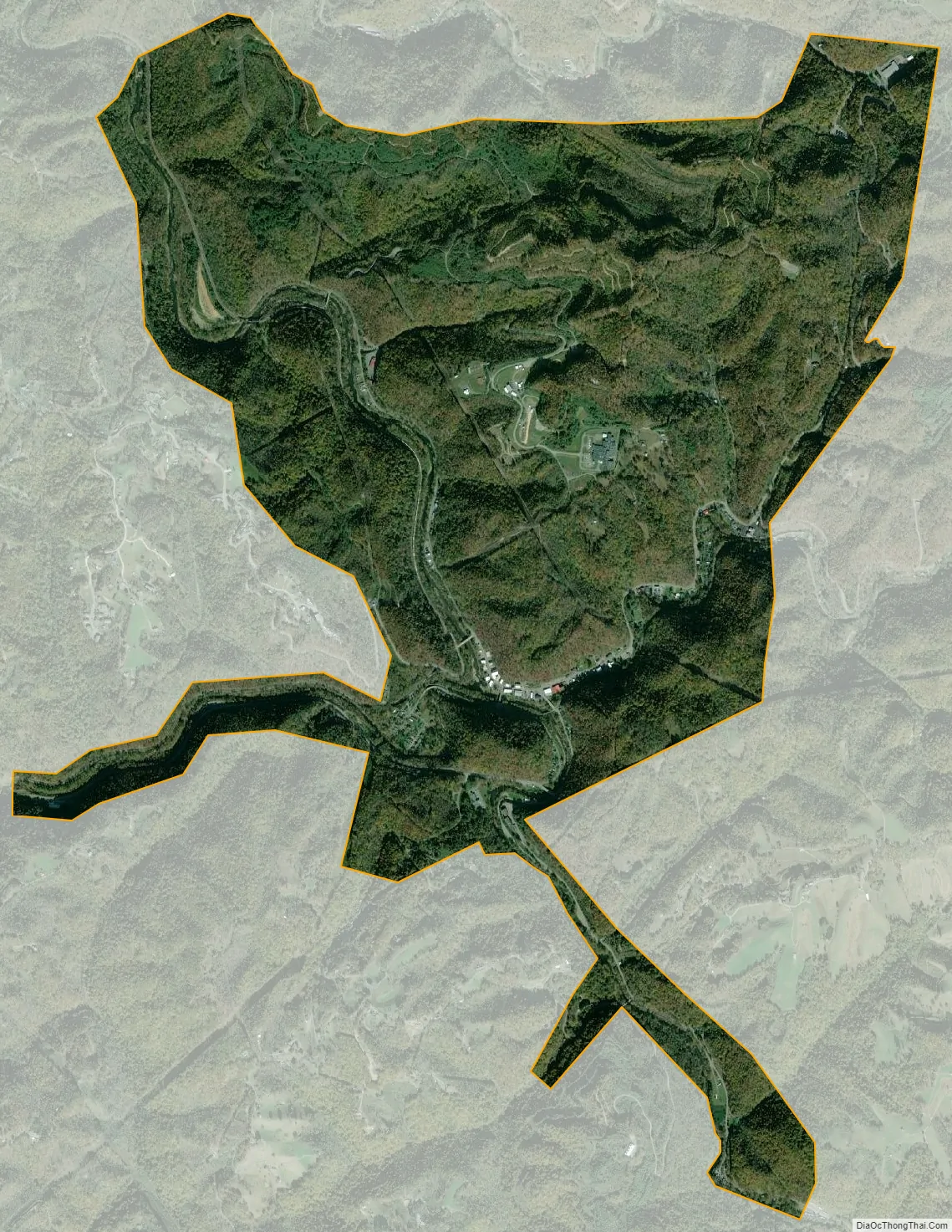
Haysi is located at the confluence of Russell Prater Creek, the McClure River, and the Russell Fork river. The area where Haysi is located used to be known as “The Mouth of McClure”. As late as 1911, Haysi was only sparsely populated and was often referred to as a laurel bed.
The first store was constructed within the present town limits of Haysi by Paris Charles for workers of the Yellow Poplar Lumber Company. Haysi began to grow with the construction of the Clinchfield Railroad between 1912 and 1915 as stores sprang up to serve the railroad workers. The railroad was constructed to export natural resources such as timber and coal from the area, and thus later growth of the town centered on workers for the coal mines which began operating around 1916. However, businesses in the town also accommodated travelers, as the rail system was a popular form of transportation at the time, and Haysi was located on a line of the Clinchfield that linked eastern Kentucky with northeast Tennessee, western North Carolina, and South Carolina. Notable early businesses included the McClure Bottling Company, Inc. (established 1914) and the Haysi Supply Company (established 1916). By 1920 Haysi businesses included a hotel, bank, hardware store, and various other retail merchants. By 1930 Main Street was lined with businesses, and the town was incorporated on February 17, 1936.
Local folklore says that in the pioneer days, prior to the establishment of bridges, a ferry boat operator named Si (Silas) shuttled people across the water in that area. It is said that when one arrived at the river and found the ferry on the opposite bank, it was common to shout “Hey Si!” to capture his attention and request passage. Thus, the town which grew around the location of this ferry service became known as “Haysi”.
The myth concerning the town’s origins is popular and widely accepted among area residents, but local historians dispute this explanation. The name Haysi is said to have originated from a post office established at a general store owned by Charles M. Hayter and Otis L. Sifers. The owners chose Haysi as a blend of their own surnames when it was necessary to provide a name to the U.S. Post Office.
Haysi Road Map
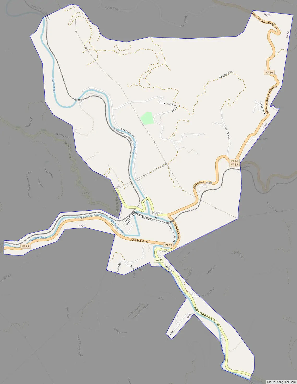
Haysi city Satellite Map
Geography
Haysi is located in northeastern Dickenson County.
According to the United States Census Bureau, the town has a total area of 3.7 square miles (9.5 km), of which 3.6 square miles (9.2 km) is land and 0.1 square miles (0.3 km), or 3.10%, is water. The town’s area was 0.89 square miles (2.3 km) in 2000.
Climate
The climate in this area is characterized by relatively high temperatures and evenly distributed precipitation throughout the year. The Köppen Climate System describes the weather as humid subtropical, and uses the abbreviation Cfa.
See also
Map of Virginia State and its subdivision:- Accomack
- Albemarle
- Alexandria
- Alleghany
- Amelia
- Amherst
- Appomattox
- Arlington
- Augusta
- Bath
- Bedford
- Bedford City
- Bland
- Botetourt
- Bristol
- Brunswick
- Buchanan
- Buckingham
- Buena Vista
- Campbell
- Caroline
- Carroll
- Charles City
- Charlotte
- Charlottesville
- Chesapeake
- Chesterfield
- Clarke
- Clifton Forge City
- Colonial Heights
- Covington
- Craig
- Culpeper
- Cumberland
- Danville
- Dickenson
- Dinwiddie
- Emporia
- Essex
- Fairfax
- Fairfax City
- Falls Church
- Fauquier
- Floyd
- Fluvanna
- Franklin
- Frederick
- Fredericksburg
- Galax
- Giles
- Gloucester
- Goochland
- Grayson
- Greene
- Greensville
- Halifax
- Hampton
- Hanover
- Harrisonburg
- Henrico
- Henry
- Highland
- Hopewell
- Isle of Wight
- James City
- King and Queen
- King George
- King William
- Lancaster
- Lee
- Lexington
- Loudoun
- Louisa
- Lunenburg
- Lynchburg
- Madison
- Manassas
- Manassas Park
- Martinsville
- Mathews
- Mecklenburg
- Middlesex
- Montgomery
- Nelson
- New Kent
- Newport News
- Norfolk
- Northampton
- Northumberland
- Norton
- Nottoway
- Orange
- Page
- Patrick
- Petersburg
- Pittsylvania
- Poquoson
- Portsmouth
- Powhatan
- Prince Edward
- Prince George
- Prince William
- Pulaski
- Radford
- Rappahannock
- Richmond
- Roanoke
- Roanoke City
- Rockbridge
- Rockingham
- Russell
- Salem
- Scott
- Shenandoah
- Smyth
- Southampton
- Spotsylvania
- Stafford
- Staunton
- Suffolk
- Surry
- Sussex
- Tazewell
- Virginia Beach
- Warren
- Washington
- Waynesboro
- Westmoreland
- Williamsburg
- Winchester
- Wise
- Wythe
- York
- Alabama
- Alaska
- Arizona
- Arkansas
- California
- Colorado
- Connecticut
- Delaware
- District of Columbia
- Florida
- Georgia
- Hawaii
- Idaho
- Illinois
- Indiana
- Iowa
- Kansas
- Kentucky
- Louisiana
- Maine
- Maryland
- Massachusetts
- Michigan
- Minnesota
- Mississippi
- Missouri
- Montana
- Nebraska
- Nevada
- New Hampshire
- New Jersey
- New Mexico
- New York
- North Carolina
- North Dakota
- Ohio
- Oklahoma
- Oregon
- Pennsylvania
- Rhode Island
- South Carolina
- South Dakota
- Tennessee
- Texas
- Utah
- Vermont
- Virginia
- Washington
- West Virginia
- Wisconsin
- Wyoming