Lake Barcroft is a census-designated place (CDP) in Fairfax County, Virginia, United States. The population was 9,558 at the 2010 census. It is also the name of the privately owned lake—part of the Cameron Run Watershed—around which this population is located. The lake is named for Dr. John W. Barcroft, who owned and operated a mill on Holmes Run during the mid-19th century.
| Name: | Lake Barcroft CDP |
|---|---|
| LSAD Code: | 57 |
| LSAD Description: | CDP (suffix) |
| State: | Virginia |
| County: | Fairfax County |
| Elevation: | 262 ft (80 m) |
| Total Area: | 2.7 sq mi (6.9 km²) |
| Land Area: | 2.4 sq mi (6.3 km²) |
| Water Area: | 0.2 sq mi (0.6 km²) |
| Total Population: | 9,558 |
| Population Density: | 3,918/sq mi (1,512.8/km²) |
| FIPS code: | 5143352 |
| GNISfeature ID: | 1492515 |
Online Interactive Map
Click on ![]() to view map in "full screen" mode.
to view map in "full screen" mode.
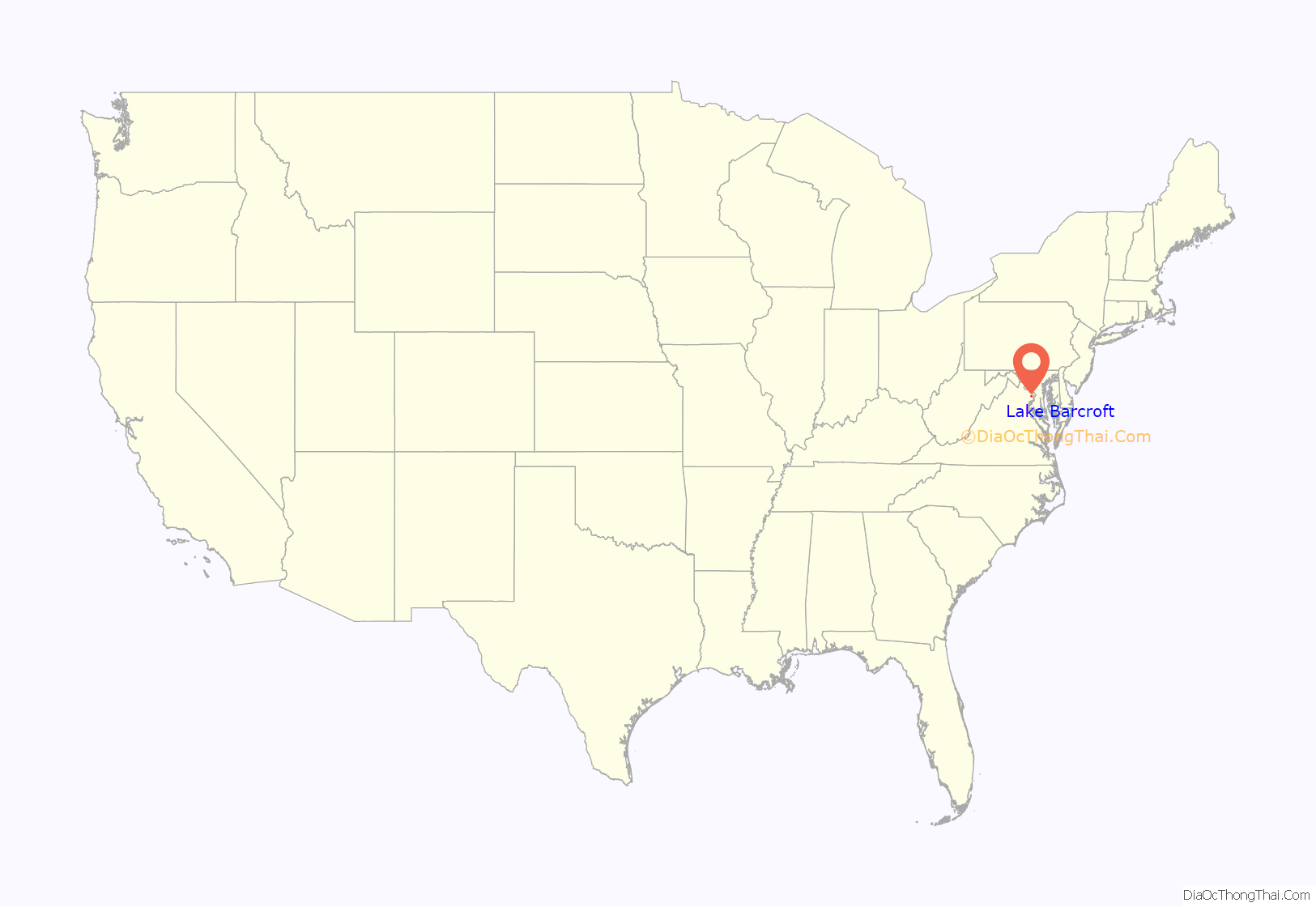
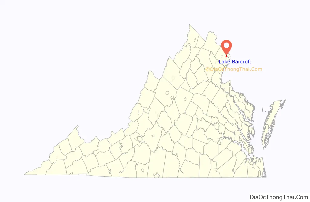
Lake Barcroft location map. Where is Lake Barcroft CDP?
History
In 1913, the Alexandria Water Company began construction of the Lake Barcroft Dam on Holmes Run to create a drinking water reservoir for the city of Alexandria. Construction of the dam was completed in 1915, putting a 620 million-gallon reservoir into service. In 1942, the company installed 24 gates at the top of the dam to raise the spillway elevation five feet, increasing the reservoir size to 800 million gallons.
In 1949, the City of Alexandria began to draw its drinking water from the Occoquan Reservoir. A year later, Colonel Joseph Barger and Associates purchased the reservoir, dam, and 680 adjacent acres of land for $1 million from the Alexandria Water Company. A year later, Barger and Associates began developing the 680 acres (2.8 km) into a residential community. During the early 1950s, residents formed a homeowners association called the Lake Barcroft Community Association (LABARCA). In 1970, community residents purchased the lake, dam, and common grounds for $300,000, and established the Barcroft Lake Management Association (BARLAMA).
In 1972, Hurricane Agnes passed over the area. The hurricane caused so much rain that the lake level rose above the top of the dam by 3 feet (0.91 m). This resulted in the lake overflowing and eroding the western, earthen shoulder of the dam. The rush of water deepened the washout, but the slow erosion protected downstream interests from the wall of water that would have resulted from a total dam collapse.
To restore the dam and lake, residents voted to establish the Lake Barcroft Watershed Improvement District (LBWID) to set up a taxing authority to fund repairs. The LBWID is a quasi-governmental entity headed by three state-appointed trustees who are residents of Lake Barcroft. The lake was dry for two years during the early 1970s while the damaged dam was rebuilt. A new gate improved the operation of the dam and is now fully automatic. The dam meets all Commonwealth dam safety requirements.
The Lake Barcroft Association (LBA) came into being in 1992 when LABARCA and BARLAMA joined up into one private entity. Lake Barcroft has excellent fishing. Largemouth bass, catfish, sunfish and a rare (non-stinging) fresh water jellyfish all inhabit Lake Barcroft. Ospreys, fishing birds of prey, are now on the lake as well.
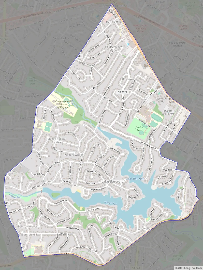
Lake Barcroft Road Map
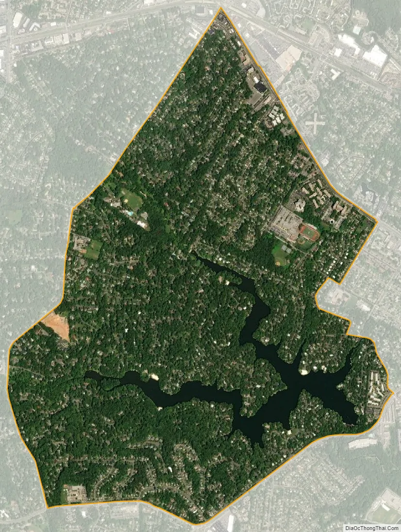
Lake Barcroft city Satellite Map
Geography
Lake Barcroft is located in eastern Fairfax County at 38°51′5″N 77°9′20″W / 38.85139°N 77.15556°W / 38.85139; -77.15556 (38.851412, −77.155654). It is bordered to the northeast by Seven Corners, to the east by Bailey’s Crossroads, to the south by Lincolnia, to the southwest by Annandale, and to the northwest by West Falls Church. Downtown Washington, D.C. is 9 miles (14 km) to the northeast. The CDP border follows Sleepy Hollow Road to the west, Leesburg Pike to the north, various roads along its border with Bailey’s Crossroads to the east, and Columbia Pike to the south.
According to the United States Census Bureau, the Lake Barcroft CDP has a total area of 2.7 square miles (6.9 km), of which 2.4 square miles (6.3 km) is land and 0.2 square miles (0.6 km), or 8.34%, is water.
The local high school is Justice High School.
The boundaries of the Lake Barcroft CDP are somewhat more expansive than those of the LBA, as the former includes several apartment buildings, condominiums, and businesses along the streets that form the border, while the latter includes exclusively single family homes.
The boundaries of the Lake Barcrofr CDP are slightly more expansive than the boundaries of the LBA and include several apartmentmbuildings which are not part of the
ent which
See also
Map of Virginia State and its subdivision:- Accomack
- Albemarle
- Alexandria
- Alleghany
- Amelia
- Amherst
- Appomattox
- Arlington
- Augusta
- Bath
- Bedford
- Bedford City
- Bland
- Botetourt
- Bristol
- Brunswick
- Buchanan
- Buckingham
- Buena Vista
- Campbell
- Caroline
- Carroll
- Charles City
- Charlotte
- Charlottesville
- Chesapeake
- Chesterfield
- Clarke
- Clifton Forge City
- Colonial Heights
- Covington
- Craig
- Culpeper
- Cumberland
- Danville
- Dickenson
- Dinwiddie
- Emporia
- Essex
- Fairfax
- Fairfax City
- Falls Church
- Fauquier
- Floyd
- Fluvanna
- Franklin
- Frederick
- Fredericksburg
- Galax
- Giles
- Gloucester
- Goochland
- Grayson
- Greene
- Greensville
- Halifax
- Hampton
- Hanover
- Harrisonburg
- Henrico
- Henry
- Highland
- Hopewell
- Isle of Wight
- James City
- King and Queen
- King George
- King William
- Lancaster
- Lee
- Lexington
- Loudoun
- Louisa
- Lunenburg
- Lynchburg
- Madison
- Manassas
- Manassas Park
- Martinsville
- Mathews
- Mecklenburg
- Middlesex
- Montgomery
- Nelson
- New Kent
- Newport News
- Norfolk
- Northampton
- Northumberland
- Norton
- Nottoway
- Orange
- Page
- Patrick
- Petersburg
- Pittsylvania
- Poquoson
- Portsmouth
- Powhatan
- Prince Edward
- Prince George
- Prince William
- Pulaski
- Radford
- Rappahannock
- Richmond
- Roanoke
- Roanoke City
- Rockbridge
- Rockingham
- Russell
- Salem
- Scott
- Shenandoah
- Smyth
- Southampton
- Spotsylvania
- Stafford
- Staunton
- Suffolk
- Surry
- Sussex
- Tazewell
- Virginia Beach
- Warren
- Washington
- Waynesboro
- Westmoreland
- Williamsburg
- Winchester
- Wise
- Wythe
- York
- Alabama
- Alaska
- Arizona
- Arkansas
- California
- Colorado
- Connecticut
- Delaware
- District of Columbia
- Florida
- Georgia
- Hawaii
- Idaho
- Illinois
- Indiana
- Iowa
- Kansas
- Kentucky
- Louisiana
- Maine
- Maryland
- Massachusetts
- Michigan
- Minnesota
- Mississippi
- Missouri
- Montana
- Nebraska
- Nevada
- New Hampshire
- New Jersey
- New Mexico
- New York
- North Carolina
- North Dakota
- Ohio
- Oklahoma
- Oregon
- Pennsylvania
- Rhode Island
- South Carolina
- South Dakota
- Tennessee
- Texas
- Utah
- Vermont
- Virginia
- Washington
- West Virginia
- Wisconsin
- Wyoming


