Matoaca is a census-designated place (CDP) in Chesterfield County, Virginia, United States. The population was 2,403 at the 2010 census. It is named after the Pamunkey princess Matoaka who was better known by her nickname “Pocahontas”. It was near the site of an Appomattoc village Matoka or Matoks, which was reputedly her girlhood home, and the palace town of the weroansqua Oppussoquionuske.
In 2016 it was listed as No. 42 in CNN Money’s Top 50 Places to Live in the United States.
| Name: | Matoaca CDP |
|---|---|
| LSAD Code: | 57 |
| LSAD Description: | CDP (suffix) |
| State: | Virginia |
| County: | Chesterfield County |
| Elevation: | 141 ft (43 m) |
| Total Area: | 2.7 sq mi (6.9 km²) |
| Land Area: | 2.5 sq mi (6.6 km²) |
| Water Area: | 0.1 sq mi (0.3 km²) |
| Total Population: | 2,403 |
| Population Density: | 890/sq mi (350/km²) |
| FIPS code: | 5150136 |
| GNISfeature ID: | 1497010 |
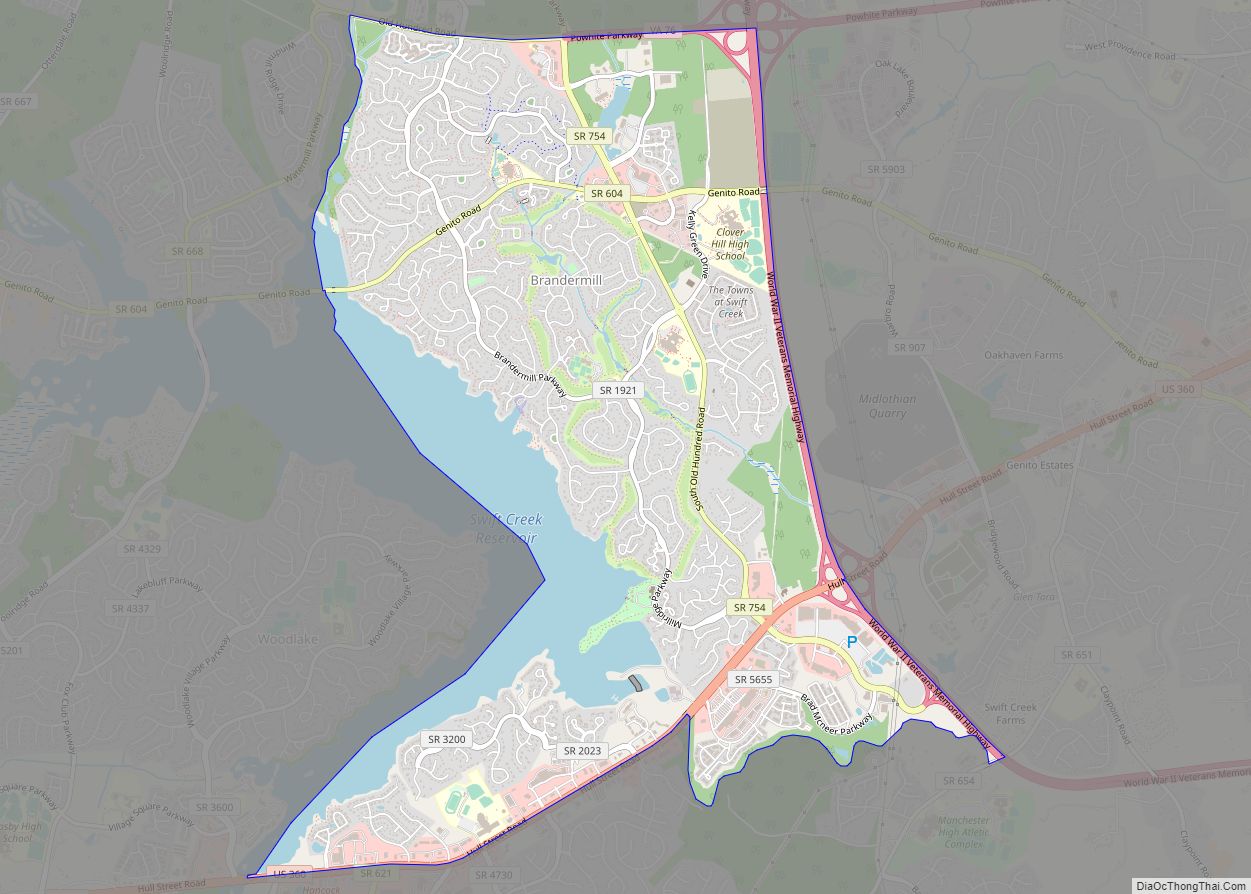
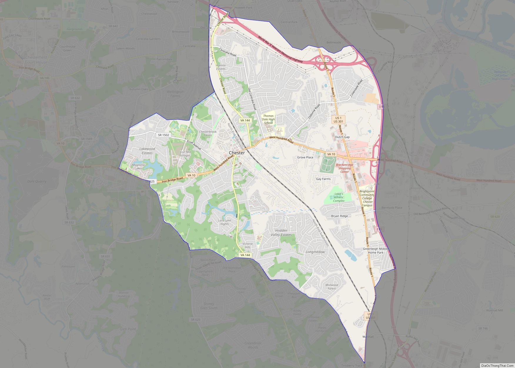
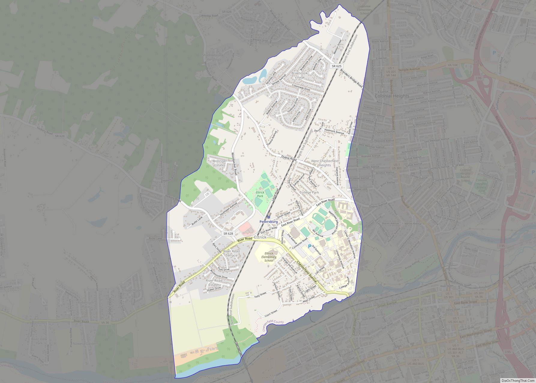
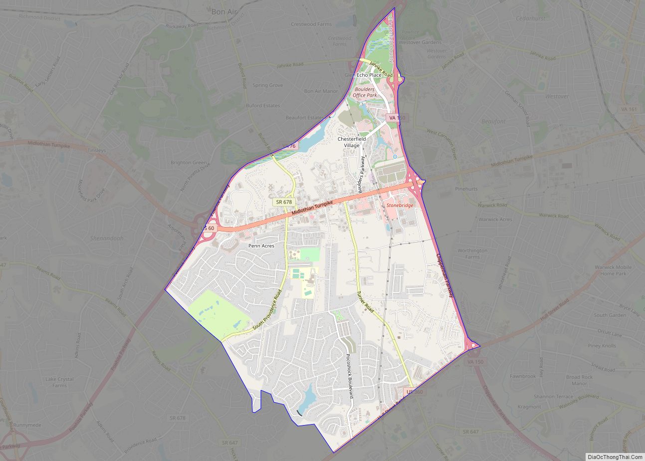
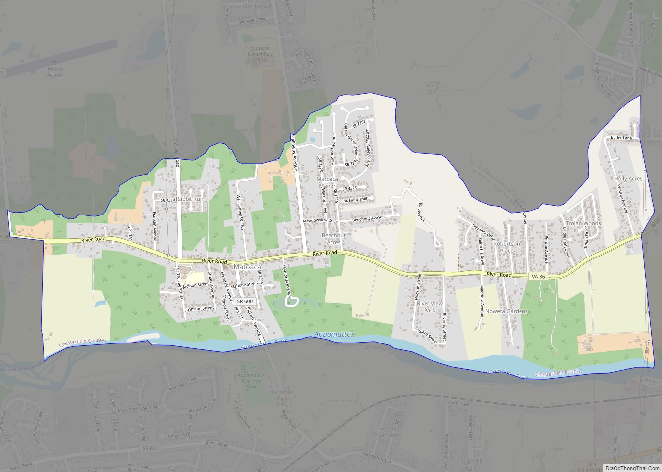
Online Interactive Map
Click on ![]() to view map in "full screen" mode.
to view map in "full screen" mode.
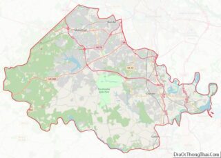
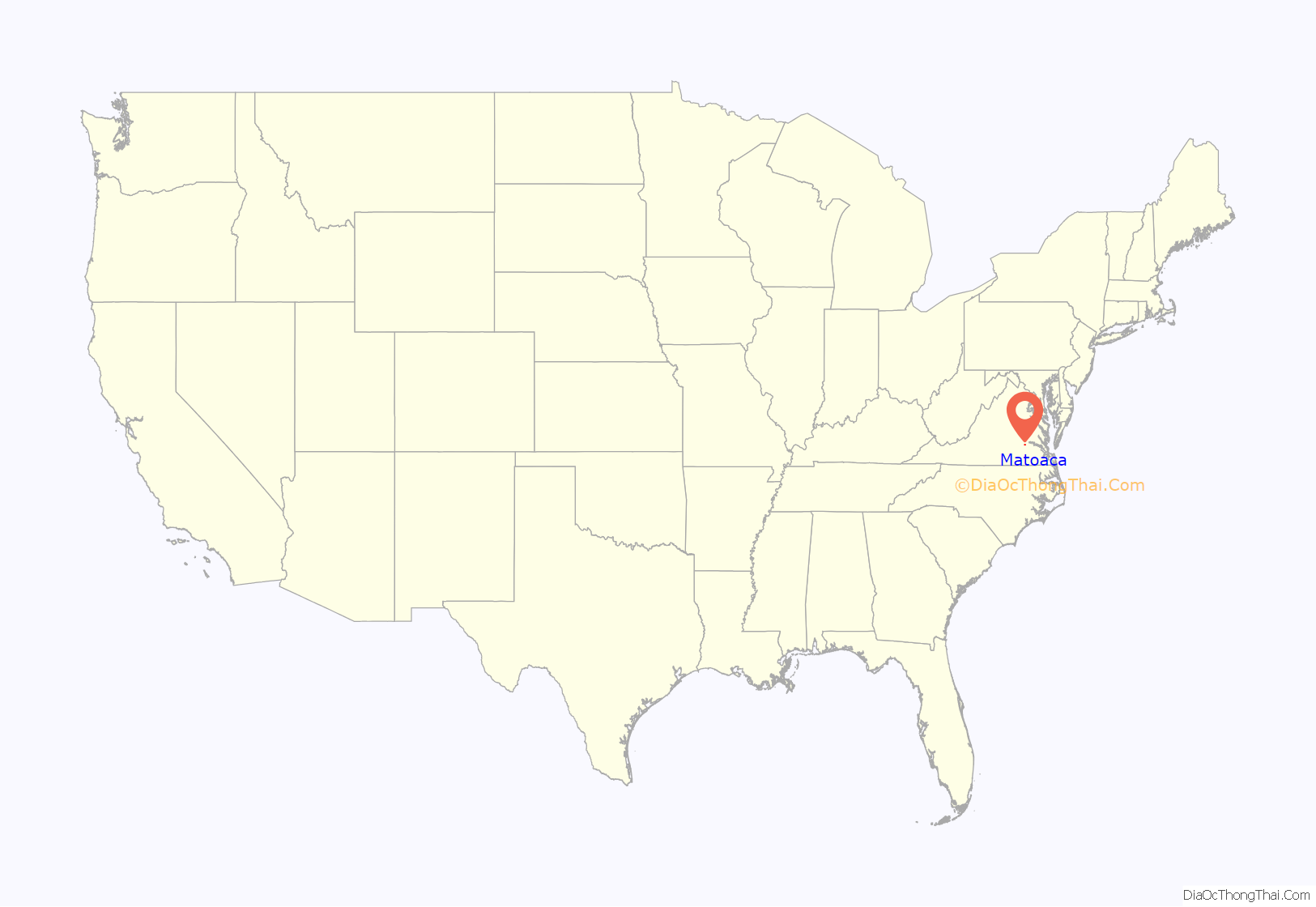
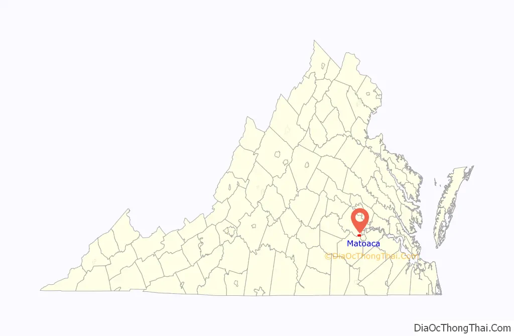
Matoaca location map. Where is Matoaca CDP?
History
Olive Hill was listed on the National Register of Historic Places in 1975.
The Appomattox River is a nearly 160-mile-long water source once used as a pathway for early colonists. Its name is derived from the Indian tribe that once inhabited its banks. Because the Appomattox runs into the James River, it was a crucial port in Virginia during the Civil War as it allowed for larger ships to dock when necessary. In the spring of 1865, after the town of Petersburg had been taken over and destroyed during the Appomattox Campaign, the Confederates attempted to slow the persecution by the Union Army by burning the high bridge that ran across the Appomattox River. Failing to do so, the Confederate Army was later forced to surrender at Appomattox Court House.
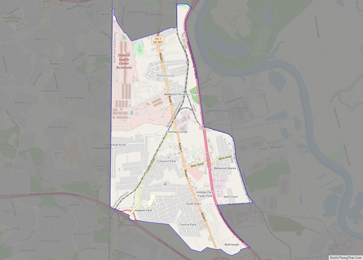
Matoaca Road Map
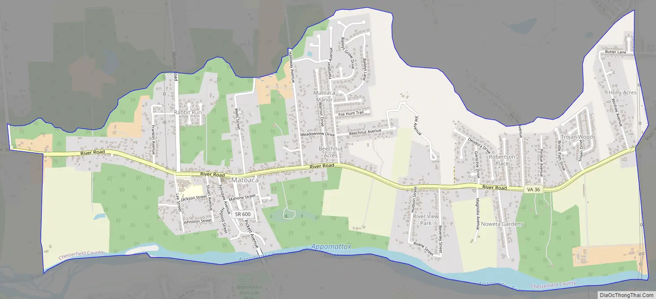
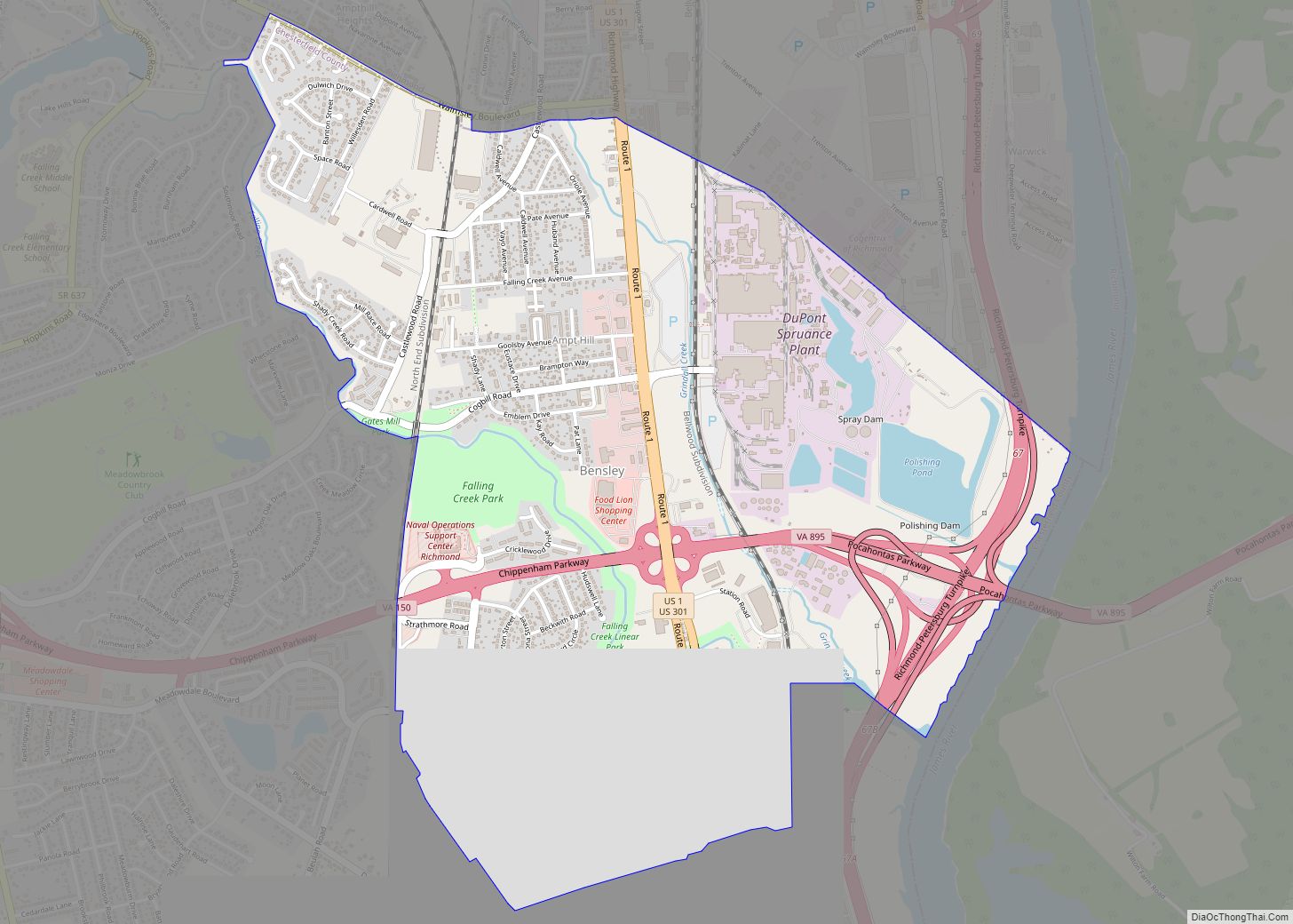
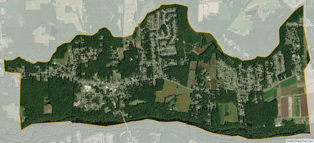
Matoaca city Satellite Map
Geography
Matoaca is located at 37°13′41″N 77°28′14″W / 37.22806°N 77.47056°W / 37.22806; -77.47056 (37.228138, −77.470437).
According to the United States Census Bureau, the CDP has a total area of 2.7 square miles (7.0 km), of which 2.5 square miles (6.5 km) is land and 0.1 square miles (0.26 km), or 4.49%, is water.
See also
Map of Virginia State and its subdivision:- Accomack
- Albemarle
- Alexandria
- Alleghany
- Amelia
- Amherst
- Appomattox
- Arlington
- Augusta
- Bath
- Bedford
- Bedford City
- Bland
- Botetourt
- Bristol
- Brunswick
- Buchanan
- Buckingham
- Buena Vista
- Campbell
- Caroline
- Carroll
- Charles City
- Charlotte
- Charlottesville
- Chesapeake
- Chesterfield
- Clarke
- Clifton Forge City
- Colonial Heights
- Covington
- Craig
- Culpeper
- Cumberland
- Danville
- Dickenson
- Dinwiddie
- Emporia
- Essex
- Fairfax
- Fairfax City
- Falls Church
- Fauquier
- Floyd
- Fluvanna
- Franklin
- Frederick
- Fredericksburg
- Galax
- Giles
- Gloucester
- Goochland
- Grayson
- Greene
- Greensville
- Halifax
- Hampton
- Hanover
- Harrisonburg
- Henrico
- Henry
- Highland
- Hopewell
- Isle of Wight
- James City
- King and Queen
- King George
- King William
- Lancaster
- Lee
- Lexington
- Loudoun
- Louisa
- Lunenburg
- Lynchburg
- Madison
- Manassas
- Manassas Park
- Martinsville
- Mathews
- Mecklenburg
- Middlesex
- Montgomery
- Nelson
- New Kent
- Newport News
- Norfolk
- Northampton
- Northumberland
- Norton
- Nottoway
- Orange
- Page
- Patrick
- Petersburg
- Pittsylvania
- Poquoson
- Portsmouth
- Powhatan
- Prince Edward
- Prince George
- Prince William
- Pulaski
- Radford
- Rappahannock
- Richmond
- Roanoke
- Roanoke City
- Rockbridge
- Rockingham
- Russell
- Salem
- Scott
- Shenandoah
- Smyth
- Southampton
- Spotsylvania
- Stafford
- Staunton
- Suffolk
- Surry
- Sussex
- Tazewell
- Virginia Beach
- Warren
- Washington
- Waynesboro
- Westmoreland
- Williamsburg
- Winchester
- Wise
- Wythe
- York
- Alabama
- Alaska
- Arizona
- Arkansas
- California
- Colorado
- Connecticut
- Delaware
- District of Columbia
- Florida
- Georgia
- Hawaii
- Idaho
- Illinois
- Indiana
- Iowa
- Kansas
- Kentucky
- Louisiana
- Maine
- Maryland
- Massachusetts
- Michigan
- Minnesota
- Mississippi
- Missouri
- Montana
- Nebraska
- Nevada
- New Hampshire
- New Jersey
- New Mexico
- New York
- North Carolina
- North Dakota
- Ohio
- Oklahoma
- Oregon
- Pennsylvania
- Rhode Island
- South Carolina
- South Dakota
- Tennessee
- Texas
- Utah
- Vermont
- Virginia
- Washington
- West Virginia
- Wisconsin
- Wyoming