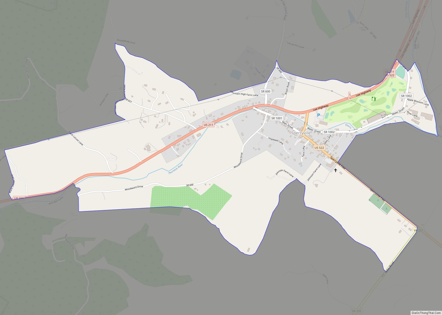
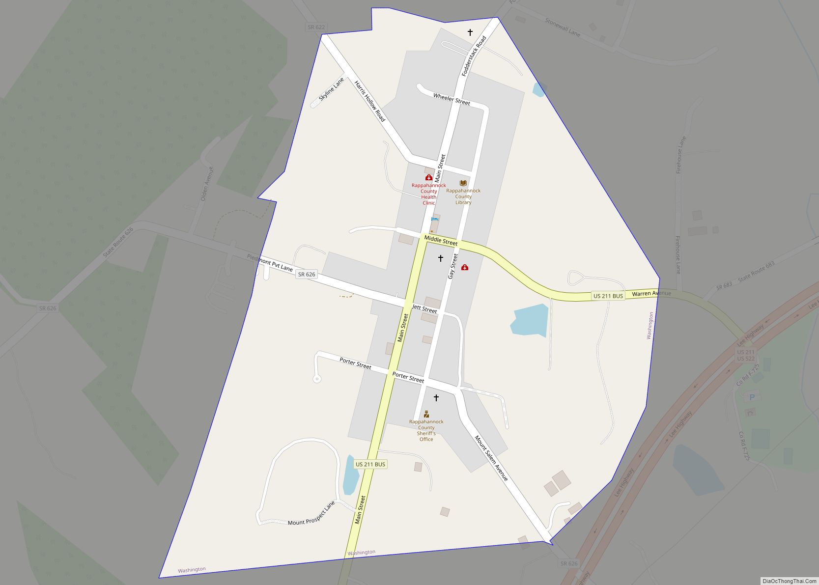
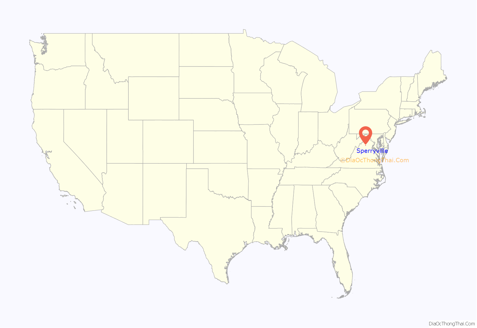
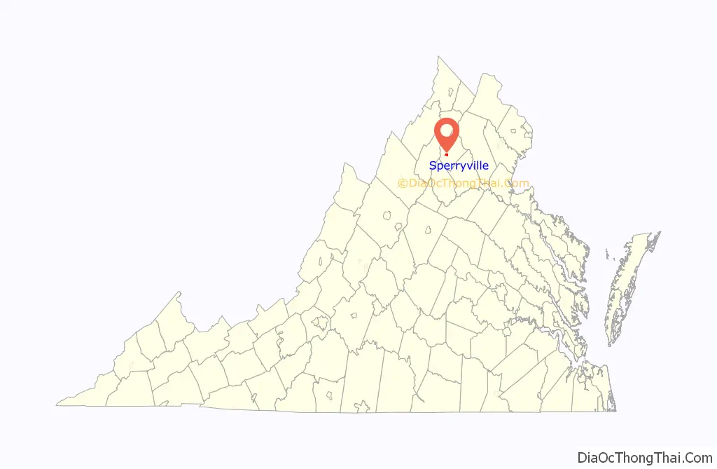
Sperryville is a census-designated place (CDP) located in the western section of Rappahannock County, Virginia, United States, near Shenandoah National Park. It consists of a village with two main streets along the two branches of the Thornton River, together with surrounding pasture- and farmland. The population as of the 2010 Census was 342.
| Name: | Sperryville CDP |
|---|---|
| LSAD Code: | 57 |
| LSAD Description: | CDP (suffix) |
| State: | Virginia |
| County: | Rappahannock County |
| Elevation: | 700 ft (200 m) |
| Total Area: | 342 |
| ZIP code: | 22740 |
| Area code: | 540 |
| FIPS code: | 5174384 |
Online Interactive Map
Click on ![]() to view map in "full screen" mode.
to view map in "full screen" mode.
Sperryville location map. Where is Sperryville CDP?
History
The land on which Sperryville is located is part of 3,000 acres granted by King George II of Great Britain to Francis Thornton in 1731. This land was regranted to Thornton in 1751 by Thomas Fairfax, 6th Lord Fairfax of Cameron, owner of the Northern Neck Proprietary, after Fairfax won his suit to prevent the king from granting land in the Proprietary. Part of this land was inherited by a descendant, also named Francis Thornton, in 1817. He was a soldier in the War of 1812, became a Presbyterian minister, and was sent from his home in Fredericksburg, Virginia, to organize a Presbyterian church in what was then western Culpeper County. In 1820 he began selling small lots of land along the main road (currently Main Street, VA Route 1001). The first deed was for a ½-acre lot “in a little town laid off by me, the said Francis Thornton Jr., and surveyed by Johnston Menefee … the village is in a flat adjoining the lands of John Menefee between the Pass Mill (today’s Fletcher’s Mill) and Thornton’s Gap.” The village of Sperryville is named on an 1821 map of Culpeper County created by John Wood.
On one of the lots, John Hopkins established an ‘ordinary’ that later became a boarding house for immigrant Irish laborers. On another lot was a tavern and stage coach office to serve people traveling from Culpeper Court House to New Market, Virginia. On other lots were a cobbler’s shop, stores, and individual homes. In the early 1800s John Kiger built Conestoga wagons in the area. The post office was established in the village in 1840. In the 1850s several turnpikes were constructed that accessed Sperryville: Thornton’s Gap from Culpeper to Sperryville, Newmarket & Sperryville, and Sperryville-Rappahannock from Sperryville east to the Rappahannock River. A tannery and worker’s homes were constructed in the late 1860s by the Smoot family. Four churches were established in the area by 1880, as well as a woolen mill, seven distillers, two hotels, four general stores, and one saloon. There were also ten corn and flour mills nearby. An apple processing facility was built in 1918 to serve the many local apple orchardists. Sperryville high school was constructed adjacent to the town. In the 1930s, a Civilian Conservation Corps camp located at Beech Spring west of the village provided farmers with a nearby market for produce, meat, milk, and eggs to feed the corpsmen housed there. The Sperryville apple packing and juice plant was created on the site of the former Smoot tannery.
The Sperryville Historic District was listed on the Virginia Landmarks Registry in 1982 and on the National Register of Historic Places in 1983.
Sperryville Road Map
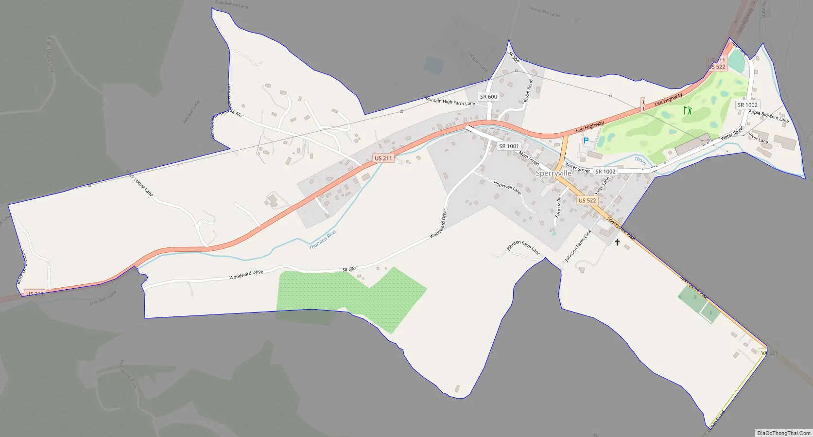
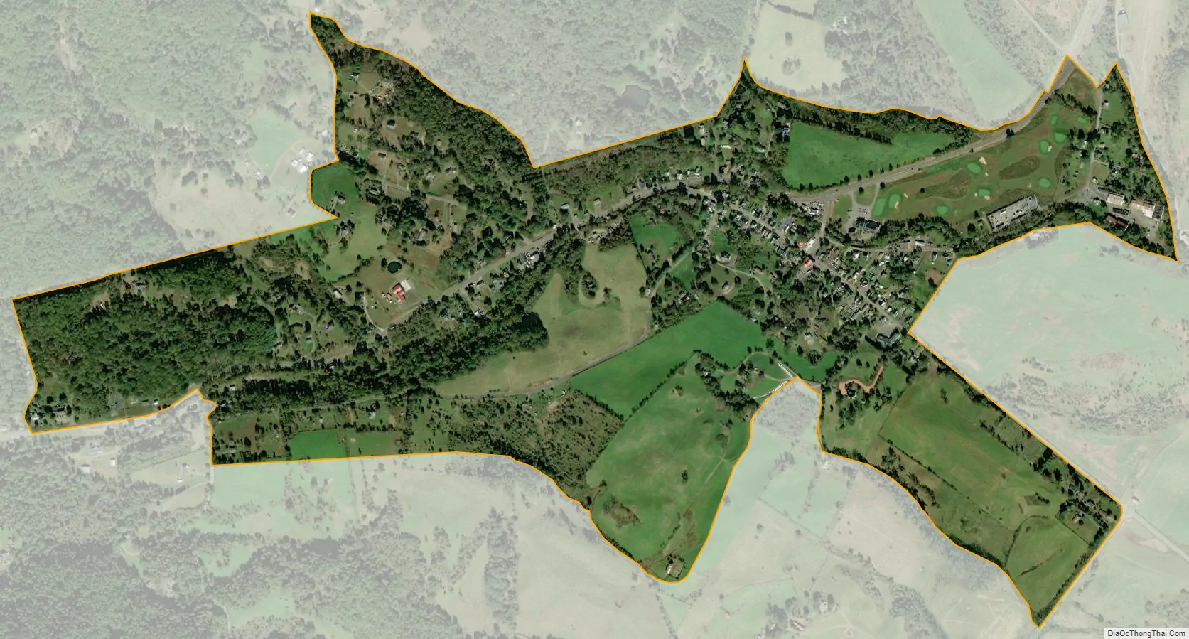
Sperryville city Satellite Map
See also
Map of Virginia State and its subdivision:- Accomack
- Albemarle
- Alexandria
- Alleghany
- Amelia
- Amherst
- Appomattox
- Arlington
- Augusta
- Bath
- Bedford
- Bedford City
- Bland
- Botetourt
- Bristol
- Brunswick
- Buchanan
- Buckingham
- Buena Vista
- Campbell
- Caroline
- Carroll
- Charles City
- Charlotte
- Charlottesville
- Chesapeake
- Chesterfield
- Clarke
- Clifton Forge City
- Colonial Heights
- Covington
- Craig
- Culpeper
- Cumberland
- Danville
- Dickenson
- Dinwiddie
- Emporia
- Essex
- Fairfax
- Fairfax City
- Falls Church
- Fauquier
- Floyd
- Fluvanna
- Franklin
- Frederick
- Fredericksburg
- Galax
- Giles
- Gloucester
- Goochland
- Grayson
- Greene
- Greensville
- Halifax
- Hampton
- Hanover
- Harrisonburg
- Henrico
- Henry
- Highland
- Hopewell
- Isle of Wight
- James City
- King and Queen
- King George
- King William
- Lancaster
- Lee
- Lexington
- Loudoun
- Louisa
- Lunenburg
- Lynchburg
- Madison
- Manassas
- Manassas Park
- Martinsville
- Mathews
- Mecklenburg
- Middlesex
- Montgomery
- Nelson
- New Kent
- Newport News
- Norfolk
- Northampton
- Northumberland
- Norton
- Nottoway
- Orange
- Page
- Patrick
- Petersburg
- Pittsylvania
- Poquoson
- Portsmouth
- Powhatan
- Prince Edward
- Prince George
- Prince William
- Pulaski
- Radford
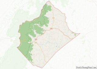
- Rappahannock
- Richmond
- Roanoke
- Roanoke City
- Rockbridge
- Rockingham
- Russell
- Salem
- Scott
- Shenandoah
- Smyth
- Southampton
- Spotsylvania
- Stafford
- Staunton
- Suffolk
- Surry
- Sussex
- Tazewell
- Virginia Beach
- Warren
- Washington
- Waynesboro
- Westmoreland
- Williamsburg
- Winchester
- Wise
- Wythe
- York
- Alabama
- Alaska
- Arizona
- Arkansas
- California
- Colorado
- Connecticut
- Delaware
- District of Columbia
- Florida
- Georgia
- Hawaii
- Idaho
- Illinois
- Indiana
- Iowa
- Kansas
- Kentucky
- Louisiana
- Maine
- Maryland
- Massachusetts
- Michigan
- Minnesota
- Mississippi
- Missouri
- Montana
- Nebraska
- Nevada
- New Hampshire
- New Jersey
- New Mexico
- New York
- North Carolina
- North Dakota
- Ohio
- Oklahoma
- Oregon
- Pennsylvania
- Rhode Island
- South Carolina
- South Dakota
- Tennessee
- Texas
- Utah
- Vermont
- Virginia
- Washington
- West Virginia
- Wisconsin
- Wyoming