Stephens City (/ˈstiːvənz/ STEE-vənz) is an incorporated town in the southern part of Frederick County, Virginia, United States, with a population of 1,829 at the time of the 2010 census. and an estimated population in 2018 of 2,041. Founded by Peter Stephens in the 1730s, the colonial town was chartered and named for Lewis Stephens (Peter’s only son) in October 1758. It was originally settled by German Protestants from Heidelberg. Stephens City is the second-oldest municipality in the Shenandoah Valley after nearby Winchester, which is about 5 mi (8 km) to the north. “Crossroads”, the first free black community in the Valley in the pre-Civil War years, was founded east of town in the 1850s. Crossroads remained until the beginning of the Civil War when the freed African Americans either escaped or were recaptured. Stephens City was saved from intentional burning in 1864 by Union Major Joseph K. Stearns. The town has gone through several name changes in its history, starting as “Stephensburg”, then “Newtown”, and finally winding up as “Stephens City”, though it nearly became “Pantops”. Interstate 81 and U.S. Route 11 pass close to and through the town, respectively.
A large section of the center of the town, including buildings and homes, covering 65 acres (26 ha), is part of the Newtown–Stephensburg Historic District and was listed on the National Register of Historic Places in 1992. Stephens City celebrated its 250th anniversary on October 12, 2008. The town is a part of the Winchester, Virginia-West Virginia Metropolitan Statistical Area, an offshoot of the Washington–Baltimore–Northern Virginia, DC–MD–VA–WV Combined Statistical Area. It is a member of the Winchester–Frederick County Metropolitan Planning Organization.
| Name: | Stephens City town |
|---|---|
| LSAD Code: | 43 |
| LSAD Description: | town (suffix) |
| State: | Virginia |
| County: | Frederick County |
| Founded: | October 12, 1758 |
| Elevation: | 764 ft (233 m) |
| Total Area: | 2.46 sq mi (6.36 km²) |
| Land Area: | 2.43 sq mi (6.28 km²) |
| Water Area: | 0.03 sq mi (0.08 km²) |
| Total Population: | 1,829 |
| Population Density: | 850.37/sq mi (328.37/km²) |
| ZIP code: | 22655 |
| Area code: | 540 |
| FIPS code: | 5175344 |
| GNISfeature ID: | 1500159 |
| Website: | stephenscity.org |
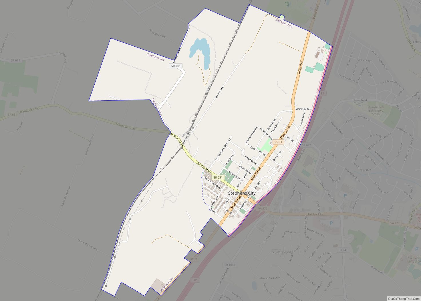
Online Interactive Map
Click on ![]() to view map in "full screen" mode.
to view map in "full screen" mode.
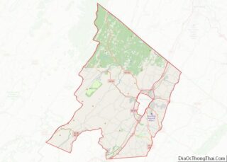
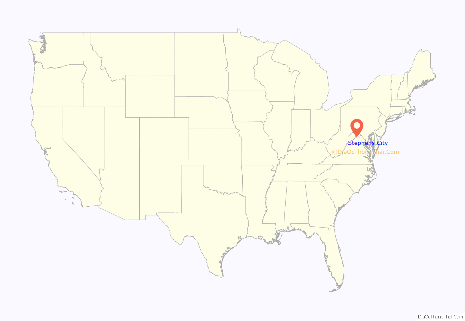
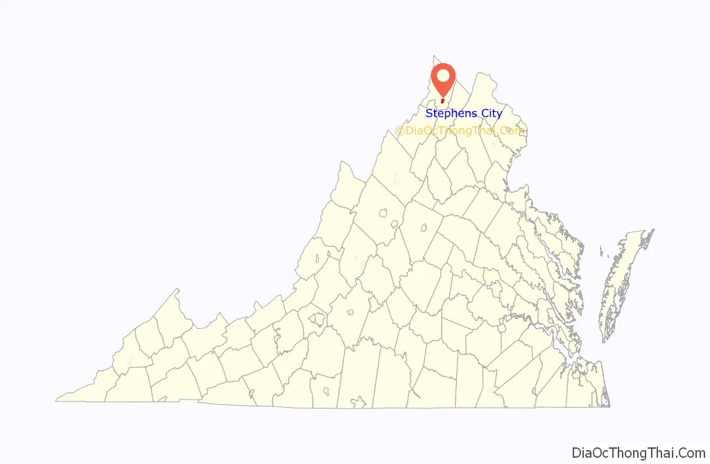
Stephens City location map. Where is Stephens City town?
History
Founding and early days
Jost Hite, a German immigrant, purchased a large land grant in the northern Shenandoah Valley in 1731. Peter Stephens and a small party of German Protestants from Heidelberg, in the Palatinate, arrived about 1732 to buy and settle that land, including the site of what became Stephens City, named for the Stephens family. Although Hite’s title to the land was challenged by Thomas Fairfax, 6th Lord Fairfax of Cameron, the land baron of the area, the matter was settled amicably.
Town lots were laid out beginning in 1754, and on September 21, 1758, Lewis Stephens petitioned the colonial government of Virginia in Williamsburg for a town charter. The Virginia General Assembly approved the charter for the town of “Stephensburgh” on October 12, 1758. The mostly German-speaking residents soon left off the “h”; the town was usually spelled “Stephensburg”. By the start of the Revolutionary War, Stephensburg was often called simply “New Town” or “Newtown”, as the new settlement on the Great Wagon Road south of Winchester.
Shenandoah Valley and Newtown’s central location attracted heavy traffic through the region, and wagon-making emerged as an important industry for the town; Newtown artisans supplied wagons throughout the state. By 1830, the town’s population had reached 800. In the late 1850s, free blacks began a settlement about a mile east of town which became known as “Crossroads” or “Freetown”, which lasted until the time of the Civil War. After the January 1, 1863, Emancipation Proclamation, most of the newly freed slaves and many of the already free blacks left the area.
When the Civil War broke out in 1861, the majority of Newtown’s young men joined Confederate forces. During the war, the town was “between the lines”, nominally controlled by the Union but with much Confederate partisan activity. On May 24, 1862, Stonewall Jackson’s Confederate forces advanced northward on the Valley Pike and attacked Union troops. At Newtown, General George Henry Gordon of the Second Massachusetts Infantry ordered his Federal troops to make a stand. The skirmishing involved heavy artillery fire, but Gordon’s men retreated without loss of the important supply wagons. When Gordon left the town to Jackson’s forces, both sides claimed a victory.
In June 1864, Major Joseph K. Stearns of the 1st New York Cavalry arrived under orders to burn the town down to help stop Confederate ambushes on the wagon road. Because the remaining population mostly consisted of women, children and the elderly, Stearns allowed the town to stand. He required the adult residents to take the “Ironclad oath”, in which they swore that they had not voluntarily provided aid to the Confederacy. The government required the oath, effectively excluding ex-Confederates from the political arena during the Reconstruction era.
In April 1867, the Virginia General Assembly granted a charter to the Winchester and Strasburg Railroad Company. The company was authorized to construct a rail line between Winchester and Strasburg, linking Newtown to the rest of the nation by railroad for the first time. Though the railroad improved the local economy, which had lagged after the end of the war, it decimated the wagon-building trade. In 1880, the United States Post Office Department, faced with nearly a dozen Newtowns in Virginia, announced that the local post office would be renamed “Pantops”. Dissatisfied with the name, the townsfolk chose “Stephens City”.
20th century to present
The 20th century brought improvements to energy and domestic systems: electrical service was introduced in 1915; and in 1941, just before World War II, the town installed a water system. The construction of Interstate 81 (I-81) during the early 1960s depressed business development in the town. The wagon road, which had been made part of U.S. Route 11, had led traffic through the center of town, but the interstate passed less than a tenth of a mile to the east, drawing off development, retail trade and ultimately, businesses. This caused downtown to decline. Developers constructed new residential subdivisions both within and outside the town boundaries to the east for access to I-81.
The town surveyed its older buildings to establish architectural significance and to determine those that contributed to the town’s historic center. The Newtown–Stephensburg Historic District was listed on the National Register of Historic Places in August 1992. Renovation of the town center has attracted heritage tourism. Anticipating more growth, the town annexed 360 acres (1.5 km) of unincorporated Frederick County in 2005, another 100 acres (0.4 km) in 2006, and 175 acres (0.7 km) in 2007. The town celebrated its 250th anniversary on October 12, 2008.
Virginia school systems had practiced resistance following the United States Supreme Court ruling in Brown v. Board of Education (1954) that segregated public schools were unconstitutional. The United States District Court for the Western District of Virginia ordered Frederick County schools desegregated (including those serving Stephens City) in Brown v. County School Board (1964). In 1994, Virgil E. Watson was elected as the first African American to serve on the Stephens City Town Council. Watson served for one term, from 1994 until 1998.
On September 17, 2004, remnants of Hurricane Ivan spawned an F1 tornado that touched down just south of the town along Interstate 81. It caused approximately $1 million in damage and injured two people. It was one of a record 40 tornadoes to hit northern Virginia that day.
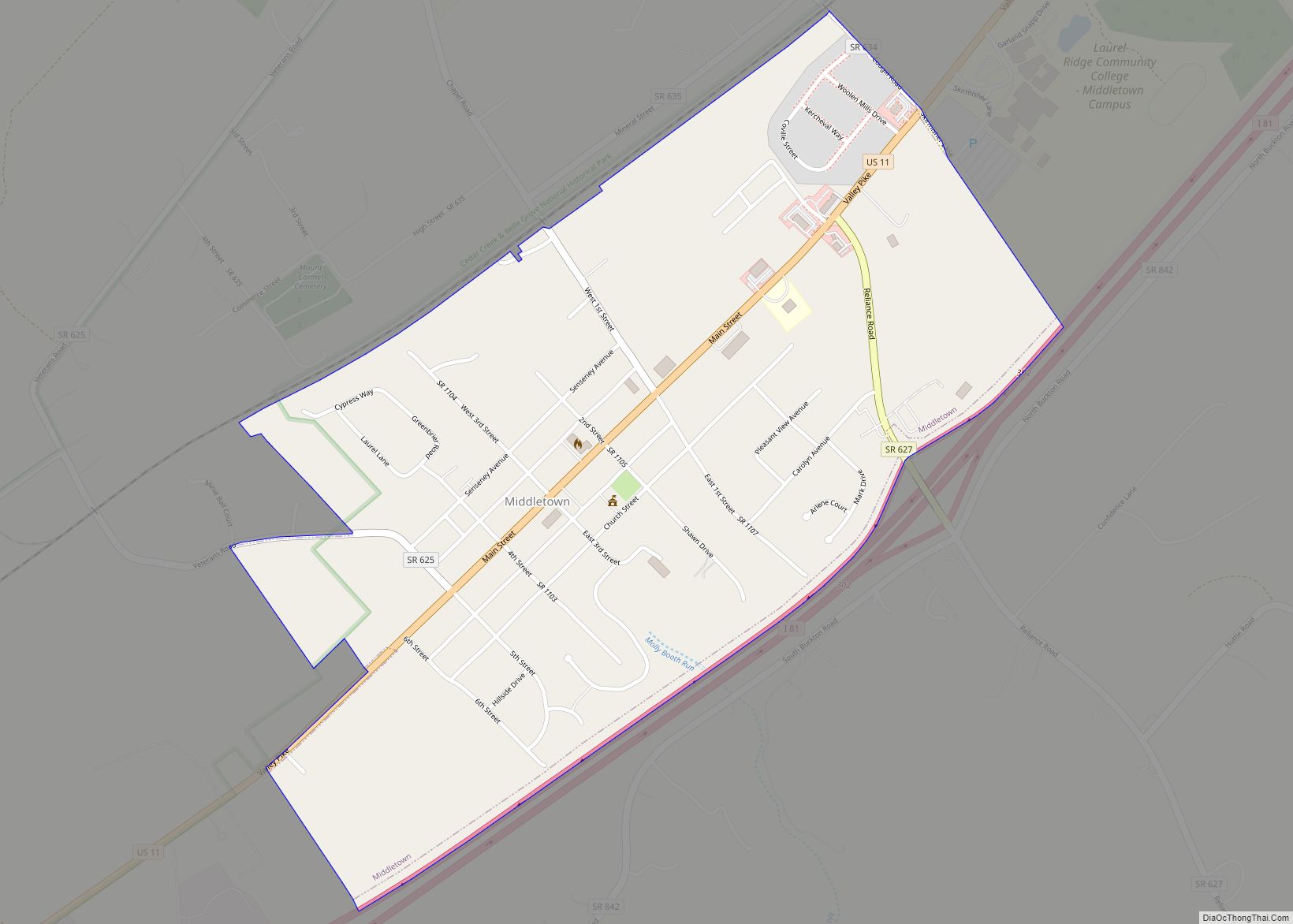
Stephens City Road Map
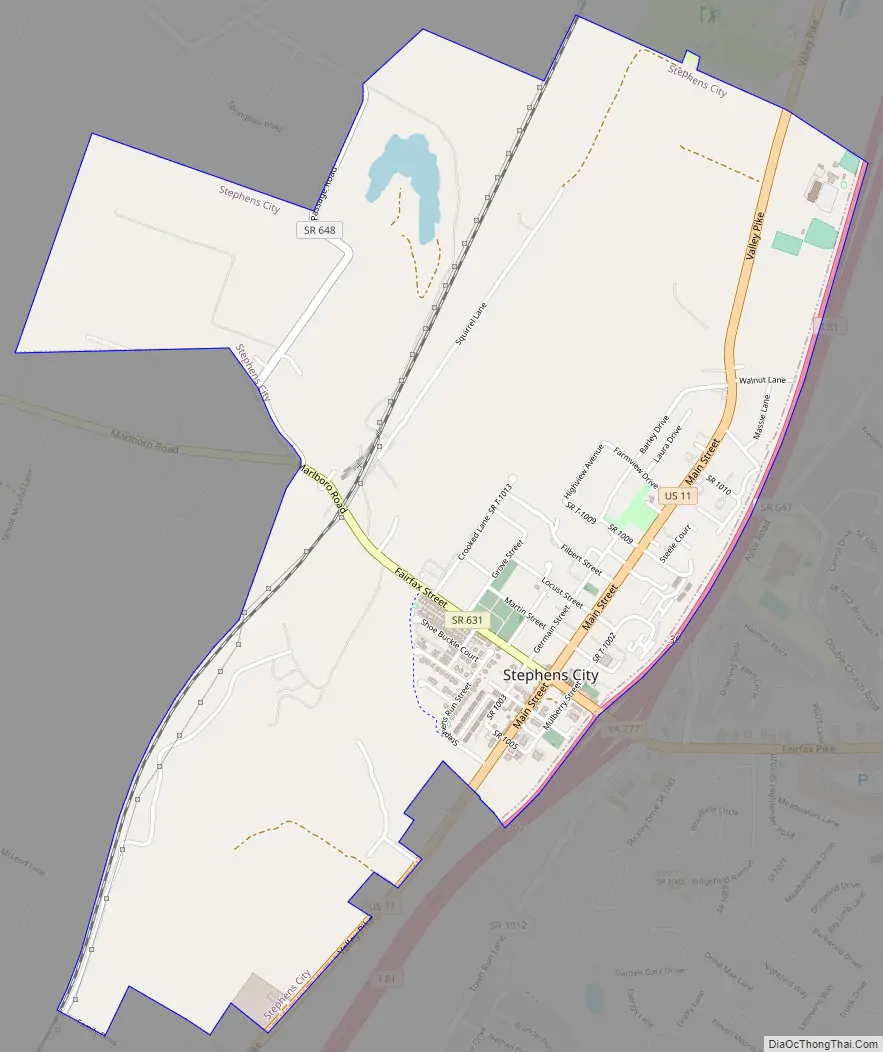
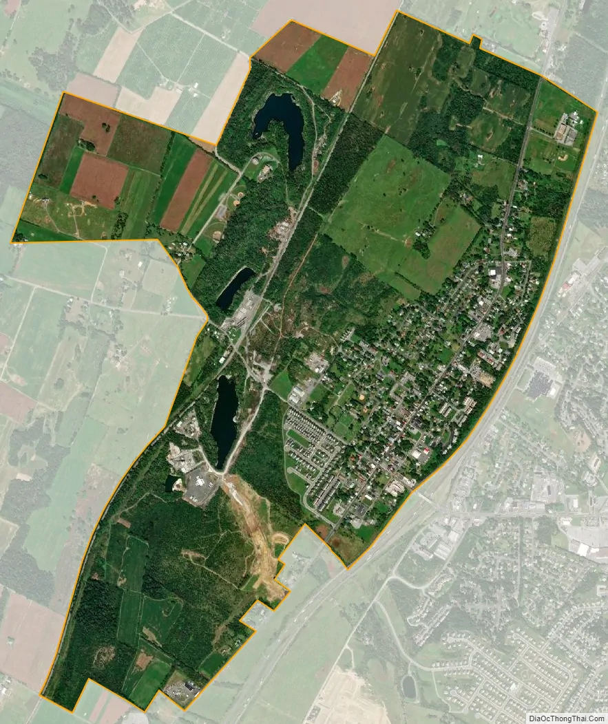
Stephens City city Satellite Map
Geography
The town is located between the Blue Ridge Mountains and the Appalachian Mountains in the northern Shenandoah Valley of Virginia in close proximity to West Virginia, Maryland, and Pennsylvania. Washington, D.C., is approximately 70 mi (110 km) to the east and the center of Baltimore is 105 mi (169 km) to the northeast by highway.
According to the U.S. Census Bureau, the town has an area of 2.4 sq mi (6.3 km), of which 0.03 sq mi (0.08 km), or 1.21%, are water. The area within the town limits drains south to Stephens Run, a tributary of the Shenandoah River, and east and north to Opequon Creek, a direct tributary of the Potomac River.
Climate
Stephens City is located in the humid subtropical climate zone (Köppen climate classification: Cfa), exhibiting four distinct seasons. Its climate is typical of Mid-Atlantic U.S. areas removed from bodies of water. The town is located in plant hardiness zone 7 throughout the town and surrounding Frederick County, indicating a temperate climate. Spring and fall are warm, with low humidity, while winter is cool, with annual snowfall averaging 15.0 in (38 cm). Average winter lows tend to be around 30 °F (−1 °C) from mid-December to mid-February. Blizzards affect Stephens City on average once every four to six years. The most violent nor’easters typically feature high winds, heavy rains, and occasional snow. These storms often affect large sections of the U.S. East Coast.
Summers are hot and humid; during this season, highs average in the upper 80s °F (lower 30s °C) and lows average in the upper 60s °F (lower 20s °C). The combination of heat and humidity in the summer brings very frequent thunderstorms, some of which occasionally produce tornadoes in the area. While hurricanes (or their remnants) occasionally track through the area in late summer and early fall, they have often weakened by the time they reach Stephens City, partly due to the city’s far inland location.
The highest recorded temperature was 107 °F (42 °C) in 1988, while the lowest recorded temperature was −18 °F (−28 °C) in 1983.
See also
Map of Virginia State and its subdivision:- Accomack
- Albemarle
- Alexandria
- Alleghany
- Amelia
- Amherst
- Appomattox
- Arlington
- Augusta
- Bath
- Bedford
- Bedford City
- Bland
- Botetourt
- Bristol
- Brunswick
- Buchanan
- Buckingham
- Buena Vista
- Campbell
- Caroline
- Carroll
- Charles City
- Charlotte
- Charlottesville
- Chesapeake
- Chesterfield
- Clarke
- Clifton Forge City
- Colonial Heights
- Covington
- Craig
- Culpeper
- Cumberland
- Danville
- Dickenson
- Dinwiddie
- Emporia
- Essex
- Fairfax
- Fairfax City
- Falls Church
- Fauquier
- Floyd
- Fluvanna
- Franklin
- Frederick
- Fredericksburg
- Galax
- Giles
- Gloucester
- Goochland
- Grayson
- Greene
- Greensville
- Halifax
- Hampton
- Hanover
- Harrisonburg
- Henrico
- Henry
- Highland
- Hopewell
- Isle of Wight
- James City
- King and Queen
- King George
- King William
- Lancaster
- Lee
- Lexington
- Loudoun
- Louisa
- Lunenburg
- Lynchburg
- Madison
- Manassas
- Manassas Park
- Martinsville
- Mathews
- Mecklenburg
- Middlesex
- Montgomery
- Nelson
- New Kent
- Newport News
- Norfolk
- Northampton
- Northumberland
- Norton
- Nottoway
- Orange
- Page
- Patrick
- Petersburg
- Pittsylvania
- Poquoson
- Portsmouth
- Powhatan
- Prince Edward
- Prince George
- Prince William
- Pulaski
- Radford
- Rappahannock
- Richmond
- Roanoke
- Roanoke City
- Rockbridge
- Rockingham
- Russell
- Salem
- Scott
- Shenandoah
- Smyth
- Southampton
- Spotsylvania
- Stafford
- Staunton
- Suffolk
- Surry
- Sussex
- Tazewell
- Virginia Beach
- Warren
- Washington
- Waynesboro
- Westmoreland
- Williamsburg
- Winchester
- Wise
- Wythe
- York
- Alabama
- Alaska
- Arizona
- Arkansas
- California
- Colorado
- Connecticut
- Delaware
- District of Columbia
- Florida
- Georgia
- Hawaii
- Idaho
- Illinois
- Indiana
- Iowa
- Kansas
- Kentucky
- Louisiana
- Maine
- Maryland
- Massachusetts
- Michigan
- Minnesota
- Mississippi
- Missouri
- Montana
- Nebraska
- Nevada
- New Hampshire
- New Jersey
- New Mexico
- New York
- North Carolina
- North Dakota
- Ohio
- Oklahoma
- Oregon
- Pennsylvania
- Rhode Island
- South Carolina
- South Dakota
- Tennessee
- Texas
- Utah
- Vermont
- Virginia
- Washington
- West Virginia
- Wisconsin
- Wyoming