Stuart is a town in Patrick County, Virginia, where it is the county seat. The population was 1,408 at the 2010 census. The town of Stuart was named after Confederate Gen. J.E.B. Stuart, of nearby Ararat, Virginia.
| Name: | Stuart town |
|---|---|
| LSAD Code: | 43 |
| LSAD Description: | town (suffix) |
| State: | Virginia |
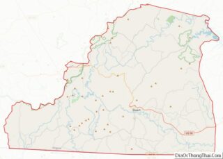
| County: | Patrick County |
| Founded: | 1792 |
| Elevation: | 1,345 ft (410 m) |
| Total Area: | 3.04 sq mi (7.87 km²) |
| Land Area: | 3.04 sq mi (7.87 km²) |
| Water Area: | 0.00 sq mi (0.00 km²) |
| Total Population: | 1,408 |
| Population Density: | 418.37/sq mi (161.53/km²) |
| ZIP code: | 24171 |
| Area code: | 276 |
| FIPS code: | 5176256 |
| GNISfeature ID: | 1500182 |
| Website: | http://www.townofstuartva.com/ |
Online Interactive Map
Click on ![]() to view map in "full screen" mode.
to view map in "full screen" mode.
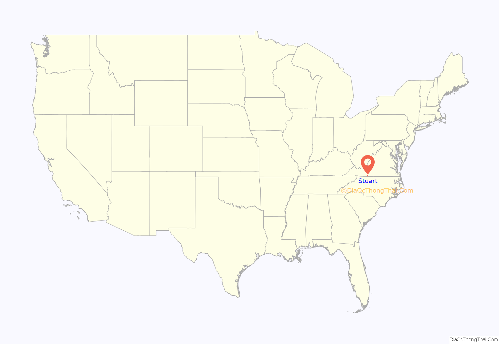
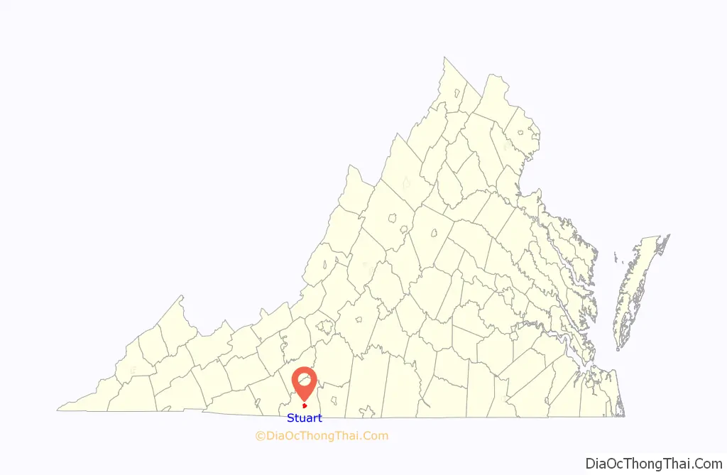
Stuart location map. Where is Stuart town?
History
Incorporation (1753–1830)
The Town of Stuart was first incorporated as Taylorsville, Virginia, in 1792, in honor of early settler George Taylor. Stuart has been the county seat of Patrick County since 1791, when the county was organized from territory of Henry County, Virginia. The Patrick County Courthouse was built in the center of the town. What is now designated as the Stuart Uptown Historic District encompasses the historic core of the county seat. It includes government, financial, religious, and commercial buildings dating from the mid-nineteenth to the mid-twentieth centuries.
Antebellum (1831–1860)
By 1850, Taylorsville had grown to include approximately 50 dwellings and businesses. The 1850 census reported 18 households with 50 adults (including 29 boarders) and 60 children living in the area of the courthouse. Occupations listed included four farmers, two innkeepers, three merchants, attorneys, two physicians, two cabinetmakers, two saddlers, one harness maker, three tailors, one bricklayer, nine laborers, a clerk, a mail carrier, and a sheriff with two deputies. The Danville and Wytheville Turnpike, the predecessor to the present-day Virginia State Route 58, was established in the 1850s. In 1848, the Richmond and Danville Railroad was chartered, and tracks were completed to Danville by 1856.
Civil War, reconstruction and growth (1860–1916)
Following the economic difficulties of the Civil War, the residents of Taylorsville focused their energies on expanding railroads to connect to markets and boost the economy. The Danville and New River Railroad was chartered in 1873, with the line completed to Martinsville, Virginia in nearby Henry County by 1881. In 1883, citizens of Patrick County approved a bond of $150,000 to expand the line. The first train pulled into Taylorsville in August 1884. With the growth associated with the railroad, Taylorsville was incorporated as a town in 1884 and was renamed Stuart in honor of Confederate Major General J.E.B. Stuart, who was born 20 miles west of town in Ararat, Virginia.
Following the completion of the railroad, the town of Stuart continued to grow steadily. The population increased 25% from 300 in 1884 to 371 in 1900. While occupations continued to center around the courthouse functions and the typical needs of a trading center, the 1900 census reflects the influence of the railroad by recording four railroad employees, eight salesmen, one insurance agent, one mining engineer, and one timber dealer. Five teachers, three hotels, two druggists, and two bartenders also indicate the growth of the town. The construction of the railroad led to the distinction of “uptown” and “downtown” Stuart. The original courthouse village was situated at the crest of a hill. An industrial and commercial area developed adjacent to the railroad, which was located further downhill along the flats of the Mayo River. “Uptown” continued to serve as the center of the town with the courthouse, churches, school, attorneys’ offices, banks, hotels, and stores. The two areas, however, were closely related and interdependent; the town’s first telephone line at the turn of the twentieth century was run between the railroad depot downtown and the Hotel Perkins uptown.
World War I to World War II (1917–1945)
Before 1915, no public water or sewer system was available. People gained their drinking water from private wells or from nearby springs. There were no streetlights, and oil lamps were used for interior lighting, the roads were unpaved and the sidewalks were wooden. After the water system was installed, it was well received. By 1926 the population of the town had increased so much that improvements needed to be made.
In 1916, the Clark Power and Light Company established the first electric light system in Stuart. Each customer was charged a flat rate of $1.25 per month, and if 300 citizens bought into the system, Clark would allow the lights to burn all night. The Stuart Power and Light Company bought them out, and they were sold to the Virginia East Coast Utilities Company. In 1938, during the Great Depression, the Appalachian Electric Power Company bought them out. Joseph H. Vipperman, a Stuart native, was the president of this company when its name was changed to American Electric Power. The first telegraph was installed in Stuart with completion of the railroad here in 1884.
Reportedly the first telephone was operated at the Hotel Perkins. By 1923, ten lines served the county, each with a central; the Stuart central was located in the home of Walter S. Gilbert. In 1937, the Lee Telephone Company acquired all the private lines. In 1974, the Central Telephone Company of Virginia bought out the Lee Company. Years later Sprint/Centel bought them out and now Centurylink serves Patrick County.
Travel to Stuart was difficult until the first hard-paved road reached Stuart from Martinsville in 1925. In 1929, a nine-mile stretch from Stuart to the North Carolina state line south was paved and improved. In 1930, the three miles to Cruzes (Cruises) Store was paved, and in 1932, the road was extended to Hillsville, Virginia. Today, State Routes 8 and U.S. Route 58 serve the town and the county, and other counties along its east-to-west stretch. Route 58 is a four-lane divided highway, crossing the entire Commonwealth, as well as Patrick County.
By 1940, the population of Stuart had increased to 600 and the majority of the buildings standing today had been constructed. The Patrick County Bank (established in 1890 and later merged with the Bank of Stuart in 1926) constructed its large Classical building directly across from the courthouse in 1911. The two uptown churches, Stuart United Methodist Church and the Stuart Baptist Church, constructed their present-day structures in the early twentieth-century.
Present day
Stuart is a town for all age groups. It has a burgeoning downtown and recent retail developments along the Highway 58 corridor. New additions include the downtown rail trail along the Mayo River, a new Farmer’s Market located within the heart of town, and new sidewalk and infrastructure improvements along Main Street.
The Stuart Uptown Historic District, Goblintown Mill, and Patrick County Courthouse are listed on the National Register of Historic Places.
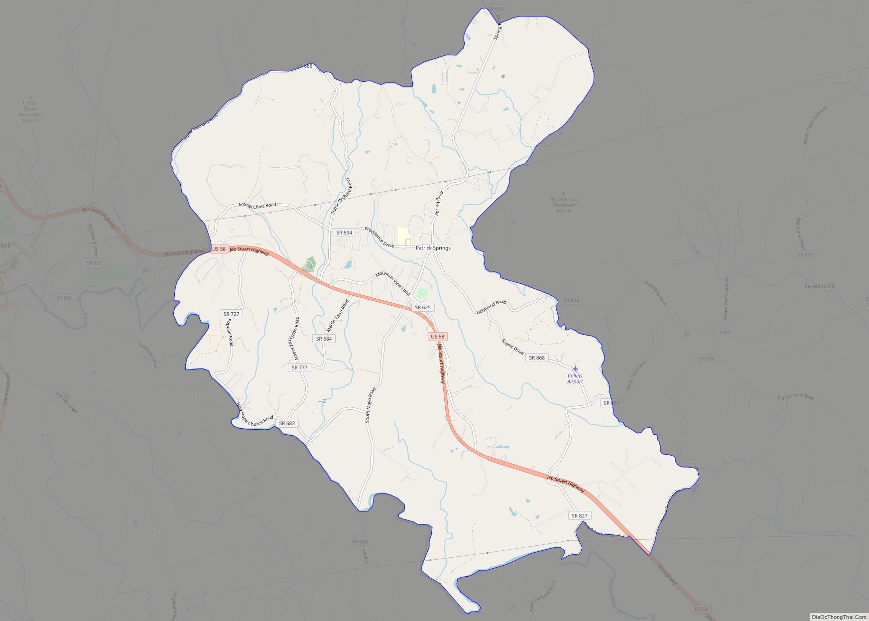
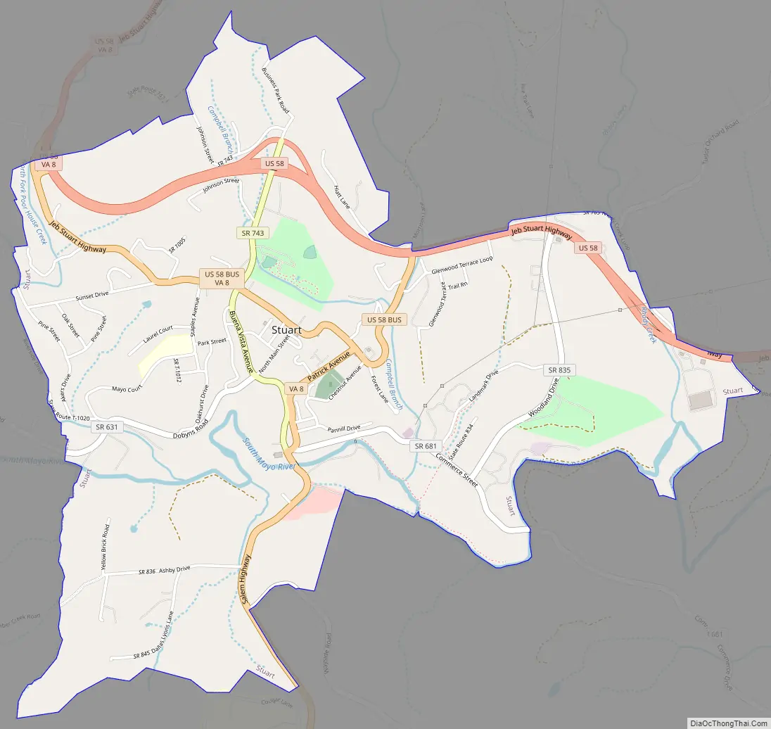
Stuart Road Map
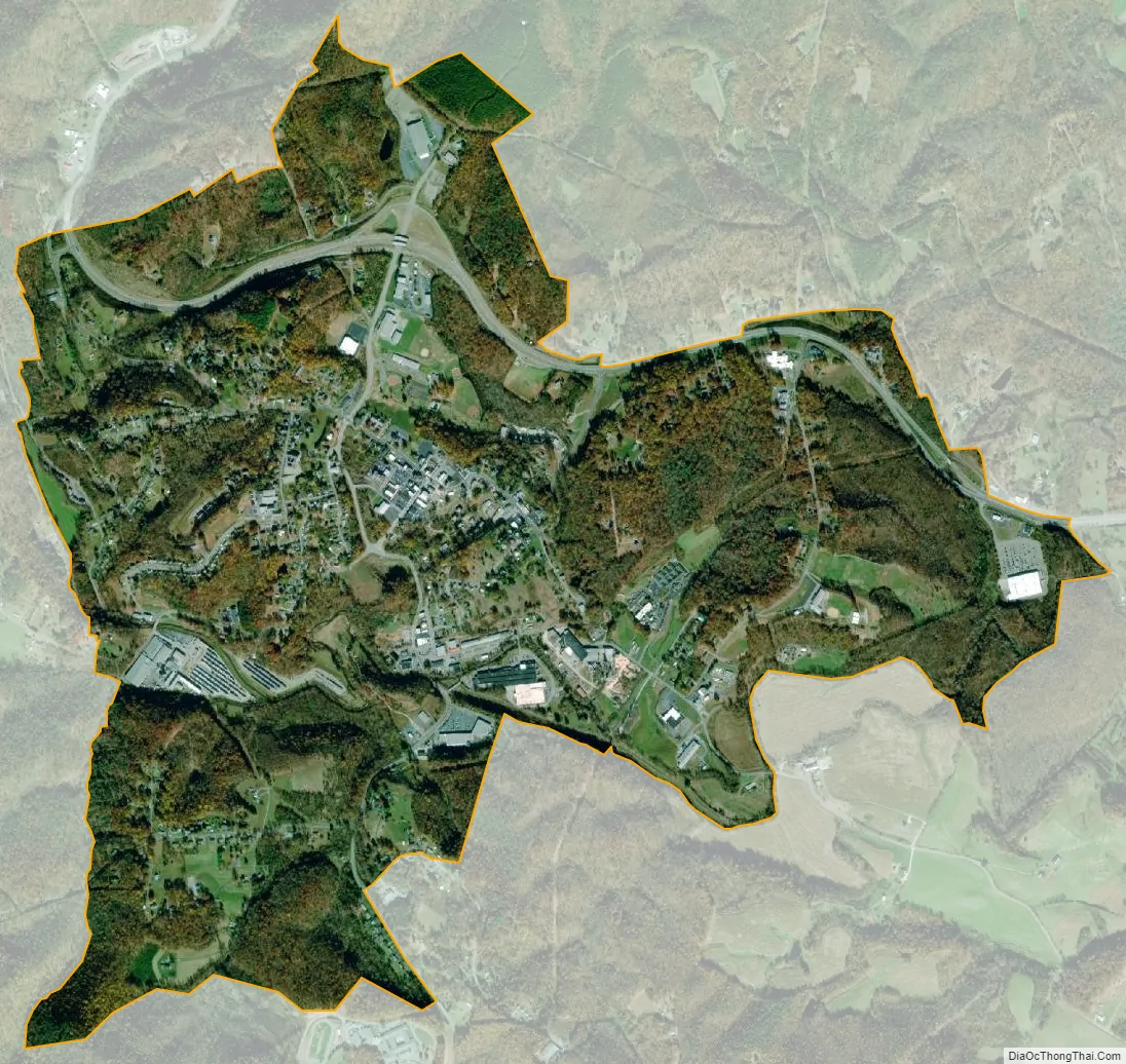
Stuart city Satellite Map
Geography
Stuart is located at 36°38′25″N 80°16′26″W / 36.64028°N 80.27389°W / 36.64028; -80.27389 (36.640197, −80.273940).
According to the United States Census Bureau, the town has a total area of 0.7 square miles (1.9 km), all of it land.
0.7 square miles (1.8 km)
The town of Stuart is a hilly community within a small valley surrounded by the Blue Ridge Mountains. The Mayo River runs through the heart of town, down through Patrick County.
Climate
See also
Map of Virginia State and its subdivision:- Accomack
- Albemarle
- Alexandria
- Alleghany
- Amelia
- Amherst
- Appomattox
- Arlington
- Augusta
- Bath
- Bedford
- Bedford City
- Bland
- Botetourt
- Bristol
- Brunswick
- Buchanan
- Buckingham
- Buena Vista
- Campbell
- Caroline
- Carroll
- Charles City
- Charlotte
- Charlottesville
- Chesapeake
- Chesterfield
- Clarke
- Clifton Forge City
- Colonial Heights
- Covington
- Craig
- Culpeper
- Cumberland
- Danville
- Dickenson
- Dinwiddie
- Emporia
- Essex
- Fairfax
- Fairfax City
- Falls Church
- Fauquier
- Floyd
- Fluvanna
- Franklin
- Frederick
- Fredericksburg
- Galax
- Giles
- Gloucester
- Goochland
- Grayson
- Greene
- Greensville
- Halifax
- Hampton
- Hanover
- Harrisonburg
- Henrico
- Henry
- Highland
- Hopewell
- Isle of Wight
- James City
- King and Queen
- King George
- King William
- Lancaster
- Lee
- Lexington
- Loudoun
- Louisa
- Lunenburg
- Lynchburg
- Madison
- Manassas
- Manassas Park
- Martinsville
- Mathews
- Mecklenburg
- Middlesex
- Montgomery
- Nelson
- New Kent
- Newport News
- Norfolk
- Northampton
- Northumberland
- Norton
- Nottoway
- Orange
- Page
- Patrick
- Petersburg
- Pittsylvania
- Poquoson
- Portsmouth
- Powhatan
- Prince Edward
- Prince George
- Prince William
- Pulaski
- Radford
- Rappahannock
- Richmond
- Roanoke
- Roanoke City
- Rockbridge
- Rockingham
- Russell
- Salem
- Scott
- Shenandoah
- Smyth
- Southampton
- Spotsylvania
- Stafford
- Staunton
- Suffolk
- Surry
- Sussex
- Tazewell
- Virginia Beach
- Warren
- Washington
- Waynesboro
- Westmoreland
- Williamsburg
- Winchester
- Wise
- Wythe
- York
- Alabama
- Alaska
- Arizona
- Arkansas
- California
- Colorado
- Connecticut
- Delaware
- District of Columbia
- Florida
- Georgia
- Hawaii
- Idaho
- Illinois
- Indiana
- Iowa
- Kansas
- Kentucky
- Louisiana
- Maine
- Maryland
- Massachusetts
- Michigan
- Minnesota
- Mississippi
- Missouri
- Montana
- Nebraska
- Nevada
- New Hampshire
- New Jersey
- New Mexico
- New York
- North Carolina
- North Dakota
- Ohio
- Oklahoma
- Oregon
- Pennsylvania
- Rhode Island
- South Carolina
- South Dakota
- Tennessee
- Texas
- Utah
- Vermont
- Virginia
- Washington
- West Virginia
- Wisconsin
- Wyoming