Wytheville (/wɪθvɪll/ Wih-th-vihl) is a town in, and the county seat of, Wythe County, in southwestern Virginia, United States. It is named after George Wythe, a signer of the United States Declaration of Independence, and mentor to Thomas Jefferson. Wytheville’s population was 8,211 at the 2010 census. Interstate Highways 77 and 81 were constructed to intersect at the town, long a crossroads for travelers.
During the American Civil War, Wytheville had a strategic importance. It was attacked in 1863 (Toland’s Raid) and 1865 (Stoneman’s 1865 Raid). The town is the birthplace of Edith Bolling Wilson, second wife of President Woodrow Wilson.
| Name: | Wytheville town |
|---|---|
| LSAD Code: | 43 |
| LSAD Description: | town (suffix) |
| State: | Virginia |
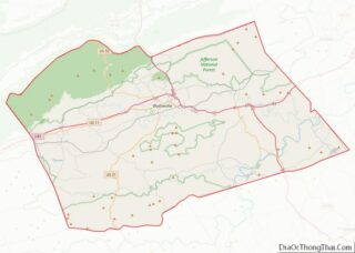
| County: | Wythe County |
| Elevation: | 2,287 ft (697 m) |
| Land Area: | 14.49 sq mi (37.53 km²) |
| Water Area: | 0.09 sq mi (0.24 km²) |
| Population Density: | 546.69/sq mi (211.07/km²) |
| ZIP code: | 24382 |
| Area code: | 276 |
| FIPS code: | 5188000 |
| GNISfeature ID: | 1498537 |
| Website: | http://www.wytheville.org/ |
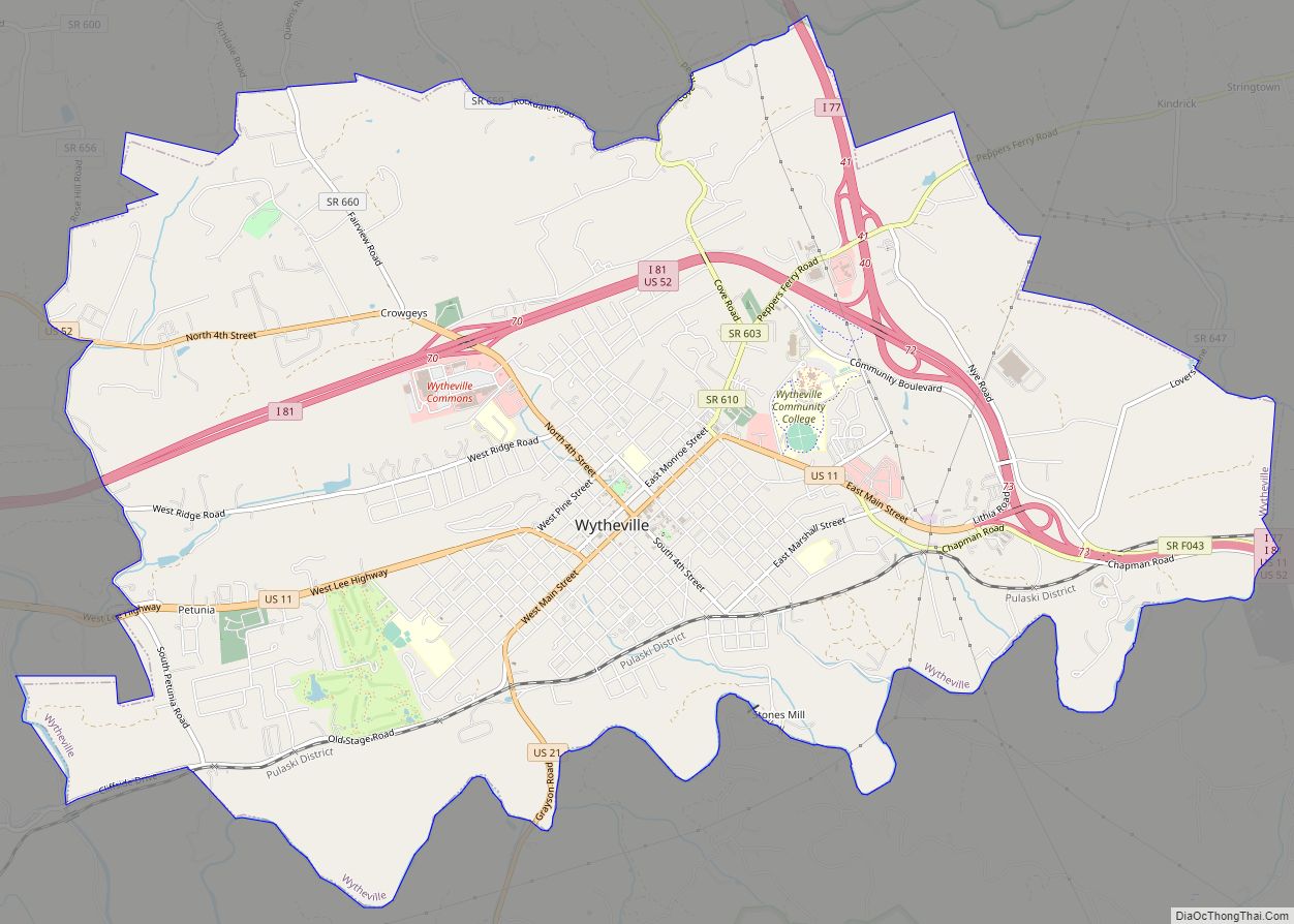
Online Interactive Map
Click on ![]() to view map in "full screen" mode.
to view map in "full screen" mode.
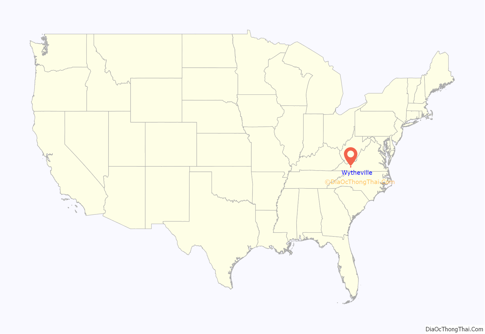
Wytheville location map. Where is Wytheville town?

History
Wythe County was created in 1789 and named for George Wythe, the “father of American Jurisprudence” and signer of the Declaration of Independence. In May 1790, Chris Simmerman donated 90 acres, along with John Davis’s 10 acres, to establish a town and county seat. Robert Adams completed a town survey in November of that year, dividing the area into half-acre lots. The town did not have an official name yet, but was generally known as Wythe Court House.
Two years later, in October 1792, the town was officially named Evansham, for prominent local citizen Jesse Evans. After a disastrous fire in March 1839, the town was renamed Wytheville. At that time, it was home to about 500 residents.
Lynching of Raymond Bird
In 1926 the last documented lynching in Virginia took place here, when Raymond Bird, an African-American man, was murdered by a large group of masked and costumed men while under arrest in the local jail. Bird was accused of raping or assaulting the three white daughters of Grover Grubb, his employer. The two older sisters, both of which bore Bird’s children, were of age and revealed that the relationship was consensual and thus did not constitute a crime. However, he was eventually arrested on the accusation that he assaulted the minor daughter. Bird was shot and killed by the mob in his jail cell, dragged a few miles behind a truck, then put his body in the boot of a car, and then his dead body hanged from a tree on Charley Brown’s land hear St. Paul Lutheran Church. The event provoked outrage and national coverage by newspapers.
Bird’s death was a catalyst for Virginia’s passing an anti-lynching law in 1928, largely because of a campaign led by Louis I. Jaffé, editor of the Norfolk Virginian-Pilot. It was supported by Governor Harry Flood Byrd Sr., who linked the bill to his efforts to attract new businesses to the state.
Polio epidemic
A few cases of polio during the summer of 1950 swelled into an epidemic of hundreds. It was known to cause infantile and even adult paralysis. Of the 5,513 inhabitants of the town, 184 people contracted the disease, resulting in 17 fatalities. From the beginning of June until the end of August, parents kept children inside, and large gatherings were cancelled to diminish the chance of infection.
As the epidemic progressed, ambulances drove victims approximately 80 miles (130 km) to Memorial Crippled Children’s Hospital in Roanoke, Virginia. Hearses from local funeral homes were used when ambulances were unavailable. African-American patients with polio were repeatedly denied admission to Roanoke’s hospital and were forced to drive approximately 300 miles (480 km) to St. Philip’s Hospital in Richmond, the closest hospital to serve blacks.
The Town Council erected billboards at all five entrances to the county, warning potential visitors of the epidemic and urging tourists to return the following year. By the end of the summer, all five billboards were stolen or demolished. Though the Town Council offered a reward for information, no one came forward.
Historic sites
The Crockett’s Cove Presbyterian Church, Haller-Gibboney Rock House, Loretto, St. John’s Episcopal Church, St. John’s Lutheran Church and Cemetery, Wythe County Poorhouse Farm, and Wytheville Historic District are listed on the National Register of Historic Places.
Wytheville Road Map
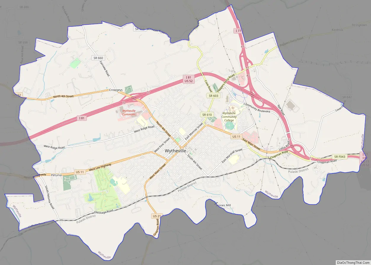
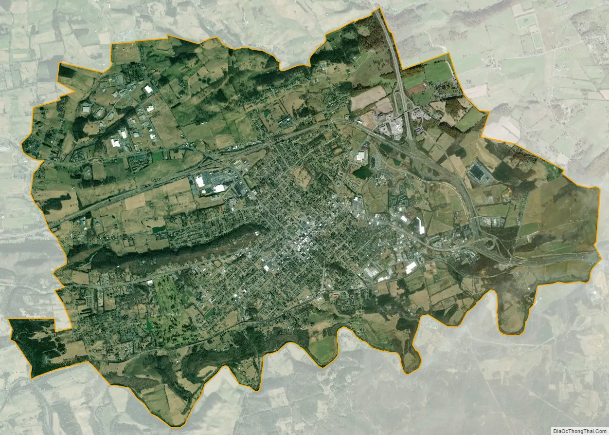
Wytheville city Satellite Map
Geography
Wytheville is located at 36°56′52″N 81°5′13″W / 36.94778°N 81.08694°W / 36.94778; -81.08694 (36.947679, −81.086955).
According to the United States Census Bureau, the town has a total area of 14.3 sq mi (37.0 km), of which 0.04 sq mi (0.1 km) (0.14%) is water.
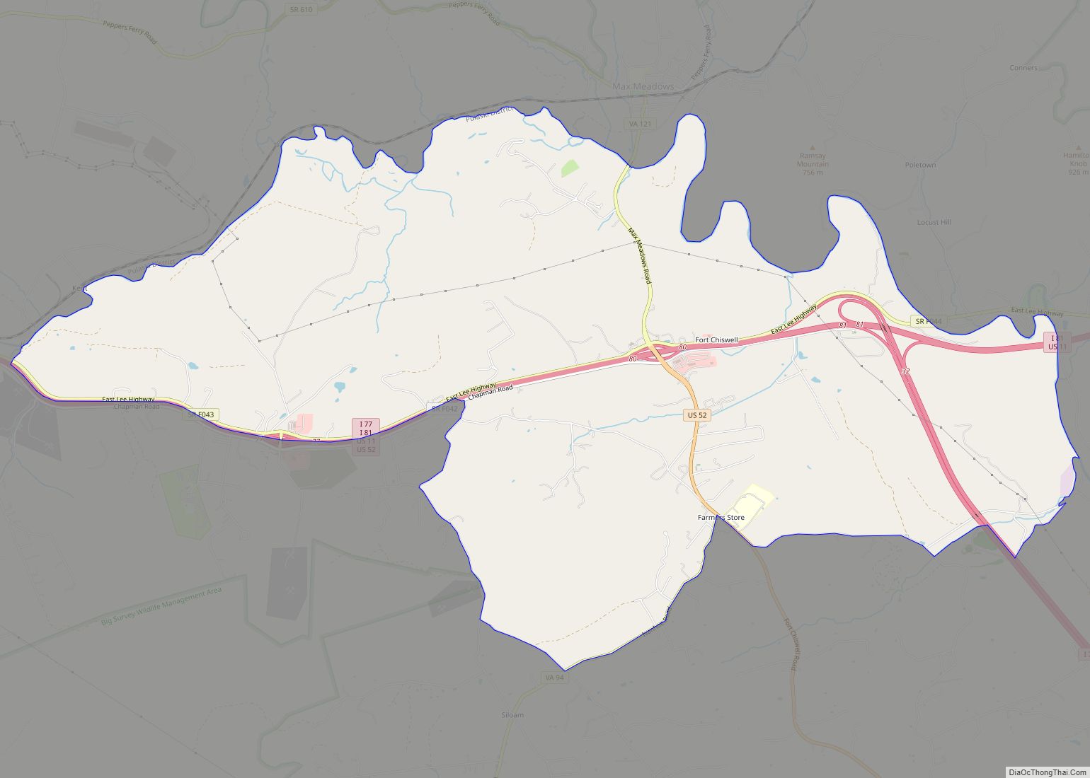
Wytheville is an important point on both I-77 and I-81 and lies amidst a wrong-way concurrency of I-77 and I-81. It is located about halfway between Bristol, Tennessee/Virginia and Roanoke. On the I-77 corridor, it is located about halfway between Charleston, West Virginia and Charlotte, North Carolina. The nearby community of Fort Chiswell is the control city for the northbound traffic on I-77 coming from Charlotte, Statesville, Elkin, and Mount Airy, North Carolina. In the near future, Interstate 74 will go through Wytheville in addition to the two other interstates.
Due to the confluence of I-77, I-81 and several U.S. Highways, and its location in the foothills of the Blue Ridge Mountains, Wytheville is known as “The Hub of Southwest Virginia” and “The Crossroads of the Blue Ridge”.
Climate
Due to its elevation, the climate of Wytheville is either classified as mountain temperate or humid subtropical (Köppen Cfb or Cfa, respectively), and the town straddles the border between USDA Plant Hardiness Zones 6B and 7A. Summers are warm and humid, although significantly cooler than low-elevation places within the state, with only 4.6 days of 90 °F (32 °C)+ highs annually, and winters are generally cool to cold with occasional intervening warm periods and 11 nights of sub-10 °F (−12 °C) lows. Monthly mean temperatures range from 32.9 °F (0.5 °C) in January to 71.7 °F (22.1 °C) in July. Snowfall averages 20.5 inches (52 cm) per season and generally occurs from December to March.
See also
Map of Virginia State and its subdivision:- Accomack
- Albemarle
- Alexandria
- Alleghany
- Amelia
- Amherst
- Appomattox
- Arlington
- Augusta
- Bath
- Bedford
- Bedford City
- Bland
- Botetourt
- Bristol
- Brunswick
- Buchanan
- Buckingham
- Buena Vista
- Campbell
- Caroline
- Carroll
- Charles City
- Charlotte
- Charlottesville
- Chesapeake
- Chesterfield
- Clarke
- Clifton Forge City
- Colonial Heights
- Covington
- Craig
- Culpeper
- Cumberland
- Danville
- Dickenson
- Dinwiddie
- Emporia
- Essex
- Fairfax
- Fairfax City
- Falls Church
- Fauquier
- Floyd
- Fluvanna
- Franklin
- Frederick
- Fredericksburg
- Galax
- Giles
- Gloucester
- Goochland
- Grayson
- Greene
- Greensville
- Halifax
- Hampton
- Hanover
- Harrisonburg
- Henrico
- Henry
- Highland
- Hopewell
- Isle of Wight
- James City
- King and Queen
- King George
- King William
- Lancaster
- Lee
- Lexington
- Loudoun
- Louisa
- Lunenburg
- Lynchburg
- Madison
- Manassas
- Manassas Park
- Martinsville
- Mathews
- Mecklenburg
- Middlesex
- Montgomery
- Nelson
- New Kent
- Newport News
- Norfolk
- Northampton
- Northumberland
- Norton
- Nottoway
- Orange
- Page
- Patrick
- Petersburg
- Pittsylvania
- Poquoson
- Portsmouth
- Powhatan
- Prince Edward
- Prince George
- Prince William
- Pulaski
- Radford
- Rappahannock
- Richmond
- Roanoke
- Roanoke City
- Rockbridge
- Rockingham
- Russell
- Salem
- Scott
- Shenandoah
- Smyth
- Southampton
- Spotsylvania
- Stafford
- Staunton
- Suffolk
- Surry
- Sussex
- Tazewell
- Virginia Beach
- Warren
- Washington
- Waynesboro
- Westmoreland
- Williamsburg
- Winchester
- Wise
- Wythe
- York
- Alabama
- Alaska
- Arizona
- Arkansas
- California
- Colorado
- Connecticut
- Delaware
- District of Columbia
- Florida
- Georgia
- Hawaii
- Idaho
- Illinois
- Indiana
- Iowa
- Kansas
- Kentucky
- Louisiana
- Maine
- Maryland
- Massachusetts
- Michigan
- Minnesota
- Mississippi
- Missouri
- Montana
- Nebraska
- Nevada
- New Hampshire
- New Jersey
- New Mexico
- New York
- North Carolina
- North Dakota
- Ohio
- Oklahoma
- Oregon
- Pennsylvania
- Rhode Island
- South Carolina
- South Dakota
- Tennessee
- Texas
- Utah
- Vermont
- Virginia
- Washington
- West Virginia
- Wisconsin
- Wyoming