Raceland is a home rule-class city in Greenup County, Kentucky, United States, in the Ohio River valley. As of the 2010 census, the population was 2,424. It is part of the Huntington–Ashland metropolitan area.
| Name: | Raceland city |
|---|---|
| LSAD Code: | 25 |
| LSAD Description: | city (suffix) |
| State: | Kentucky |
| County: | Greenup County |
| Elevation: | 545 ft (166 m) |
| Total Area: | 2.48 sq mi (6.42 km²) |
| Land Area: | 2.48 sq mi (6.42 km²) |
| Water Area: | 0.00 sq mi (0.00 km²) |
| Total Population: | 2,343 |
| Population Density: | 945.90/sq mi (365.21/km²) |
| ZIP code: | 41169 |
| Area code: | 606 |
| FIPS code: | 2163858 |
| GNISfeature ID: | 0501513 |
| Website: | www.racelandky.org |
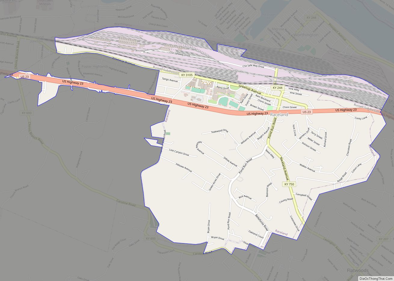
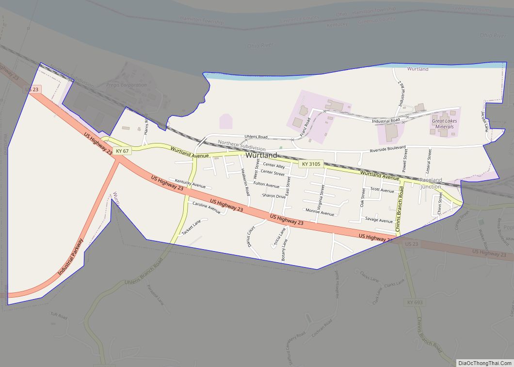
Online Interactive Map
Click on ![]() to view map in "full screen" mode.
to view map in "full screen" mode.
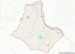
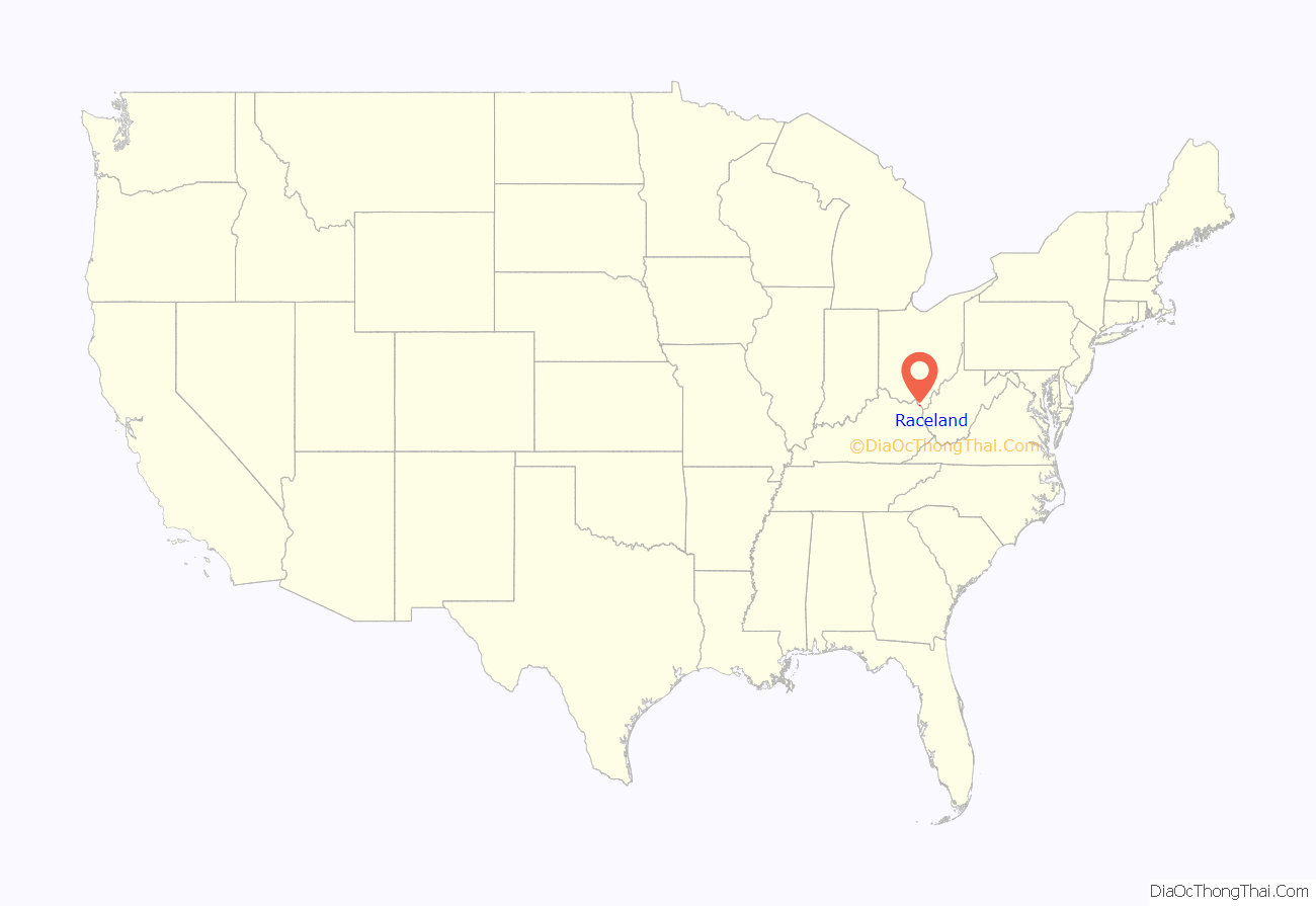
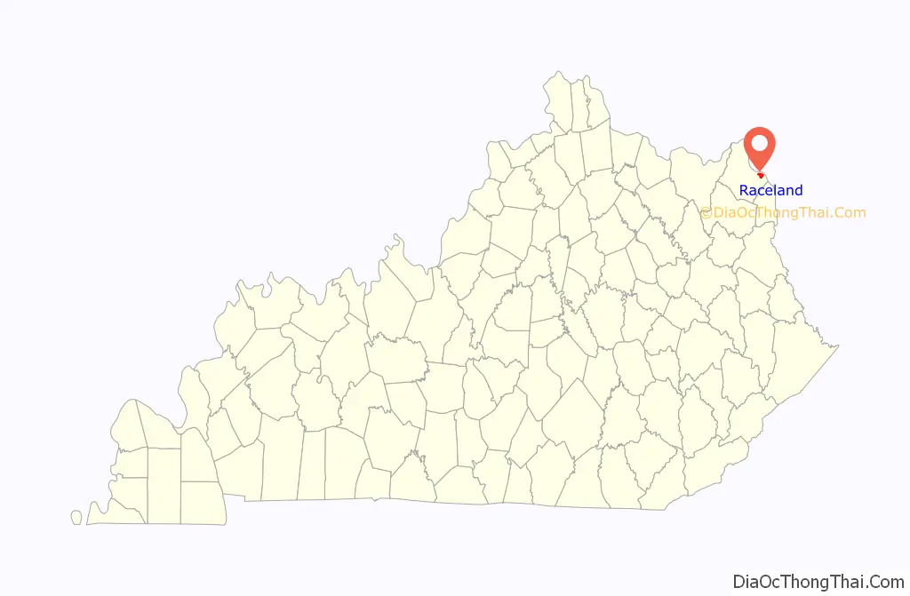
Raceland location map. Where is Raceland city?
History
The city of Raceland and the land surrounding it were part of a 5,000-acre (20 km) Revolutionary War grant to Abraham Buford. His son, Charles Buford, divided up the land and sold it in tracts. Eventually, one of the tracts was bequeathed to Benjamen Chinn, who sold his tract in town lots. He gave the town the name “Chinnville”. Its first post office was established on March 7, 1910. It became an incorporated city on July 31, 1915.
In 1924, Jack O. Keene (who later established Keeneland in Lexington, Kentucky), opened Raceland Race Course near the city. Due to this, the town was renamed Raceland on April 1, 1925. The racetrack was eventually abandoned and the city was once again named Chinnville, but on April 1, 1930, the city was again named Raceland.
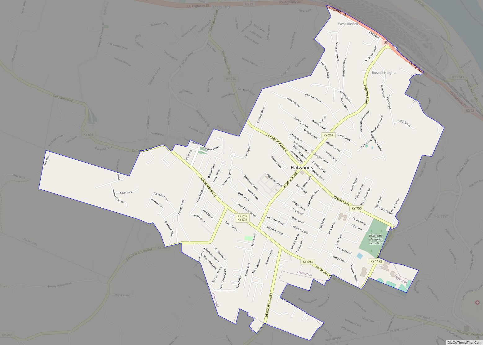
Raceland Road Map
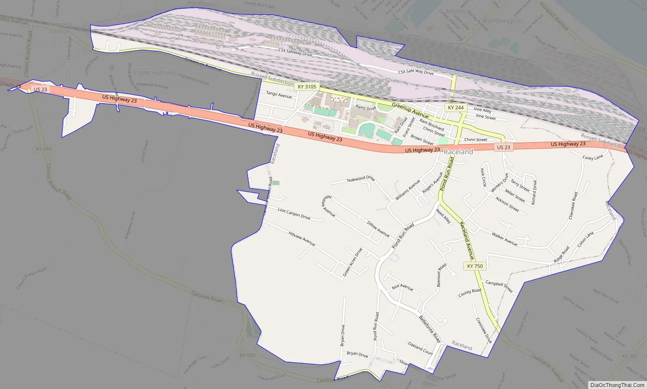
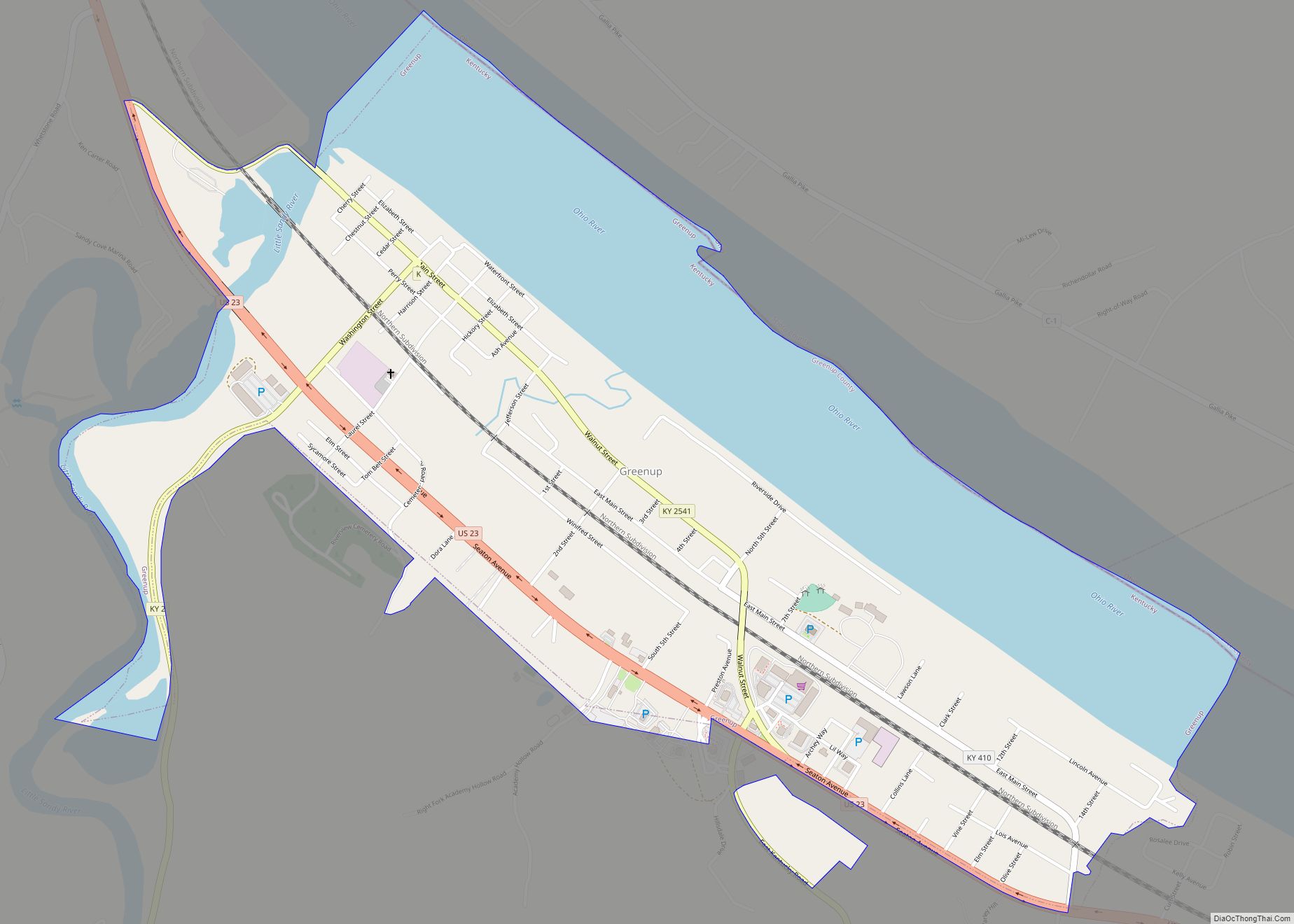
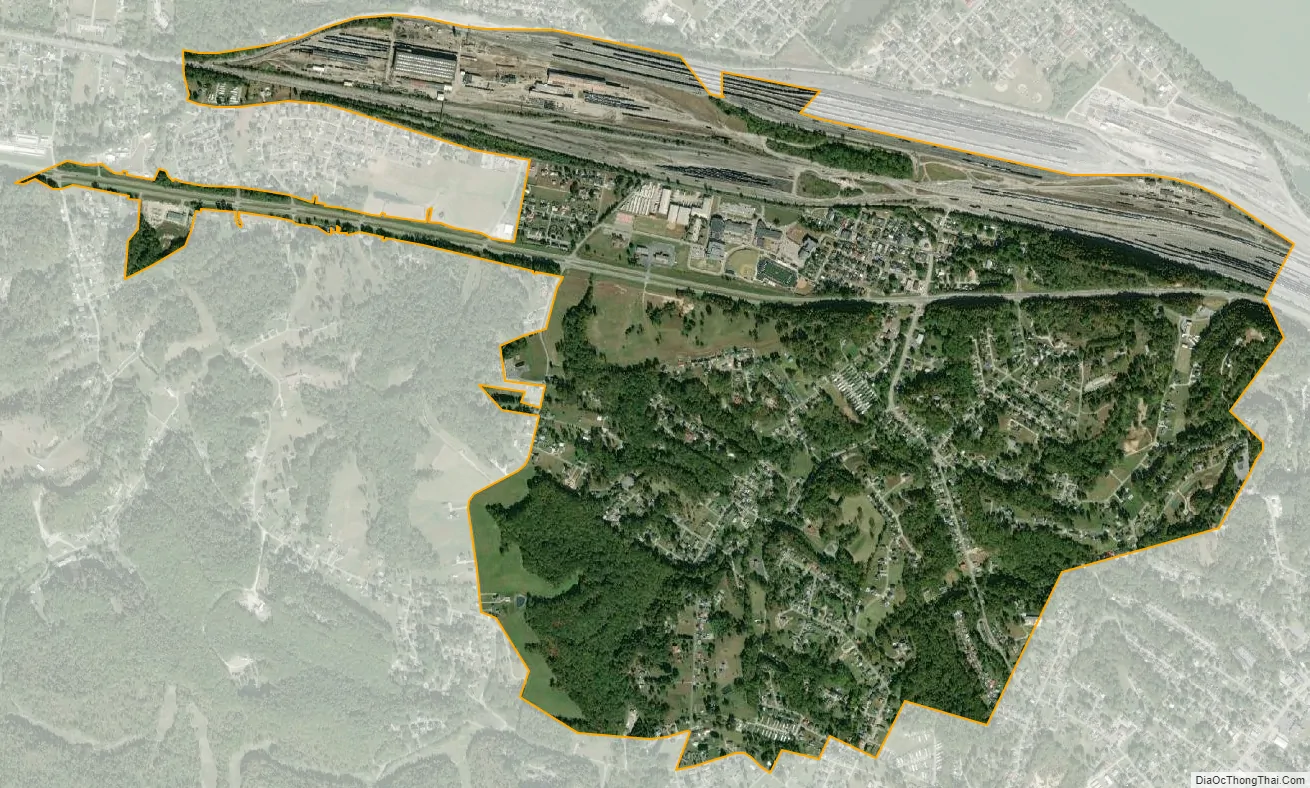
Raceland city Satellite Map
Geography
Raceland is located in eastern Greenup County at 38°32′13″N 82°43′52″W / 38.53694°N 82.73111°W / 38.53694; -82.73111 (38.537003, -82.731137). It is bordered to the north by the city of Worthington, to the southeast by the city of Flatwoods, and at its far northwest corner by the city of Wurtland. U.S. Route 23 (Seaton Avenue) is the main highway through Raceland, leading southeast 7 miles (11 km) to Ashland and northwest 25 miles (40 km) to Portsmouth, Ohio.
According to the United States Census Bureau, Raceland has a total area of 2.5 square miles (6.4 km), all land.
See also
Map of Kentucky State and its subdivision:- Adair
- Allen
- Anderson
- Ballard
- Barren
- Bath
- Bell
- Boone
- Bourbon
- Boyd
- Boyle
- Bracken
- Breathitt
- Breckinridge
- Bullitt
- Butler
- Caldwell
- Calloway
- Campbell
- Carlisle
- Carroll
- Carter
- Casey
- Christian
- Clark
- Clay
- Clinton
- Crittenden
- Cumberland
- Daviess
- Edmonson
- Elliott
- Estill
- Fayette
- Fleming
- Floyd
- Franklin
- Fulton
- Gallatin
- Garrard
- Grant
- Graves
- Grayson
- Green
- Greenup
- Hancock
- Hardin
- Harlan
- Harrison
- Hart
- Henderson
- Henry
- Hickman
- Hopkins
- Jackson
- Jefferson
- Jessamine
- Johnson
- Kenton
- Knott
- Knox
- Larue
- Laurel
- Lawrence
- Lee
- Leslie
- Letcher
- Lewis
- Lincoln
- Livingston
- Logan
- Lyon
- Madison
- Magoffin
- Marion
- Marshall
- Martin
- Mason
- McCracken
- McCreary
- McLean
- Meade
- Menifee
- Mercer
- Metcalfe
- Monroe
- Montgomery
- Morgan
- Muhlenberg
- Nelson
- Nicholas
- Ohio
- Oldham
- Owen
- Owsley
- Pendleton
- Perry
- Pike
- Powell
- Pulaski
- Robertson
- Rockcastle
- Rowan
- Russell
- Scott
- Shelby
- Simpson
- Spencer
- Taylor
- Todd
- Trigg
- Trimble
- Union
- Warren
- Washington
- Wayne
- Webster
- Whitley
- Wolfe
- Woodford
- Alabama
- Alaska
- Arizona
- Arkansas
- California
- Colorado
- Connecticut
- Delaware
- District of Columbia
- Florida
- Georgia
- Hawaii
- Idaho
- Illinois
- Indiana
- Iowa
- Kansas
- Kentucky
- Louisiana
- Maine
- Maryland
- Massachusetts
- Michigan
- Minnesota
- Mississippi
- Missouri
- Montana
- Nebraska
- Nevada
- New Hampshire
- New Jersey
- New Mexico
- New York
- North Carolina
- North Dakota
- Ohio
- Oklahoma
- Oregon
- Pennsylvania
- Rhode Island
- South Carolina
- South Dakota
- Tennessee
- Texas
- Utah
- Vermont
- Virginia
- Washington
- West Virginia
- Wisconsin
- Wyoming