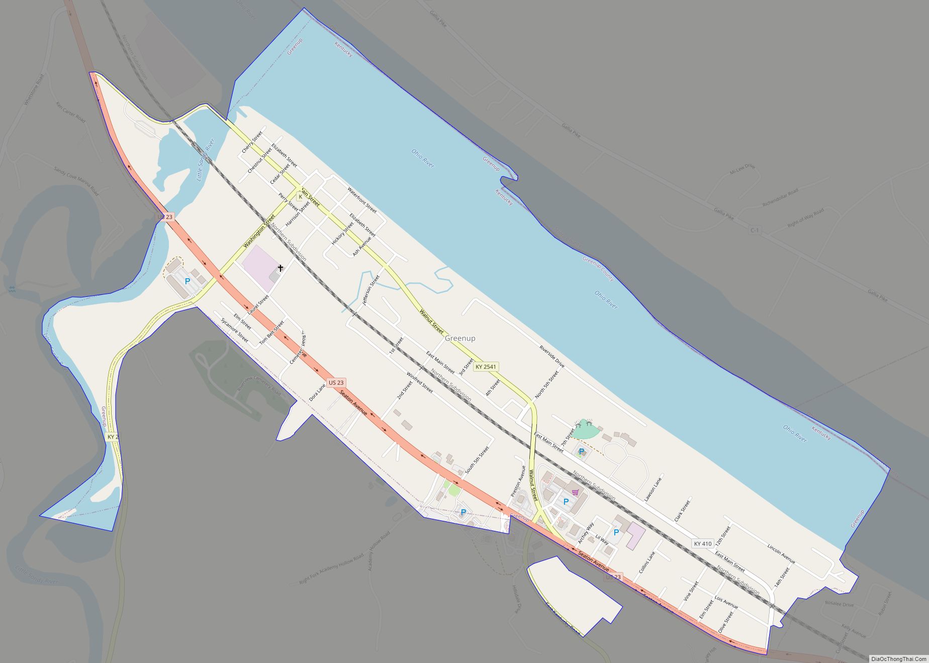
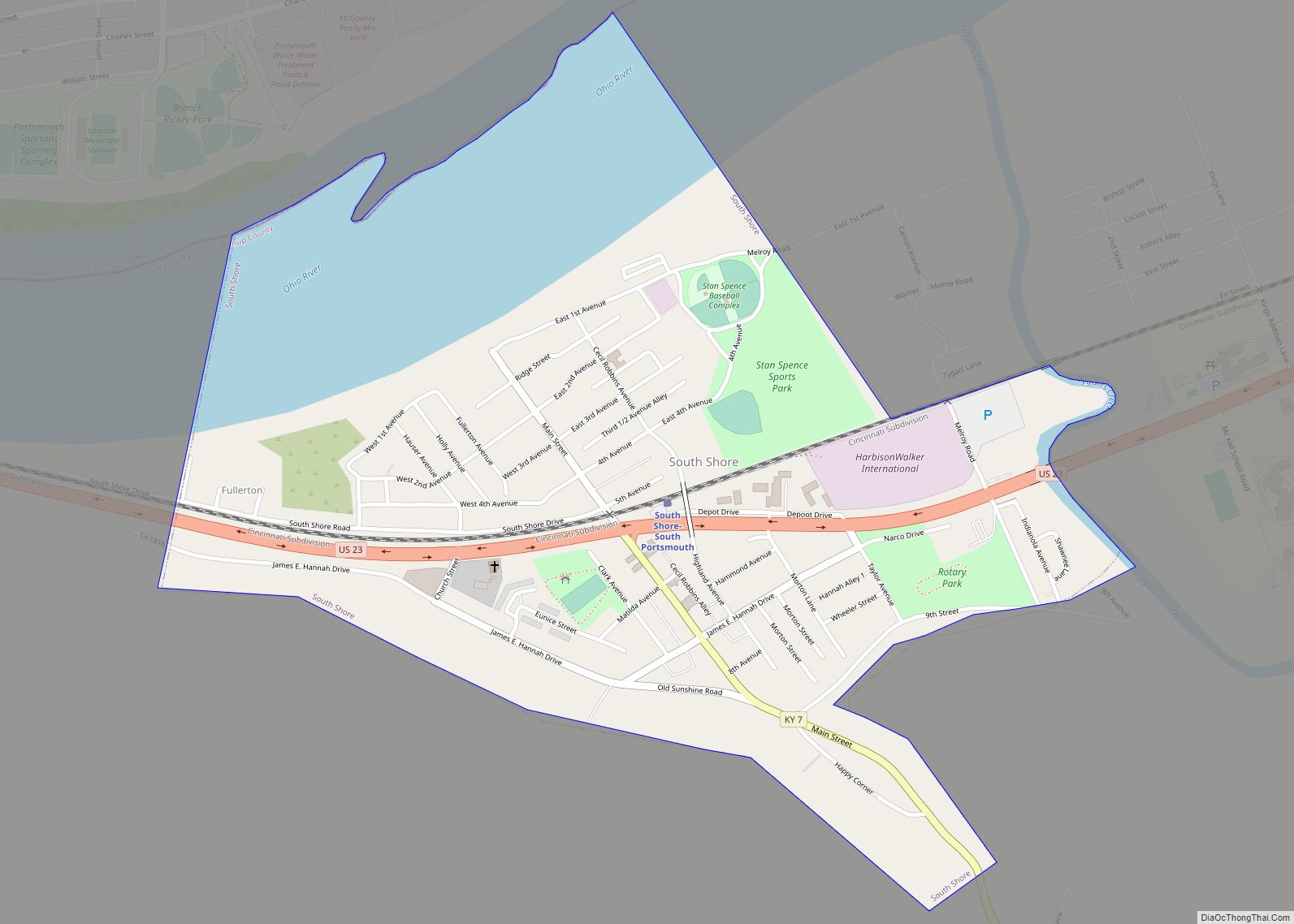
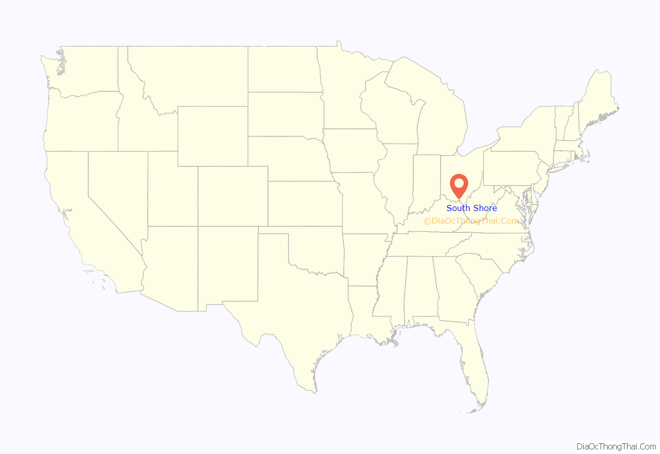
South Shore is a home rule-class city in Greenup County, Kentucky, United States. The population was 1,122 at the 2010 census, down from 1,226 in 2000. It is located along the Ohio River across from Portsmouth, Ohio, at the mouth of Tygarts Creek. South Shore is a part of the Huntington-Ashland, WV-KY-OH, Metropolitan Statistical Area (MSA).
The South Portsmouth–South Shore station serves Amtrak’s Cardinal Trains 50 & 51.
| Name: | South Shore city |
|---|---|
| LSAD Code: | 25 |
| LSAD Description: | city (suffix) |
| State: | Kentucky |
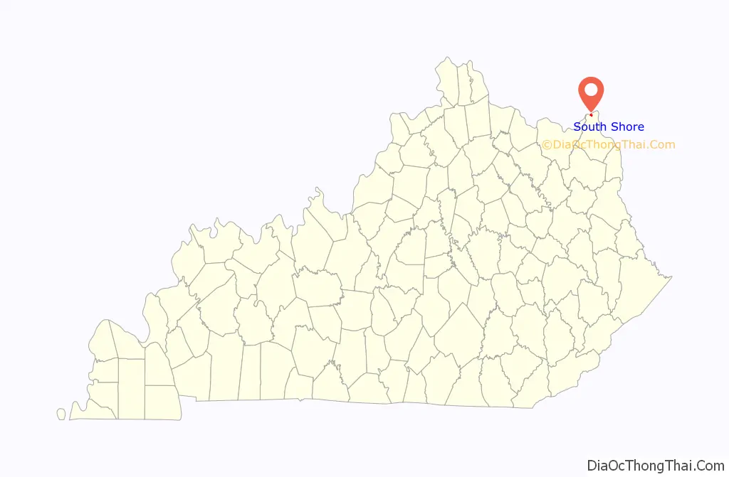
| County: | Greenup County |
| Incorporated: | July 2, 1957 |
| Elevation: | 545 ft (166 m) |
| Total Area: | 0.85 sq mi (2.20 km²) |
| Land Area: | 0.66 sq mi (1.70 km²) |
| Water Area: | 0.19 sq mi (0.50 km²) |
| Total Population: | 1,066 |
| Population Density: | 1,622.53/sq mi (626.91/km²) |
| ZIP code: | 41175 |
| Area code: | 606 |
| FIPS code: | 2172210 |
| GNISfeature ID: | 0503976 |
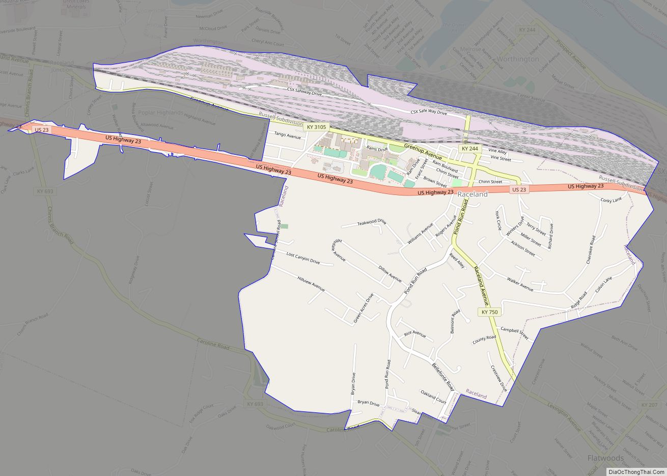
Online Interactive Map
Click on ![]() to view map in "full screen" mode.
to view map in "full screen" mode.
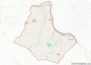
South Shore location map. Where is South Shore city?
History
South Shore was first settled in 1890 by the Fullerton, Warnock, and the Morton families from the nearby Tygarts Valley. Significant development occurred after the coming of the Chesapeake and Ohio Railroad and George D. Winn’s ferry to Portsmouth, Ohio, in the 1890s. Winn began to petition for a post office in 1893, and on July 21 the post office was established as “Fullerton”, after his brothers Harvey and Harrison Fullerton. The town was incorporated for a short period during 1919.
In 1895, the Taylor brickyard was established near Fullerton by Clyde King and became the area’s top employer. The Taylor name was applied to both the local railway station and the nearby McCall post office on January 16, 1930. This post office was then renamed “South Shore” on February 4, 1940. Shortly after the city of South Shore was incorporated on July 2, 1957, the Fullerton and South Shore post offices were consolidated under the South Shore name. South Shore eventually annexed the entire city of Fullerton, significantly expanding its boundaries.
South Shore Road Map
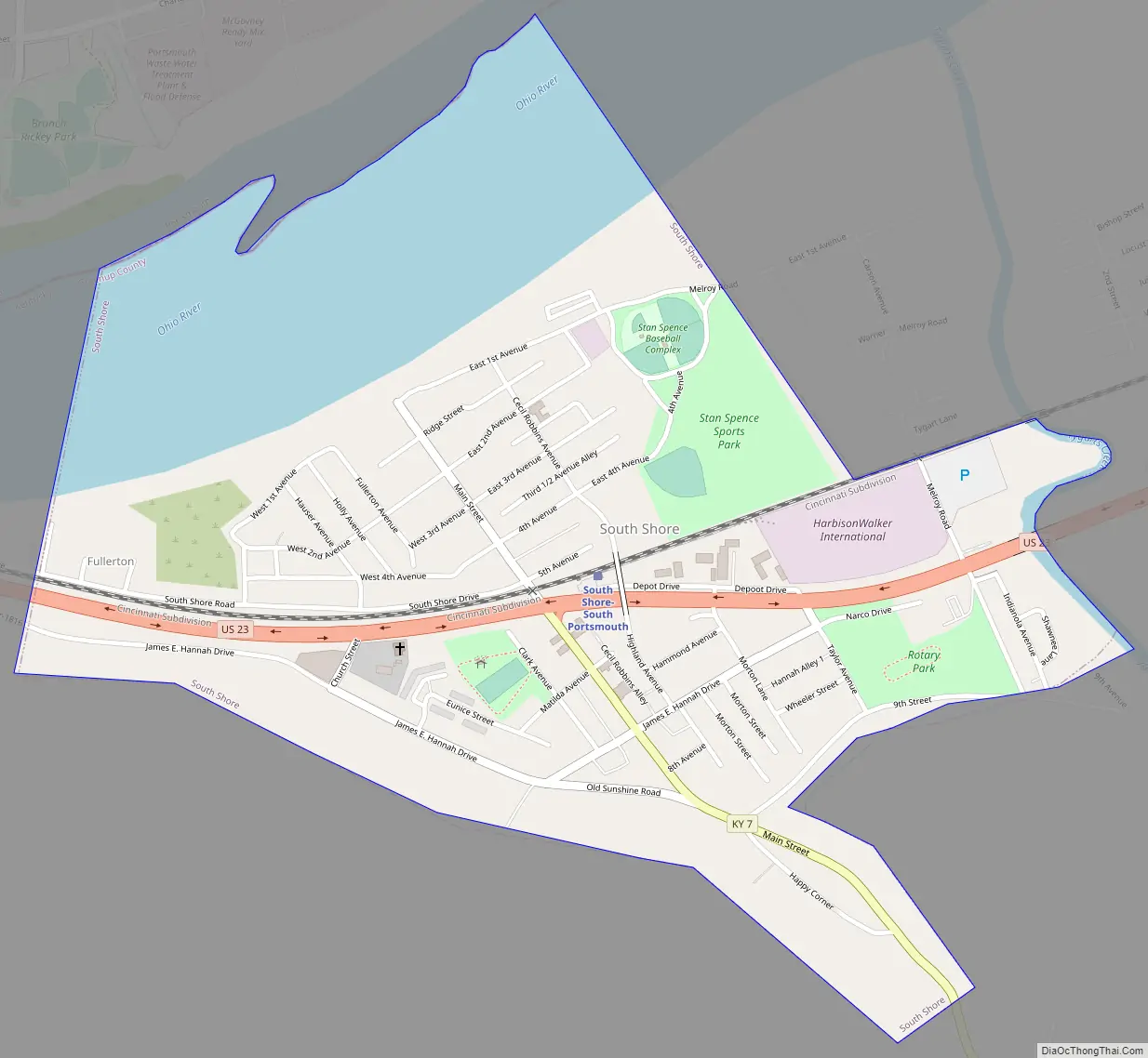
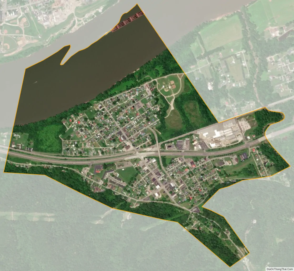
South Shore city Satellite Map
Geography
South Shore is located in northern Greenup County at 38°43′18″N 82°57′49″W / 38.72167°N 82.96361°W / 38.72167; -82.96361 (38.721577, -82.963606), on the south bank of the Ohio River. U.S. Route 23 passes through the city limits, leading southeast 16 miles (26 km) to Greenup, the county seat, and 29 miles (47 km) to Ashland. To the west, US-23 leads 2 miles (3 km) to the south end of the U.S. Grant Bridge, which carries the highway across the Ohio River into Portsmouth.
According to the United States Census Bureau, the city of South Shore has a total area of 0.85 square miles (2.2 km), of which 0.66 square miles (1.7 km) is land and 0.19 square miles (0.5 km), or 22.79%, is water.
See also
Map of Kentucky State and its subdivision:- Adair
- Allen
- Anderson
- Ballard
- Barren
- Bath
- Bell
- Boone
- Bourbon
- Boyd
- Boyle
- Bracken
- Breathitt
- Breckinridge
- Bullitt
- Butler
- Caldwell
- Calloway
- Campbell
- Carlisle
- Carroll
- Carter
- Casey
- Christian
- Clark
- Clay
- Clinton
- Crittenden
- Cumberland
- Daviess
- Edmonson
- Elliott
- Estill
- Fayette
- Fleming
- Floyd
- Franklin
- Fulton
- Gallatin
- Garrard
- Grant
- Graves
- Grayson
- Green
- Greenup
- Hancock
- Hardin
- Harlan
- Harrison
- Hart
- Henderson
- Henry
- Hickman
- Hopkins
- Jackson
- Jefferson
- Jessamine
- Johnson
- Kenton
- Knott
- Knox
- Larue
- Laurel
- Lawrence
- Lee
- Leslie
- Letcher
- Lewis
- Lincoln
- Livingston
- Logan
- Lyon
- Madison
- Magoffin
- Marion
- Marshall
- Martin
- Mason
- McCracken
- McCreary
- McLean
- Meade
- Menifee
- Mercer
- Metcalfe
- Monroe
- Montgomery
- Morgan
- Muhlenberg
- Nelson
- Nicholas
- Ohio
- Oldham
- Owen
- Owsley
- Pendleton
- Perry
- Pike
- Powell
- Pulaski
- Robertson
- Rockcastle
- Rowan
- Russell
- Scott
- Shelby
- Simpson
- Spencer
- Taylor
- Todd
- Trigg
- Trimble
- Union
- Warren
- Washington
- Wayne
- Webster
- Whitley
- Wolfe
- Woodford
- Alabama
- Alaska
- Arizona
- Arkansas
- California
- Colorado
- Connecticut
- Delaware
- District of Columbia
- Florida
- Georgia
- Hawaii
- Idaho
- Illinois
- Indiana
- Iowa
- Kansas
- Kentucky
- Louisiana
- Maine
- Maryland
- Massachusetts
- Michigan
- Minnesota
- Mississippi
- Missouri
- Montana
- Nebraska
- Nevada
- New Hampshire
- New Jersey
- New Mexico
- New York
- North Carolina
- North Dakota
- Ohio
- Oklahoma
- Oregon
- Pennsylvania
- Rhode Island
- South Carolina
- South Dakota
- Tennessee
- Texas
- Utah
- Vermont
- Virginia
- Washington
- West Virginia
- Wisconsin
- Wyoming