Stearns is an unincorporated community and census-designated place (CDP) in McCreary County, Kentucky, United States. The population was 1,365 at the 2020 census. It was founded by Justus Smith Stearns.
| Name: | Stearns CDP |
|---|---|
| LSAD Code: | 57 |
| LSAD Description: | CDP (suffix) |
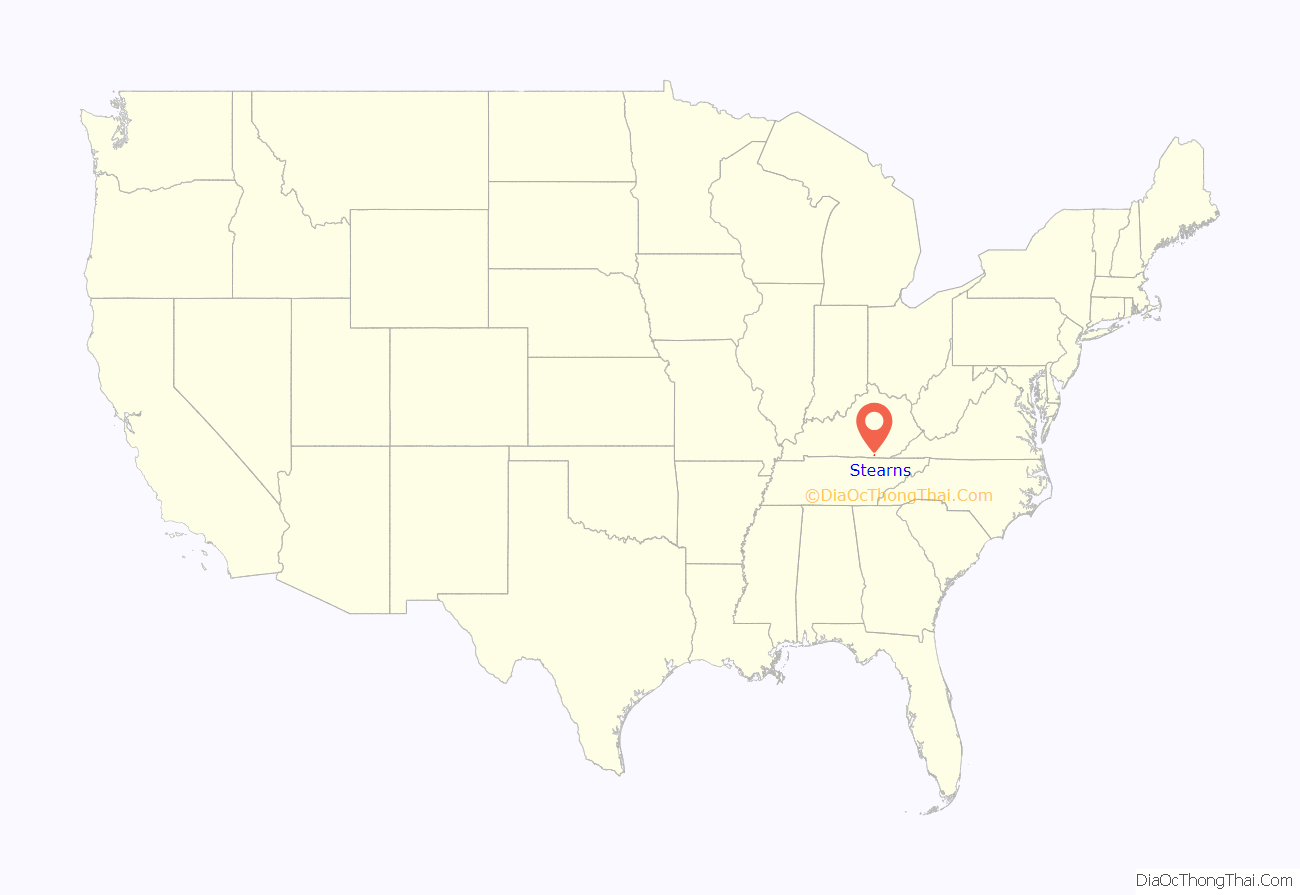
| State: | Kentucky |
| County: | McCreary County |
| Elevation: | 1,339 ft (408 m) |
| Total Area: | 4.05 sq mi (10.50 km²) |
| Land Area: | 4.02 sq mi (10.41 km²) |
| Water Area: | 0.03 sq mi (0.09 km²) |
| Total Population: | 1,365 |
| Population Density: | 339.55/sq mi (131.11/km²) |
| ZIP code: | 42647 |
| Area code: | 606 |
| FIPS code: | 2173362 |
| GNISfeature ID: | 0515673 |
Online Interactive Map
Click on ![]() to view map in "full screen" mode.
to view map in "full screen" mode.
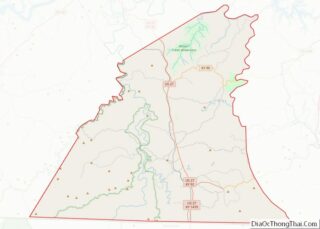
Stearns location map. Where is Stearns CDP?

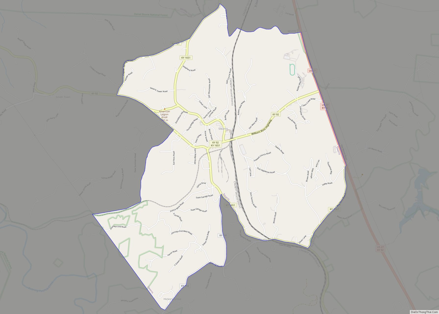
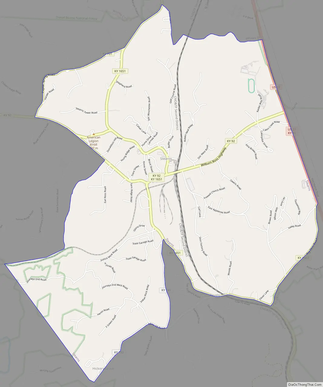
Stearns Road Map
Stearns city Satellite Map

Geography
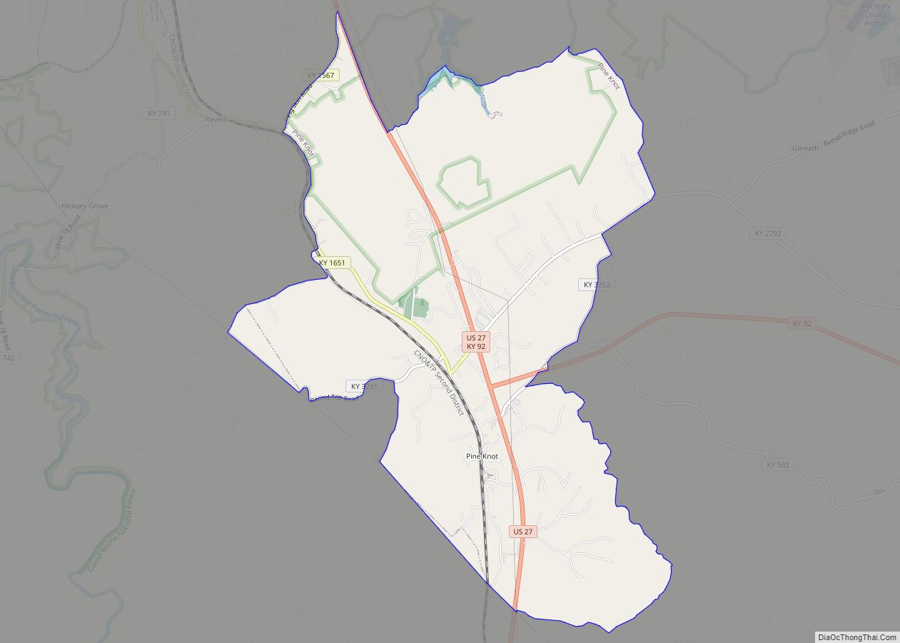
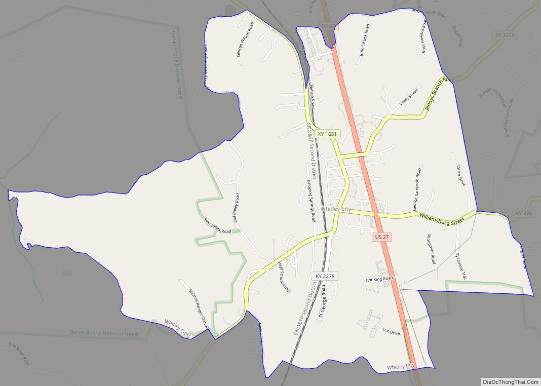
Stearns is located in south-central McCreary County at 36°41′53″N 84°28′36″W / 36.69806°N 84.47667°W / 36.69806; -84.47667 (36.697976, -84.476776). It is bordered to the north by Whitley City, the county seat, and to the south by Pine Knot. The unincorporated community of Revelo is partly within the Stearns CDP, along its southern border.
U.S. Route 27 runs along the eastern edge of Stearns, leading north through Whitley City 31 miles (50 km) to Somerset and south 16 miles (26 km) to Oneida, Tennessee. Kentucky Route 92 passes through the center of Stearns and leads west 29 miles (47 km) to Monticello. Eastbound KY 92 joins US 27 south to Pine Knot, then turns east to lead to Williamsburg.
According to the United States Census Bureau, the Stearns CDP has a total area of 4.05 square miles (10.5 km), of which 0.03 square miles (0.08 km), or 0.84%, are water. The community is drained to the west by tributaries of Roaring Paunch Creek, which continues west to the South Fork of the Cumberland River, while the east side of the community is drained by tributaries of Marsh Creek, which flows north to the main stem of the Cumberland River.
See also
Map of Kentucky State and its subdivision:- Adair
- Allen
- Anderson
- Ballard
- Barren
- Bath
- Bell
- Boone
- Bourbon
- Boyd
- Boyle
- Bracken
- Breathitt
- Breckinridge
- Bullitt
- Butler
- Caldwell
- Calloway
- Campbell
- Carlisle
- Carroll
- Carter
- Casey
- Christian
- Clark
- Clay
- Clinton
- Crittenden
- Cumberland
- Daviess
- Edmonson
- Elliott
- Estill
- Fayette
- Fleming
- Floyd
- Franklin
- Fulton
- Gallatin
- Garrard
- Grant
- Graves
- Grayson
- Green
- Greenup
- Hancock
- Hardin
- Harlan
- Harrison
- Hart
- Henderson
- Henry
- Hickman
- Hopkins
- Jackson
- Jefferson
- Jessamine
- Johnson
- Kenton
- Knott
- Knox
- Larue
- Laurel
- Lawrence
- Lee
- Leslie
- Letcher
- Lewis
- Lincoln
- Livingston
- Logan
- Lyon
- Madison
- Magoffin
- Marion
- Marshall
- Martin
- Mason
- McCracken
- McCreary
- McLean
- Meade
- Menifee
- Mercer
- Metcalfe
- Monroe
- Montgomery
- Morgan
- Muhlenberg
- Nelson
- Nicholas
- Ohio
- Oldham
- Owen
- Owsley
- Pendleton
- Perry
- Pike
- Powell
- Pulaski
- Robertson
- Rockcastle
- Rowan
- Russell
- Scott
- Shelby
- Simpson
- Spencer
- Taylor
- Todd
- Trigg
- Trimble
- Union
- Warren
- Washington
- Wayne
- Webster
- Whitley
- Wolfe
- Woodford
- Alabama
- Alaska
- Arizona
- Arkansas
- California
- Colorado
- Connecticut
- Delaware
- District of Columbia
- Florida
- Georgia
- Hawaii
- Idaho
- Illinois
- Indiana
- Iowa
- Kansas
- Kentucky
- Louisiana
- Maine
- Maryland
- Massachusetts
- Michigan
- Minnesota
- Mississippi
- Missouri
- Montana
- Nebraska
- Nevada
- New Hampshire
- New Jersey
- New Mexico
- New York
- North Carolina
- North Dakota
- Ohio
- Oklahoma
- Oregon
- Pennsylvania
- Rhode Island
- South Carolina
- South Dakota
- Tennessee
- Texas
- Utah
- Vermont
- Virginia
- Washington
- West Virginia
- Wisconsin
- Wyoming