Annandale (/ˈænəndeɪl/) is a census-designated place (CDP) in Fairfax County, Virginia. The population of the CDP was 43,363 as of the 2020 United States Census. It is home to the oldest and largest branch of the Northern Virginia Community College system, and to one of the D.C. area’s Koreatowns.
| Name: | Annandale CDP |
|---|---|
| LSAD Code: | 57 |
| LSAD Description: | CDP (suffix) |
| State: | Virginia |
| County: | Fairfax County |
| Elevation: | 361 ft (110 m) |
| Total Area: | 7.86 sq mi (20.4 km²) |
| Land Area: | 7.86 sq mi (20.4 km²) |
| Water Area: | 0.0 sq mi (0.0 km²) |
| Total Population: | 43,363 |
| Population Density: | 5,516.9/sq mi (2,130.1/km²) |
| ZIP code: | 22003 |
| FIPS code: | 5101912 |
| GNISfeature ID: | 1492474 |
| Website: | www.annandale.va.us |
Online Interactive Map
Click on ![]() to view map in "full screen" mode.
to view map in "full screen" mode.
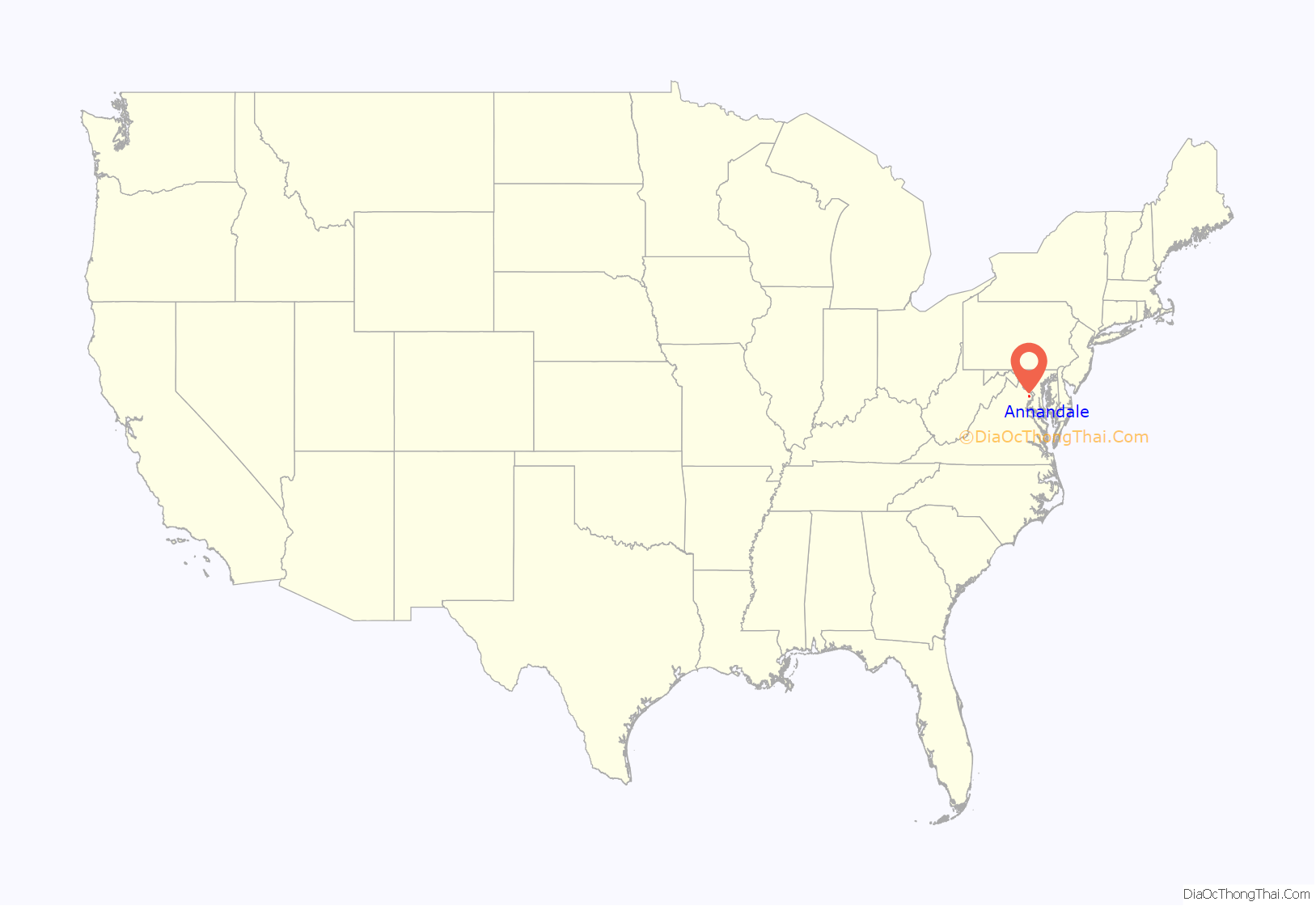
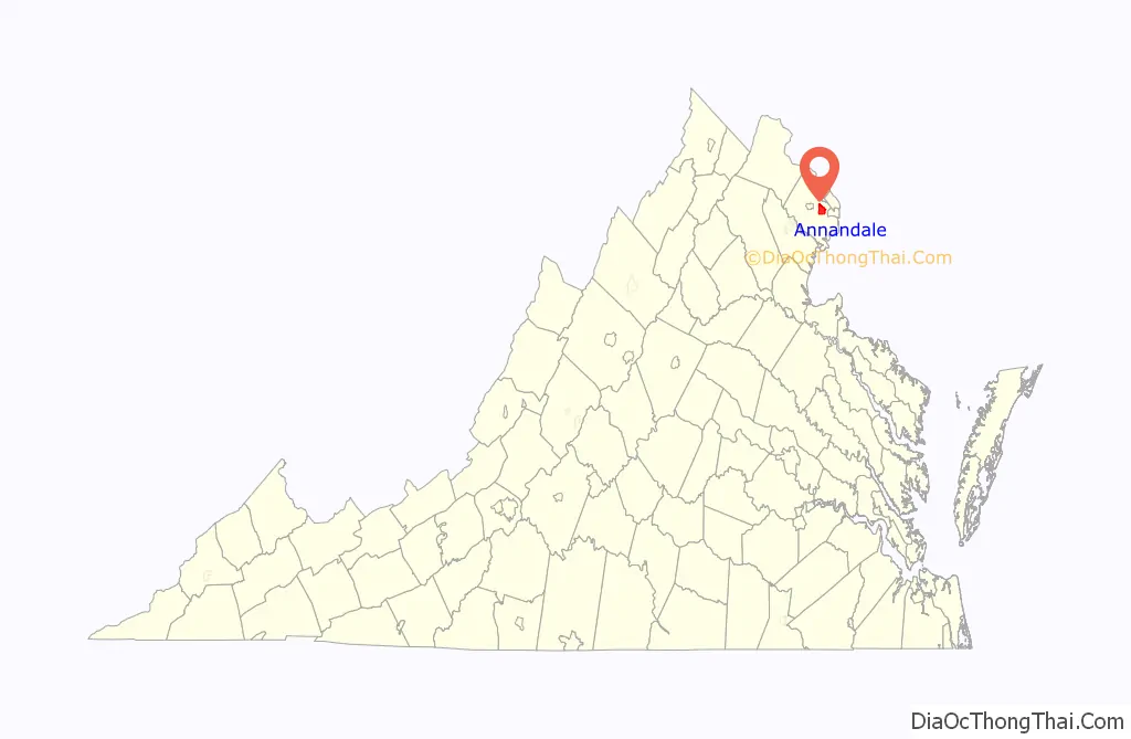
Annandale location map. Where is Annandale CDP?
History
When Europeans arrived in the 17th century, the area around Annandale, which would become Fairfax County, was inhabited by an Algonquian-speaking sub-group called the Taux, also known as the Doeg or Dogue. In 1685, an Englishman, Col. William H. Fitzhugh, purchased over 24,000 acres (37.5 square miles) of wilderness in the area and converted it into one of the largest tobacco plantations in Northern Virginia. It stretched from current day Fairfax City to Springfield and Falls Church and south to Pohick Church. Fitzhugh’s descendants later named it “Ravensworth.” For over six generations, the Fitzhugh family farmed at Ravensworth and slowly sold off portions of the land.
In 1830 the community of Annandale was named by a Scottish settler, after the town named Annan located at the mouth of the River Annan. Annandale followed nearby Dumfries to become the second place in Dumfriesshire to become the name of a settlement in Virginia. In 1806, the Little River Turnpike (now Virginia State Route 236) had been completed through the community, connecting it with Alexandria and Fairfax. In 1808, the Columbia Pike (now Virginia State Route 244) was built, connecting the District of Columbia with Little River Turnpike in what is now Annandale. The first businessman to locate in Annandale was William Garges, who built a blacksmith shop and a livery stable at the intersection of Columbia Pike, Little River Turnpike and Backlick Road, which would become the center of town. Garges became the first postmaster at the Annandale Post Office, which opened in 1837. Small farms and businesses grew up around the town and its first church, the Annandale Methodist Chapel, was built in 1846.
The American Civil War touched Annandale several times between 1861 and 1865. Union troops defending the vicinity of Washington, D.C., frequently took positions in and around the town. Confederate forces probing those defenses skirmished with them from time to time. The Methodist Chapel, which had fallen into disrepair during the war, was dismantled by Union troops to obtain construction materials in 1863.
After the war, farmers and businessmen returned to their pursuits and dairy farming began to grow in Fairfax County. Small communities continued to develop or grow near railroad stations and the dairy farms. Residents would build stores, churches and schools for their communities. By 1925, Fairfax County contained more dairy farms than any other county in Virginia. In the 1930s and 1940s, work in the area for the federal government grew as President Franklin D. Roosevelt implemented the New Deal and the United States entered World War II.
After World War II, growth continued, with housing developments in suburbs like Annandale accompanied by businesses, schools, and roads to support the new residents. The suburbs became “bedroom communities” with many residents commuting to work in Washington or surrounding small cities. That trend has continued to today with further growth and many residents now commuting to work in Northern Virginia as well as in and around Washington.
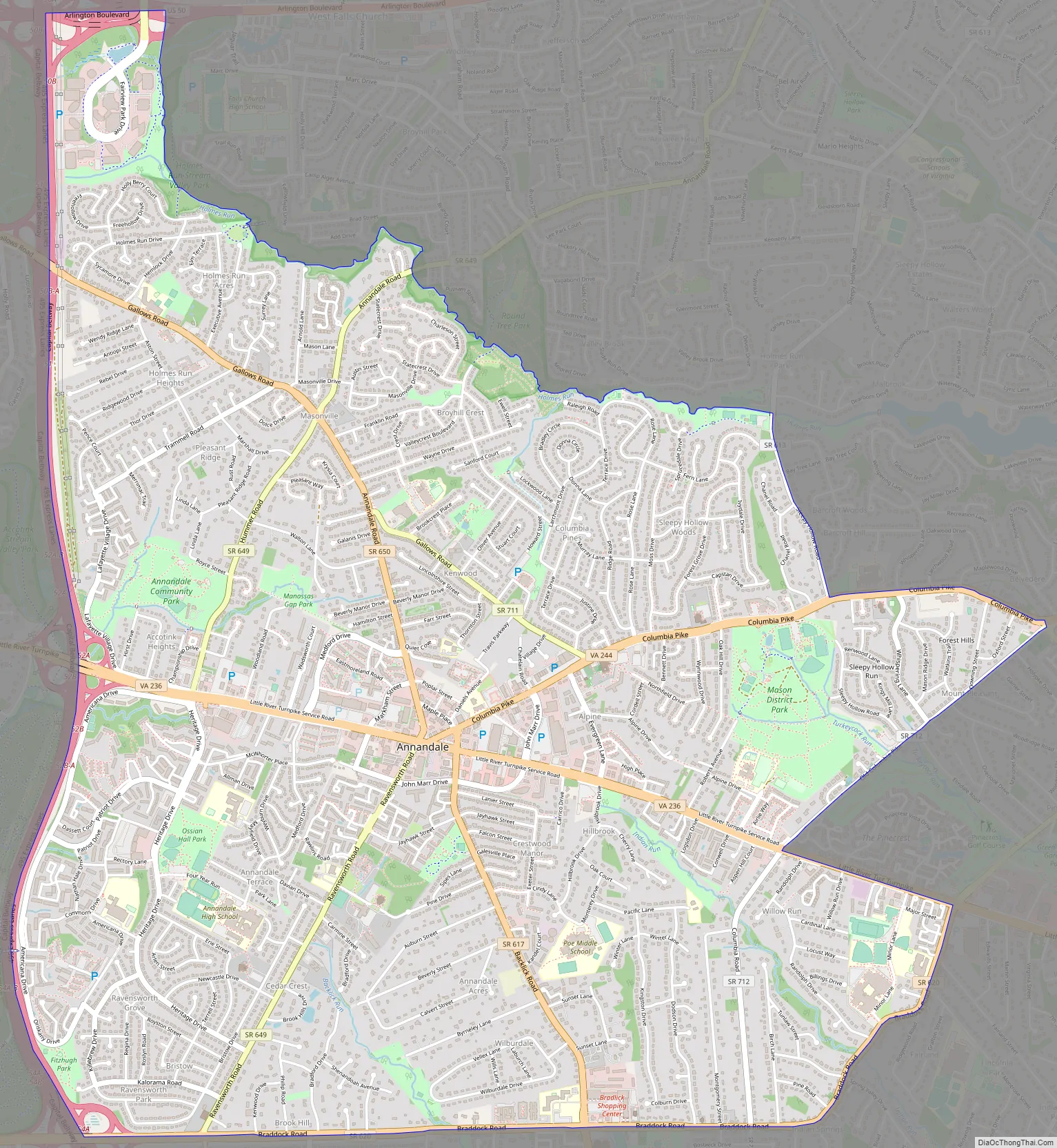
Annandale Road Map
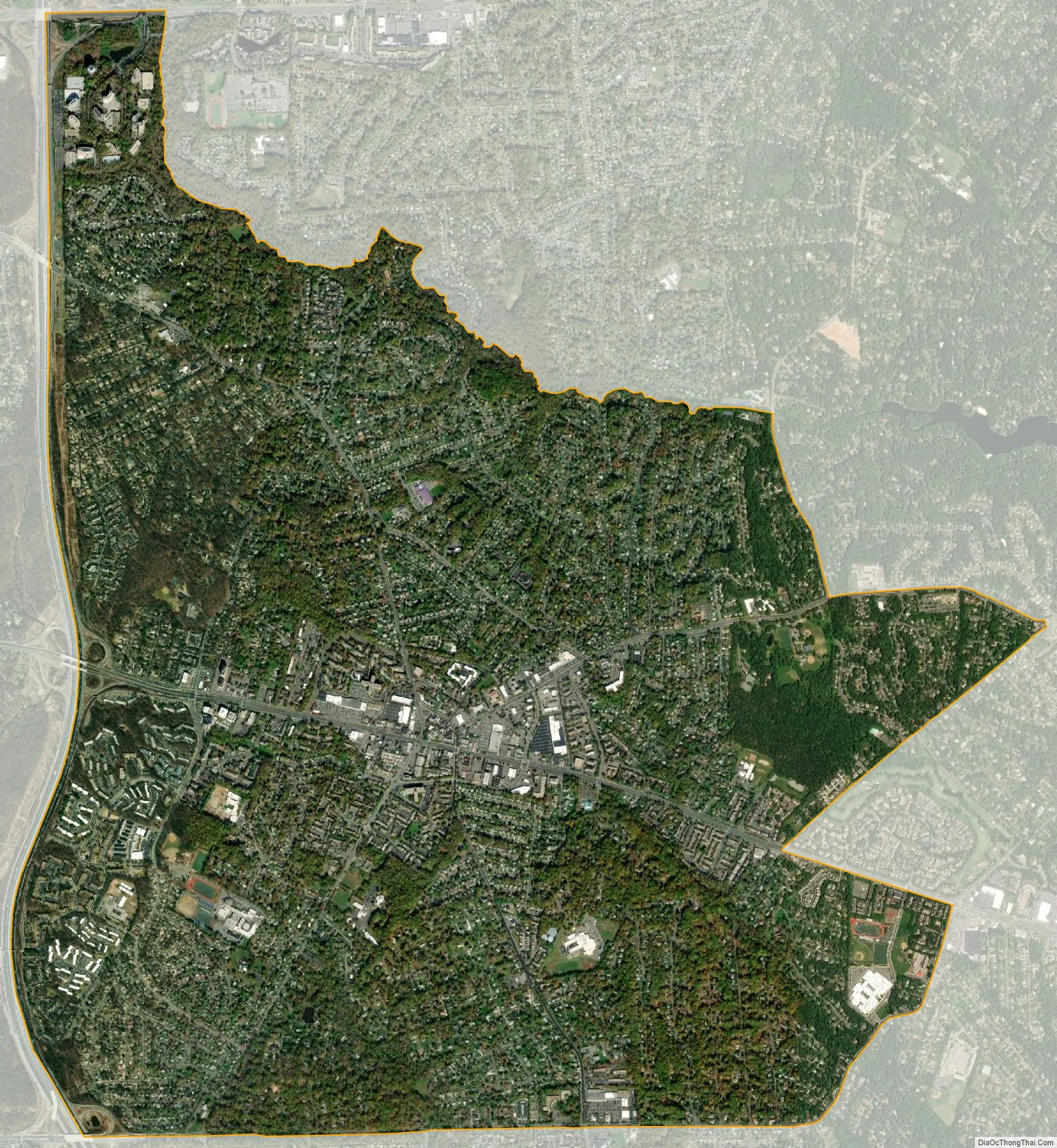
Annandale city Satellite Map
Geography
Annandale is located at 38°50′3″N 77°12′41″W / 38.83417°N 77.21139°W / 38.83417; -77.21139 (38.834134, −77.211277). Annandale is mostly traversed by the Capital Beltway (Interstate 495) and Little River Turnpike (Virginia State Route 236). The center of town is considered to be where Little River Turnpike, Columbia Pike, and Backlick Road meet, around two miles (3 km) east of Interstate 495 on Little River Turnpike.
Annandale is bordered to the north by West Falls Church, to the east by Lake Barcroft and Lincolnia, to the south by North Springfield, and to the west by Wakefield and Woodburn. The CDP border follows Braddock Road to the south, Interstate 495 to the west, Holmes Run and Arlington Boulevard (U.S. Route 50) to the north, and Sleepy Hollow Road, Columbia Pike, and Little River Turnpike to the east.
According to the United States Census Bureau, the CDP has a total area of 7.86 square miles (20.4 km), all of it land. The area is part of the coastal plain located just east of the Fall Line separating the coastal plain of Virginia from the Piedmont. It is characterized by rolling hills, stream valleys, and heavy red clay soils.
The Annandale region is bisected by Accotink Creek, which in Colonial times was a primary link for ocean-going ships that would load tobacco and other goods where Little River Turnpike – Annandale’s oldest road and the first toll road in America – crosses it. With the construction of the Springfield Dam in 1918, Lake Accotink was created to serve as a water source for World War I-era Army Camp A.A. Humphreys (now named Fort Belvoir). In 1960, when the lake was no longer needed by the Army, the Fairfax County Park Authority leased the land and finally bought the site in 1965. Today, Lake Accotink is a popular recreation area with walking, hiking and biking trails, fishing and boat rentals.
Also along Accotink Creek runs the Gerry Connolly Cross County Trail which provides uninterrupted hiking, biking, running and cross-country skiing for 20 miles (32 km) in Annandale. The trail meanders through parks and forests filled with deer, fox, geese and numerous species of native birds. In the spring, Accotink Creek is stocked with trout, and fishermen are often seen wading in its waters.
See also
Map of Virginia State and its subdivision:- Accomack
- Albemarle
- Alexandria
- Alleghany
- Amelia
- Amherst
- Appomattox
- Arlington
- Augusta
- Bath
- Bedford
- Bedford City
- Bland
- Botetourt
- Bristol
- Brunswick
- Buchanan
- Buckingham
- Buena Vista
- Campbell
- Caroline
- Carroll
- Charles City
- Charlotte
- Charlottesville
- Chesapeake
- Chesterfield
- Clarke
- Clifton Forge City
- Colonial Heights
- Covington
- Craig
- Culpeper
- Cumberland
- Danville
- Dickenson
- Dinwiddie
- Emporia
- Essex
- Fairfax
- Fairfax City
- Falls Church
- Fauquier
- Floyd
- Fluvanna
- Franklin
- Frederick
- Fredericksburg
- Galax
- Giles
- Gloucester
- Goochland
- Grayson
- Greene
- Greensville
- Halifax
- Hampton
- Hanover
- Harrisonburg
- Henrico
- Henry
- Highland
- Hopewell
- Isle of Wight
- James City
- King and Queen
- King George
- King William
- Lancaster
- Lee
- Lexington
- Loudoun
- Louisa
- Lunenburg
- Lynchburg
- Madison
- Manassas
- Manassas Park
- Martinsville
- Mathews
- Mecklenburg
- Middlesex
- Montgomery
- Nelson
- New Kent
- Newport News
- Norfolk
- Northampton
- Northumberland
- Norton
- Nottoway
- Orange
- Page
- Patrick
- Petersburg
- Pittsylvania
- Poquoson
- Portsmouth
- Powhatan
- Prince Edward
- Prince George
- Prince William
- Pulaski
- Radford
- Rappahannock
- Richmond
- Roanoke
- Roanoke City
- Rockbridge
- Rockingham
- Russell
- Salem
- Scott
- Shenandoah
- Smyth
- Southampton
- Spotsylvania
- Stafford
- Staunton
- Suffolk
- Surry
- Sussex
- Tazewell
- Virginia Beach
- Warren
- Washington
- Waynesboro
- Westmoreland
- Williamsburg
- Winchester
- Wise
- Wythe
- York
- Alabama
- Alaska
- Arizona
- Arkansas
- California
- Colorado
- Connecticut
- Delaware
- District of Columbia
- Florida
- Georgia
- Hawaii
- Idaho
- Illinois
- Indiana
- Iowa
- Kansas
- Kentucky
- Louisiana
- Maine
- Maryland
- Massachusetts
- Michigan
- Minnesota
- Mississippi
- Missouri
- Montana
- Nebraska
- Nevada
- New Hampshire
- New Jersey
- New Mexico
- New York
- North Carolina
- North Dakota
- Ohio
- Oklahoma
- Oregon
- Pennsylvania
- Rhode Island
- South Carolina
- South Dakota
- Tennessee
- Texas
- Utah
- Vermont
- Virginia
- Washington
- West Virginia
- Wisconsin
- Wyoming


