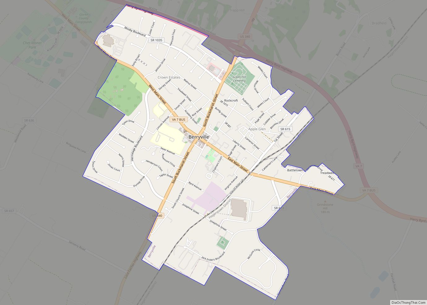
Berryville is an incorporated town in and the county seat of Clarke County, Virginia, United States. The population was 4,574 at the 2020 census, up from 4,185 at the 2010 census.
| Name: | Berryville town |
|---|---|
| LSAD Code: | 43 |
| LSAD Description: | town (suffix) |
| State: | Virginia |
| County: | Clarke County |
| Elevation: | 591 ft (180 m) |
| Total Area: | 2.27 sq mi (5.88 km²) |
| Land Area: | 2.27 sq mi (5.88 km²) |
| Water Area: | 0.00 sq mi (0.00 km²) |
| Total Population: | 4,185 |
| Population Density: | 1,926.40/sq mi (743.73/km²) |
| ZIP code: | 22611 |
| Area code: | 540 |
| FIPS code: | 5106968 |
| GNISfeature ID: | 1498453 |
| Website: | www.berryvilleva.gov |
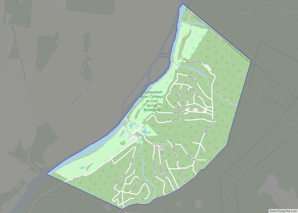
Online Interactive Map
Click on ![]() to view map in "full screen" mode.
to view map in "full screen" mode.
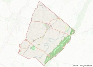
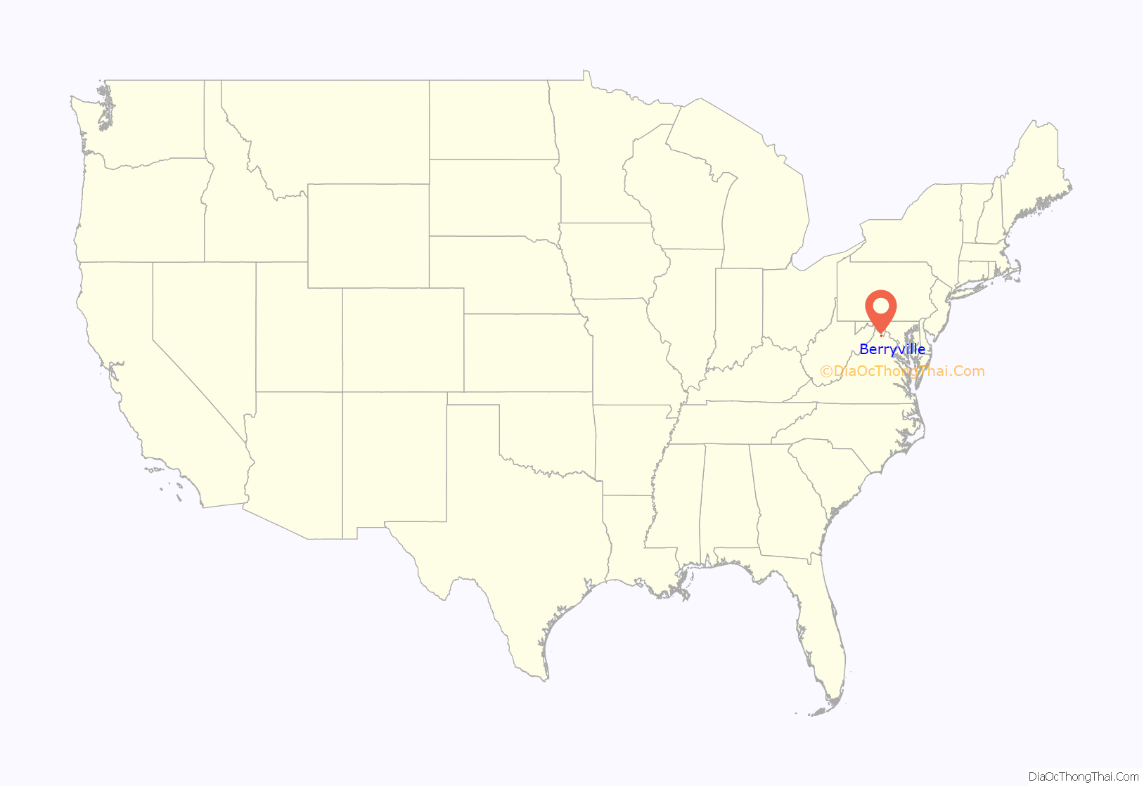
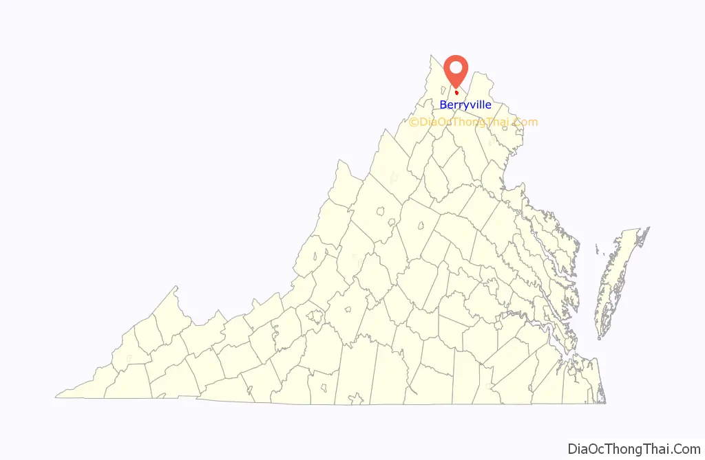
Berryville location map. Where is Berryville town?
History
Berryville was founded at the intersection of the Winchester Turnpike and Charlestown Road. The land was first granted by the Crown to Captain Isaac Pennington in 1734, and George Washington surveyed it on October 23, 1750. In 1754, Pennington sold the land to Colonel John Hite.
According to legend, Daniel Morgan would engage in combat with young toughs at the intersection, having first piled large stones nearby to use as ammunition in case of need. Because of this story, and a rowdy tavern nearby, the area was first given the informal name of “Battle Town”.
Hite sold the tract in 1765 to his son-in-law, Major Charles Smith. Smith named his estate “Battle Town”, and on the site of the former tavern he built a clapboard homestead. This structure still stands on what is now Main Street and is now known as “The Nook”.
Daniel Morgan returned to the area after distinguishing himself in the Revolution, living at Saratoga, and briefly at Soldier’s Rest. He was one of the frequent (and reputedly most quarrelsome) patrons of the new tavern (where now stands the Battletown Inn).
Major Smith’s son, John Smith, in 1797 sold 20 acres (81,000 m) of his inheritance to Benjamin Berry and Sarah (Berry) Stribling, who divided it into lots for a town. It was established as the town of Berryville on January 15, 1798.
By 1810, the town had at least 25 homes, three stores, an apothecary (pharmacy), two taverns, and an academy (school). It was not much larger when it was designated as the county seat of newly formed Clarke County in 1836. An 1855 gazetteer described it as “a small town” that “has some trade, and contains an academy and 1 or 2 churches.”
In the Gettysburg Campaign, the town was used as an outpost supporting Winchester during Second Battle of Winchester. In 1864 General Jubal A. Early briefly had his headquarters in the town. Not long afterward the Battle of Berryville was fought in and around the town during the Valley Campaigns of 1864.
The railroad reached the town in the 1870s.
Virginia governor and U.S. senator Harry F. Byrd long resided in Berryville. A state senator in 1916, he built a log cabin named “Westwood” (a name he also gave his daughter) in Berryville at a family-owned orchard. The cabin was constructed from chestnut logs prior to the chestnut blight. In 1926, Byrd purchased Rosemont, an estate adjacent to his family’s apple orchards in Berryville. He moved there with his family after his term as governor ended in 1929.
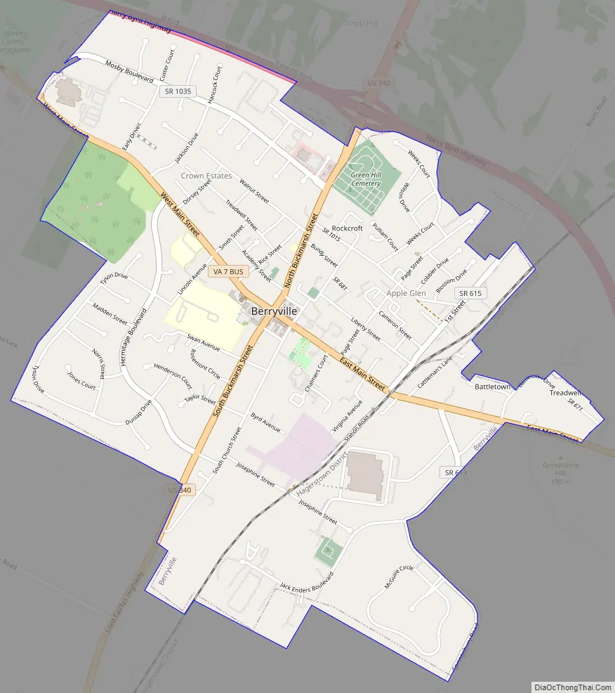
Berryville Road Map
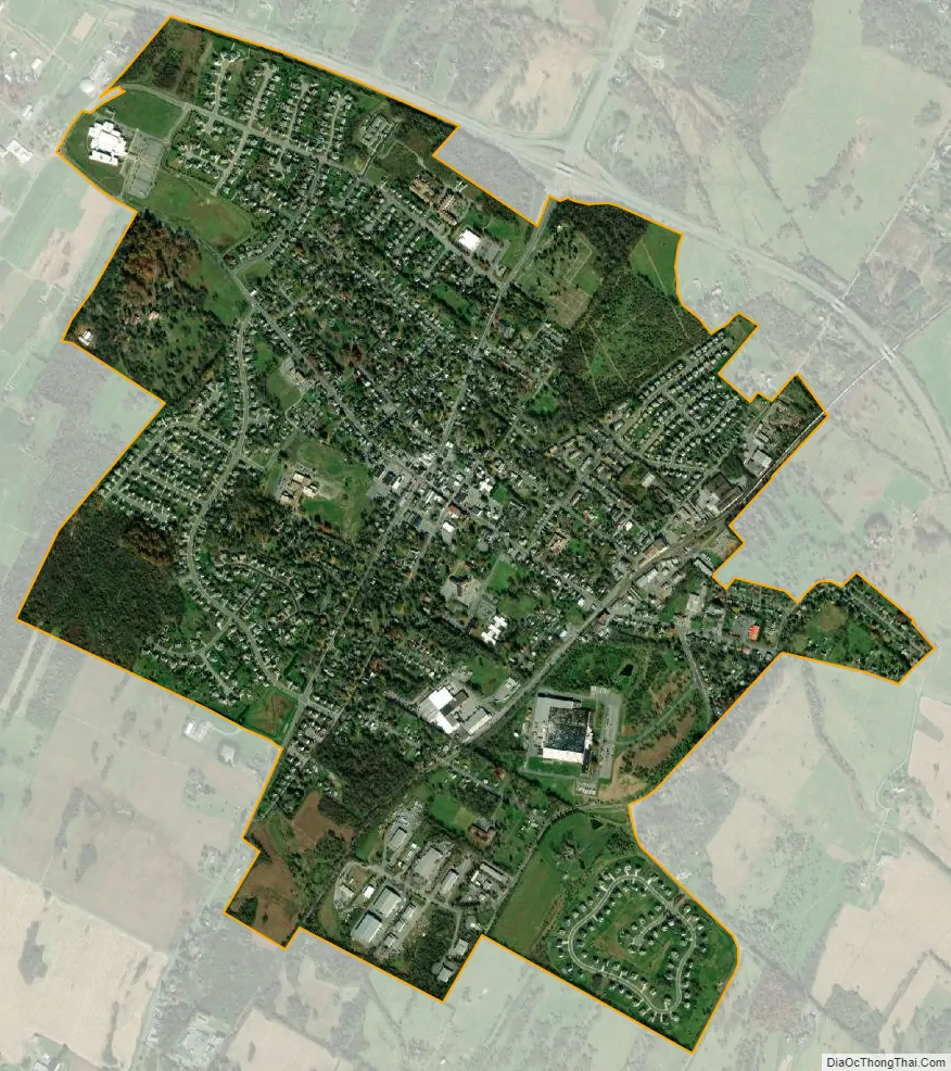
Berryville city Satellite Map
Geography
Berryville is located in the northern Shenandoah Valley, 11 miles (18 km) east of Winchester and 5 miles (8 km) south of the West Virginia border. U.S. Route 340 passes through the center of town, leading northeast 12 miles (19 km) to Charles Town, West Virginia, and southwest 22 miles (35 km) to Front Royal. Virginia State Route 7 bypasses Berryville along its northern border as a four-lane freeway, leading west to Winchester and east across the Blue Ridge Mountains 24 miles (39 km) to Leesburg.
According to the United States Census Bureau, Berryville has a total area of 2.3 square miles (5.9 km), all of it land.
See also
Map of Virginia State and its subdivision:- Accomack
- Albemarle
- Alexandria
- Alleghany
- Amelia
- Amherst
- Appomattox
- Arlington
- Augusta
- Bath
- Bedford
- Bedford City
- Bland
- Botetourt
- Bristol
- Brunswick
- Buchanan
- Buckingham
- Buena Vista
- Campbell
- Caroline
- Carroll
- Charles City
- Charlotte
- Charlottesville
- Chesapeake
- Chesterfield
- Clarke
- Clifton Forge City
- Colonial Heights
- Covington
- Craig
- Culpeper
- Cumberland
- Danville
- Dickenson
- Dinwiddie
- Emporia
- Essex
- Fairfax
- Fairfax City
- Falls Church
- Fauquier
- Floyd
- Fluvanna
- Franklin
- Frederick
- Fredericksburg
- Galax
- Giles
- Gloucester
- Goochland
- Grayson
- Greene
- Greensville
- Halifax
- Hampton
- Hanover
- Harrisonburg
- Henrico
- Henry
- Highland
- Hopewell
- Isle of Wight
- James City
- King and Queen
- King George
- King William
- Lancaster
- Lee
- Lexington
- Loudoun
- Louisa
- Lunenburg
- Lynchburg
- Madison
- Manassas
- Manassas Park
- Martinsville
- Mathews
- Mecklenburg
- Middlesex
- Montgomery
- Nelson
- New Kent
- Newport News
- Norfolk
- Northampton
- Northumberland
- Norton
- Nottoway
- Orange
- Page
- Patrick
- Petersburg
- Pittsylvania
- Poquoson
- Portsmouth
- Powhatan
- Prince Edward
- Prince George
- Prince William
- Pulaski
- Radford
- Rappahannock
- Richmond
- Roanoke
- Roanoke City
- Rockbridge
- Rockingham
- Russell
- Salem
- Scott
- Shenandoah
- Smyth
- Southampton
- Spotsylvania
- Stafford
- Staunton
- Suffolk
- Surry
- Sussex
- Tazewell
- Virginia Beach
- Warren
- Washington
- Waynesboro
- Westmoreland
- Williamsburg
- Winchester
- Wise
- Wythe
- York
- Alabama
- Alaska
- Arizona
- Arkansas
- California
- Colorado
- Connecticut
- Delaware
- District of Columbia
- Florida
- Georgia
- Hawaii
- Idaho
- Illinois
- Indiana
- Iowa
- Kansas
- Kentucky
- Louisiana
- Maine
- Maryland
- Massachusetts
- Michigan
- Minnesota
- Mississippi
- Missouri
- Montana
- Nebraska
- Nevada
- New Hampshire
- New Jersey
- New Mexico
- New York
- North Carolina
- North Dakota
- Ohio
- Oklahoma
- Oregon
- Pennsylvania
- Rhode Island
- South Carolina
- South Dakota
- Tennessee
- Texas
- Utah
- Vermont
- Virginia
- Washington
- West Virginia
- Wisconsin
- Wyoming