Front Royal is the only incorporated town in Warren County, Virginia, United States. The population was 15,011 at the 2020 census. It is the county seat of Warren County.
| Name: | Front Royal town |
|---|---|
| LSAD Code: | 43 |
| LSAD Description: | town (suffix) |
| State: | Virginia |
| County: | Warren County |
| Founded: | 1788 |
| Elevation: | 568 ft (173 m) |
| Total Area: | 10.52 sq mi (27.24 km²) |
| Land Area: | 10.27 sq mi (26.61 km²) |
| Water Area: | 0.24 sq mi (0.63 km²) |
| Total Population: | 15,011 |
| Population Density: | 1,430.48/sq mi (552.33/km²) |
| ZIP code: | 22630 |
| Area code: | 540 |
| FIPS code: | 5129968 |
| GNISfeature ID: | 1498480 |
| Website: | http://www.frontroyalva.com |
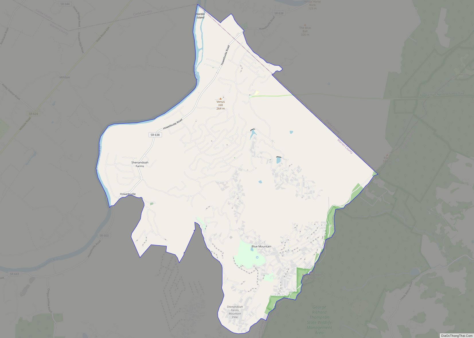
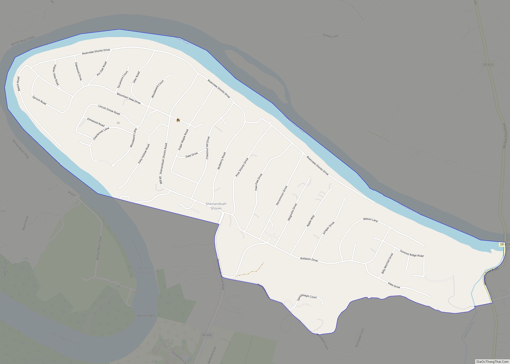
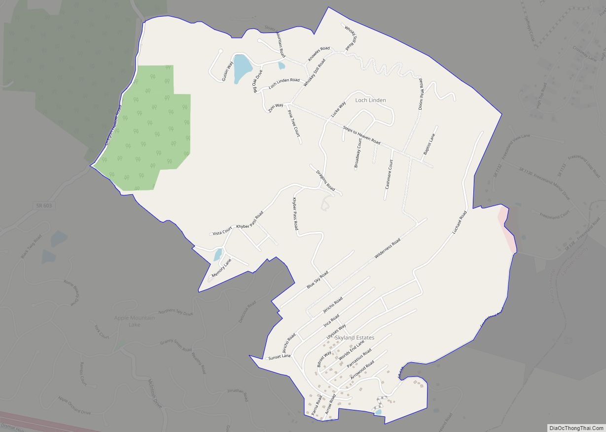
Online Interactive Map
Click on ![]() to view map in "full screen" mode.
to view map in "full screen" mode.
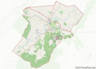
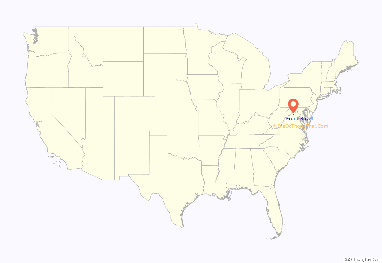
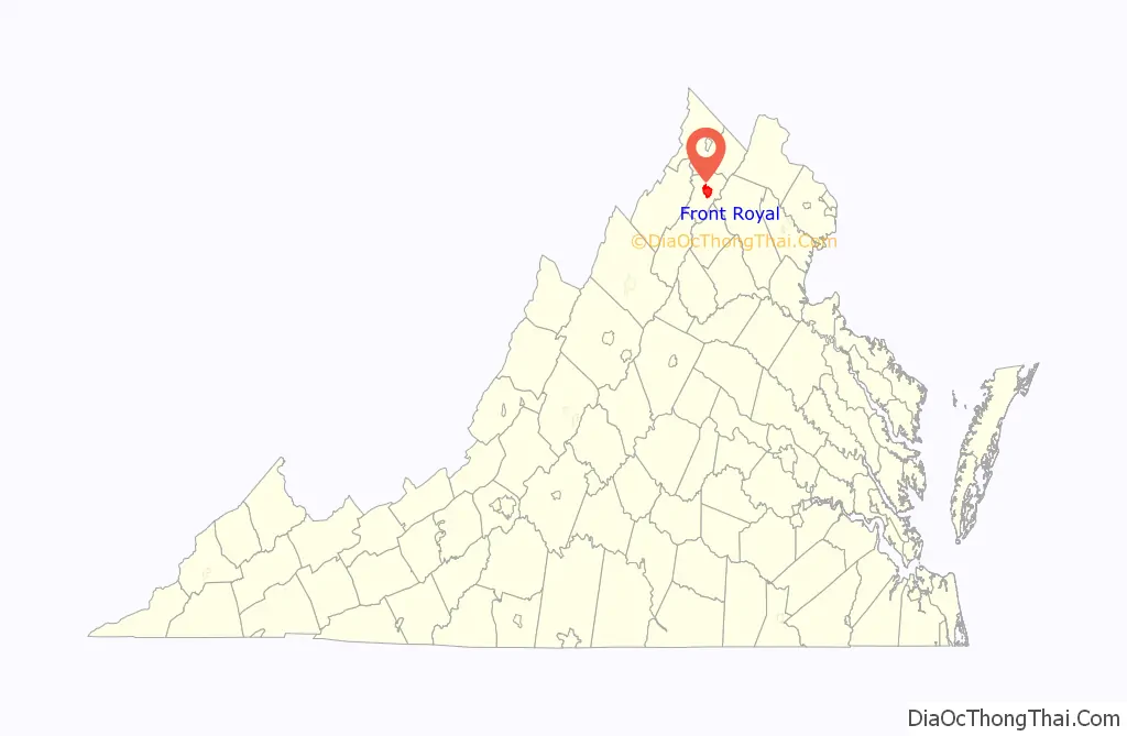
Front Royal location map. Where is Front Royal town?
History
The entire Shenandoah Valley including the area to become Front Royal was annexed and claimed for hunting by the Iroquois Confederation during the later Beaver Wars, by 1672. Some bands of the Shawnee settled in the area as client groups to the Iroquois and alternately to the Cherokee after 1721. The Iroquois formally sold their entire claim east of the Alleghenies to the Virginia Colony at the Treaty of Lancaster in 1744. Front Royal, originally settled in 1754 under the name LeHewtown, had been known to European explorers as early as the 1670s, and the nearby settlement of Chester’s Ferry was in existence by 1736. The town also had a well-known nickname by the 1790s, “Helltown,” due to the many livestock wranglers and boatmen on the Shenandoah coming through the area, who came into town looking for alcohol. It was incorporated as “Front Royal” in 1788.
Rail service was established in 1854 with the construction of the Alexandria, Orange and Manassas Gap Railroad between Manassas and Riverton. This line was soon extended to Strasburg in time to become a factor in the Battle of Front Royal on May 23, 1862, and throughout the Civil War. Lumber, agriculture, manufacturing and grain mills provided employment in the region for decades after the Civil War.
The American Viscose rayon plant, once Front Royal’s principal employer, with 3,000 workers at its peak, operated between the 1930s and 1989. The plant manufactured rayon for tires during World War II and later produced rayon for rocket nozzles for the Defense Department and the National Aeronautics and Space Administration.
Etymology
Several theories regarding the origins of the name “Front Royal” have been suggested.
A common theory is that the town was named for a giant oak tree – the “Royal” Tree of England – that stood in the public square during colonial days where Chester and Main Streets now join. It was there that the local militia were drilled. During drills, a frequent command given by the drill sergeant was, “front the Royal Oak!” The command was repeated and eventually shortened to simply “Front Royal”. This theory is supported by a bulletin published by the United States Geological Survey in 1905, which states that the town was first known as Royal Oak, with the current name being derived from the commands of a confused colonel.
A second account holds that when local militia were stationed around the town during the American Revolution, the sentry would call out “Front”, to which the required entry password was to respond “Royal”. Eventually their military post became known as “Camp Front Royal”.
A third version holds that, in early decades of European settlement, the area was referred to in French as “le front royal”, meaning the British frontier. French settlers, trappers, and explorers in the Ohio Country of the mid-18th century were referring to the land grant made by King Charles II, then in control of Thomas, Lord Fairfax, Baron of Cameron. In English, “le front royal” is translated to the “Royal Frontier”.
The name was in common usage by 1788, when the town was incorporated as “Front-Royal.”
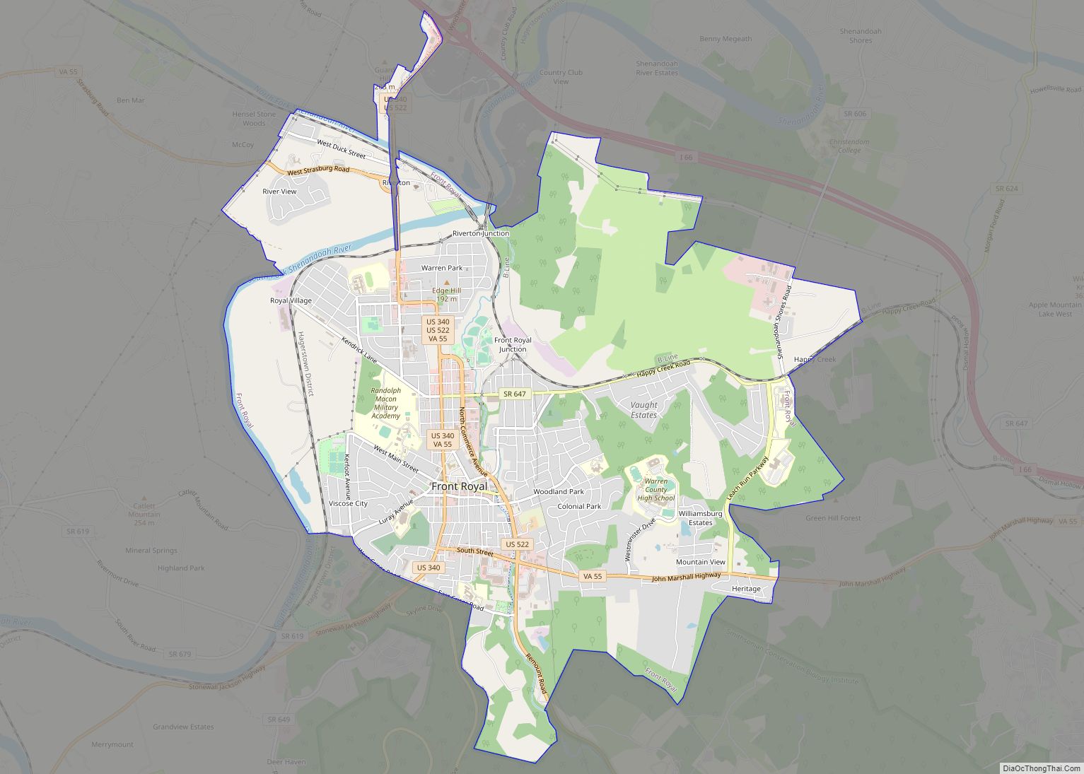
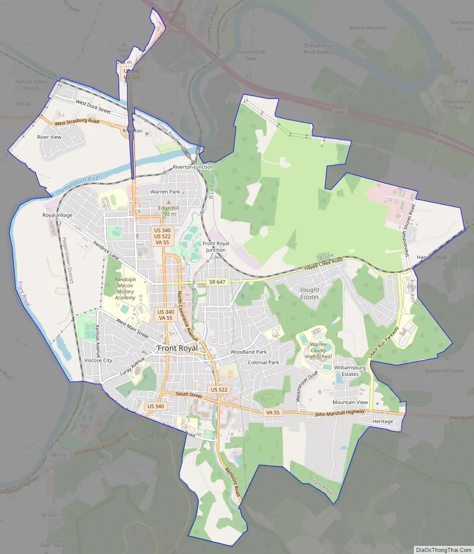
Front Royal Road Map
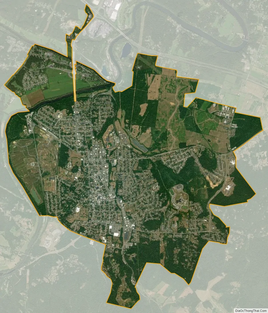
Front Royal city Satellite Map
Geography
Front Royal is approximately 76 miles (122 km) west of Washington, D.C., 13 miles (21 km) southeast of Middletown, 12.5 (20 km) miles east of Strasburg and 26.3 miles (42 km) northeast of Woodstock.
According to the 2010 United States Census, the town has a total area of 9.5 square miles (24.6 km), of which 9.3 square miles (24.1 km) is land and 0.2 square miles (0.5 km) (2.52%) is water. In 2014, the town annexed additional land, increasing the town’s total land area to 10.5 square miles (27.2 km).
Front Royal is located at the confluence of the North and South Forks of the Shenandoah River.
Climate
Front Royal experiences a humid subtropical climate, with summer highs in the low to mid 80s and winter lows in the upper 20s. Front Royal averages 43 inches of precipitation per year, with 24 inches of snowfall per year.
See also
Map of Virginia State and its subdivision:- Accomack
- Albemarle
- Alexandria
- Alleghany
- Amelia
- Amherst
- Appomattox
- Arlington
- Augusta
- Bath
- Bedford
- Bedford City
- Bland
- Botetourt
- Bristol
- Brunswick
- Buchanan
- Buckingham
- Buena Vista
- Campbell
- Caroline
- Carroll
- Charles City
- Charlotte
- Charlottesville
- Chesapeake
- Chesterfield
- Clarke
- Clifton Forge City
- Colonial Heights
- Covington
- Craig
- Culpeper
- Cumberland
- Danville
- Dickenson
- Dinwiddie
- Emporia
- Essex
- Fairfax
- Fairfax City
- Falls Church
- Fauquier
- Floyd
- Fluvanna
- Franklin
- Frederick
- Fredericksburg
- Galax
- Giles
- Gloucester
- Goochland
- Grayson
- Greene
- Greensville
- Halifax
- Hampton
- Hanover
- Harrisonburg
- Henrico
- Henry
- Highland
- Hopewell
- Isle of Wight
- James City
- King and Queen
- King George
- King William
- Lancaster
- Lee
- Lexington
- Loudoun
- Louisa
- Lunenburg
- Lynchburg
- Madison
- Manassas
- Manassas Park
- Martinsville
- Mathews
- Mecklenburg
- Middlesex
- Montgomery
- Nelson
- New Kent
- Newport News
- Norfolk
- Northampton
- Northumberland
- Norton
- Nottoway
- Orange
- Page
- Patrick
- Petersburg
- Pittsylvania
- Poquoson
- Portsmouth
- Powhatan
- Prince Edward
- Prince George
- Prince William
- Pulaski
- Radford
- Rappahannock
- Richmond
- Roanoke
- Roanoke City
- Rockbridge
- Rockingham
- Russell
- Salem
- Scott
- Shenandoah
- Smyth
- Southampton
- Spotsylvania
- Stafford
- Staunton
- Suffolk
- Surry
- Sussex
- Tazewell
- Virginia Beach
- Warren
- Washington
- Waynesboro
- Westmoreland
- Williamsburg
- Winchester
- Wise
- Wythe
- York
- Alabama
- Alaska
- Arizona
- Arkansas
- California
- Colorado
- Connecticut
- Delaware
- District of Columbia
- Florida
- Georgia
- Hawaii
- Idaho
- Illinois
- Indiana
- Iowa
- Kansas
- Kentucky
- Louisiana
- Maine
- Maryland
- Massachusetts
- Michigan
- Minnesota
- Mississippi
- Missouri
- Montana
- Nebraska
- Nevada
- New Hampshire
- New Jersey
- New Mexico
- New York
- North Carolina
- North Dakota
- Ohio
- Oklahoma
- Oregon
- Pennsylvania
- Rhode Island
- South Carolina
- South Dakota
- Tennessee
- Texas
- Utah
- Vermont
- Virginia
- Washington
- West Virginia
- Wisconsin
- Wyoming