Bowling Green is an incorporated town in Caroline County, Virginia, United States. The population was 1,111 at the 2010 census.
The county seat of Caroline County since 1803, Bowling Green is best known as the “cradle of American horse racing”, the home of the second oldest Virginia Masonic Lodge, and the current location of the oldest continuously inhabited residence in Virginia.
| Name: | Bowling Green town |
|---|---|
| LSAD Code: | 43 |
| LSAD Description: | town (suffix) |
| State: | Virginia |
| County: | Caroline County |
| Founded: | 1837 |
| Elevation: | 226 ft (69 m) |
| Total Area: | 1.63 sq mi (4.22 km²) |
| Land Area: | 1.60 sq mi (4.15 km²) |
| Water Area: | 0.02 sq mi (0.06 km²) |
| Total Population: | 1,111 |
| Population Density: | 732.54/sq mi (282.81/km²) |
| ZIP code: | 22427-22428 |
| Area code: | 804 |
| FIPS code: | 5108888 |
| GNISfeature ID: | 1498454 |
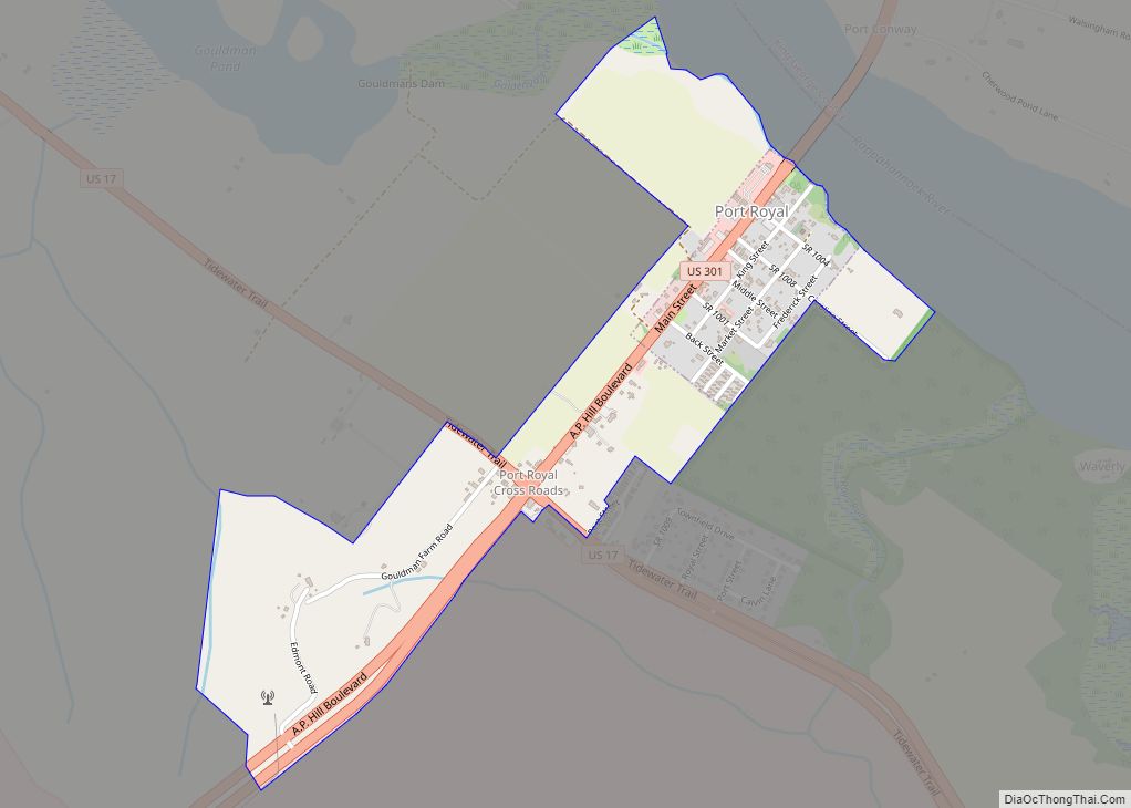
Online Interactive Map
Click on ![]() to view map in "full screen" mode.
to view map in "full screen" mode.
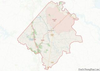
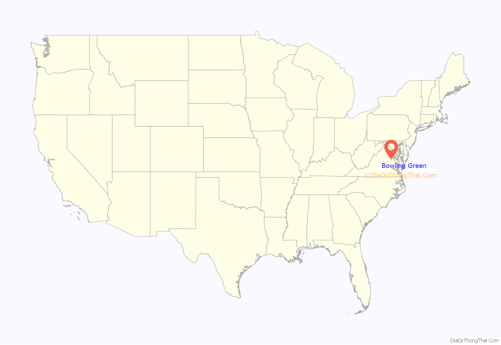
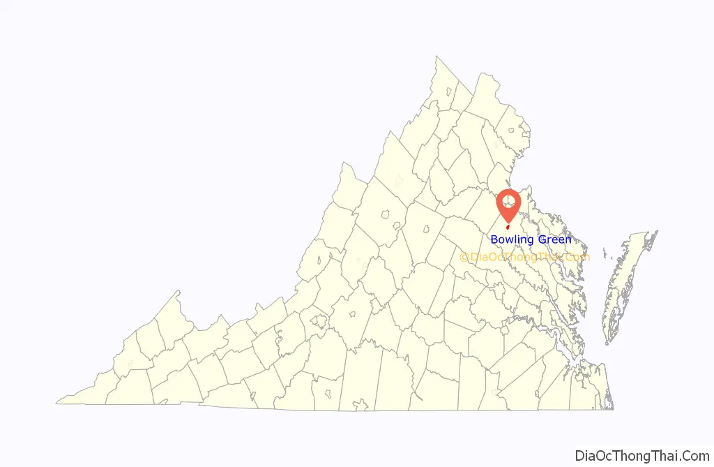
Bowling Green location map. Where is Bowling Green town?
History
The town of Bowling Green was earlier known as New Hope. One of the earliest stage roads in the colony ran through the area from Richmond to the Potomac River, where a ferry crossing was operated to Charles County, Maryland. One of the first stage lines in America to maintain a regular schedule operated along this road. New Hope Tavern was built along the road in the 18th century and the area around it became known as New Hope.
The town was renamed for “The Bowling Green” which was the plantation of town founder, Major John Thomas Hoomes, who donated the land and funds for a new courthouse when the community became the county seat in 1803. The origin of the plantation’s name is not definitive but may be based on the 2-acre (8,100 m) green sward in front of the plantation house itself. The Bowling Green Estate was the site of one of the first tracks built to race horses in America. The plantation house, pre-Georgian tidewater colonial in style, was built circa 1741. A prominent colonial landmark, it is one of the oldest houses in original condition in Virginia and is listed on both the Virginia Landmarks Register and the National Register of Historic Places.
The present Caroline County Court House was built in 1835 and Bowling Green was incorporated as a town about 2 years later, in 1837. The town is best known as the “cradle of American horse racing” and as the home of the second-oldest Masonic Lodge in Virginia, Kilwinning Crosse, No. 2-237 .
The Richmond, Fredericksburg and Potomac Railroad (chartered in 1834) was built through nearby Milford (just west of town) and reached Fredericksburg by 1837. This important rail link between several major northern railroads at Washington, DC and other major southern railroads at Richmond was long partially owned by the Commonwealth of Virginia, and became part of CSX Transportation in the 1990s. It is a major freight railroad line for north–south traffic and the corridor also hosts many Amtrak trains. Although the closest Virginia Railway Express (VRE) commuter passenger rail service to Northern Virginia is currently accessed at Fredericksburg, future VRE extensions southward may include service at Milford which would be very convenient for Bowling Green and the surrounding area.
In 1855, a gazetteer described the town as having “2 churches, 3 stores, 2 mills, and about 300 inhabitants”.
Today, Bowling Green is located along Virginia State Route 2, one of the two earlier highways between Richmond and Fredericksburg. In later years, U.S. Route 301 was built through the area, connecting Richmond with Baltimore, Maryland with what was effectively an eastern bypass of the Washington, DC area for north–south traffic along the U.S. east coast. A new road, Virginia State Route 207 was established from Bowling Green west to Carmel Church, where it intersects Interstate 95 and U.S. Route 1, major north–south highways. The musician Jason Manns is from Bowling Green.
In 1941, the United States government acquired 77,000 acres (310 km) of Caroline County to the north and east of Bowling Green and established the A.P. Hill Military Reservation. Now known as Fort A.P. Hill, it was named for a Virginia military hero, U.S. Army and later Confederate General Ambrose Powell Hill, who was killed just prior to the end of the War in 1865. At the massive complex, thousands of regular military and reserve troops undergo training each year. It has also been the site of national Jamboree gatherings of the Boy Scouts of America.
In addition to “The Bowling Green,” Auburn, the Bowling Green Historic District, Caroline County Courthouse, and Green Falls are listed on the National Register of Historic Places.
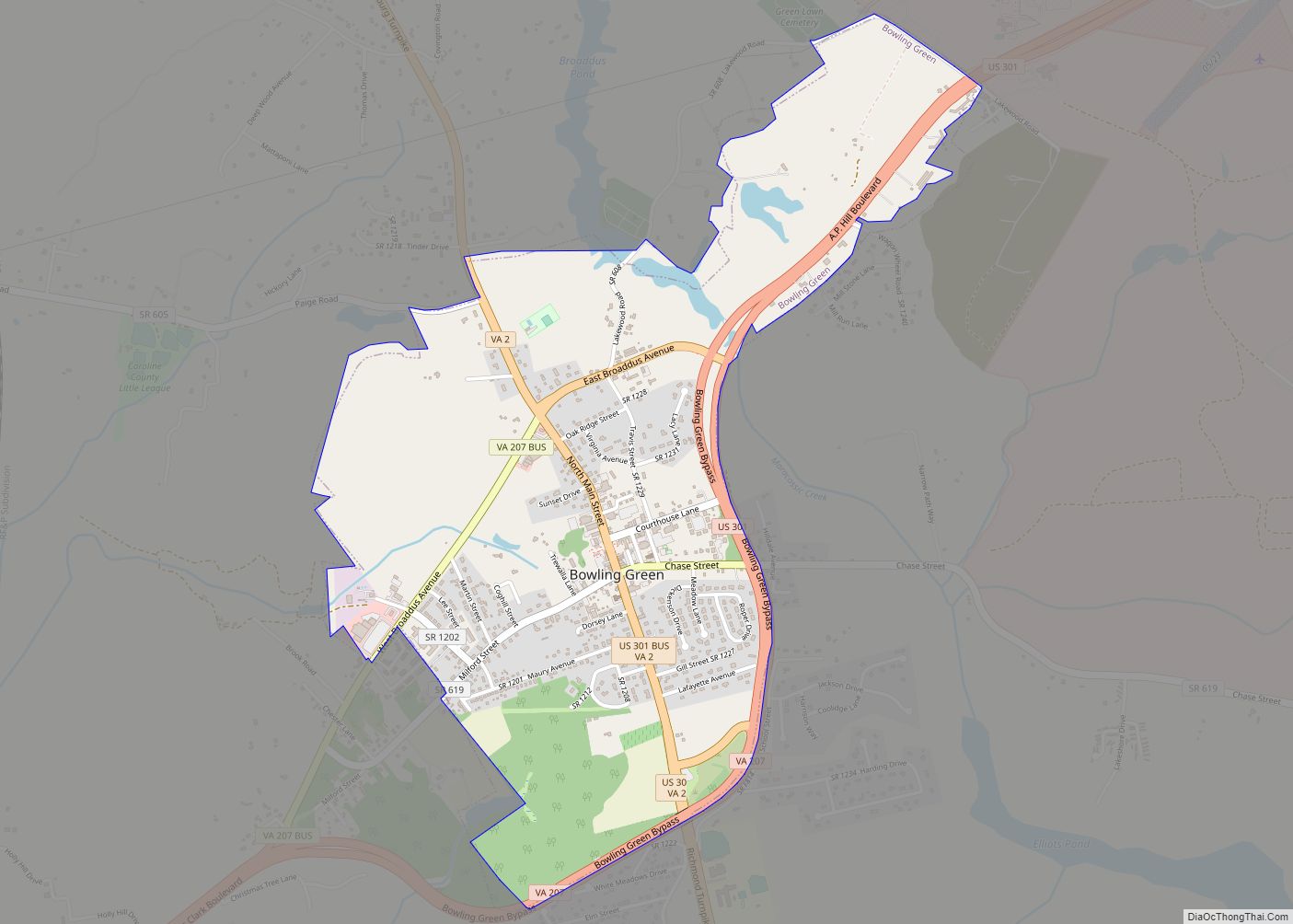
Bowling Green Road Map
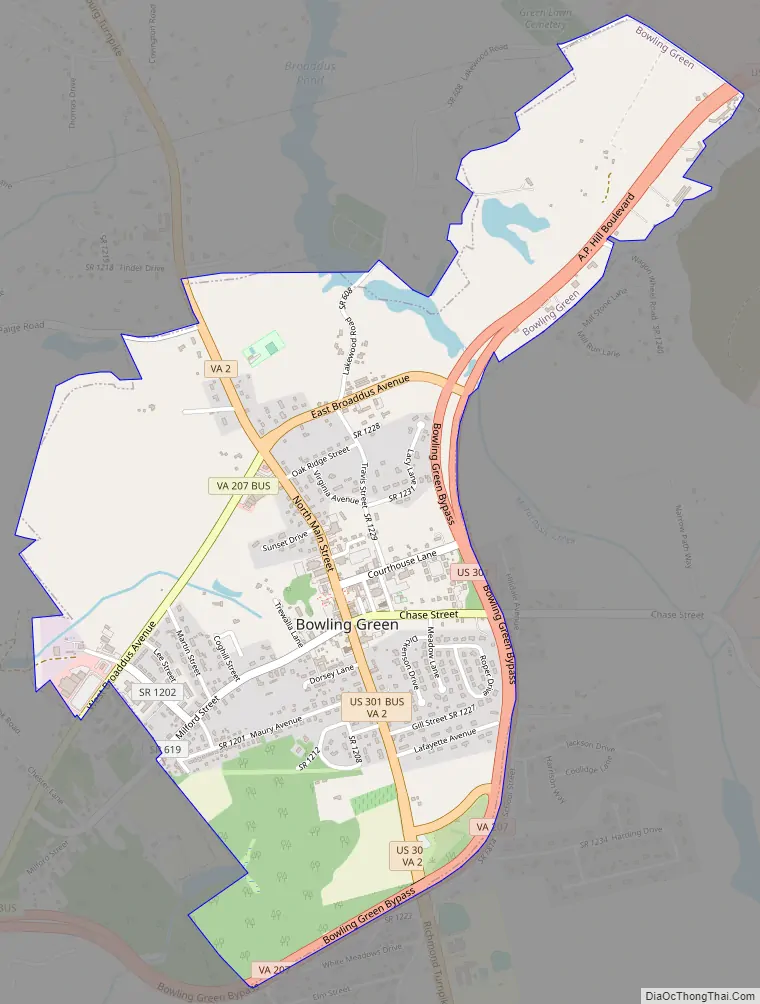
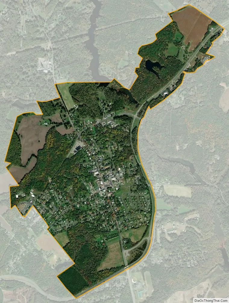
Bowling Green city Satellite Map
Geography
Bowling Green is located at 38°3′12″N 77°20′51″W / 38.05333°N 77.34750°W / 38.05333; -77.34750 (38.053428, −77.347404).
According to the United States Census Bureau, the town has a total area of 1.6 square miles (4.2 km), of which 1.6 square miles (4.1 km) is land and 0.04 square mile (0.1 km) (1.24%) is water.
See also
Map of Virginia State and its subdivision:- Accomack
- Albemarle
- Alexandria
- Alleghany
- Amelia
- Amherst
- Appomattox
- Arlington
- Augusta
- Bath
- Bedford
- Bedford City
- Bland
- Botetourt
- Bristol
- Brunswick
- Buchanan
- Buckingham
- Buena Vista
- Campbell
- Caroline
- Carroll
- Charles City
- Charlotte
- Charlottesville
- Chesapeake
- Chesterfield
- Clarke
- Clifton Forge City
- Colonial Heights
- Covington
- Craig
- Culpeper
- Cumberland
- Danville
- Dickenson
- Dinwiddie
- Emporia
- Essex
- Fairfax
- Fairfax City
- Falls Church
- Fauquier
- Floyd
- Fluvanna
- Franklin
- Frederick
- Fredericksburg
- Galax
- Giles
- Gloucester
- Goochland
- Grayson
- Greene
- Greensville
- Halifax
- Hampton
- Hanover
- Harrisonburg
- Henrico
- Henry
- Highland
- Hopewell
- Isle of Wight
- James City
- King and Queen
- King George
- King William
- Lancaster
- Lee
- Lexington
- Loudoun
- Louisa
- Lunenburg
- Lynchburg
- Madison
- Manassas
- Manassas Park
- Martinsville
- Mathews
- Mecklenburg
- Middlesex
- Montgomery
- Nelson
- New Kent
- Newport News
- Norfolk
- Northampton
- Northumberland
- Norton
- Nottoway
- Orange
- Page
- Patrick
- Petersburg
- Pittsylvania
- Poquoson
- Portsmouth
- Powhatan
- Prince Edward
- Prince George
- Prince William
- Pulaski
- Radford
- Rappahannock
- Richmond
- Roanoke
- Roanoke City
- Rockbridge
- Rockingham
- Russell
- Salem
- Scott
- Shenandoah
- Smyth
- Southampton
- Spotsylvania
- Stafford
- Staunton
- Suffolk
- Surry
- Sussex
- Tazewell
- Virginia Beach
- Warren
- Washington
- Waynesboro
- Westmoreland
- Williamsburg
- Winchester
- Wise
- Wythe
- York
- Alabama
- Alaska
- Arizona
- Arkansas
- California
- Colorado
- Connecticut
- Delaware
- District of Columbia
- Florida
- Georgia
- Hawaii
- Idaho
- Illinois
- Indiana
- Iowa
- Kansas
- Kentucky
- Louisiana
- Maine
- Maryland
- Massachusetts
- Michigan
- Minnesota
- Mississippi
- Missouri
- Montana
- Nebraska
- Nevada
- New Hampshire
- New Jersey
- New Mexico
- New York
- North Carolina
- North Dakota
- Ohio
- Oklahoma
- Oregon
- Pennsylvania
- Rhode Island
- South Carolina
- South Dakota
- Tennessee
- Texas
- Utah
- Vermont
- Virginia
- Washington
- West Virginia
- Wisconsin
- Wyoming