Brambleton is a census-designated place (CDP) in Loudoun County, Virginia, United States, south of the Dulles Greenway. The population as of the 2010 United States Census was 9,845. In 2017, Brambleton had an estimated population of 19,900, with a median age of 34.3 and a median household income of $173,690. Between 2016 and 2017 the population of Brambleton, VA grew from 17,063 to 19,876, a 16.5% increase and its median household income grew from $164,321 to $173,690, a 5.7% increase. Construction started on the Brambleton community in 2001.
| Name: | Brambleton CDP |
|---|---|
| LSAD Code: | 57 |
| LSAD Description: | CDP (suffix) |
| State: | Virginia |
| County: | Loudoun County |
| Elevation: | 380 ft (120 m) |
| Total Area: | 5.81 sq mi (15.04 km²) |
| Land Area: | 5.75 sq mi (14.90 km²) |
| Water Area: | 0.05 sq mi (0.13 km²) |
| Total Population: | 19,876 |
| ZIP code: | 20148 |
| Area code: | 571 and 703 |
| FIPS code: | 5109188 |
| GNISfeature ID: | 2584813 |
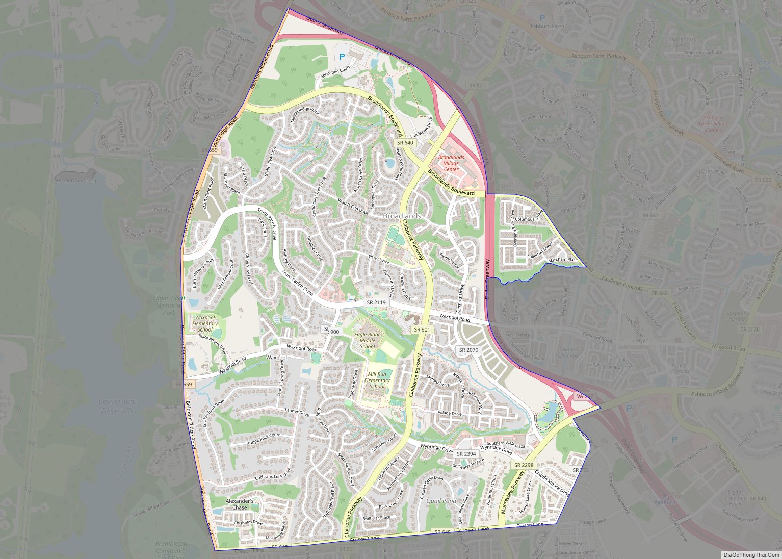
Online Interactive Map
Click on ![]() to view map in "full screen" mode.
to view map in "full screen" mode.
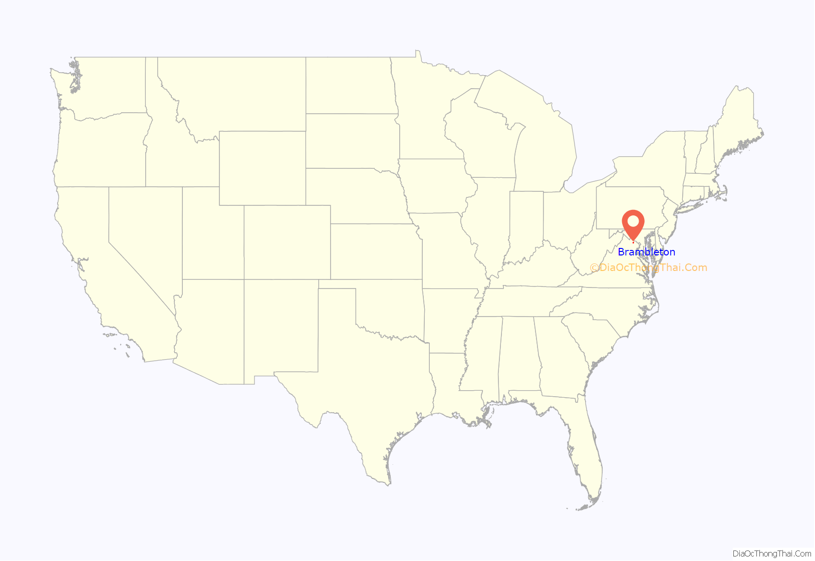
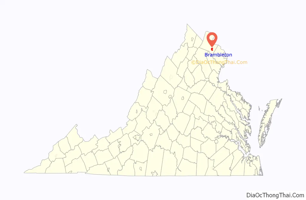
Brambleton location map. Where is Brambleton CDP?
History
Brambleton is located at the site of the former community of Royville, which existed as early as 1908 at the intersection of Belmont Ridge Road and Creighton Road. Developing the Brambleton planned community began in earnest in the spring of 1999, immediately after Brambleton Group L.L.C., a division of Soave Real Estate, acquired the property. Road improvements were necessary along Route 607/772 to connect Brambleton via the Loudoun County Parkway to Exit 7 of the Dulles Greenway.
Residents in the development are members of the Brambleton Community Association, a homeowners association.
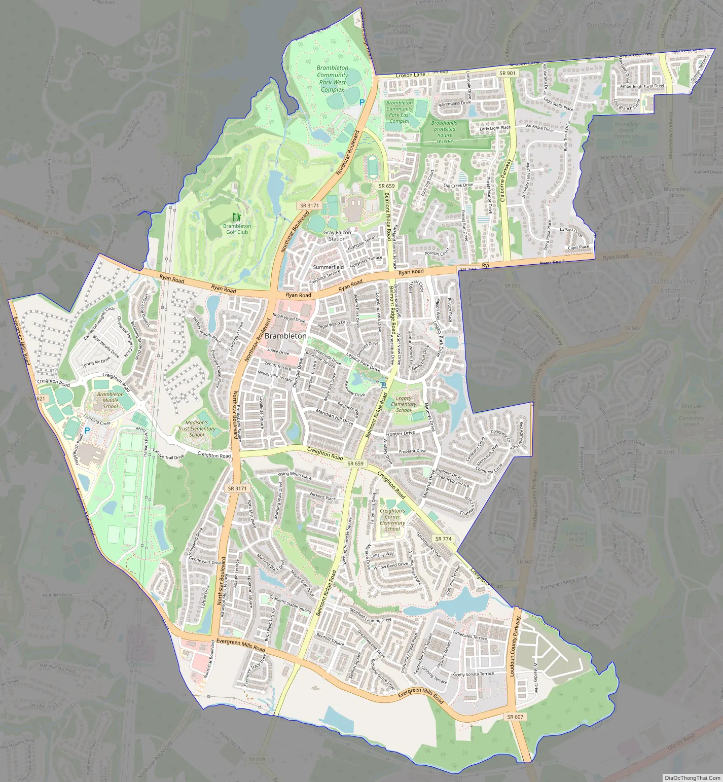
Brambleton Road Map
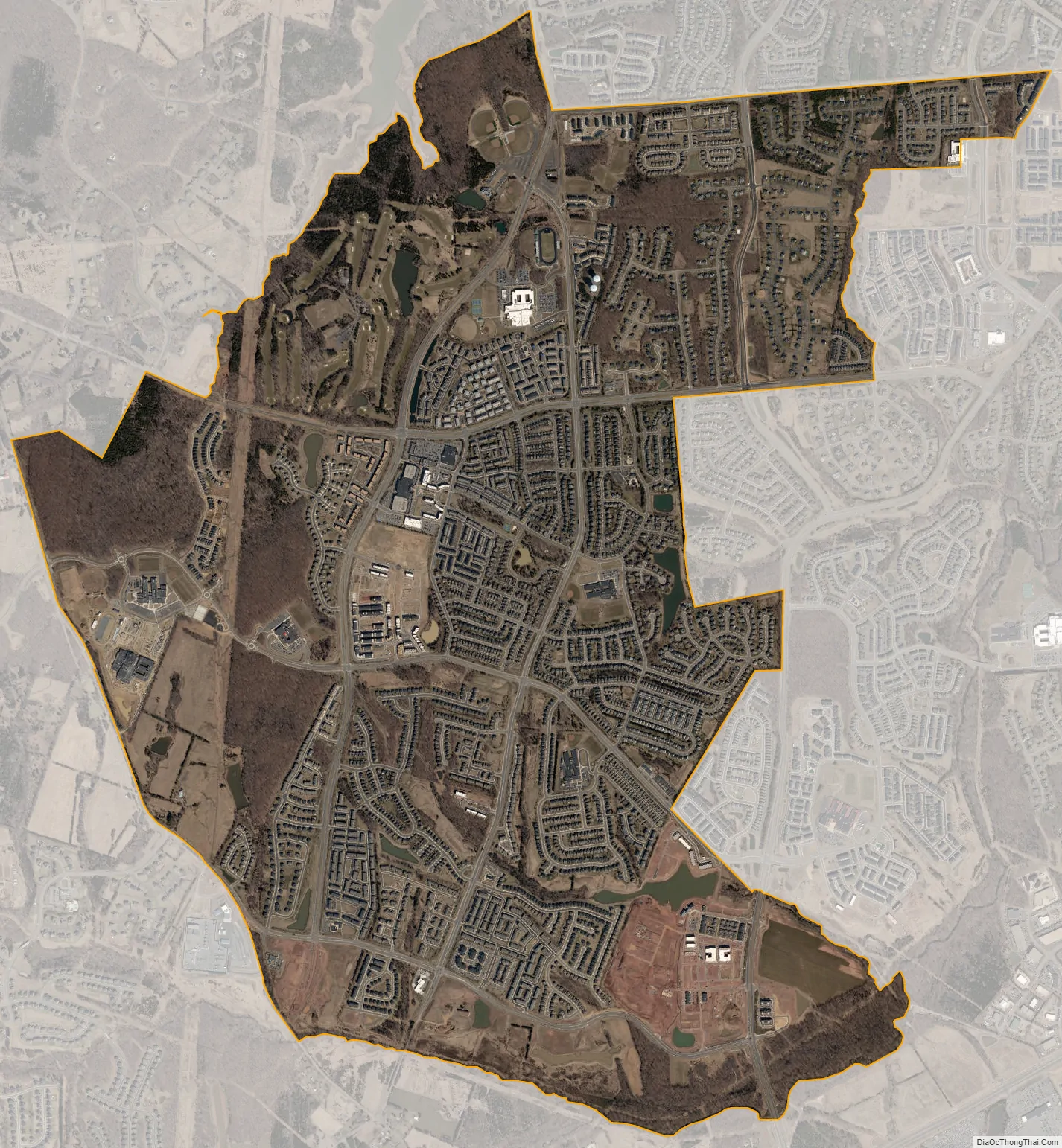
Brambleton city Satellite Map
Geography
Brambleton is located in southeastern Loudoun County, 11 miles (18 km) south of Leesburg, the county seat, and 1.3 mi (2.1 km) northwest of Washington Dulles International Airport. It is 33 miles (53 km) by highway west of downtown Washington, D.C. Neighboring communities counted by the U.S. Census Bureau include Broadlands to the north, Moorefield or Moorefield Station to the northeast, Loudoun Valley Estates to the east, and Arcola to the south. To the west is rural or low-density suburban land.
According to the Census Bureau, the Brambleton CDP has a total area of 5.8 square miles (15.0 km), of which 0.04 square miles (0.1 km), or 0.88%, are water. The community drains north to Beaverdam Run and east to Broad Run, both part of the Potomac River watershed.
See also
Map of Virginia State and its subdivision:- Accomack
- Albemarle
- Alexandria
- Alleghany
- Amelia
- Amherst
- Appomattox
- Arlington
- Augusta
- Bath
- Bedford
- Bedford City
- Bland
- Botetourt
- Bristol
- Brunswick
- Buchanan
- Buckingham
- Buena Vista
- Campbell
- Caroline
- Carroll
- Charles City
- Charlotte
- Charlottesville
- Chesapeake
- Chesterfield
- Clarke
- Clifton Forge City
- Colonial Heights
- Covington
- Craig
- Culpeper
- Cumberland
- Danville
- Dickenson
- Dinwiddie
- Emporia
- Essex
- Fairfax
- Fairfax City
- Falls Church
- Fauquier
- Floyd
- Fluvanna
- Franklin
- Frederick
- Fredericksburg
- Galax
- Giles
- Gloucester
- Goochland
- Grayson
- Greene
- Greensville
- Halifax
- Hampton
- Hanover
- Harrisonburg
- Henrico
- Henry
- Highland
- Hopewell
- Isle of Wight
- James City
- King and Queen
- King George
- King William
- Lancaster
- Lee
- Lexington
- Loudoun
- Louisa
- Lunenburg
- Lynchburg
- Madison
- Manassas
- Manassas Park
- Martinsville
- Mathews
- Mecklenburg
- Middlesex
- Montgomery
- Nelson
- New Kent
- Newport News
- Norfolk
- Northampton
- Northumberland
- Norton
- Nottoway
- Orange
- Page
- Patrick
- Petersburg
- Pittsylvania
- Poquoson
- Portsmouth
- Powhatan
- Prince Edward
- Prince George
- Prince William
- Pulaski
- Radford
- Rappahannock
- Richmond
- Roanoke
- Roanoke City
- Rockbridge
- Rockingham
- Russell
- Salem
- Scott
- Shenandoah
- Smyth
- Southampton
- Spotsylvania
- Stafford
- Staunton
- Suffolk
- Surry
- Sussex
- Tazewell
- Virginia Beach
- Warren
- Washington
- Waynesboro
- Westmoreland
- Williamsburg
- Winchester
- Wise
- Wythe
- York
- Alabama
- Alaska
- Arizona
- Arkansas
- California
- Colorado
- Connecticut
- Delaware
- District of Columbia
- Florida
- Georgia
- Hawaii
- Idaho
- Illinois
- Indiana
- Iowa
- Kansas
- Kentucky
- Louisiana
- Maine
- Maryland
- Massachusetts
- Michigan
- Minnesota
- Mississippi
- Missouri
- Montana
- Nebraska
- Nevada
- New Hampshire
- New Jersey
- New Mexico
- New York
- North Carolina
- North Dakota
- Ohio
- Oklahoma
- Oregon
- Pennsylvania
- Rhode Island
- South Carolina
- South Dakota
- Tennessee
- Texas
- Utah
- Vermont
- Virginia
- Washington
- West Virginia
- Wisconsin
- Wyoming