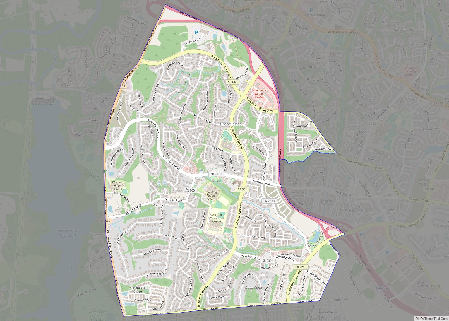
Broadlands is a census-designated place (CDP) in Loudoun County, Virginia, United States. It is a 1,500-acre (610 ha) master-planned community started and developed by Van Metre Homes in the 1990s. It is built on wetlands and is certified as a Community Wildlife Habitat by the National Wildlife Federation.
The population as of the 2010 Census was 12,313.
According to Data US, which includes US Census American Community Survey data, between 2012 and 2016 Broadlands had an estimated population of 13,872 people, with a median age of 33.9 and a median household income of $169,353.
| Name: | Broadlands CDP |
|---|---|
| LSAD Code: | 57 |
| LSAD Description: | CDP (suffix) |
| State: | Virginia |
| County: | Loudoun County |
| Elevation: | 363 ft (111 m) |
| Total Area: | 3.25 sq mi (8.42 km²) |
| Land Area: | 3.23 sq mi (8.37 km²) |
| Water Area: | 0.02 sq mi (0.04 km²) |
| Total Population: | 12,313 |
| Population Density: | 3,808/sq mi (1,470.4/km²) |
| ZIP code: | 20148 |
| Area code: | 571 and 703 |
| FIPS code: | 5109952 |
| GNISfeature ID: | 2584815 |
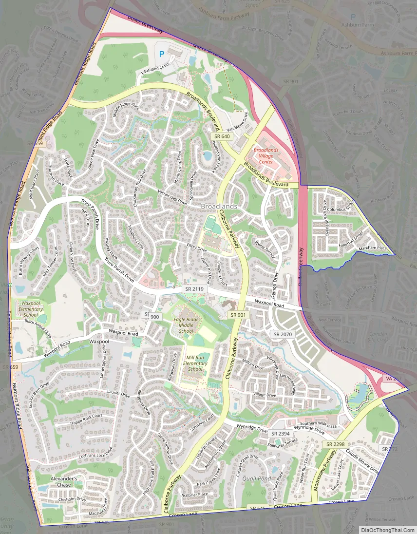
Online Interactive Map
Click on ![]() to view map in "full screen" mode.
to view map in "full screen" mode.
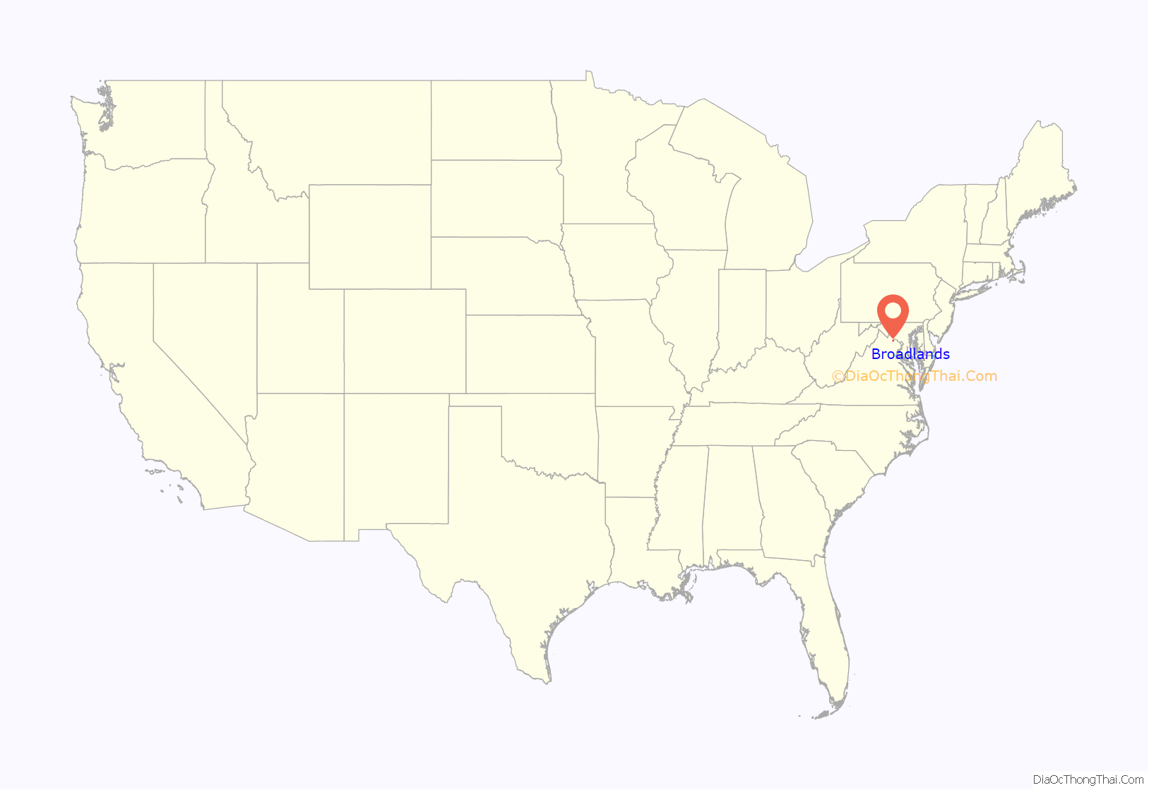
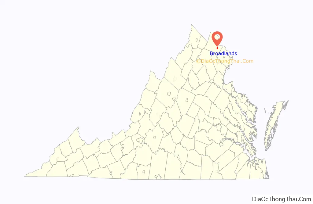
Broadlands location map. Where is Broadlands CDP?
Broadlands Road Map
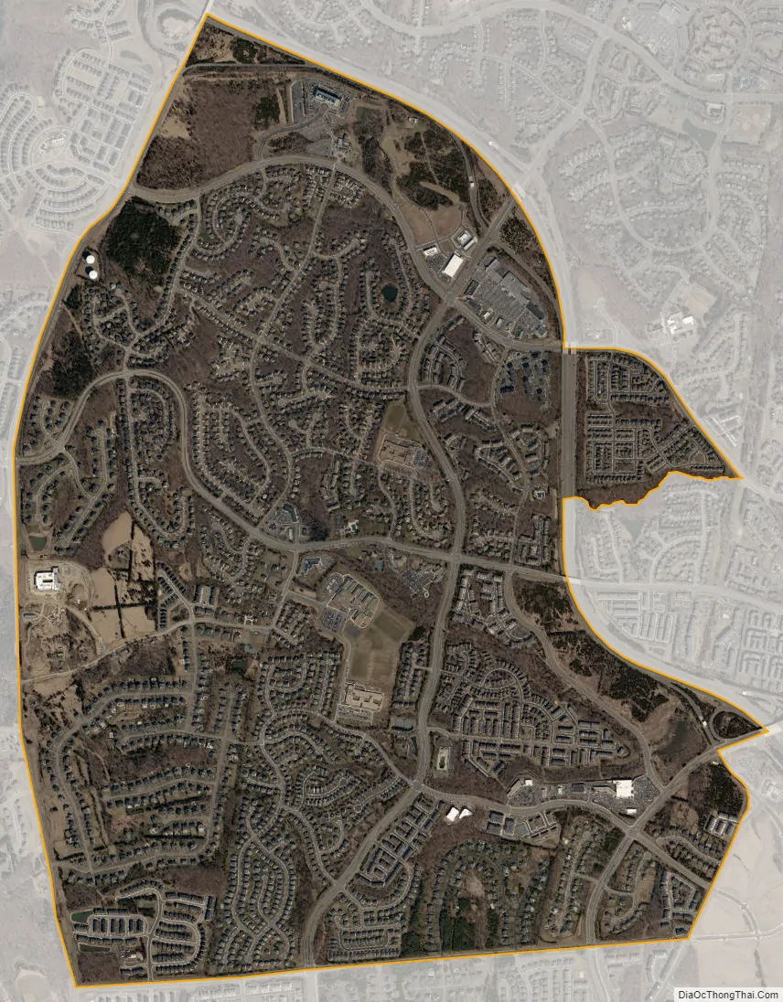
Broadlands city Satellite Map
Geography
Broadlands is located in eastern Loudoun County, just off the Dulles Greenway at Claiborne Parkway (Exit 5) or Ashburn Village Blvd/Moorview Parkway (Exit 6), midway between Dulles International Airport and the town of Leesburg, close to AOL’s headquarters and other corporate centers. It is bordered to the northeast, across the Dulles Greenway, by Ashburn, and to the south it is bordered by Brambleton.
From the center of Broadlands, by car, it is 33 miles (53 km) to Washington DC and 9.3 miles (15.0 km) to the main terminal of Washington Dulles International Airport.
According to the U.S. Census Bureau, the Broadlands CDP has a total area of 3.2 square miles (8.4 km), of which 0.02 square miles (0.04 km), or 0.50%, are water. The CDP includes the pre-Broadlands community of Waxpool in the west. Most of the CDP drains via Beaverdam Run east toward Broad Run, a north-flowing tributary of the Potomac River. The westernmost part of the community drains west to Beaverdam Creek Reservoir, which flows to Goose Creek, another north-flowing tributary of the Potomac.
See also
Map of Virginia State and its subdivision:- Accomack
- Albemarle
- Alexandria
- Alleghany
- Amelia
- Amherst
- Appomattox
- Arlington
- Augusta
- Bath
- Bedford
- Bedford City
- Bland
- Botetourt
- Bristol
- Brunswick
- Buchanan
- Buckingham
- Buena Vista
- Campbell
- Caroline
- Carroll
- Charles City
- Charlotte
- Charlottesville
- Chesapeake
- Chesterfield
- Clarke
- Clifton Forge City
- Colonial Heights
- Covington
- Craig
- Culpeper
- Cumberland
- Danville
- Dickenson
- Dinwiddie
- Emporia
- Essex
- Fairfax
- Fairfax City
- Falls Church
- Fauquier
- Floyd
- Fluvanna
- Franklin
- Frederick
- Fredericksburg
- Galax
- Giles
- Gloucester
- Goochland
- Grayson
- Greene
- Greensville
- Halifax
- Hampton
- Hanover
- Harrisonburg
- Henrico
- Henry
- Highland
- Hopewell
- Isle of Wight
- James City
- King and Queen
- King George
- King William
- Lancaster
- Lee
- Lexington
- Loudoun
- Louisa
- Lunenburg
- Lynchburg
- Madison
- Manassas
- Manassas Park
- Martinsville
- Mathews
- Mecklenburg
- Middlesex
- Montgomery
- Nelson
- New Kent
- Newport News
- Norfolk
- Northampton
- Northumberland
- Norton
- Nottoway
- Orange
- Page
- Patrick
- Petersburg
- Pittsylvania
- Poquoson
- Portsmouth
- Powhatan
- Prince Edward
- Prince George
- Prince William
- Pulaski
- Radford
- Rappahannock
- Richmond
- Roanoke
- Roanoke City
- Rockbridge
- Rockingham
- Russell
- Salem
- Scott
- Shenandoah
- Smyth
- Southampton
- Spotsylvania
- Stafford
- Staunton
- Suffolk
- Surry
- Sussex
- Tazewell
- Virginia Beach
- Warren
- Washington
- Waynesboro
- Westmoreland
- Williamsburg
- Winchester
- Wise
- Wythe
- York
- Alabama
- Alaska
- Arizona
- Arkansas
- California
- Colorado
- Connecticut
- Delaware
- District of Columbia
- Florida
- Georgia
- Hawaii
- Idaho
- Illinois
- Indiana
- Iowa
- Kansas
- Kentucky
- Louisiana
- Maine
- Maryland
- Massachusetts
- Michigan
- Minnesota
- Mississippi
- Missouri
- Montana
- Nebraska
- Nevada
- New Hampshire
- New Jersey
- New Mexico
- New York
- North Carolina
- North Dakota
- Ohio
- Oklahoma
- Oregon
- Pennsylvania
- Rhode Island
- South Carolina
- South Dakota
- Tennessee
- Texas
- Utah
- Vermont
- Virginia
- Washington
- West Virginia
- Wisconsin
- Wyoming