Glen Allen is a census-designated place (CDP) in Henrico County, Virginia, United States. The population was 16,187 as of the 2020 Census, up from 14,774 at the 2010 census. Areas outside the CDP which use a “Glen Allen” mailing address include residences in neighboring Hanover County.
| Name: | Glen Allen CDP |
|---|---|
| LSAD Code: | 57 |
| LSAD Description: | CDP (suffix) |
| State: | Virginia |
| County: | Henrico County |
| Elevation: | 207 ft (63 m) |
| Total Area: | 8.9 sq mi (22.9 km²) |
| Land Area: | 8.8 sq mi (22.9 km²) |
| Water Area: | 0.0 sq mi (0.0 km²) |
| Total Population: | 16,187 |
| Population Density: | 1,800/sq mi (710/km²) |
| ZIP code: | 23058-23060 |
| Area code: | 804 |
| FIPS code: | 5131200 |
| GNISfeature ID: | 1494958 |
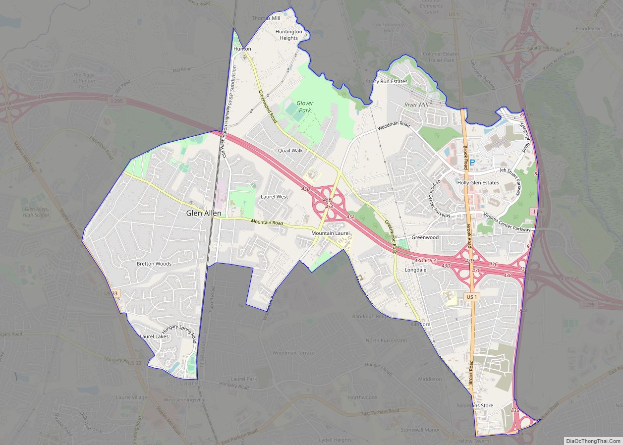
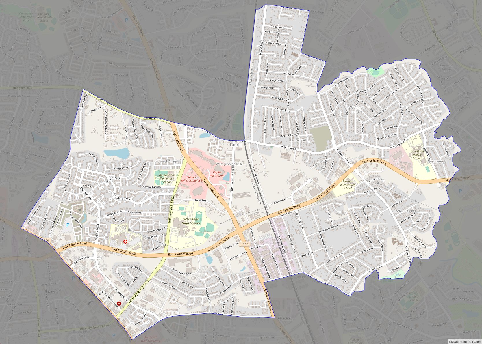
Online Interactive Map
Click on ![]() to view map in "full screen" mode.
to view map in "full screen" mode.
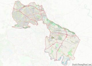
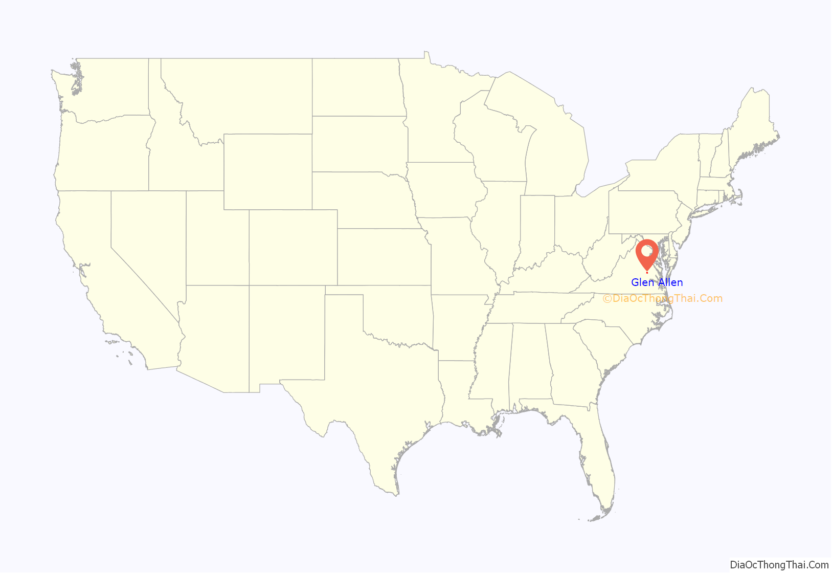
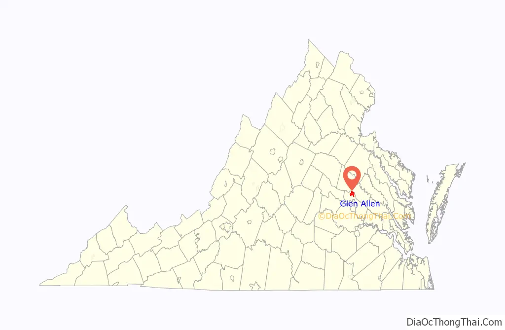
Glen Allen location map. Where is Glen Allen CDP?
History
Called “Mountain Road Crossing” when rail service began in 1836, the settlement which came to be known as Glen Allen took its name from the homestead of a local landowner, Mrs. Benjamin Allen. Its most noted resident was Captain John Cussons, a native Englishman, Confederate scout, author, and entrepreneur. Cussons made his residence here after the Civil War and founded a successful printing company. Later he built a fashionable resort hotel known as Forest Lodge adjacent to the railroad tracks.
The area of Glen Allen used to be mostly rural farmland, but it is now a growing suburb of Richmond.
Glen Allen Road Map
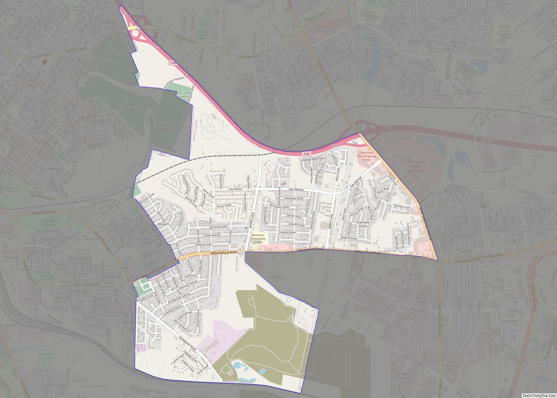
Glen Allen city Satellite Map

Geography
According to the United States Census Bureau, the CDP has a total area of 8.86 square miles (22.94 km), of which 8.79 square miles (22.77 km) are land and 0.069 square miles (0.18 km), or 0.76%, are water.
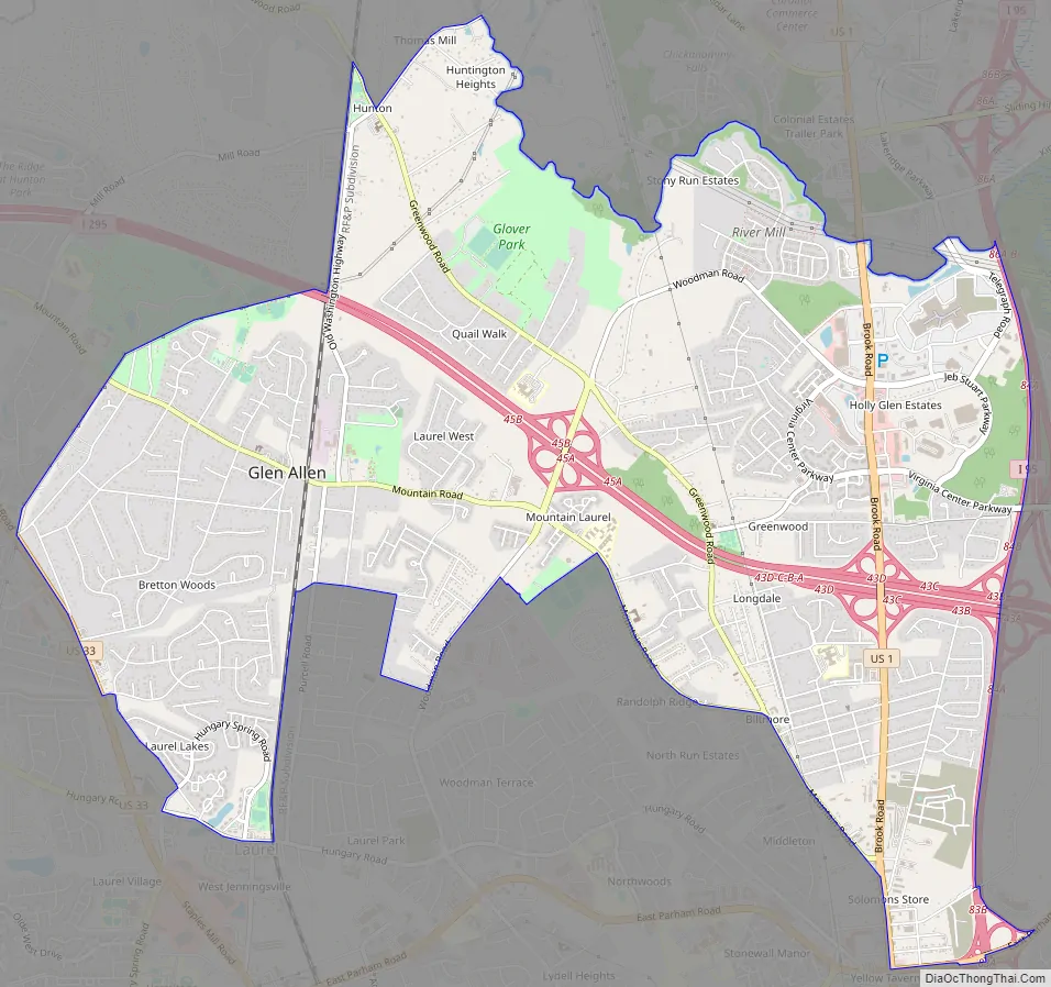
The Glen Allen census-designated place is in northern Henrico County, approximately 11 miles (18 km) north-northwest of downtown Richmond. The CDP is bordered to the north by the Chickahominy River, which forms the Henrico–Hanover County line. The eastern border of the CDP is Interstate 95, from the Chickahominy River south to East Parham Road. The southern border of the CDP follows East Parham Road, U.S. Route 1, Virginia State Route 157 (Mountain Road), Jessie Chavis Drive, North Run, Woodman Road, Blackburn Road, Winston Boulevard, and Indale Road to the CSX railroad line, which it follows south to Hungary Road. The western border of the CDP follows Hungary Spring Road, Old Route 33, Attems Way, and U.S. Route 33 (Staples Mill Road) to Courtney Road, then follows a power line northeast back to the CSX rail line. The border follows the railroad north to County Road 625 (Greenwood Road), then takes Old Washington Highway to the Chickahominy River. Glen Allen uses two postal addresses, ZIP codes 23059 and 23060, which cover neighboring communities as well, including rural areas of Hanover County to the north.
The Glen Allen CDP includes all or portions of the communities of Hunton, Greenwood, Longdale, Holly Glen Estates, Biltmore, and Yellow Tavern.
See also
Map of Virginia State and its subdivision:- Accomack
- Albemarle
- Alexandria
- Alleghany
- Amelia
- Amherst
- Appomattox
- Arlington
- Augusta
- Bath
- Bedford
- Bedford City
- Bland
- Botetourt
- Bristol
- Brunswick
- Buchanan
- Buckingham
- Buena Vista
- Campbell
- Caroline
- Carroll
- Charles City
- Charlotte
- Charlottesville
- Chesapeake
- Chesterfield
- Clarke
- Clifton Forge City
- Colonial Heights
- Covington
- Craig
- Culpeper
- Cumberland
- Danville
- Dickenson
- Dinwiddie
- Emporia
- Essex
- Fairfax
- Fairfax City
- Falls Church
- Fauquier
- Floyd
- Fluvanna
- Franklin
- Frederick
- Fredericksburg
- Galax
- Giles
- Gloucester
- Goochland
- Grayson
- Greene
- Greensville
- Halifax
- Hampton
- Hanover
- Harrisonburg
- Henrico
- Henry
- Highland
- Hopewell
- Isle of Wight
- James City
- King and Queen
- King George
- King William
- Lancaster
- Lee
- Lexington
- Loudoun
- Louisa
- Lunenburg
- Lynchburg
- Madison
- Manassas
- Manassas Park
- Martinsville
- Mathews
- Mecklenburg
- Middlesex
- Montgomery
- Nelson
- New Kent
- Newport News
- Norfolk
- Northampton
- Northumberland
- Norton
- Nottoway
- Orange
- Page
- Patrick
- Petersburg
- Pittsylvania
- Poquoson
- Portsmouth
- Powhatan
- Prince Edward
- Prince George
- Prince William
- Pulaski
- Radford
- Rappahannock
- Richmond
- Roanoke
- Roanoke City
- Rockbridge
- Rockingham
- Russell
- Salem
- Scott
- Shenandoah
- Smyth
- Southampton
- Spotsylvania
- Stafford
- Staunton
- Suffolk
- Surry
- Sussex
- Tazewell
- Virginia Beach
- Warren
- Washington
- Waynesboro
- Westmoreland
- Williamsburg
- Winchester
- Wise
- Wythe
- York
- Alabama
- Alaska
- Arizona
- Arkansas
- California
- Colorado
- Connecticut
- Delaware
- District of Columbia
- Florida
- Georgia
- Hawaii
- Idaho
- Illinois
- Indiana
- Iowa
- Kansas
- Kentucky
- Louisiana
- Maine
- Maryland
- Massachusetts
- Michigan
- Minnesota
- Mississippi
- Missouri
- Montana
- Nebraska
- Nevada
- New Hampshire
- New Jersey
- New Mexico
- New York
- North Carolina
- North Dakota
- Ohio
- Oklahoma
- Oregon
- Pennsylvania
- Rhode Island
- South Carolina
- South Dakota
- Tennessee
- Texas
- Utah
- Vermont
- Virginia
- Washington
- West Virginia
- Wisconsin
- Wyoming