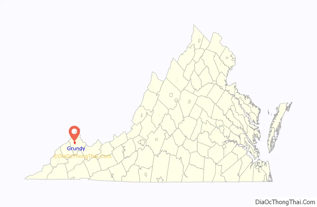
Grundy is a town in Buchanan County, Virginia, United States, an area located within the Appalachian Mountains region. It is the county seat of Buchanan County. The town is home to the Appalachian School of Law. The population was 875 as of the 2020 census.
Legislation establishing Buchanan County in 1858 designated a plat of land at the confluence of the Levisa Fork River and Slate Creek as the seat of government for the county and directed the erection of the county courthouse on the plat, which marked the beginnings of what would be Grundy.
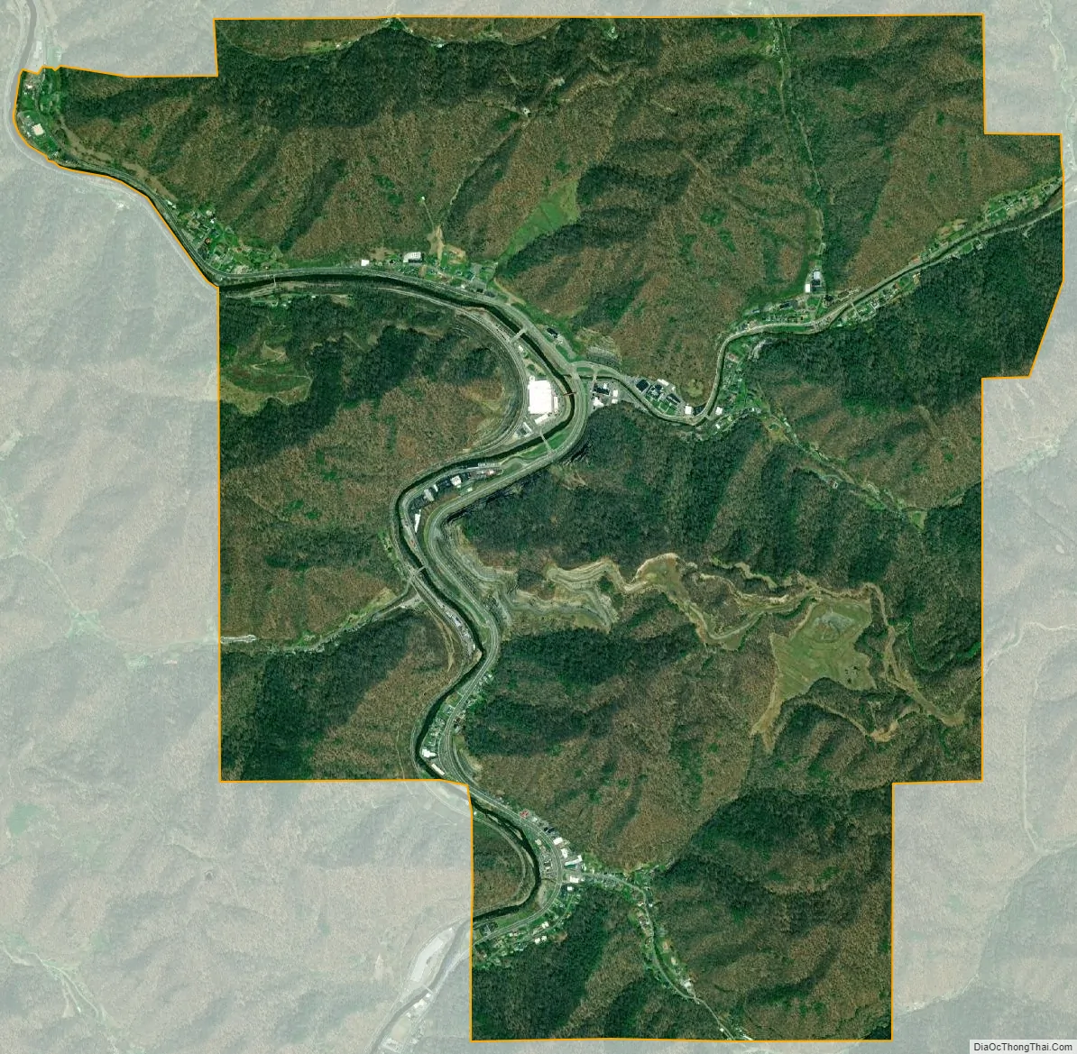
Although originally developed along the Levisa Fork River, which provided a transportation and power waterway, the town suffered from nine major floods since 1929 that have caused extensive damage, the last of which occurred in 1977. It is notable for having major businesses relocated in the 21st century to higher ground to prevent such damage in the future. A mountain opposite the historic town was blasted to provide a kind of plateau where much of the town was relocated and redeveloped. The federal project included construction of bridges and a flood wall, as well as the relocation of some roadways.
During the American Civil War, the town served as a stop-over for Union troops on their way to the Battle of Saltville.
| Name: | Grundy town |
|---|---|
| LSAD Code: | 43 |
| LSAD Description: | town (suffix) |
| State: | Virginia |
| County: | Buchanan County |
| Founded: | 1858 |
| Elevation: | 1,050 ft (320 m) |
| Total Area: | 5.04 sq mi (13.05 km²) |
| Land Area: | 4.99 sq mi (12.91 km²) |
| Water Area: | 0.05 sq mi (0.14 km²) |
| Total Population: | 875 |
| Population Density: | 180.30/sq mi (69.62/km²) |
| ZIP code: | 24614 |
| Area code: | 276 |
| FIPS code: | 5133648 |
| GNISfeature ID: | 1498485 |
| Website: | townofgrundy.com |
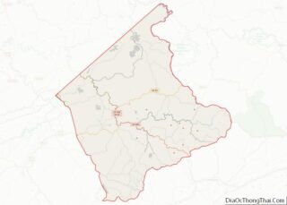
Online Interactive Map
Click on ![]() to view map in "full screen" mode.
to view map in "full screen" mode.
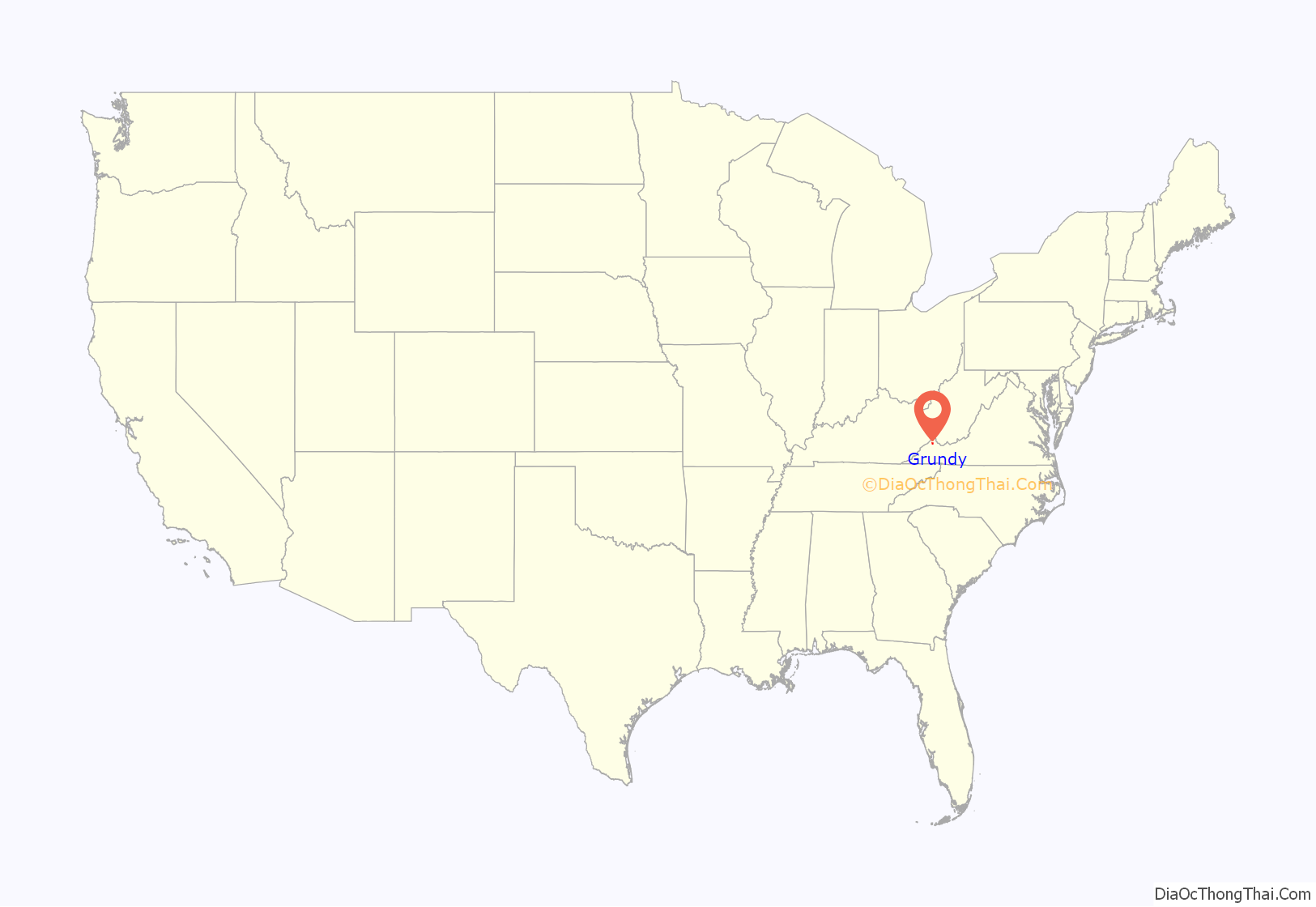
Grundy location map. Where is Grundy town?
History
The town, founded in 1858 upon the formation of Buchanan County, was named for Felix Grundy (1777–1840), United States Attorney General (1838–1839) and United States Senator from Tennessee (1839–1840). It was incorporated in 1876. The present courthouse dates from 1905 and has been listed on the National Register of Historic Places since 1982. Since the late 19th century, this area depended on coal mining as the basis of its economy. The decline in mining resulted in a loss of jobs and population.
Civil War events
In October 1864, Union raiders under Brigadier General Stephen G. Burbridge passed through Grundy on their way to destroy the saltworks near Saltville in Smyth County. There they were met by Confederate troops commanded by Brigadier General Alfred E. Jackson at the Battle of Saltville. The Union troops were defeated in the battle, but returned later and succeeded in destroying the saltworks.
Red Jacket Mine explosion
On April 25, 1938, a catastrophic mine explosion happened in the Keen Mountain Coal Mine. 45 were killed and 3 injured. This is widely regarded as one of the worst mining disasters in Virginia’s history. The disaster was reported in the Charleston Gazette.
Grundy Flood-control Project
Since 1929, Grundy has suffered nine major floods of the adjoining Levisa Fork River. After the inundation of April 4, 1977, many businesses did not reopen, and owners abandoned the buildings that housed them. In 1984 many businesses flooded again.
A 21st-century project to relocate much of the town to higher ground has been completed. The project started in 2001. The mountain on the other side of the Levisa Fork was blasted to create 13 acres (53,000 m) of relatively level land. After a few years of blasting, utilities were placed and new bridges were built across the river. A new town center on the west bank features a multi-level Wal-Mart with a parking deck.
Buildings backing on the river have been demolished, and a new flood wall protects the county courthouse. U.S. Route 460 was relocated to the top of the flood wall. Businesses formerly located downtown were relocated to an industrial building located just outside town. State Route 83 will be rerouted to meet U.S. Route 460 down the street where U.S. Route 460 originally took a directional split to go through downtown Grundy. Additional work upriver is under study to reroute U.S. Route 460 inland from its current path.
Base of a regional grocery store chain
Grundy was the home of the predecessor to the Food City Stores, when Jack Smith opened a Piggly Wiggly franchise in 1955. The store was Smith’s first and the chain has now grown to 150 stores, primarily located in Virginia, Kentucky, Tennessee Georgia and Alabama. The chain is known for sponsoring the Food City 500 NASCAR race at Bristol Motor Speedway. The Grundy store remained open one day short of 50 years. It closed in November 2005. A new store opened up just outside the town limits in Vansant. The Grundy store was re-opened on June 29, 2011, as one of the KVAT Food City Stores. It is a Super Dollar Foods Center location.
Education as a new sustaining industry
Grundy is home to the Appalachian School of Law, which opened in 1997, and the Appalachian College of Pharmacy, which opened in 2005. Buchanan County chose Grundy as the site for the ASL to revitalize the town, which had been in a steady economic decline since the Flood of 1977. The ASL has generated $12 million for the local economy. Its presence has increased demand for construction of rental homes and stimulated the opening of additional businesses in the area. Additionally, ASL has successfully demonstrated the concept of creating institutions of higher education as an economic development tool.
This success contributed to the founding of the Appalachian College of Pharmacy, located in Oakwood. Like the Appalachian School of Law, it was created as part of a continuing economic redevelopment effort in the region. ACP is forecast to add $20 million per year to the local economy.
Appalachian School of Law shooting
On January 16, 2002, Dean Anthony Sutin, Professor Thomas Blackwell, and 1L student Angela Dales were shot and killed on the campus of the Appalachian School of Law by Peter Odighizuwa, 43, of Nigeria, a student. At his trial, Odighizuwa was found to be mentally competent. He pleaded guilty to the murders to avoid the death penalty, and was sentenced to multiple life terms in prison.
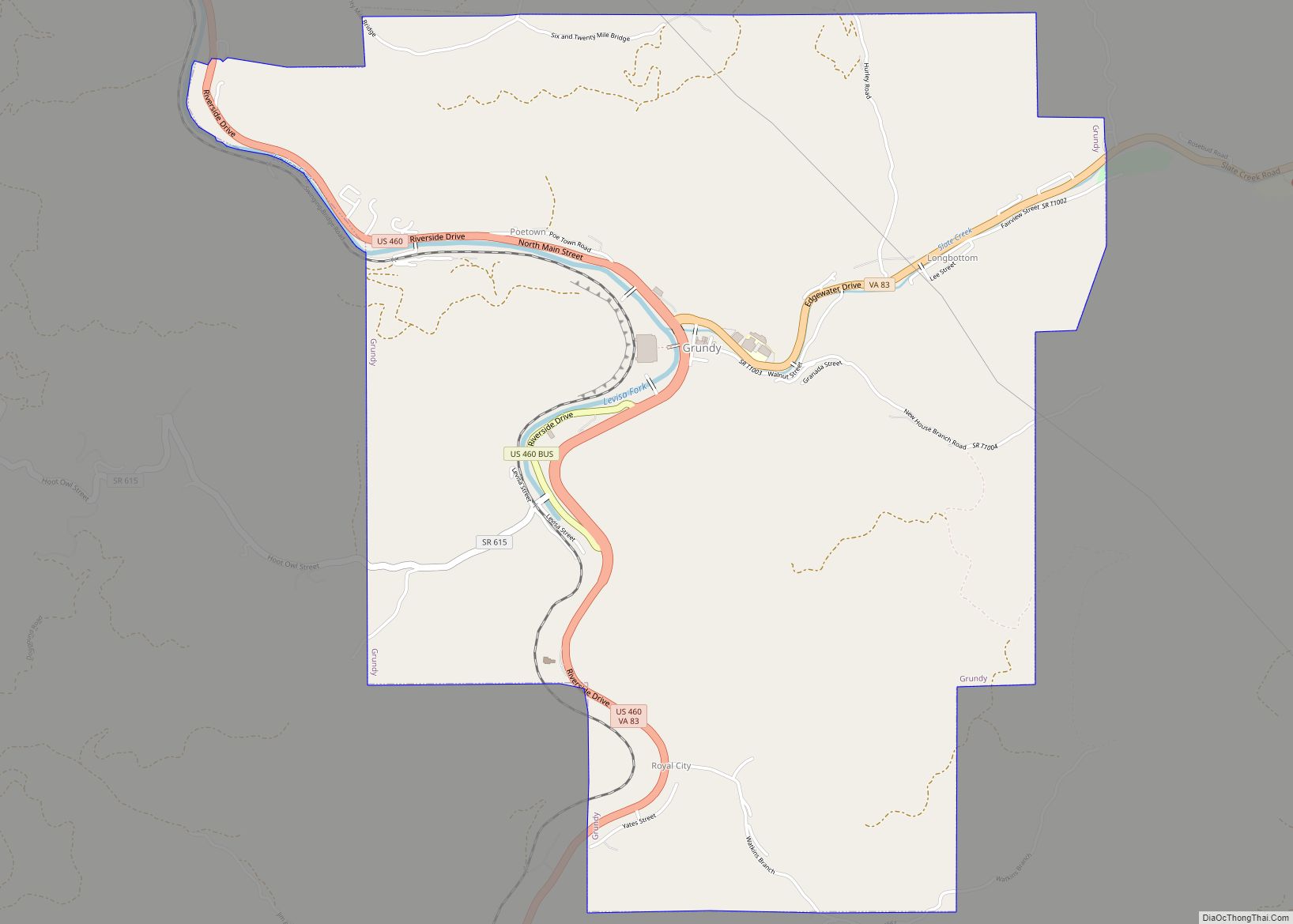
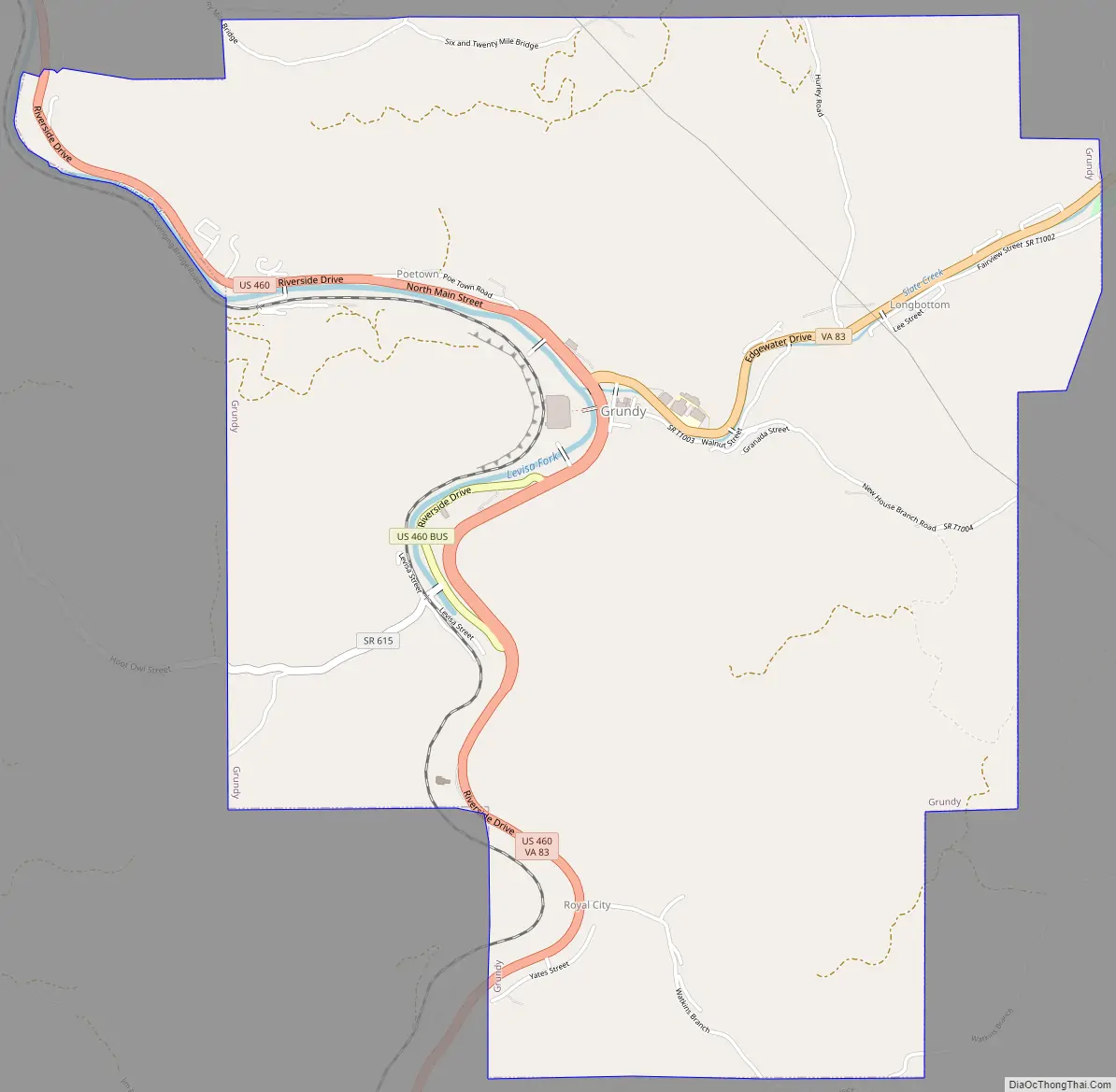
Grundy Road Map
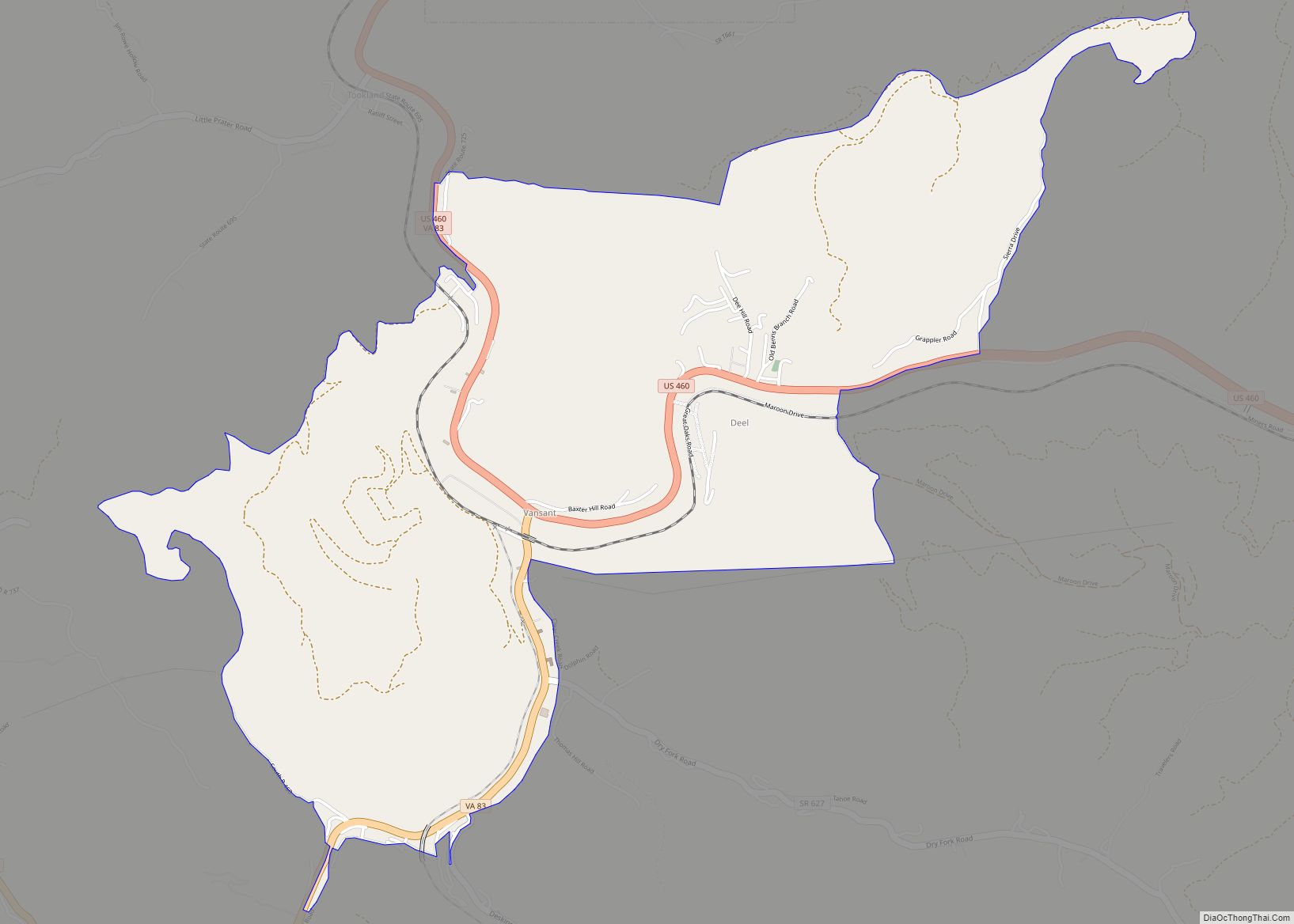
Grundy city Satellite Map
Geography
Grundy is located at 37°16′36″N 82°5′42″W / 37.27667°N 82.09500°W / 37.27667; -82.09500 (37.276760, −82.095038). The town is located at intersection of U.S. Route 460 and State Route 83 directly on the banks of the Levisa Fork River. Grundy is located in the coalfields of the Appalachian Mountains.
According to the United States Census Bureau, the town has a total area of 5.0 square miles (13.1 km), all of which is land.
Grundy is located in the Cumberland Plateau Region.
Transportation
Grundy is served by the Grundy Municipal Airport located in Vansant, which serves general aviation traffic. Commercial traffic can be found at Beckley Raleigh County Memorial Airport in West Virginia and at the Tri-Cities Regional Airport in Tennessee.
Four County Transit maintains a local trolley system that services downtown locations. Stops include the Grundy courthouse, Grundy Church of Christ, the former Food City parking lot, the Grundy Community Center, the Appalachian School of Law, and the former downtown parking lot.
The Norfolk Southern Railway maintains tracks and runs trains through the town. However, there are no passenger rail services or stops currently in Grundy.
Grundy is served by U.S. Route 460. The Coalfields Expressway will be built just to the north and east of town. State Route 83 is also a major highway in the area.
See also
Map of Virginia State and its subdivision:- Accomack
- Albemarle
- Alexandria
- Alleghany
- Amelia
- Amherst
- Appomattox
- Arlington
- Augusta
- Bath
- Bedford
- Bedford City
- Bland
- Botetourt
- Bristol
- Brunswick
- Buchanan
- Buckingham
- Buena Vista
- Campbell
- Caroline
- Carroll
- Charles City
- Charlotte
- Charlottesville
- Chesapeake
- Chesterfield
- Clarke
- Clifton Forge City
- Colonial Heights
- Covington
- Craig
- Culpeper
- Cumberland
- Danville
- Dickenson
- Dinwiddie
- Emporia
- Essex
- Fairfax
- Fairfax City
- Falls Church
- Fauquier
- Floyd
- Fluvanna
- Franklin
- Frederick
- Fredericksburg
- Galax
- Giles
- Gloucester
- Goochland
- Grayson
- Greene
- Greensville
- Halifax
- Hampton
- Hanover
- Harrisonburg
- Henrico
- Henry
- Highland
- Hopewell
- Isle of Wight
- James City
- King and Queen
- King George
- King William
- Lancaster
- Lee
- Lexington
- Loudoun
- Louisa
- Lunenburg
- Lynchburg
- Madison
- Manassas
- Manassas Park
- Martinsville
- Mathews
- Mecklenburg
- Middlesex
- Montgomery
- Nelson
- New Kent
- Newport News
- Norfolk
- Northampton
- Northumberland
- Norton
- Nottoway
- Orange
- Page
- Patrick
- Petersburg
- Pittsylvania
- Poquoson
- Portsmouth
- Powhatan
- Prince Edward
- Prince George
- Prince William
- Pulaski
- Radford
- Rappahannock
- Richmond
- Roanoke
- Roanoke City
- Rockbridge
- Rockingham
- Russell
- Salem
- Scott
- Shenandoah
- Smyth
- Southampton
- Spotsylvania
- Stafford
- Staunton
- Suffolk
- Surry
- Sussex
- Tazewell
- Virginia Beach
- Warren
- Washington
- Waynesboro
- Westmoreland
- Williamsburg
- Winchester
- Wise
- Wythe
- York
- Alabama
- Alaska
- Arizona
- Arkansas
- California
- Colorado
- Connecticut
- Delaware
- District of Columbia
- Florida
- Georgia
- Hawaii
- Idaho
- Illinois
- Indiana
- Iowa
- Kansas
- Kentucky
- Louisiana
- Maine
- Maryland
- Massachusetts
- Michigan
- Minnesota
- Mississippi
- Missouri
- Montana
- Nebraska
- Nevada
- New Hampshire
- New Jersey
- New Mexico
- New York
- North Carolina
- North Dakota
- Ohio
- Oklahoma
- Oregon
- Pennsylvania
- Rhode Island
- South Carolina
- South Dakota
- Tennessee
- Texas
- Utah
- Vermont
- Virginia
- Washington
- West Virginia
- Wisconsin
- Wyoming