Hamilton is a town in the Loudoun Valley of Loudoun County, Virginia, United States. The population was 506 as of the 2010 census.
| Name: | Hamilton town |
|---|---|
| LSAD Code: | 43 |
| LSAD Description: | town (suffix) |
| State: | Virginia |
| County: | Loudoun County |
| Elevation: | 512 ft (156 m) |
| Total Area: | 0.21 sq mi (0.54 km²) |
| Land Area: | 0.21 sq mi (0.54 km²) |
| Water Area: | 0.00 sq mi (0.00 km²) |
| Total Population: | 506 |
| Population Density: | 3,009.57/sq mi (1,161.67/km²) |
| ZIP code: | 20158-20159 |
| Area code: | 540 |
| FIPS code: | 5134240 |
| GNISfeature ID: | 1499516 |
| Website: | Town.Hamilton.VA.US |
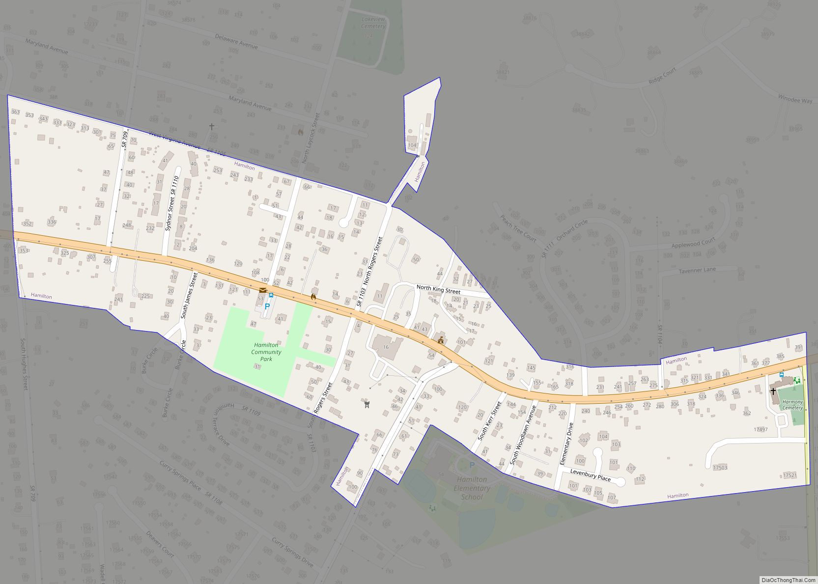
Online Interactive Map
Click on ![]() to view map in "full screen" mode.
to view map in "full screen" mode.
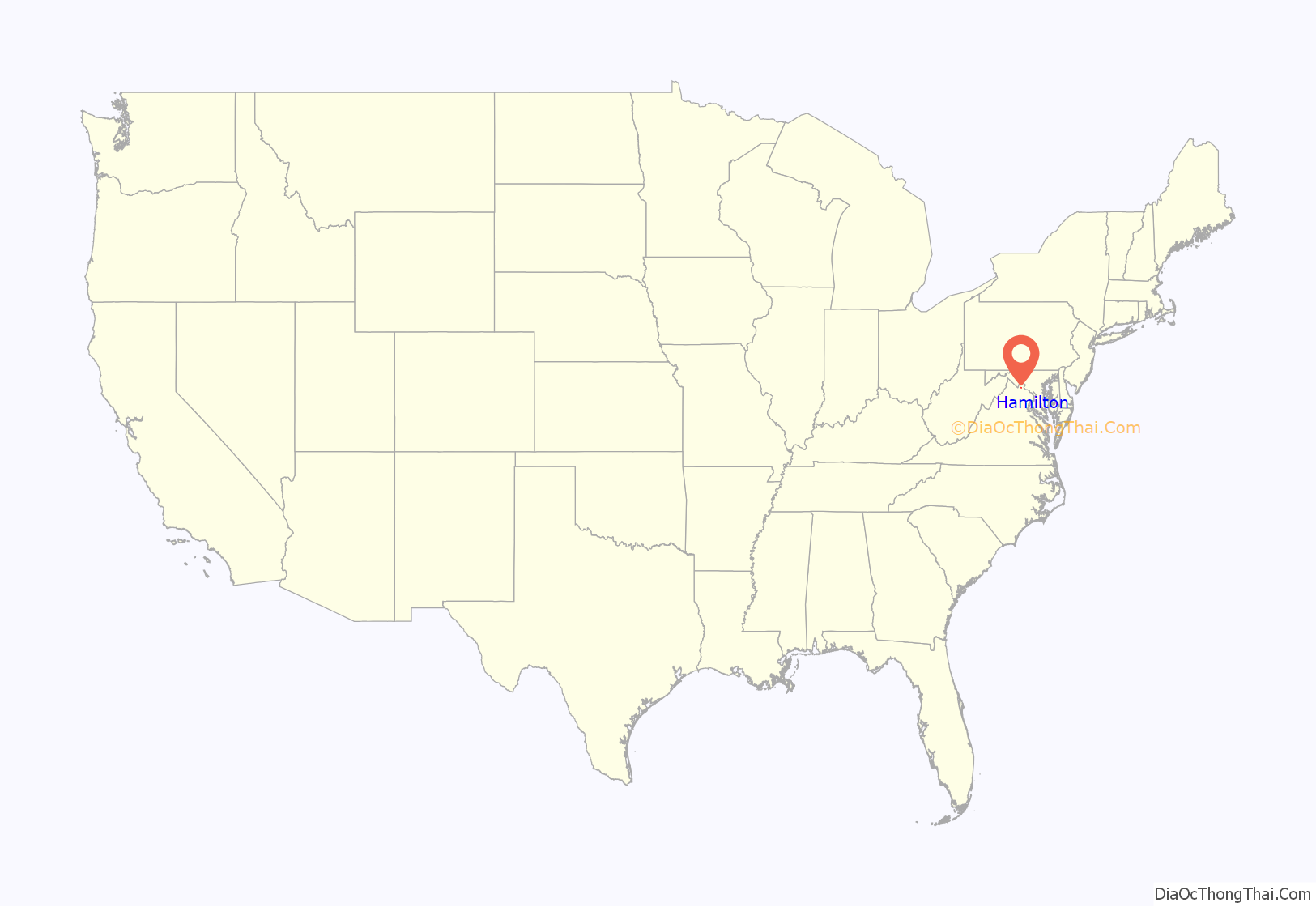
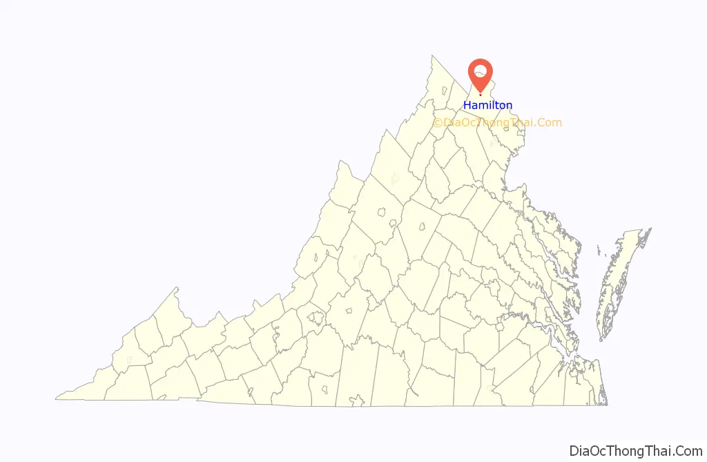
Hamilton location map. Where is Hamilton town?
History
The present Town of Hamilton was once occupied by several native tribes. European settlers arrived in the 1730s. In 1768, George and Tabitha Roach Tavenner built the first house in the Hamilton area. Their son, Richard and his wife Ann Hatcher, built an estate called Harmony and the surrounding area was thereafter known as Harmony.
The Leesburg and Snickers Gap Turnpike Company opened a road connecting Leesburg and Snickersville in 1831. Growth ensued and by 1833, the area had enough population to sustain Harmony Methodist Church, which was built on land donated by Richard and Ann Hatcher Tavenner. The town also became known as Hamilton Store after a store founded there by Charles Bennett Hamilton. In 1835, John Quincy Adams approved a post office located in Hamilton’s store and the town’s name was recorded as Hamilton.
The last important Civil War action in Loudoun County, known as The Harmony Skirmish, took place on March 21, 1865, as confederate Colonel John S. Mosby and his troops surprised troops commanded by Colonel Marcus Reno.
By 1868, a steam railroad from Alexandria had come to Hamilton along the future route of the Washington and Old Dominion Railroad. Many tourists came to the town seeking relief from the city’s heat. There was a 1+1⁄2-mile boardwalk that traversed the town and a dance hall. By 1900, the Town of Hamilton was Loudoun County’s second largest town. The booming businesses in Hamilton included two newspapers, a butcher shop, a men’s clothing store, a broom factory, a milliner, a dentist, two hardware stores, a stove shop, a flat racecourse, a livery stable and boarding houses.
The advent of the automobile led to a slow decline in tourism. In 1926, many of the town’s central businesses were destroyed by fire and tourism thereafter declined sharply. Hamilton has since been known more as a residential community.
During the town’s history, it was the site of a vibrant Afro-American community.
The Hamilton Masonic Lodge, Janney House, William Smith House, Spring Hill Farm, and Sunnyside Farm are listed on the National Register of Historic Places.
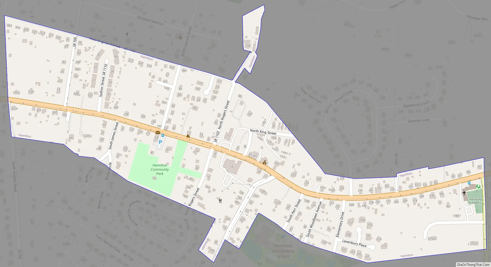
Hamilton Road Map
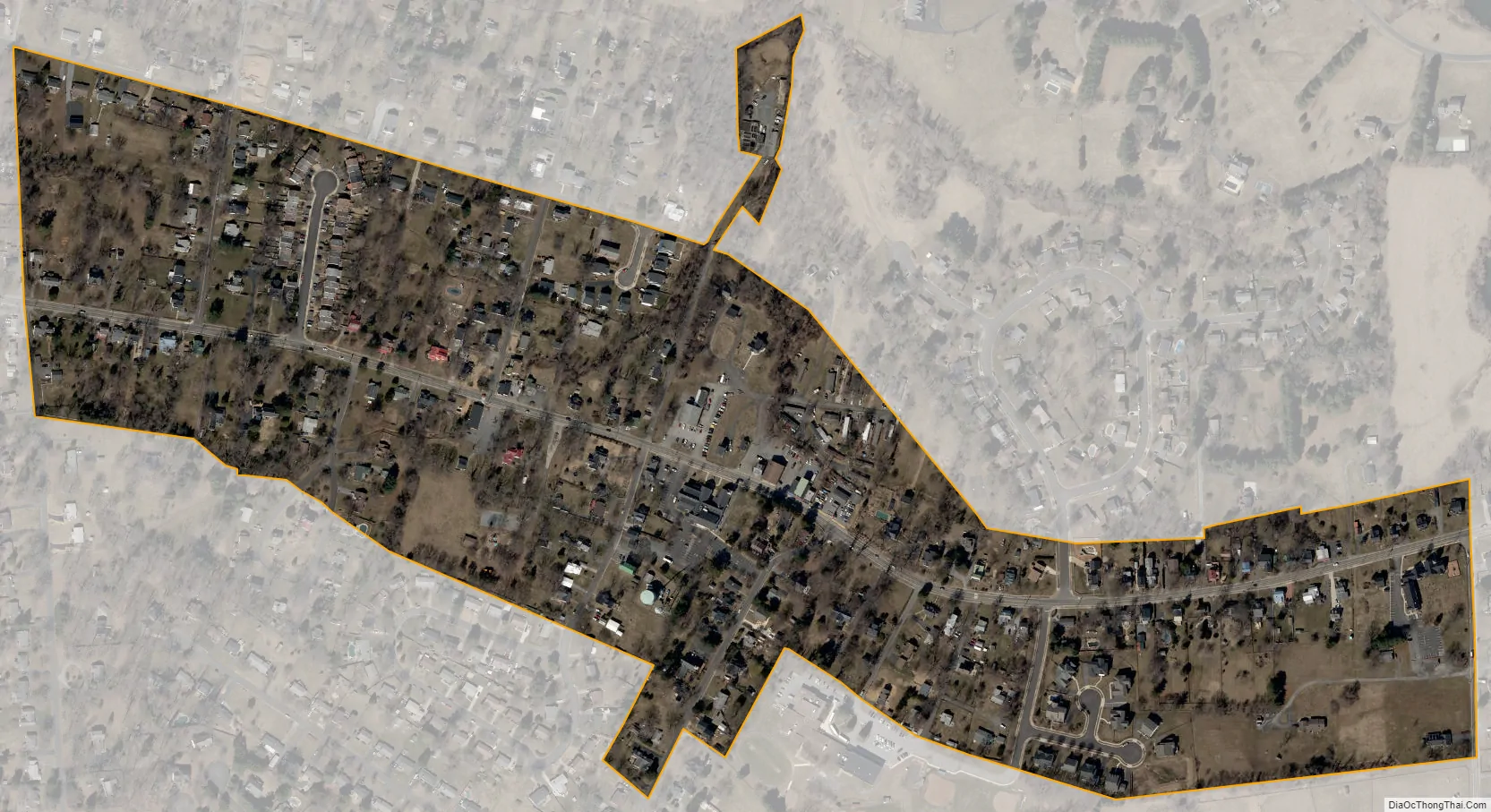
Hamilton city Satellite Map
Geography
Hamilton is located 6 miles west of the county seat Leesburg at 39°8′2″N 77°39′51″W / 39.13389°N 77.66417°W / 39.13389; -77.66417 (39.133889, −77.664151), near the western base of Catoctin Mountain.
According to the United States Census Bureau, the town has a total area of 0.2 square miles (0.6 km), all of it land.
See also
Map of Virginia State and its subdivision:- Accomack
- Albemarle
- Alexandria
- Alleghany
- Amelia
- Amherst
- Appomattox
- Arlington
- Augusta
- Bath
- Bedford
- Bedford City
- Bland
- Botetourt
- Bristol
- Brunswick
- Buchanan
- Buckingham
- Buena Vista
- Campbell
- Caroline
- Carroll
- Charles City
- Charlotte
- Charlottesville
- Chesapeake
- Chesterfield
- Clarke
- Clifton Forge City
- Colonial Heights
- Covington
- Craig
- Culpeper
- Cumberland
- Danville
- Dickenson
- Dinwiddie
- Emporia
- Essex
- Fairfax
- Fairfax City
- Falls Church
- Fauquier
- Floyd
- Fluvanna
- Franklin
- Frederick
- Fredericksburg
- Galax
- Giles
- Gloucester
- Goochland
- Grayson
- Greene
- Greensville
- Halifax
- Hampton
- Hanover
- Harrisonburg
- Henrico
- Henry
- Highland
- Hopewell
- Isle of Wight
- James City
- King and Queen
- King George
- King William
- Lancaster
- Lee
- Lexington
- Loudoun
- Louisa
- Lunenburg
- Lynchburg
- Madison
- Manassas
- Manassas Park
- Martinsville
- Mathews
- Mecklenburg
- Middlesex
- Montgomery
- Nelson
- New Kent
- Newport News
- Norfolk
- Northampton
- Northumberland
- Norton
- Nottoway
- Orange
- Page
- Patrick
- Petersburg
- Pittsylvania
- Poquoson
- Portsmouth
- Powhatan
- Prince Edward
- Prince George
- Prince William
- Pulaski
- Radford
- Rappahannock
- Richmond
- Roanoke
- Roanoke City
- Rockbridge
- Rockingham
- Russell
- Salem
- Scott
- Shenandoah
- Smyth
- Southampton
- Spotsylvania
- Stafford
- Staunton
- Suffolk
- Surry
- Sussex
- Tazewell
- Virginia Beach
- Warren
- Washington
- Waynesboro
- Westmoreland
- Williamsburg
- Winchester
- Wise
- Wythe
- York
- Alabama
- Alaska
- Arizona
- Arkansas
- California
- Colorado
- Connecticut
- Delaware
- District of Columbia
- Florida
- Georgia
- Hawaii
- Idaho
- Illinois
- Indiana
- Iowa
- Kansas
- Kentucky
- Louisiana
- Maine
- Maryland
- Massachusetts
- Michigan
- Minnesota
- Mississippi
- Missouri
- Montana
- Nebraska
- Nevada
- New Hampshire
- New Jersey
- New Mexico
- New York
- North Carolina
- North Dakota
- Ohio
- Oklahoma
- Oregon
- Pennsylvania
- Rhode Island
- South Carolina
- South Dakota
- Tennessee
- Texas
- Utah
- Vermont
- Virginia
- Washington
- West Virginia
- Wisconsin
- Wyoming