Parksley is a town in Accomack County, Virginia, United States. The population was 842 at the 2010 census. It is home to the Eastern Shore Railway Museum.
| Name: | Parksley town |
|---|---|
| LSAD Code: | 43 |
| LSAD Description: | town (suffix) |
| State: | Virginia |
| County: | Accomack County |
| Elevation: | 43 ft (13 m) |
| Total Area: | 0.62 sq mi (1.60 km²) |
| Land Area: | 0.62 sq mi (1.60 km²) |
| Water Area: | 0.00 sq mi (0.00 km²) |
| Total Population: | 842 |
| Population Density: | 1,311.69/sq mi (506.15/km²) |
| ZIP code: | 23421 |
| Area code: | 757, 948 (planned) |
| FIPS code: | 5160680 |
| GNISfeature ID: | 1497072 |
Online Interactive Map
Click on ![]() to view map in "full screen" mode.
to view map in "full screen" mode.
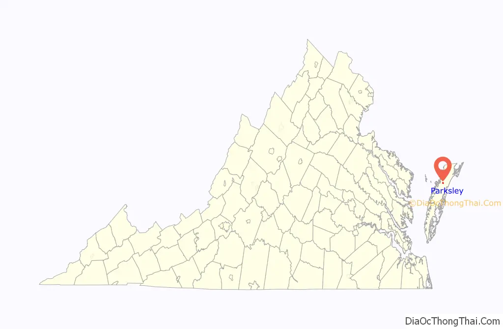
Parksley location map. Where is Parksley town?

History
The history of Parksley is directly tied to the arrival of the New York, Philadelphia, and Norfolk [NYP&N] Railroad on Virginia’s Eastern Shore in the mid-1880s. When the rail line connecting the lower Delmarva Peninsula to the markets of the northeast was built in 1884, several new towns were created along its route which bypassed many of the shore’s older established communities. Parksley was the second such planned town on the Virginia shore (after Cape Charles at the railroad’s southern terminus in Northampton County) and was laid out in 1885 under the management of the Parksley Land Improvement Company. In 1898, town leaders made an unsuccessful attempt to relocate the county seat from Accomac to the Parksley. The town was incorporated in 1904. During the first half of the 20th century, Parksley became an important shipping point for seafood and agricultural products harvested from the Chesapeake Bay and the Atlantic Ocean in Accomack County. During World War II, Parksley was the site of the Shore National Guard Armory and its airfield was utilized by the Civil Air Patrol, part of military reconnaissance activities guarding the east coast of the United States against possible German invasion. Parksley was home to the Parksley Spuds, a team which played in the Eastern Shore Baseball League.
As of 2021, Parksley has had most of its historic train tracks removed. The removal was approved by the company Canonie Atlantic Co., despite the protests of some locals and New York, Philadelphia and Norfolk Railroad. The removal was approved; the only remaining train tracks in Parksley are associated with the Eastern Shore Railway Museum.
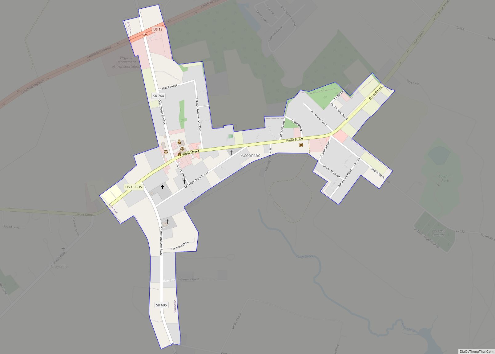
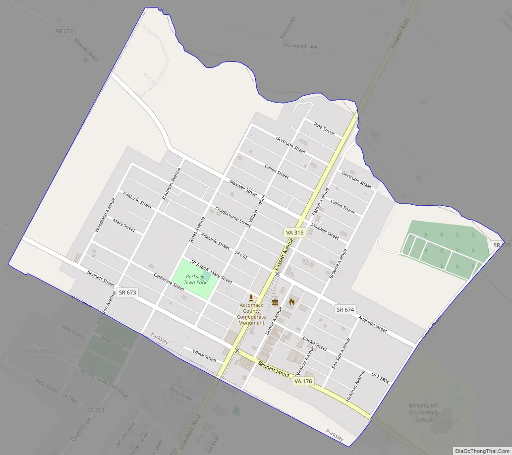
Parksley Road Map
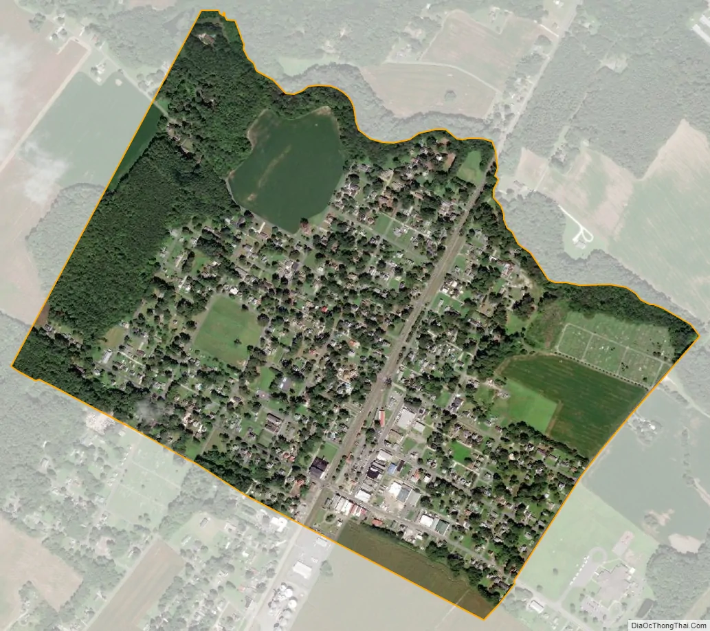
Parksley city Satellite Map
Geography
Parksley is located at 37°47′6″N 75°39′15″W / 37.78500°N 75.65417°W / 37.78500; -75.65417 (37.785078, -75.654222).
According to the United States Census Bureau the town has a total area of 0.6 square miles (1.6 km), all of it land.
It lies at an elevation of 43 feet.
See also
Map of Virginia State and its subdivision:- Accomack
- Albemarle
- Alexandria
- Alleghany
- Amelia
- Amherst
- Appomattox
- Arlington
- Augusta
- Bath
- Bedford
- Bedford City
- Bland
- Botetourt
- Bristol
- Brunswick
- Buchanan
- Buckingham
- Buena Vista
- Campbell
- Caroline
- Carroll
- Charles City
- Charlotte
- Charlottesville
- Chesapeake
- Chesterfield
- Clarke
- Clifton Forge City
- Colonial Heights
- Covington
- Craig
- Culpeper
- Cumberland
- Danville
- Dickenson
- Dinwiddie
- Emporia
- Essex
- Fairfax
- Fairfax City
- Falls Church
- Fauquier
- Floyd
- Fluvanna
- Franklin
- Frederick
- Fredericksburg
- Galax
- Giles
- Gloucester
- Goochland
- Grayson
- Greene
- Greensville
- Halifax
- Hampton
- Hanover
- Harrisonburg
- Henrico
- Henry
- Highland
- Hopewell
- Isle of Wight
- James City
- King and Queen
- King George
- King William
- Lancaster
- Lee
- Lexington
- Loudoun
- Louisa
- Lunenburg
- Lynchburg
- Madison
- Manassas
- Manassas Park
- Martinsville
- Mathews
- Mecklenburg
- Middlesex
- Montgomery
- Nelson
- New Kent
- Newport News
- Norfolk
- Northampton
- Northumberland
- Norton
- Nottoway
- Orange
- Page
- Patrick
- Petersburg
- Pittsylvania
- Poquoson
- Portsmouth
- Powhatan
- Prince Edward
- Prince George
- Prince William
- Pulaski
- Radford
- Rappahannock
- Richmond
- Roanoke
- Roanoke City
- Rockbridge
- Rockingham
- Russell
- Salem
- Scott
- Shenandoah
- Smyth
- Southampton
- Spotsylvania
- Stafford
- Staunton
- Suffolk
- Surry
- Sussex
- Tazewell
- Virginia Beach
- Warren
- Washington
- Waynesboro
- Westmoreland
- Williamsburg
- Winchester
- Wise
- Wythe
- York
- Alabama
- Alaska
- Arizona
- Arkansas
- California
- Colorado
- Connecticut
- Delaware
- District of Columbia
- Florida
- Georgia
- Hawaii
- Idaho
- Illinois
- Indiana
- Iowa
- Kansas
- Kentucky
- Louisiana
- Maine
- Maryland
- Massachusetts
- Michigan
- Minnesota
- Mississippi
- Missouri
- Montana
- Nebraska
- Nevada
- New Hampshire
- New Jersey
- New Mexico
- New York
- North Carolina
- North Dakota
- Ohio
- Oklahoma
- Oregon
- Pennsylvania
- Rhode Island
- South Carolina
- South Dakota
- Tennessee
- Texas
- Utah
- Vermont
- Virginia
- Washington
- West Virginia
- Wisconsin
- Wyoming