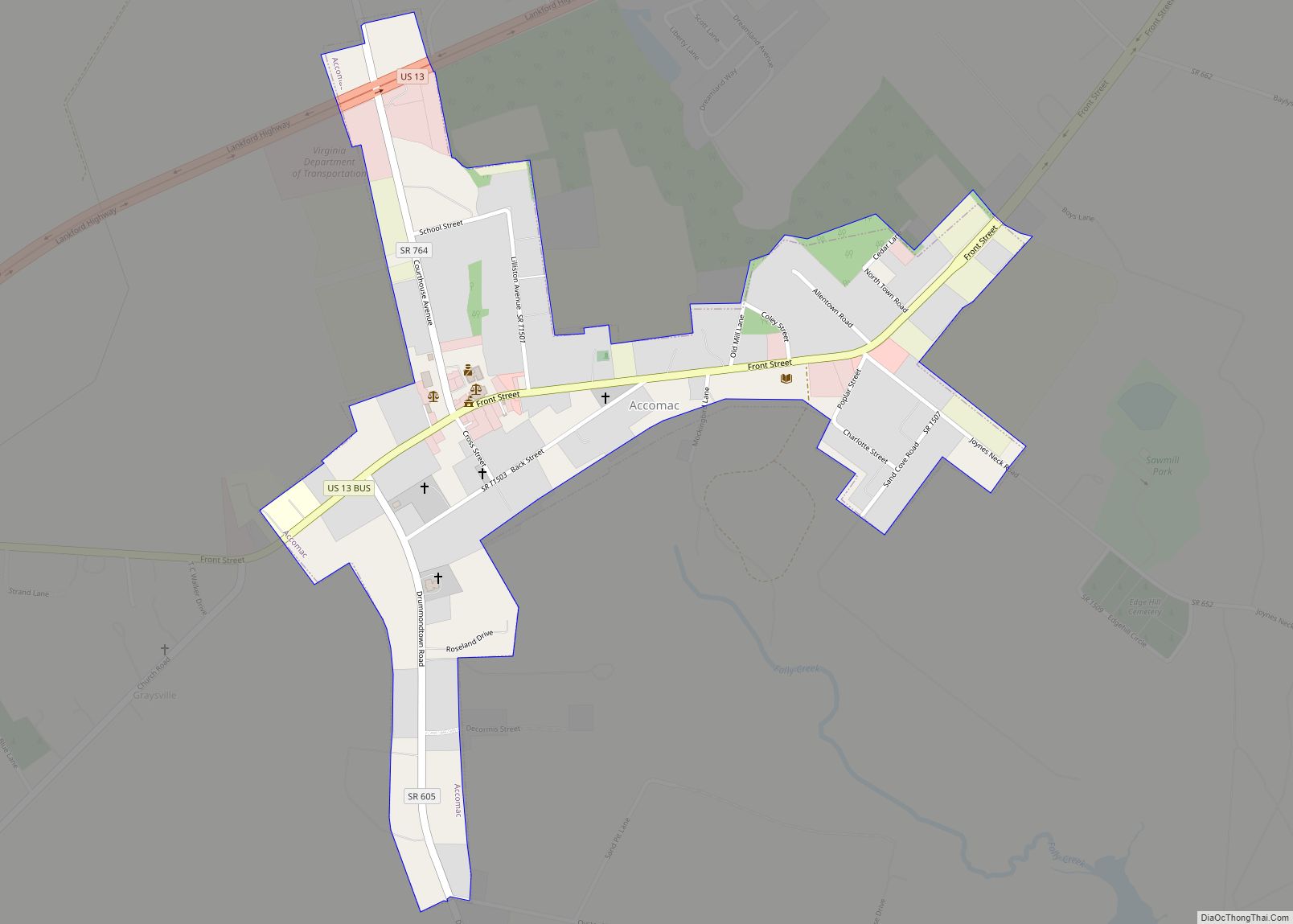
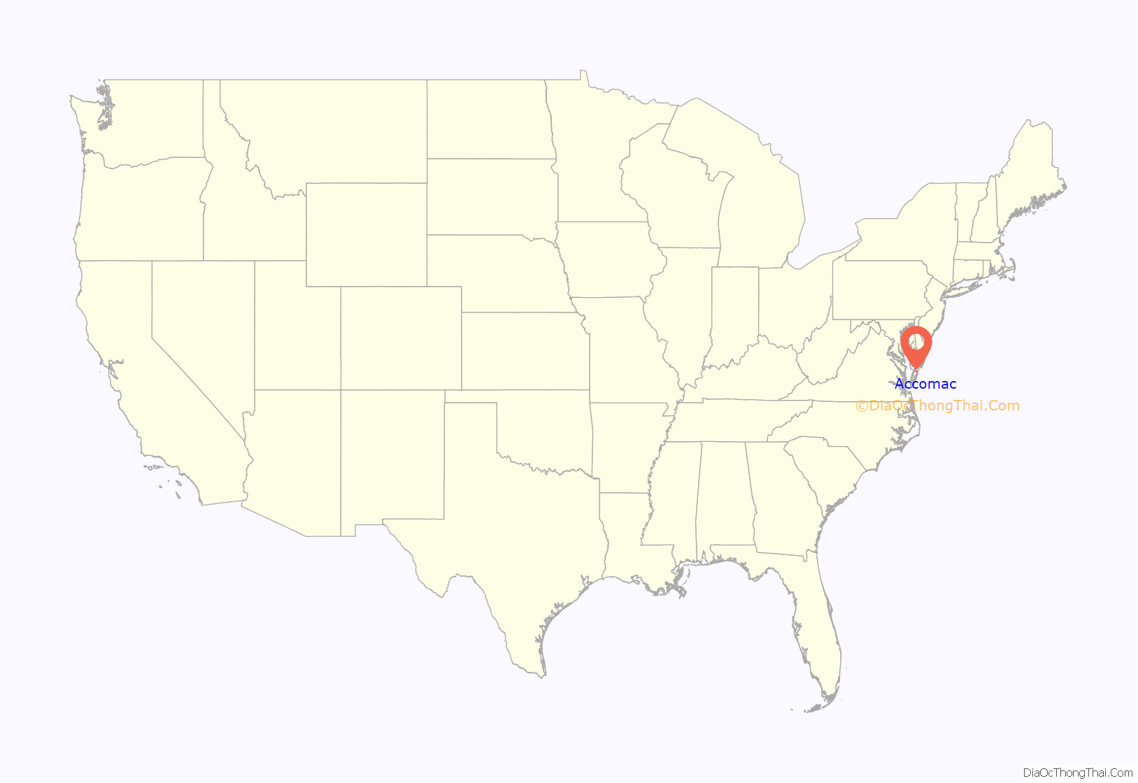
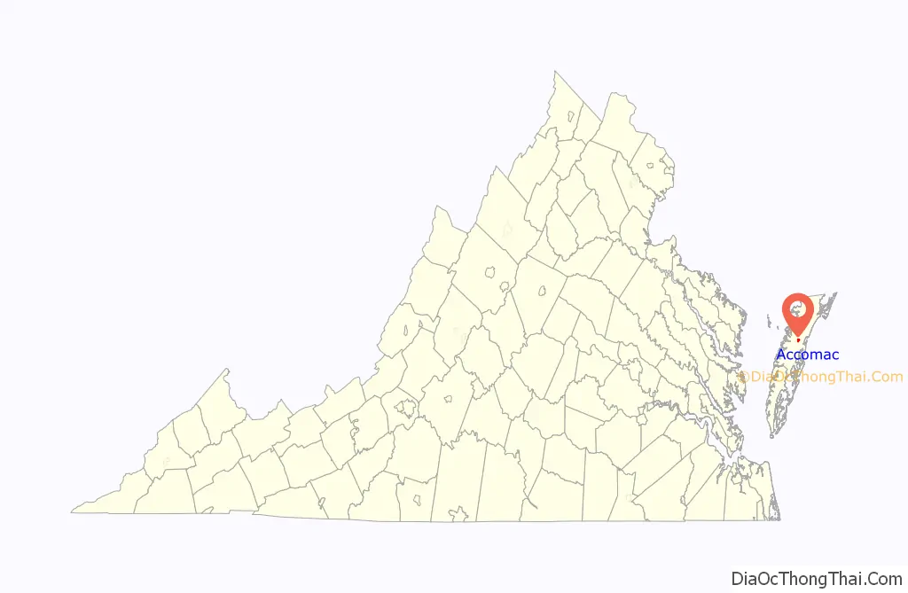
Accomac is a town in and the county seat of Accomack County, Virginia, United States. The population was 526 at the 2020 census.
| Name: | Accomac town |
|---|---|
| LSAD Code: | 43 |
| LSAD Description: | town (suffix) |
| State: | Virginia |
| County: | Accomack County |
| Elevation: | 39 ft (12 m) |
| Total Area: | 0.41 sq mi (1.06 km²) |
| Land Area: | 0.41 sq mi (1.06 km²) |
| Water Area: | 0.00 sq mi (0.00 km²) |
| Total Population: | 526 |
| Population Density: | 1,188.73/sq mi (458.69/km²) |
| ZIP code: | 23301 |
| FIPS code: | 5100180 |
| GNISfeature ID: | 1498445 |
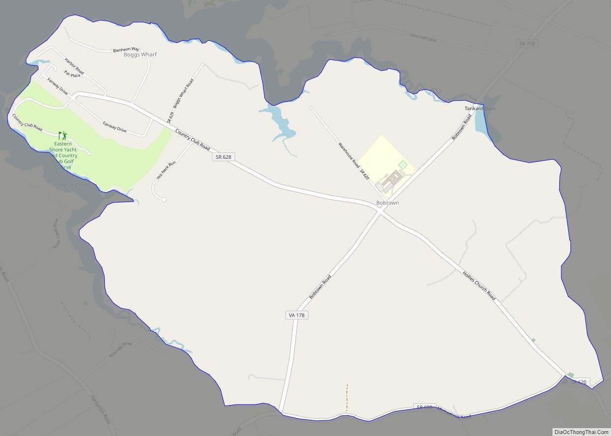
Online Interactive Map
Click on ![]() to view map in "full screen" mode.
to view map in "full screen" mode.
Accomac location map. Where is Accomac town?
History
Though Accomack County was established as one of Virginia’s eight original shires in 1634, the government was situated in the southern part of the Eastern Shore near Eastville until the division of the shore into two counties (Northampton and Accomack) in 1663. During this era, religious diversity began in the area, as Presbyterian Francis Makemie received a plantation nearby which he used as a base for his mercantile and missionary journeys, and where he died at age 50 a few years after winning a New York court case brought against his preaching (as the Scots-Irish emigrant to Maryland’s Eastern Shore counties produced a preaching license from Barbados). Early Baptist Elijah Baker (Baptist) also arrived near Accomac before the American Revolutionary War, and was likewise imprisoned for unauthorized preaching, but eventually also had that case dismissed.
After the creation of the present-day Accomack County, the court convened alternatively at Pungoteague and Onancock until the 1690s when it shifted to the house of John Cole at the site that later became the town of Accomac, then known by the name Matompkin. A brick courthouse was built in 1756 and the surrounding settlement became known as Accomack Courthouse. On December 7, 1786, Richard Drummond, Gilbert Poiley, John McLean, Edward Kerr, Catherine Scott, Patience Robertson, and William Berkeley petitioned the Virginia House of Delegates for the creation of an incorporated town at Accomack Courthouse. Their petition was granted and the House of Delegates passed an “Act to establish a Town at the Courthouse of the county of Accomack…by the name of Drummond,” named in honor of the chief landholder in the new town. Many of the town’s historic houses, churches, and other buildings were constructed between the last decade of the eighteenth century and first half of the nineteenth century, representing vernacular interpretations of late Georgian, Federal, and Greek Revival architectural styles, as the town prospered as the terminus of a ferry across Chesapeake Bay. The modern ferry only travels between nearby Onancock, Virginia and Tangier Island.
During the American Civil War, the Union Army occupied the Eastern Shore to cut supply lines to the south and prevent the Confederate Army from using the shore as a staging area to attack the north through Maryland. Union General Henry H. Lockwood commanded the occupying forces and established a headquarters in the rectory of St. James Episcopal Church (then home to town physician Dr. Peter F. Browne). Other than damages to the Presbyterian and Methodist Churches which were used by the army for stables and housing, Drummondtown escaped the war with little damage.
The late nineteenth century brought slow but steady economic prosperity for the citizens of Drummondtown, fueled by the arrival of the railroad from the north, and several new homes were constructed in and around the older core of the town in the 1880s and 1890s. The coming of the railroad also presented a challenge for Drummondtown when residents of the newly established town of Parksley initiated a referendum to move the county seat to the new community. The referendum vote took place in 1895 after nearly a decade of debate, and the residents of Accomack County elected to keep the court where it had been located for the past two centuries. By this time, the town had been renamed “Accomac” by order of the United States Post Office Department dated August 9, 1893. The name Accomac is derived from a Native American word translated to mean “on the other side”.
Accomac Road Map
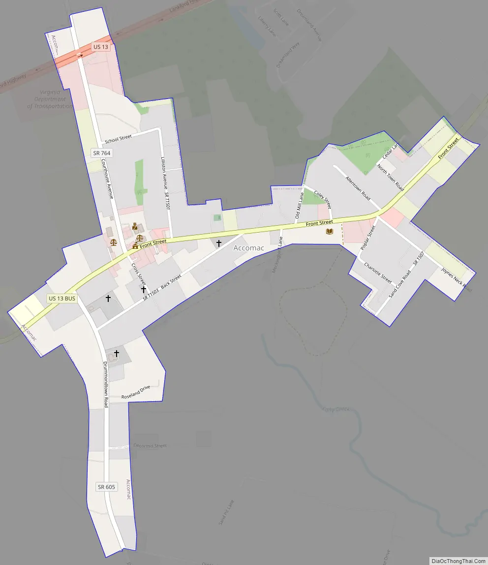
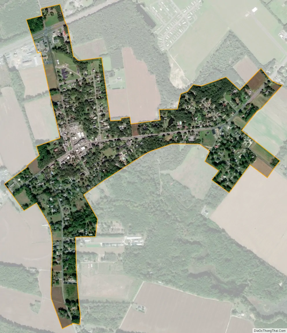
Accomac city Satellite Map
Geography
Accomac is located at 37°43′7″N 75°40′2″W / 37.71861°N 75.66722°W / 37.71861; -75.66722 (37.718678, −75.667323).
According to the United States Census Bureau, the town has a total area of 0.4 square miles (1.1 km), all of it land.
See also
Map of Virginia State and its subdivision:- Accomack
- Albemarle
- Alexandria
- Alleghany
- Amelia
- Amherst
- Appomattox
- Arlington
- Augusta
- Bath
- Bedford
- Bedford City
- Bland
- Botetourt
- Bristol
- Brunswick
- Buchanan
- Buckingham
- Buena Vista
- Campbell
- Caroline
- Carroll
- Charles City
- Charlotte
- Charlottesville
- Chesapeake
- Chesterfield
- Clarke
- Clifton Forge City
- Colonial Heights
- Covington
- Craig
- Culpeper
- Cumberland
- Danville
- Dickenson
- Dinwiddie
- Emporia
- Essex
- Fairfax
- Fairfax City
- Falls Church
- Fauquier
- Floyd
- Fluvanna
- Franklin
- Frederick
- Fredericksburg
- Galax
- Giles
- Gloucester
- Goochland
- Grayson
- Greene
- Greensville
- Halifax
- Hampton
- Hanover
- Harrisonburg
- Henrico
- Henry
- Highland
- Hopewell
- Isle of Wight
- James City
- King and Queen
- King George
- King William
- Lancaster
- Lee
- Lexington
- Loudoun
- Louisa
- Lunenburg
- Lynchburg
- Madison
- Manassas
- Manassas Park
- Martinsville
- Mathews
- Mecklenburg
- Middlesex
- Montgomery
- Nelson
- New Kent
- Newport News
- Norfolk
- Northampton
- Northumberland
- Norton
- Nottoway
- Orange
- Page
- Patrick
- Petersburg
- Pittsylvania
- Poquoson
- Portsmouth
- Powhatan
- Prince Edward
- Prince George
- Prince William
- Pulaski
- Radford
- Rappahannock
- Richmond
- Roanoke
- Roanoke City
- Rockbridge
- Rockingham
- Russell
- Salem
- Scott
- Shenandoah
- Smyth
- Southampton
- Spotsylvania
- Stafford
- Staunton
- Suffolk
- Surry
- Sussex
- Tazewell
- Virginia Beach
- Warren
- Washington
- Waynesboro
- Westmoreland
- Williamsburg
- Winchester
- Wise
- Wythe
- York
- Alabama
- Alaska
- Arizona
- Arkansas
- California
- Colorado
- Connecticut
- Delaware
- District of Columbia
- Florida
- Georgia
- Hawaii
- Idaho
- Illinois
- Indiana
- Iowa
- Kansas
- Kentucky
- Louisiana
- Maine
- Maryland
- Massachusetts
- Michigan
- Minnesota
- Mississippi
- Missouri
- Montana
- Nebraska
- Nevada
- New Hampshire
- New Jersey
- New Mexico
- New York
- North Carolina
- North Dakota
- Ohio
- Oklahoma
- Oregon
- Pennsylvania
- Rhode Island
- South Carolina
- South Dakota
- Tennessee
- Texas
- Utah
- Vermont
- Virginia
- Washington
- West Virginia
- Wisconsin
- Wyoming