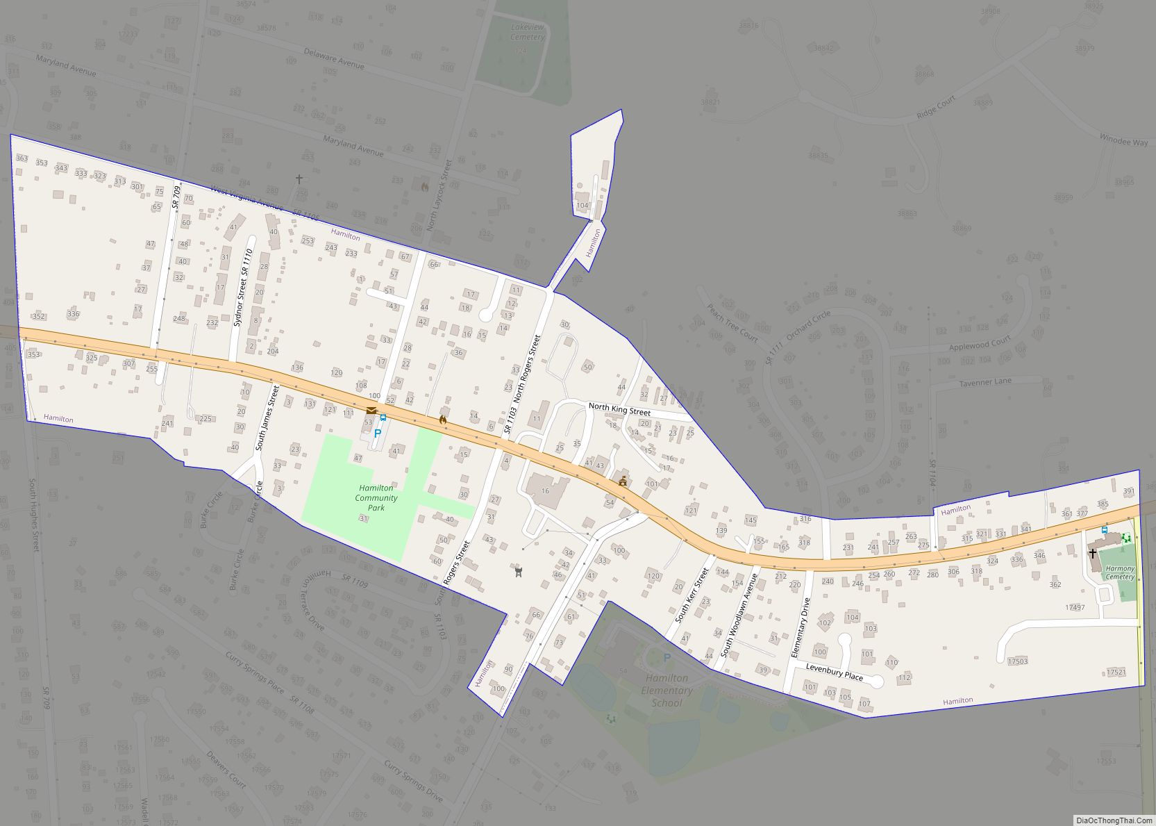
Round Hill is a town in Loudoun County, Virginia, United States. Its population was 539 at the 2010 census and an estimated 656 in 2019. The town is located at the crossroads of Virginia Routes 7 and 719 (Woodgrove Road), approximately 50 miles (80 km) northwest of Washington, D.C. The town’s name refers a hill two miles northeast of a 910-foot (280 m) hill used during the American Civil War as a signal post by both Confederate and Union troops. House of Round Hill was built in 2004. Patsy Cline went to Round Hill Elementary School.
| Name: | Round Hill town |
|---|---|
| LSAD Code: | 43 |
| LSAD Description: | town (suffix) |
| State: | Virginia |
| County: | Loudoun County |
| Incorporated: | 1900 |
| Elevation: | 548 ft (167 m) |
| Total Area: | 0.37 sq mi (0.96 km²) |
| Land Area: | 0.37 sq mi (0.95 km²) |
| Water Area: | 0.00 sq mi (0.01 km²) |
| Total Population: | 539 |
| Population Density: | 1,787.47/sq mi (690.88/km²) |
| FIPS code: | 5169168 |
| Website: | www.roundhillva.org |
Online Interactive Map
Click on ![]() to view map in "full screen" mode.
to view map in "full screen" mode.
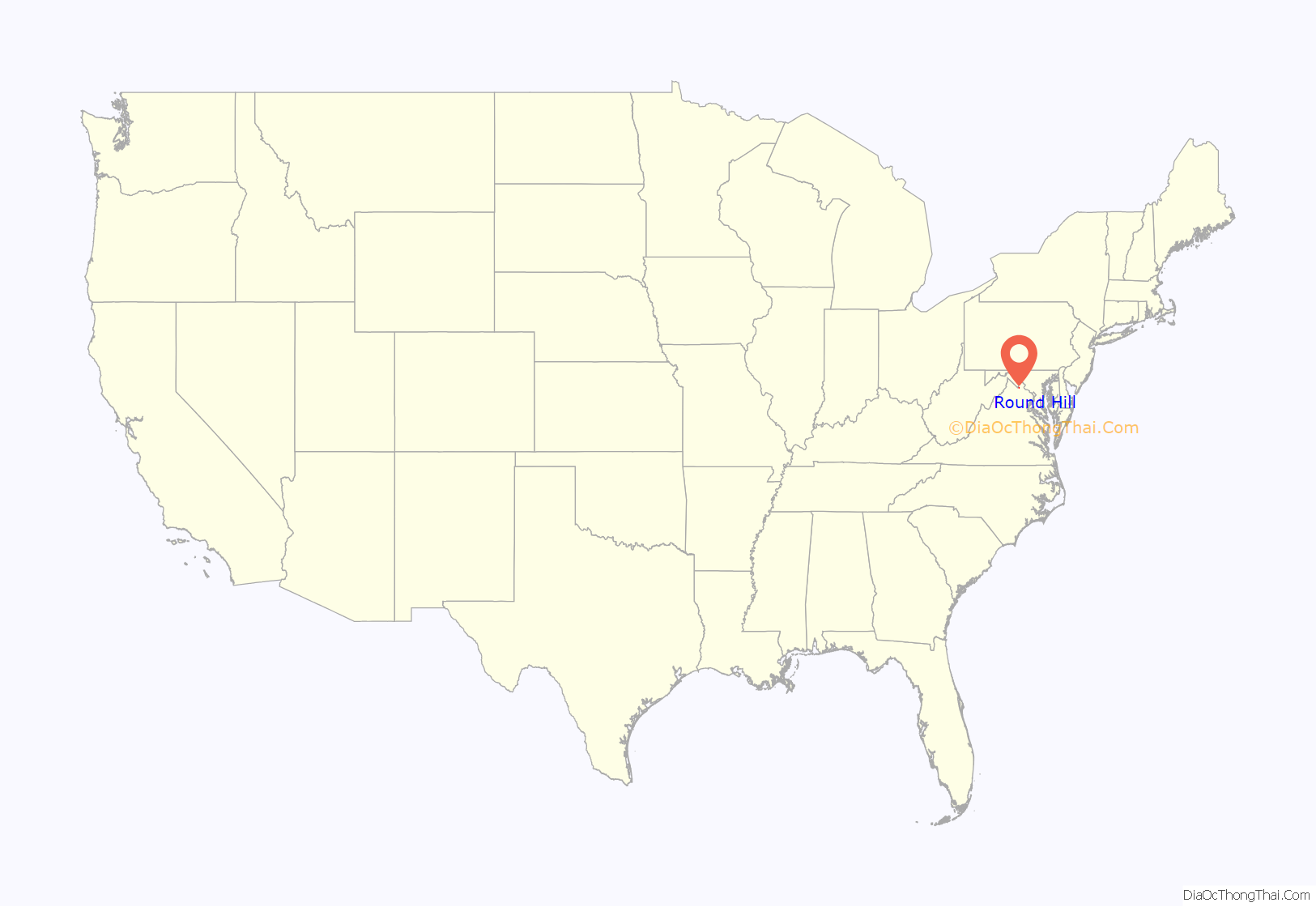
Round Hill location map. Where is Round Hill town?
History
Round Hill was incorporated on February 5, 1900. From 1874 to 1900, the settlement had been the terminus of a Washington and Ohio rail line that ultimately became the Washington and Old Dominion Railroad. The railway allowed agricultural products to be brought into Washington, D.C., and allowed the residents of the District to escape to the surrounding countryside for holidays. Many of the town’s older residences were originally boarding houses, inns, and taverns where people would go upon arrival. The town was considered a convenient destination as it lies close to the Shenandoah River (7 miles/11.3 km distant), the Shenandoah National Park (30 miles/48 km), the Appalachian Trail (4 miles/6.4 km), Harpers Ferry (15 miles/24 km), the Chesapeake and Ohio Canal National Historic Park (12 miles/19 km), and the paved Washington & Old Dominion Railroad Trail (3 miles/4.8 km).
The town has recently been ringed by fast-growing suburbs of Washington, D.C., that have brought thousands of residents to just outside the town. The town’s water and sewer infrastructure is used to serve many of these new developments. The town has a Hometown Festival every year on Memorial Day, complete with a parade and other activities, which are held both in the town park as well as outside of it.
In 2019, the town was officially designated an Appalachian Trail Community by the Appalachian Trail Conservancy. Beginning that same year, an Appalachian Trail Festival has been held every summer at B Chord Brewing (located outside the town near Snickers Gap, alongside Route 7) to celebrate this designation.
The Ketoctin Baptist Church, Round Hill Historic District, and Woodgrove are listed on the National Register of Historic Places.
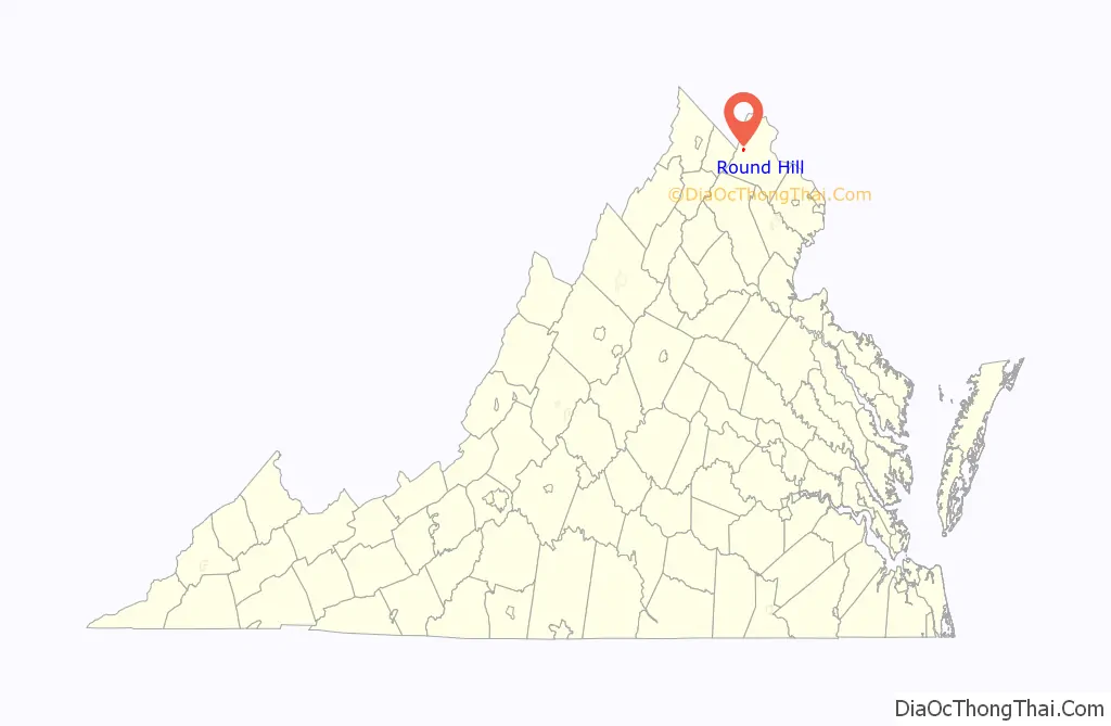
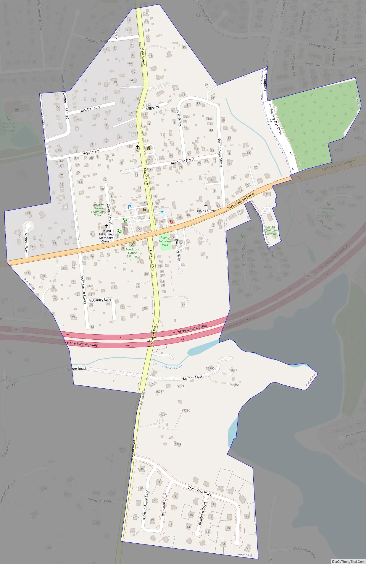
Round Hill Road Map
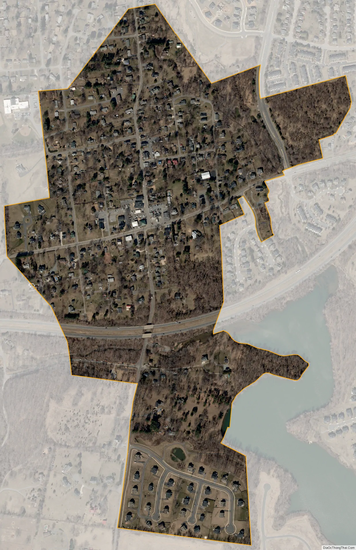
Round Hill city Satellite Map
Geography
Round Hill is located in western Loudoun County at 39°8′1″N 77°46′13″W / 39.13361°N 77.77028°W / 39.13361; -77.77028 (39.133625, −77.770217). It is 12 miles (19 km) west of Leesburg, the Loudoun county seat, and 24 miles (39 km) east of Winchester.
According to the United States Census Bureau, the town has a total area of 0.39 square miles (1.0 km), of which 2.4 acres (9,537 m), or 0.99%, are water. The town sits at the foot of the Blue Ridge Mountains and is drained by the North Fork of Goose Creek, which flows east to the Potomac River past Leesburg.
See also
Map of Virginia State and its subdivision:- Accomack
- Albemarle
- Alexandria
- Alleghany
- Amelia
- Amherst
- Appomattox
- Arlington
- Augusta
- Bath
- Bedford
- Bedford City
- Bland
- Botetourt
- Bristol
- Brunswick
- Buchanan
- Buckingham
- Buena Vista
- Campbell
- Caroline
- Carroll
- Charles City
- Charlotte
- Charlottesville
- Chesapeake
- Chesterfield
- Clarke
- Clifton Forge City
- Colonial Heights
- Covington
- Craig
- Culpeper
- Cumberland
- Danville
- Dickenson
- Dinwiddie
- Emporia
- Essex
- Fairfax
- Fairfax City
- Falls Church
- Fauquier
- Floyd
- Fluvanna
- Franklin
- Frederick
- Fredericksburg
- Galax
- Giles
- Gloucester
- Goochland
- Grayson
- Greene
- Greensville
- Halifax
- Hampton
- Hanover
- Harrisonburg
- Henrico
- Henry
- Highland
- Hopewell
- Isle of Wight
- James City
- King and Queen
- King George
- King William
- Lancaster
- Lee
- Lexington
- Loudoun
- Louisa
- Lunenburg
- Lynchburg
- Madison
- Manassas
- Manassas Park
- Martinsville
- Mathews
- Mecklenburg
- Middlesex
- Montgomery
- Nelson
- New Kent
- Newport News
- Norfolk
- Northampton
- Northumberland
- Norton
- Nottoway
- Orange
- Page
- Patrick
- Petersburg
- Pittsylvania
- Poquoson
- Portsmouth
- Powhatan
- Prince Edward
- Prince George
- Prince William
- Pulaski
- Radford
- Rappahannock
- Richmond
- Roanoke
- Roanoke City
- Rockbridge
- Rockingham
- Russell
- Salem
- Scott
- Shenandoah
- Smyth
- Southampton
- Spotsylvania
- Stafford
- Staunton
- Suffolk
- Surry
- Sussex
- Tazewell
- Virginia Beach
- Warren
- Washington
- Waynesboro
- Westmoreland
- Williamsburg
- Winchester
- Wise
- Wythe
- York
- Alabama
- Alaska
- Arizona
- Arkansas
- California
- Colorado
- Connecticut
- Delaware
- District of Columbia
- Florida
- Georgia
- Hawaii
- Idaho
- Illinois
- Indiana
- Iowa
- Kansas
- Kentucky
- Louisiana
- Maine
- Maryland
- Massachusetts
- Michigan
- Minnesota
- Mississippi
- Missouri
- Montana
- Nebraska
- Nevada
- New Hampshire
- New Jersey
- New Mexico
- New York
- North Carolina
- North Dakota
- Ohio
- Oklahoma
- Oregon
- Pennsylvania
- Rhode Island
- South Carolina
- South Dakota
- Tennessee
- Texas
- Utah
- Vermont
- Virginia
- Washington
- West Virginia
- Wisconsin
- Wyoming