South Hill is a town in Mecklenburg County, Virginia, United States. The population was 4,650 at the 2010 census. Located on major Interstate and U.S. highways, it has a full-service hospital (serving patients from several rural counties), a tobacco market, and several hotels. South Hill has a close relationship with the neighboring town of La Crosse. Lake Gaston, a large reservoir popular with boaters and fishermen, is a short distance to the southwest.
The Colonial Theatre was listed on the National Register of Historic Places in 2003.
| Name: | South Hill town |
|---|---|
| LSAD Code: | 43 |
| LSAD Description: | town (suffix) |
| State: | Virginia |
| County: | Mecklenburg County |
| Elevation: | 436 ft (133 m) |
| Total Area: | 6.85 sq mi (25.52 km²) |
| Land Area: | 6.82 sq mi (25.45 km²) |
| Water Area: | 0.03 sq mi (0.07 km²) |
| Total Population: | 4,650 |
| Population Density: | 442.65/sq mi (170.90/km²) |
| ZIP code: | 23970 |
| Area code: | 434 |
| FIPS code: | 5173904 |
| GNISfeature ID: | 2391422 |
| Website: | http://www.southhillva.org/ |
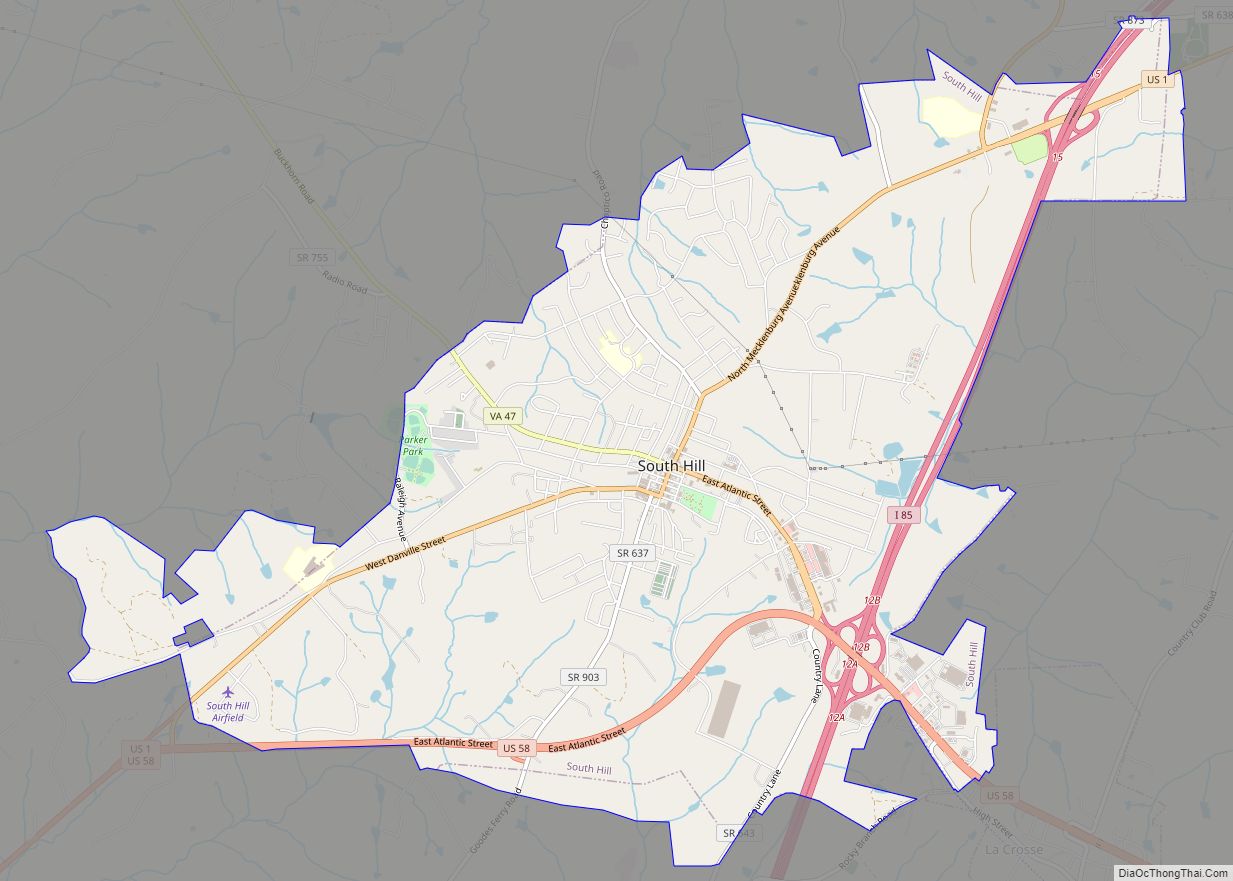
Online Interactive Map
Click on ![]() to view map in "full screen" mode.
to view map in "full screen" mode.
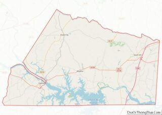
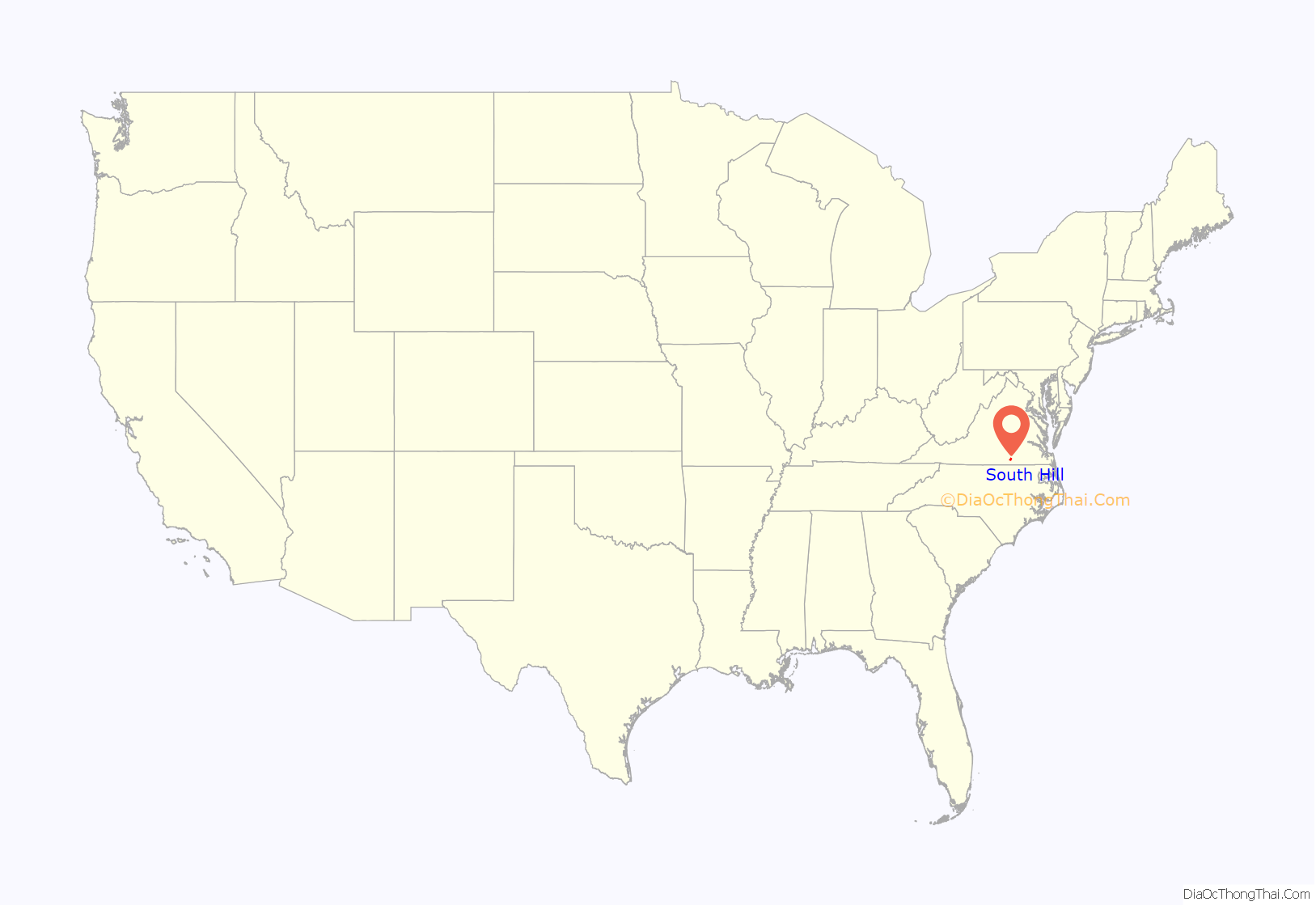
South Hill location map. Where is South Hill town?
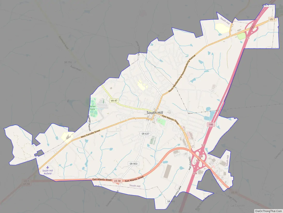
South Hill Road Map
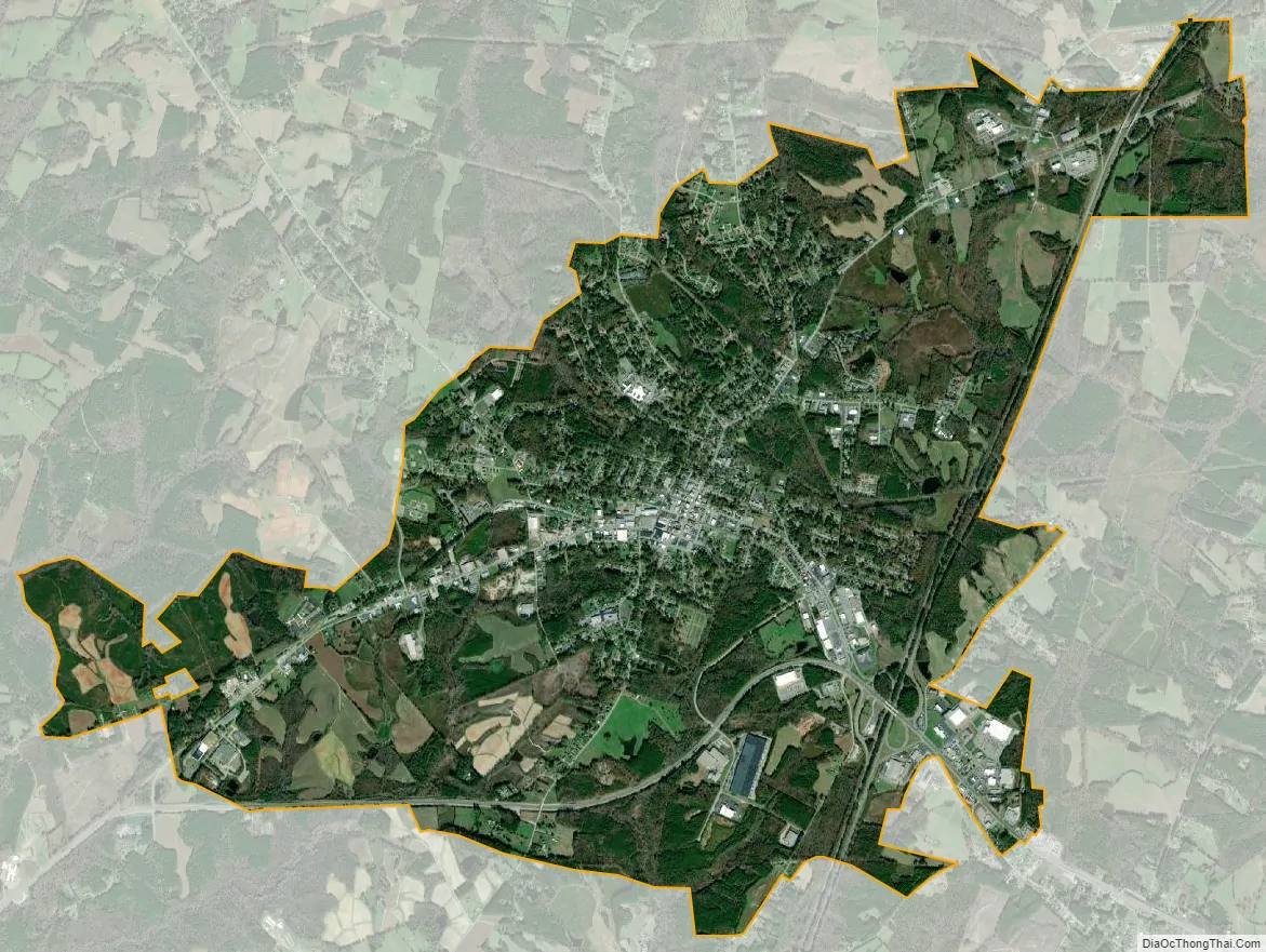
South Hill city Satellite Map
Geography
South Hill is located at 36°43′36″N 78°7′50″W / 36.72667°N 78.13056°W / 36.72667; -78.13056 (36.726759, −78.130597).
The town has a total area of 6.31 square miles (16.4 km), of which 6.27 square miles (16.4 km) is land and 0.04 square mile (0.1 km) (0.47%) is water.
See also
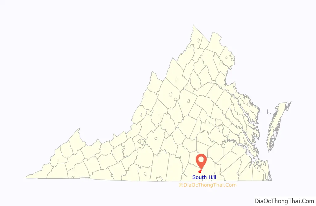
Map of Virginia State and its subdivision:- Accomack
- Albemarle
- Alexandria
- Alleghany
- Amelia
- Amherst
- Appomattox
- Arlington
- Augusta
- Bath
- Bedford
- Bedford City
- Bland
- Botetourt
- Bristol
- Brunswick
- Buchanan
- Buckingham
- Buena Vista
- Campbell
- Caroline
- Carroll
- Charles City
- Charlotte
- Charlottesville
- Chesapeake
- Chesterfield
- Clarke
- Clifton Forge City
- Colonial Heights
- Covington
- Craig
- Culpeper
- Cumberland
- Danville
- Dickenson
- Dinwiddie
- Emporia
- Essex
- Fairfax
- Fairfax City
- Falls Church
- Fauquier
- Floyd
- Fluvanna
- Franklin
- Frederick
- Fredericksburg
- Galax
- Giles
- Gloucester
- Goochland
- Grayson
- Greene
- Greensville
- Halifax
- Hampton
- Hanover
- Harrisonburg
- Henrico
- Henry
- Highland
- Hopewell
- Isle of Wight
- James City
- King and Queen
- King George
- King William
- Lancaster
- Lee
- Lexington
- Loudoun
- Louisa
- Lunenburg
- Lynchburg
- Madison
- Manassas
- Manassas Park
- Martinsville
- Mathews
- Mecklenburg
- Middlesex
- Montgomery
- Nelson
- New Kent
- Newport News
- Norfolk
- Northampton
- Northumberland
- Norton
- Nottoway
- Orange
- Page
- Patrick
- Petersburg
- Pittsylvania
- Poquoson
- Portsmouth
- Powhatan
- Prince Edward
- Prince George
- Prince William
- Pulaski
- Radford
- Rappahannock
- Richmond
- Roanoke
- Roanoke City
- Rockbridge
- Rockingham
- Russell
- Salem
- Scott
- Shenandoah
- Smyth
- Southampton
- Spotsylvania
- Stafford
- Staunton
- Suffolk
- Surry
- Sussex
- Tazewell
- Virginia Beach
- Warren
- Washington
- Waynesboro
- Westmoreland
- Williamsburg
- Winchester
- Wise
- Wythe
- York
- Alabama
- Alaska
- Arizona
- Arkansas
- California
- Colorado
- Connecticut
- Delaware
- District of Columbia
- Florida
- Georgia
- Hawaii
- Idaho
- Illinois
- Indiana
- Iowa
- Kansas
- Kentucky
- Louisiana
- Maine
- Maryland
- Massachusetts
- Michigan
- Minnesota
- Mississippi
- Missouri
- Montana
- Nebraska
- Nevada
- New Hampshire
- New Jersey
- New Mexico
- New York
- North Carolina
- North Dakota
- Ohio
- Oklahoma
- Oregon
- Pennsylvania
- Rhode Island
- South Carolina
- South Dakota
- Tennessee
- Texas
- Utah
- Vermont
- Virginia
- Washington
- West Virginia
- Wisconsin
- Wyoming