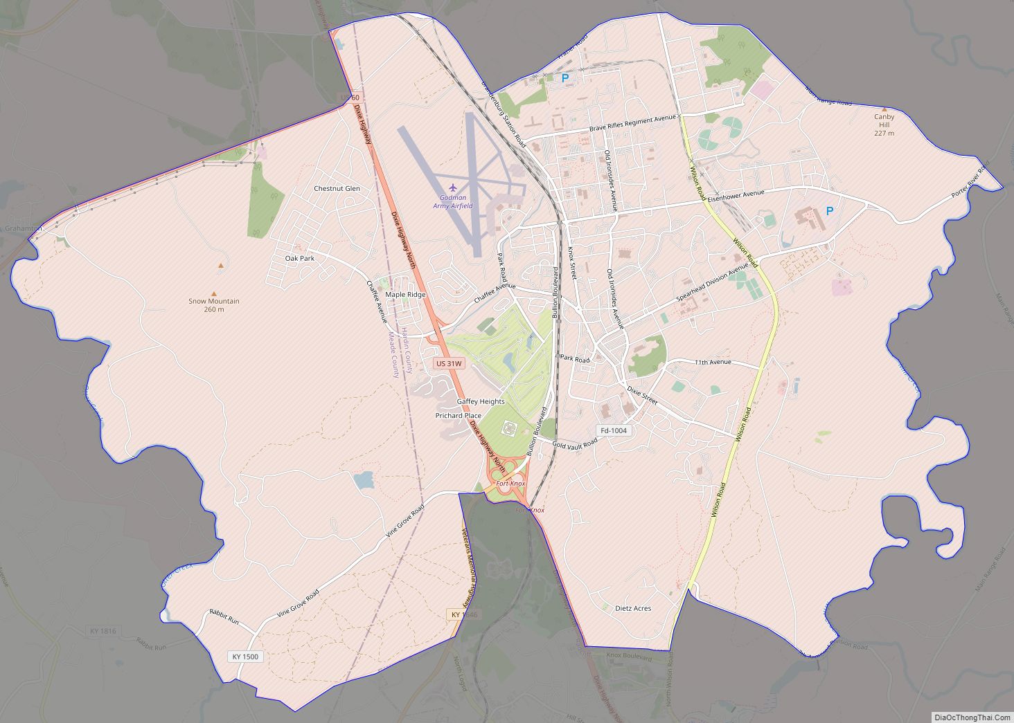
Fort Knox is a United States Army installation in Kentucky, south of Louisville and north of Elizabethtown. It is adjacent to the United States Bullion Depository, which is used to house a large portion of the United States’ official gold reserves, and with which it is often conflated. The 109,000-acre (170 sq mi; 440 km) base covers parts of Bullitt, Hardin and Meade counties. It currently holds the Army Human Resources Center of Excellence, including the Army Human Resources Command. It is named in honor of Henry Knox, Chief of Artillery in the American Revolutionary War and the first United States Secretary of War.
For 60 years, Fort Knox was the home of the U.S. Army Armor Center and School, and was used by both the Army and the Marine Corps to train crews on the American tanks of the day; the last was the M1 Abrams main battle tank. The history of the U.S. Army’s Cavalry and Armored forces, and of General George S. Patton’s career, is shown at the General George Patton Museum on the grounds of Fort Knox.
In 2011, the U.S. Army Armor School moved to Fort Benning, Georgia, where the Infantry School is also based. In 2014, the U.S. Army Cadet Command relocated to Fort Knox and all summer training for ROTC cadets now takes place there.
On 16 October 2020, V Corps was reactivated at Fort Knox, just over seven years after the colors were last cased in Wiesbaden, Germany in July 2013.
| Name: | Fort Knox CDP |
|---|---|
| LSAD Code: | 57 |
| LSAD Description: | CDP (suffix) |
| State: | Kentucky |
| County: | Hardin County, Meade County |
| FIPS code: | 2128540 |
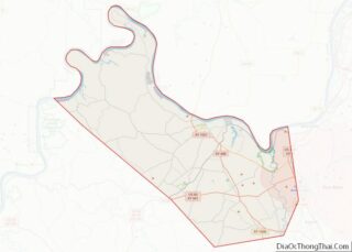
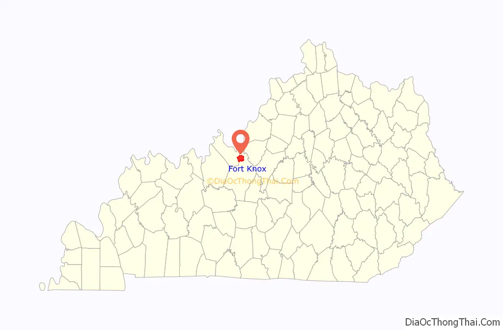
Online Interactive Map
Click on ![]() to view map in "full screen" mode.
to view map in "full screen" mode.
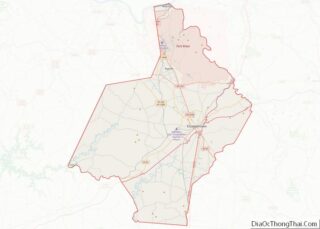
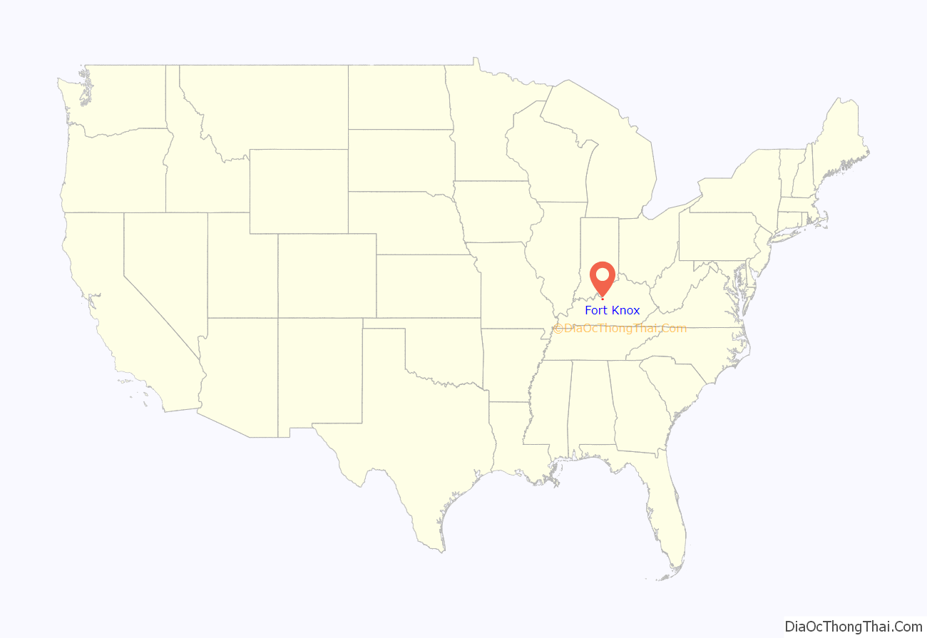
Fort Knox location map. Where is Fort Knox CDP?
History
Fortification
Fortifications were constructed near the site in 1861, during the Civil War when Fort Duffield was constructed. Fort Duffield was located on what was known as Muldraugh Hill on a strategic point overlooking the confluence of the Salt and Ohio Rivers and the Louisville and Nashville Turnpike. The area was contested by both Union and Confederate forces. Bands of organized guerrillas frequently raided the area during the war. John Hunt Morgan and the 2nd Kentucky Cavalry Regiment of the Confederate Army raided the area before staging his infamous raid across Indiana and Ohio.
Post Civil War
After the war, the area now occupied by the Army was home to various small communities. In October 1903, military maneuvers for the Regular Army and the National Guards of several states were held at West Point, Kentucky and the surrounding area. In April 1918, field artillery units from Camp Zachary Taylor arrived at West Point for training. 20,000 acres (8,100 ha) near the village of Stithton were leased to the government and construction for a permanent training center was started in July 1918.
New camp
The new camp was named after Henry Knox, the Continental Army’s chief of artillery during the Revolutionary War and the country’s first Secretary of War. The camp was extended by the purchase of a further 40,000 acres (16,000 ha) in June 1918 and construction properly began in July 1918. The building program was reduced following the end of the war and reduced further following cuts to the army in 1921 after the National Defense Act of 1920. The camp was greatly reduced and became a semi-permanent training center for the 5th Corps Area for Reserve Officer training, the National Guard, and Citizen’s Military Training Camps (CMTC). For a short while, from 1925 to 1928, the area was designated as “Camp Henry Knox National Forest.”
Air Corps use
The post contains an airfield, called Godman Army Airfield, that was used by the United States Army Air Corps, and its successor, the United States Army Air Forces as a training base during World War II. It was used by the Kentucky Air National Guard for several years after the war until they relocated to Standiford Field in Louisville. The airfield is still in use by the United States Army Aviation Branch.
Protection of America’s founding documents
For protection after the Japanese attack on Pearl Harbor in 1941, the Declaration of Independence, the Constitution of the United States and the Gettysburg Address were all moved for safekeeping to the United States Bullion Depository until Major W. C. Hatfield ordered their release after the D-Day Landings on 19 September 1944.
Mechanized military unit occupation
In 1931 a small force of the mechanized cavalry was assigned to Camp Knox to use it as a training site. The camp was turned into a permanent garrison in January 1932 and renamed Fort Knox. The 1st Cavalry Regiment arrived later in the month to become the 1st Cavalry Regiment (Mechanized).
In 1936 the 1st was joined by the 13th to become the 7th Cavalry Brigade (Mechanized). The site quickly became the center for mechanization tactics and doctrine. The success of the German mechanized units at the start of World War II was a major impetus to operations at the fort. A new Armored Force was established in July 1940 with its headquarters at Fort Knox with the 7th Cavalry Brigade becoming the 1st Armored Division. The Armored Force School and the Armored Force Replacement Center were also sited at Fort Knox in October 1940, and their successors remained there until 2010, when the Armor School moved to Fort Benning, Georgia. The site was expanded to cope with its new role. By 1943, there were 3,820 buildings on 106,861 acres (43,245 ha). A third of the post has been torn down within the last ten years, with another third slated by 2010.
1947 Universal Military Training Experimental Unit
In 1947, Fort Knox hosted the Universal Military Training Experimental Unit, a six-month project that aimed to demonstrate the feasibility and effectiveness of providing new 18-20 year-old Army recruits with basic military training that emphasized physical, mental, and spiritual well-being. This project was undertaken with the aim of persuading the public to support President Harry S. Truman’s proposal to require all eligible American men to undergo universal military training.
Stripes (1981) was filmed using the exterior of Fort Knox but did not show the inside of the facility for security reasons.
1993 shooting
On 18 October 1993, Arthur Hill went on a shooting rampage, killing three and wounding two before attempting suicide, shooting and severely wounding himself. The shooting occurred at Fort Knox’s Training Support Center. Prior to the incident, Hill’s coworkers claimed they were afraid of a mentally unstable person who was at work. Hill died on 21 October of his self-inflicted gunshot wound.
2013 shooting
On 3 April 2013, a civilian employee was shot and killed in a parking lot on post. The victim was an employee of the United States Army Human Resources Command and was transported to the Ireland Army Community Hospital, where he was pronounced dead. This shooting caused a temporary lock-down that was lifted around 7 p.m. on the same day. U.S. Army Sgt. Marquinta E. Jacobs, a soldier stationed at Fort Knox, was charged on 4 April with the shooting. He pleaded guilty to charges of premeditated murder and aggravated assault, and was sentenced to 30 years in prison on 10 January 2014.
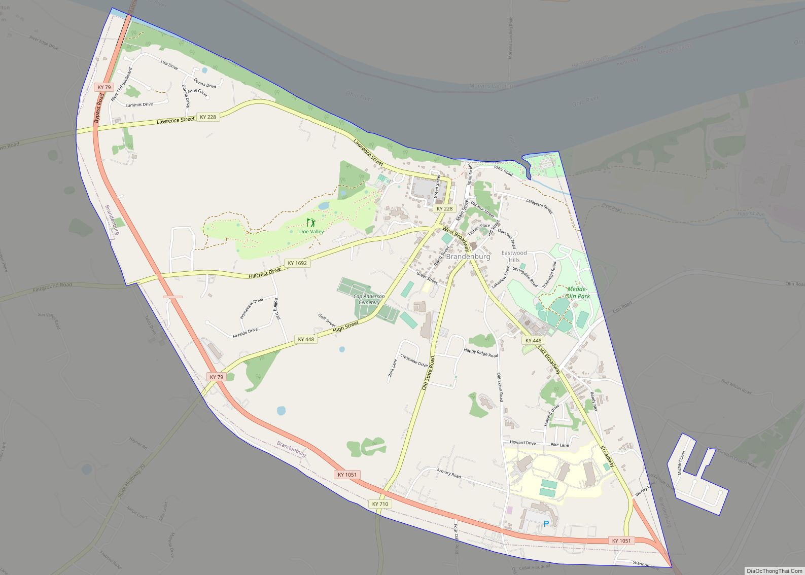
Fort Knox Road Map

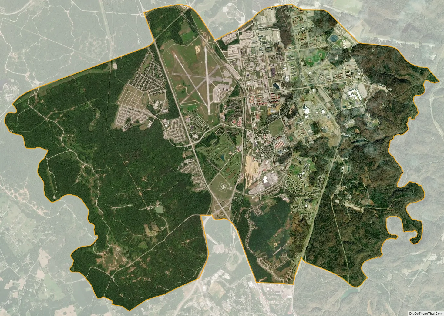
Fort Knox city Satellite Map
Geography
Fort Knox is located at 37°54’09.96″ North, 85°57’09.11″ West, along the Ohio River. The depository itself is located at 37°52’59.59″ North, 85°57’55.31″ West.
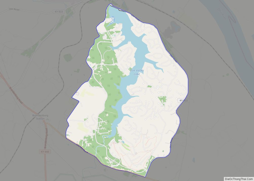
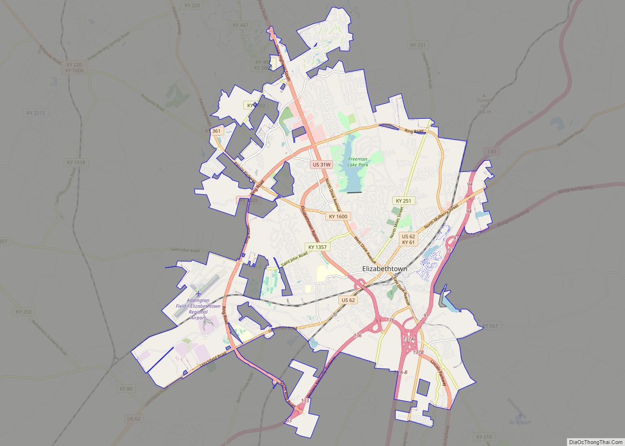
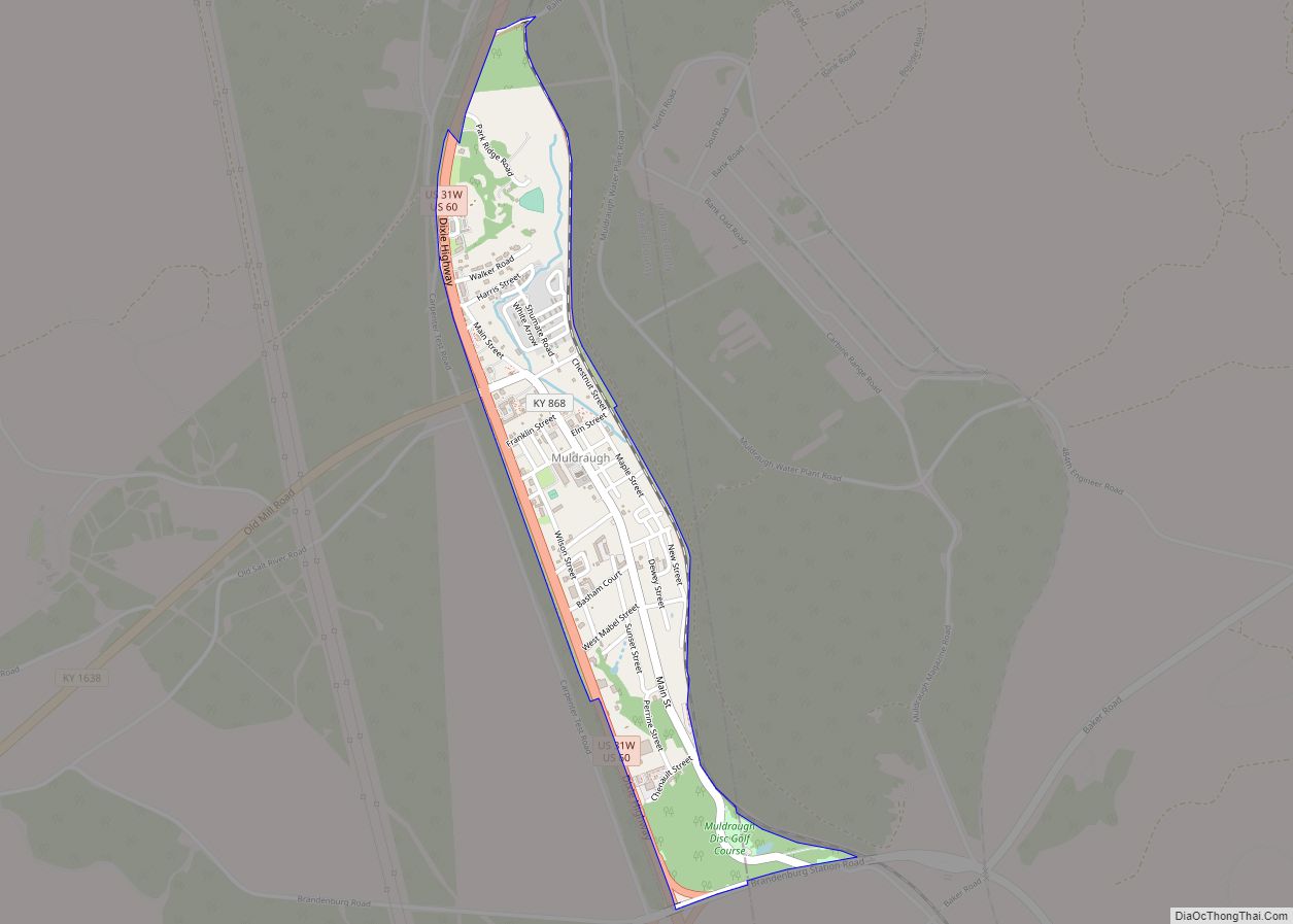
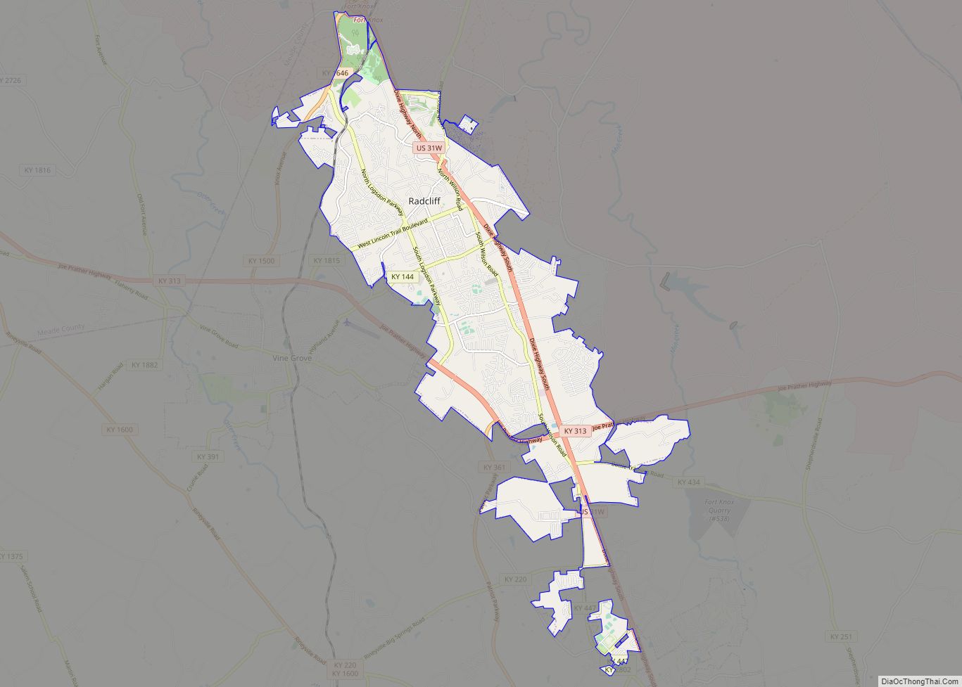
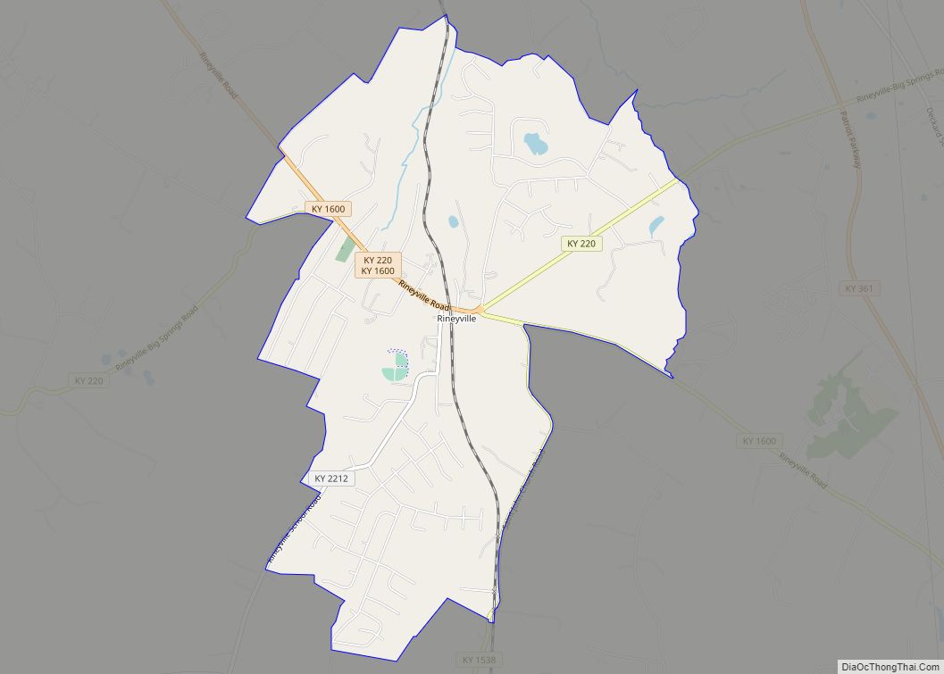
According to the Census Bureau, the base CDP has a total area of 20.94 square miles (54.23 km), of which 20.92 sq mi (54.18 km) is land and 0.03 sq mi (0.08 km)—0.14%—is water. Communities near Fort Knox include Brandenburg, Elizabethtown, Hodgenville, Louisville, Radcliff, Shepherdsville, and Vine Grove, Kentucky. The Meade County city of Muldraugh is completely surrounded by Fort Knox.
Climate
The climate in this area is characterized by hot, humid summers and generally mild to cool winters. According to the Köppen Climate Classification system, Fort Knox has a humid subtropical climate, abbreviated “Cfa” on climate maps.
See also
Map of Kentucky State and its subdivision:- Adair
- Allen
- Anderson
- Ballard
- Barren
- Bath
- Bell
- Boone
- Bourbon
- Boyd
- Boyle
- Bracken
- Breathitt
- Breckinridge
- Bullitt
- Butler
- Caldwell
- Calloway
- Campbell
- Carlisle
- Carroll
- Carter
- Casey
- Christian
- Clark
- Clay
- Clinton
- Crittenden
- Cumberland
- Daviess
- Edmonson
- Elliott
- Estill
- Fayette
- Fleming
- Floyd
- Franklin
- Fulton
- Gallatin
- Garrard
- Grant
- Graves
- Grayson
- Green
- Greenup
- Hancock
- Hardin
- Harlan
- Harrison
- Hart
- Henderson
- Henry
- Hickman
- Hopkins
- Jackson
- Jefferson
- Jessamine
- Johnson
- Kenton
- Knott
- Knox
- Larue
- Laurel
- Lawrence
- Lee
- Leslie
- Letcher
- Lewis
- Lincoln
- Livingston
- Logan
- Lyon
- Madison
- Magoffin
- Marion
- Marshall
- Martin
- Mason
- McCracken
- McCreary
- McLean
- Meade
- Menifee
- Mercer
- Metcalfe
- Monroe
- Montgomery
- Morgan
- Muhlenberg
- Nelson
- Nicholas
- Ohio
- Oldham
- Owen
- Owsley
- Pendleton
- Perry
- Pike
- Powell
- Pulaski
- Robertson
- Rockcastle
- Rowan
- Russell
- Scott
- Shelby
- Simpson
- Spencer
- Taylor
- Todd
- Trigg
- Trimble
- Union
- Warren
- Washington
- Wayne
- Webster
- Whitley
- Wolfe
- Woodford
- Alabama
- Alaska
- Arizona
- Arkansas
- California
- Colorado
- Connecticut
- Delaware
- District of Columbia
- Florida
- Georgia
- Hawaii
- Idaho
- Illinois
- Indiana
- Iowa
- Kansas
- Kentucky
- Louisiana
- Maine
- Maryland
- Massachusetts
- Michigan
- Minnesota
- Mississippi
- Missouri
- Montana
- Nebraska
- Nevada
- New Hampshire
- New Jersey
- New Mexico
- New York
- North Carolina
- North Dakota
- Ohio
- Oklahoma
- Oregon
- Pennsylvania
- Rhode Island
- South Carolina
- South Dakota
- Tennessee
- Texas
- Utah
- Vermont
- Virginia
- Washington
- West Virginia
- Wisconsin
- Wyoming